
Camping in Greater Zion & Bryce (Southwest)
Zion, Bryce Canyon, Cedar Breaks, Kanab, Escalante and Capitol Reef's western approach - red rock desert below, cool plateau forest above. BLAZE 360 tracks 78 campgrounds and 280 trails here, with overnight comfort scores and drive times so you know what to expect before you commit.
Know before you go: Greater Zion & Bryce (Southwest)
- Elevation range
- 3,022–10,285 ft
- Typical July high
- 95°F
- Typical January low
- 25°F
- Booking mix
- 61 reservable · 17 first-come
Campgrounds
Showing 78 of 78 campgrounds.
Paiute Wilderness Area
Littlefield, AZ
The 87,900-acre Paiute Wilderness, several miles southwest of St. George, Utah, dominates the northwest portion of the Arizona Strip. It is separated from the Beaver Dam Mountains Wilderness to the north by Interstate 15. The Virgin Mountains form the backbone of this area rising over 5,600 feet from the desert floor. Mt. Bangs, the highest peak in the area at 8,012 feet, provides a commanding view of the area and the Basin and Range country to the west. Part of the wilderness is in the Arizona Strip Field Office and part in the Grand Canyon-Parashant National Monument.
Barker Recreation Area
Escalante, UT
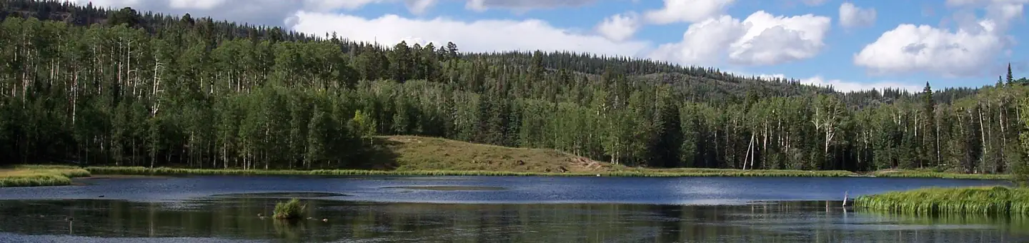
Barker Recreation Area is located high on the Colorado Plateau at an elevation of 9,300 feet. Visitors enjoy canoeing, fishing and exploring local trails. Recreation Upper Barker Reservoir provides canoeing, kayaking and fishing for rainbow and brook trout. Numerous hiking, biking and horse trails can be accessed from both the Upper and Lower Barker Reservoir trailheads. Trails, including the non-motorized Great Western Trail, lead to nine backcountry fishing lakes and beautiful mountain views. The area also has excellent stream fishing and spectacular fall colors.
Escalante Petrified Forest State Park
Escalante, UT
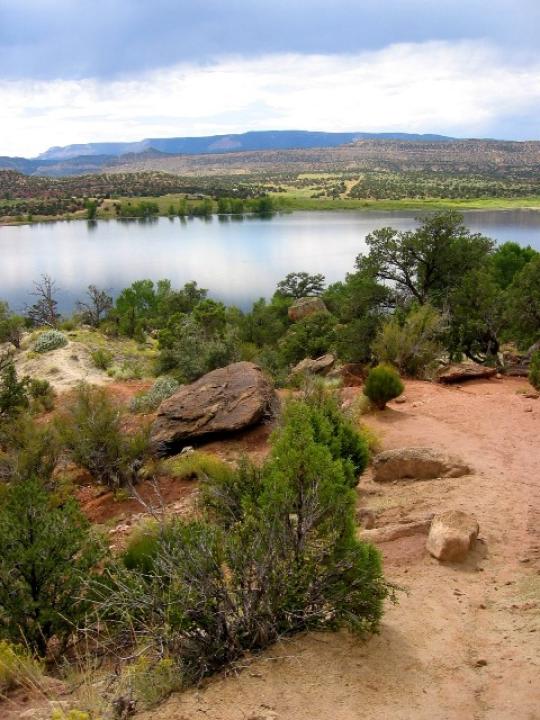
Escalante Petrified Forest State Park features colorful deposits of mineralized wood. Visitors will enjoy hiking through the petrified forest.

Gunlock State Park
Gunlock, UT
Gunlock State Park is hidden in South Western Utah as an escape from the world. Its red rocks, magical waterfalls in season, and sparkling waters make this a unique State Park.
Otter Creek, Tamarisk Point Rec Site
Antimony, UT
Otter Creek has an activity for almost everyone. The cold, clear water of this large reservoir offers year-round fishing for rainbow trout. For wildlife watchers, numerous waterfowl, raptors, deer, antelope, and elk abound. If you re an ATV rider, you ll want to try the Paiute ATV trail, which can be accessed from here. The primary activities are fishing and boating although it also serves as a regional staging site for extended and day trips into the surrounding National Forest, Utah State Lands and BLM managed lands by horse, foot, and vehicle. The Richfield Field Office manages day use facilities, dispersed and primitive camping facilities, and fishing access to the Reservoir at Fisherman's Beach, Tamarisk Point, and South Point along the west side of the reservoir. There is no potable water but picnic tables and pit toilets are available. Otter Creek Reservoir is located at the southeastern corner of Paiute County near the town of Antimony. A Utah State Park is located at the south
Grand Wash Cliffs Wilderness Area
Littlefield, AZ
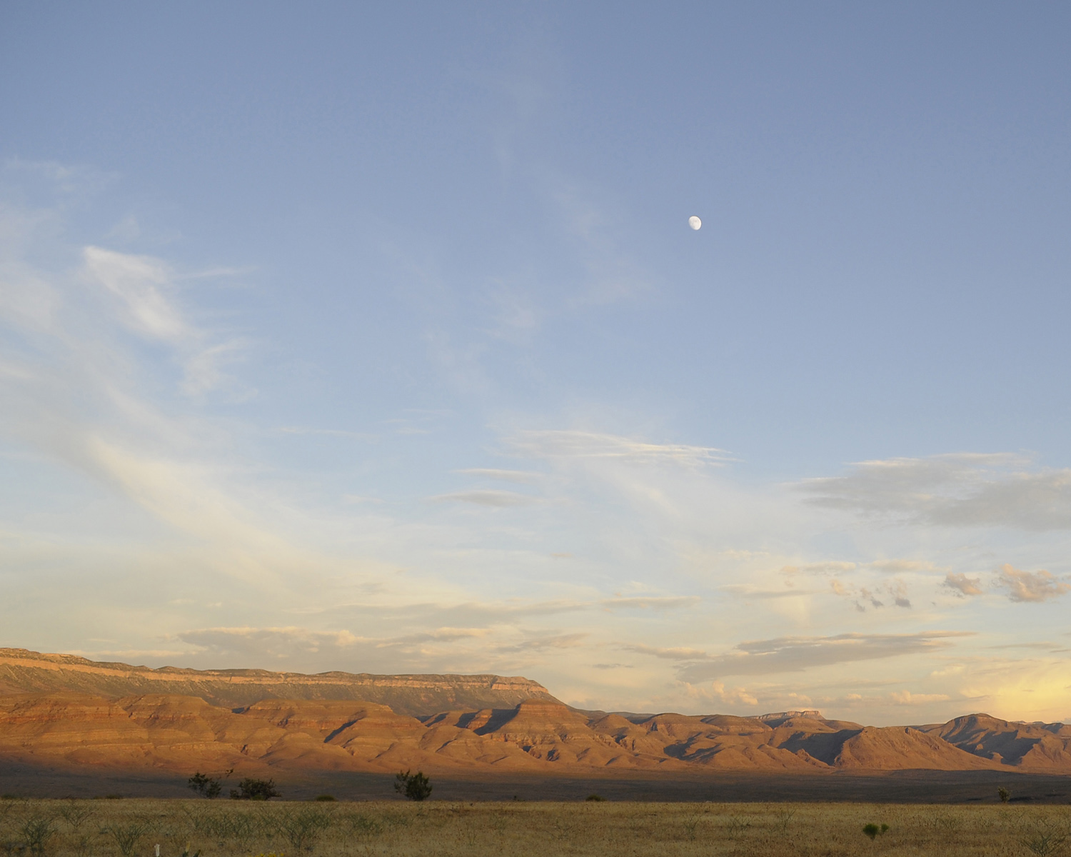
The remote 37,030-acre Grand Wash Cliffs Wilderness Area is a 12-mile-long stretch of the Grand Wash Cliffs. St. George, Utah, the largest town in the area is 36 air miles north of the wilderness. Filled with rugged canyons, scenic escarpments, miles of towering cliffs and sandstone buttes, the wilderness marks the transition zone between the Colorado Plateau and Basin and Range provinces. The cliffs are important habitat for the desert tortoise, gila monster and desert bighorn sheep. Vegetation is a mix of Mojave Desert shrubs, annual grasses and pinyon-juniper woodland from colder desert country.
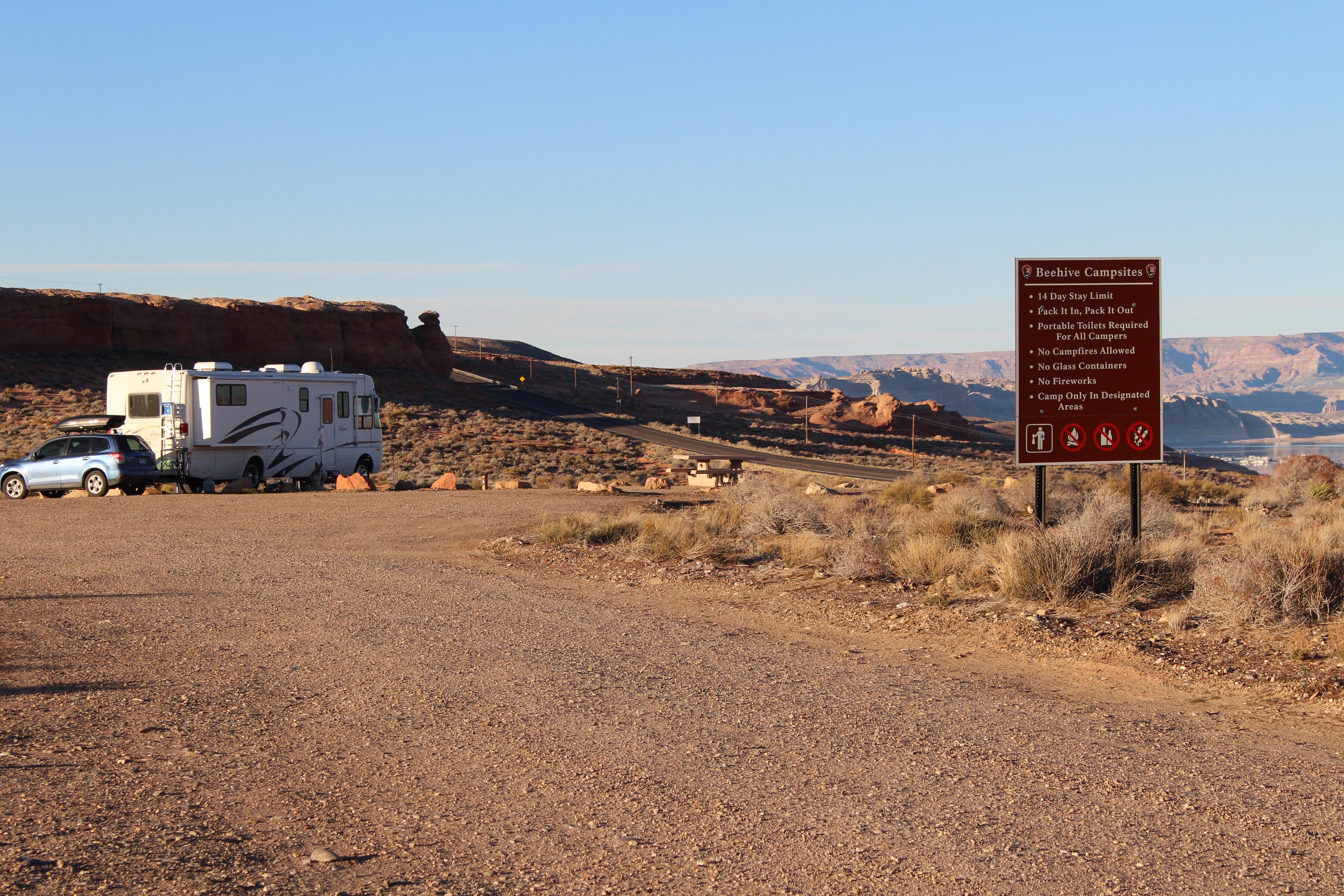
Beehives Primitive Campground
Page, AZ
No reservations. $14 per night. 21 designated sites. Across the highway from Wahweap South Entrance. Picnic table at each site. No hookups or dump stations. Pack it in, pack it out. No campfires or glass containers. Three-night camping limit.
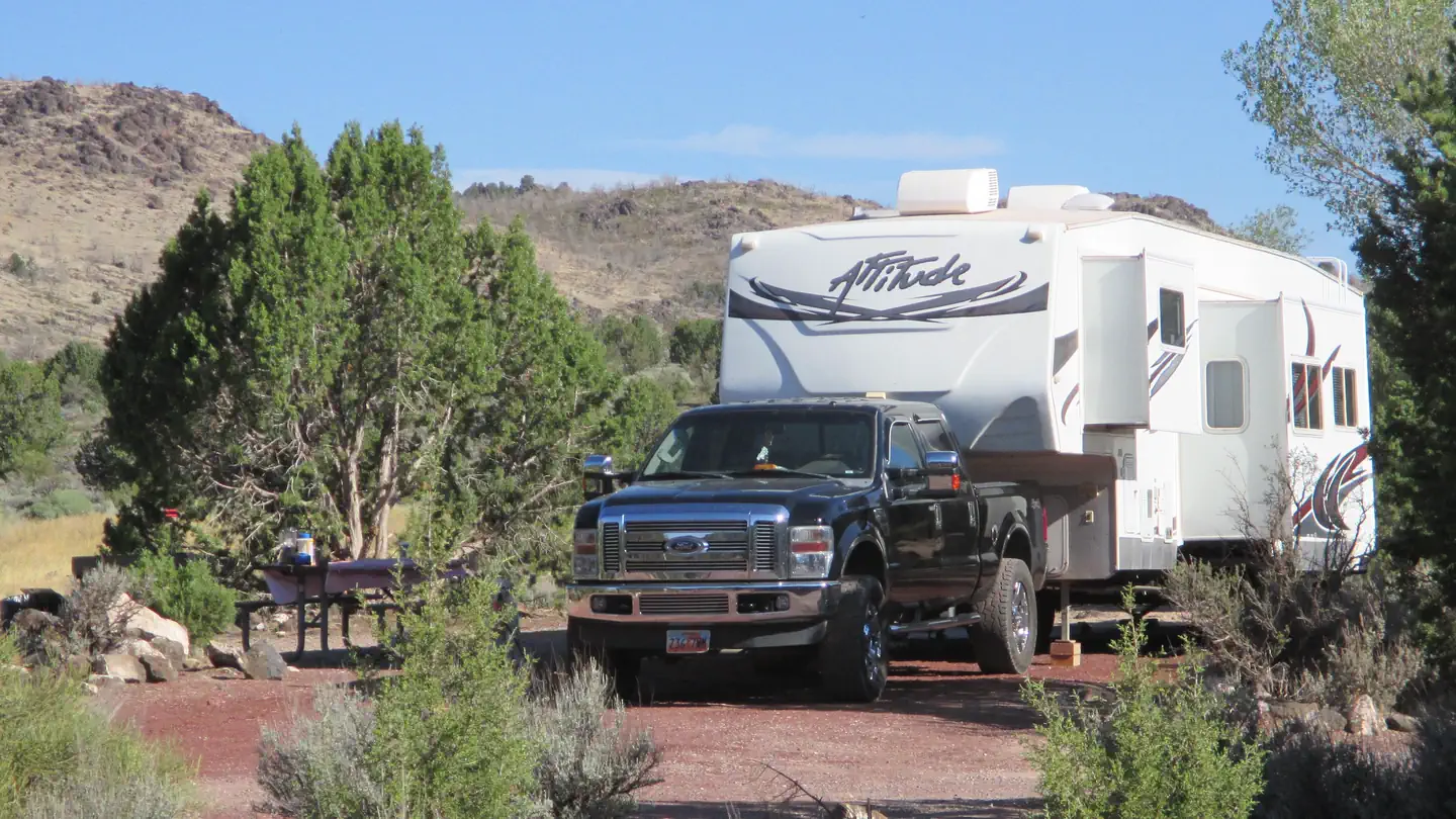
Baker Dam Campground
Brookside, UT
Overview In the early 1980s, the Baker Dam Recreation Area was developed to take advantage of the recreational opportunities provided by the reservoir. Increased public demand led to an expansion of the recreation area in 1994 that included enlarging the campground and adding a day use section. Today, the recreation area serves as a base camp to enjoy not only the reservoir, but adjacent public lands as well. Please protect your resources by acting responsibly and following the rules.
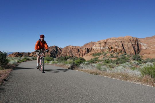
Snow Canyon State Park
St. George, UT
Snow Canyon State Park features red Navajo sandstone, capped by an overlay of black lava rock. Photography, hiking, biking, horseback riding, and camping are popular activities. Early spring and fall use of the park are especially appealing due to southern Utah's moderate climate.
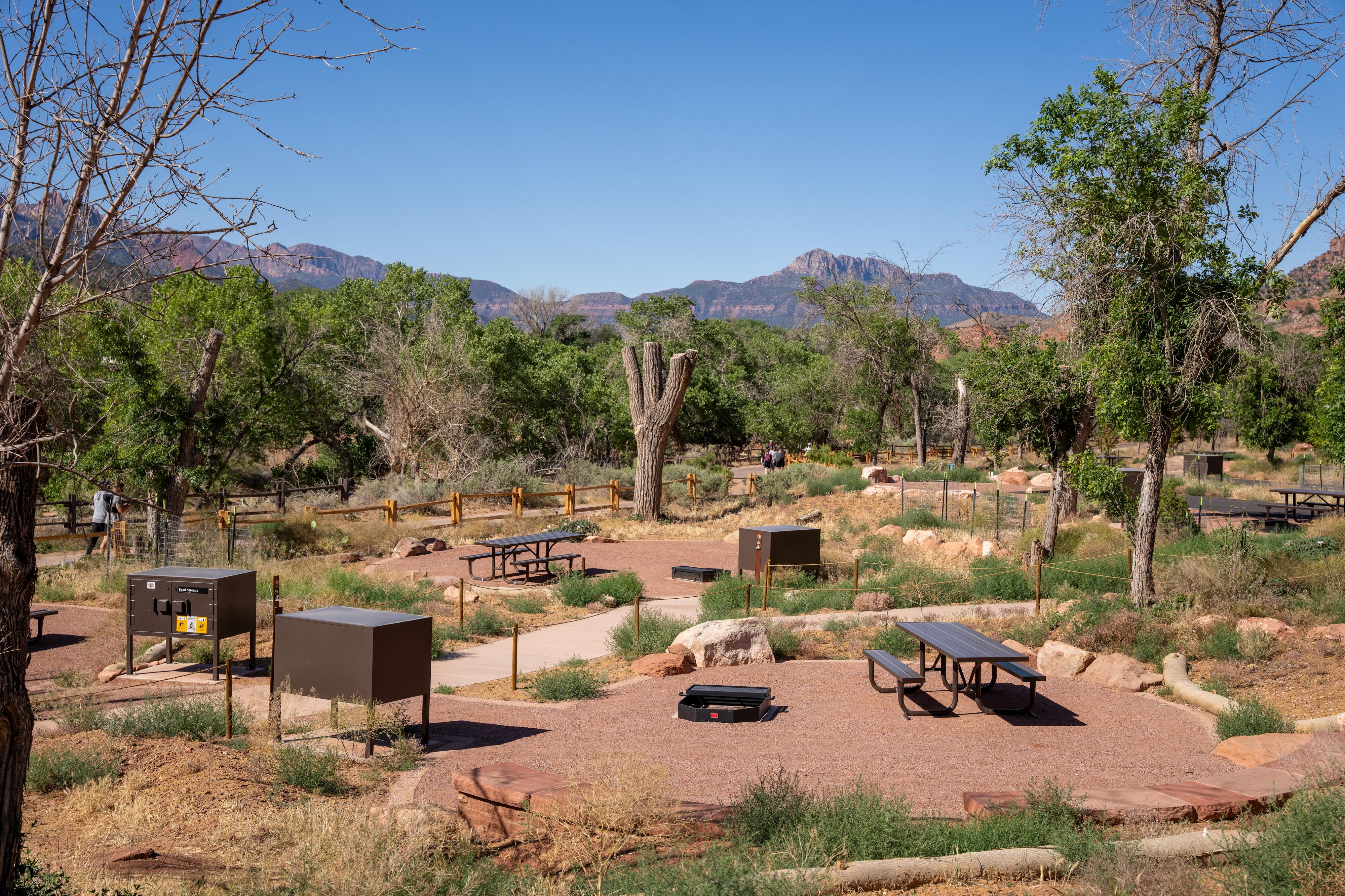
South Campground
Springdale, UT
South Campground is located between the Zion Canyon Visitor Center and Zion Nature Center, ½ mile from the South Entrance in Springdale, Utah. Campsites are typically available from mid-March through October 31. All sites include a parking space, a picnic table, a fire ring, a food storage box, and space for a tent or RV/camper. All campsites in South Campground require reservations. Reservations
Clay Flat Kiosk
Orderville, UT
"The Clay Flay Kiosk is located on the Yellowjacket road approximately two miles south of Highway 89, just north of Kanab, UT. It serves as a staging area for ATVs, UTVs, and horse trailers. It accesses Harris Mountain and Moncur Spring. You will also find several dispersed camping sites in this area. This area is also used for grazing. Please be cautious and respectful of the wildlife and range improvements. "
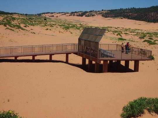
Coral Pink Sand Dunes State Park
Kanab, UT
Rippling arcs of rust-colored sand welcome you as you enter Coral Pink Sand Dunes State Park. Contrasted by blue skies, juniper and pinion pines, and steep red cliffs, the park is a wonderful place for camping, photography, off-highway vehicle riding, and playing in the sand.
Upper Pleasant Creek Campground
Boulder, UT
Campground. This is a favorite for campers. There is trout fishing nearby at Lower Bowns Reservoir and Lower Pleasant Creek. RVs over 25 feet long are not advised. Water will be turned off at threat of first frost. Campground closes 10/15/20 or threat of first frost.
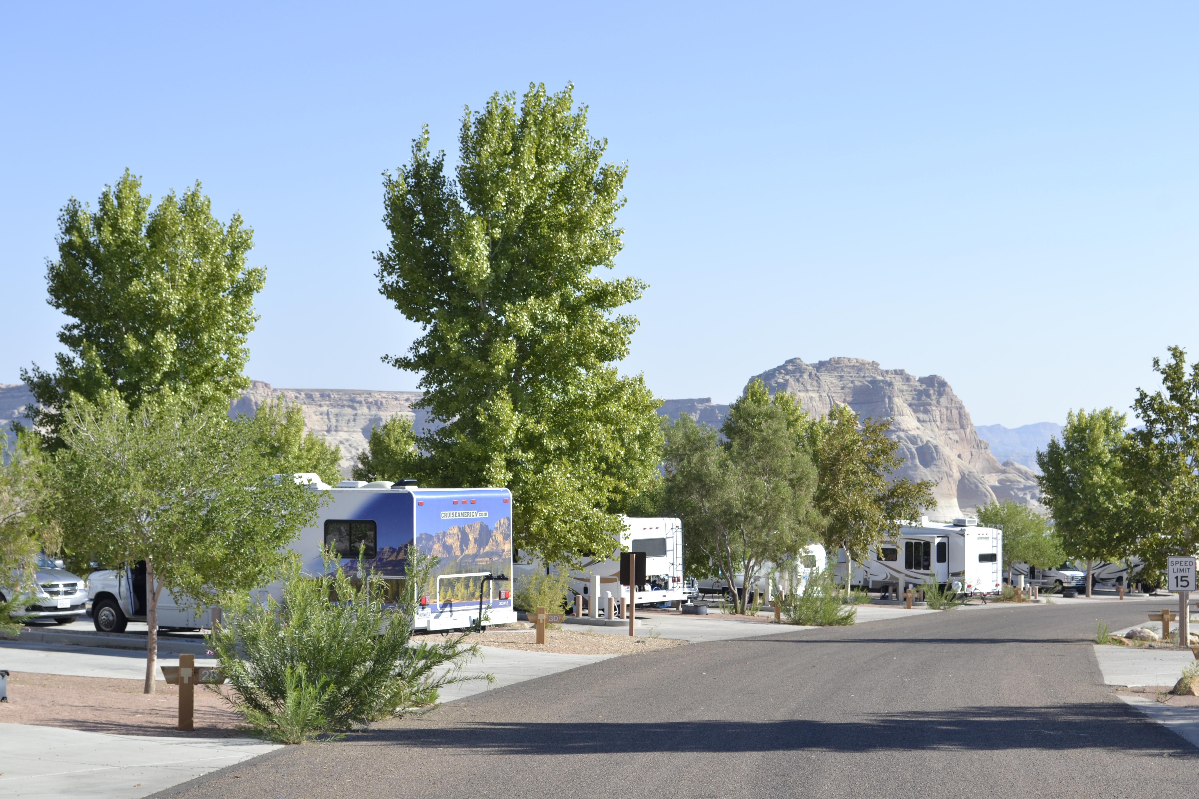
Wahweap Campground & RV Park
Page, AZ
Operated by Lake Powell Resors & Marinas. 112 dry campsites (no hook-ups), 90 full hook-ups, and 6 group camping sites. Facilities include restrooms, laundry, showers, store, phones, dump station and potable water. The amphitheater, picnic area and swim beach are nearby. Fees apply. To make reservations for full hook-ups, group or dry camping please visit www.lakepowell.com or call 800-528-6154. T
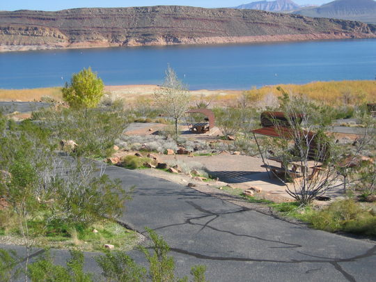
Quail Creek State Park
Hurricane, UT
Boasting some of the warmest waters in the state and a mild winter climate, Quail Creek Reservoir lures boaters and anglers year-round. Spend a day on the water or visit a nearby state or national park, then retire to a campsite in a spectacular red rock desert setting.
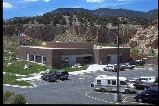
Fremont Indian State Park
Sevier, UT
Fremont Indian State Park and Museum was established to preserve a treasury of rock art and archaeological sites. The museum visitor center offers a video program introducing visitors to the Fremont Indians.
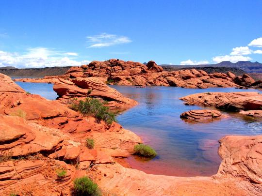
Sand Hollow State Park
Hurricane, UT
With its warm blue waters and red sandstone landscape, one of Utah's newer state parks is also one of the most visited. You can boat and fish on the reservoir or explore the dunes of Sand Mountain on an off-road vehicle.
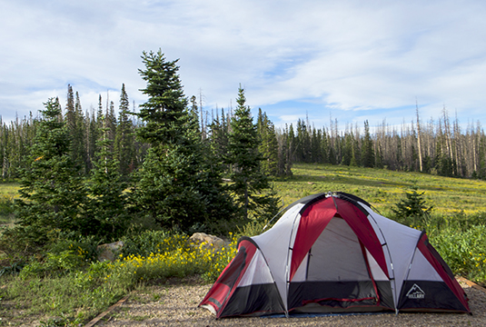
Point Supreme Campground
Brian Head, UT
Point Supreme Campground is surrounded by meadows of wildflowers in the summer! At 10,000 feet elevation, it is a comfortable place to camp during the hotter summer months. The Point Supreme Campground has 25 campsites and accommodates both tents and RVs. Camping is available from mid-June to mid-September. Note that the campground opening and closing dates may be vary & are subject to favorable w
Hog Canyon East Kiosk
Kanab, UT
The Hog Canyon East Kiosk is simply that. The only thing you’ll find here is a Kanab Field Office Transportation Map and a small corral. Visitors typically access this from the Crocodile Staging area, or a small parking area near Best Friends Animal Sanctuary. These routes are suitable for four-wheel-drive jeeps, ATVs, UTVs, and horseback. These routes are not recommended for street or two-wheel-drive vehicles due to steep inclines, rocky surfaces, narrow routes, and deep sand. For more information, detailed maps, and current conditions, contact the Grand Staircase-Escalante National Monument Visitor Center in Kanab, UT.
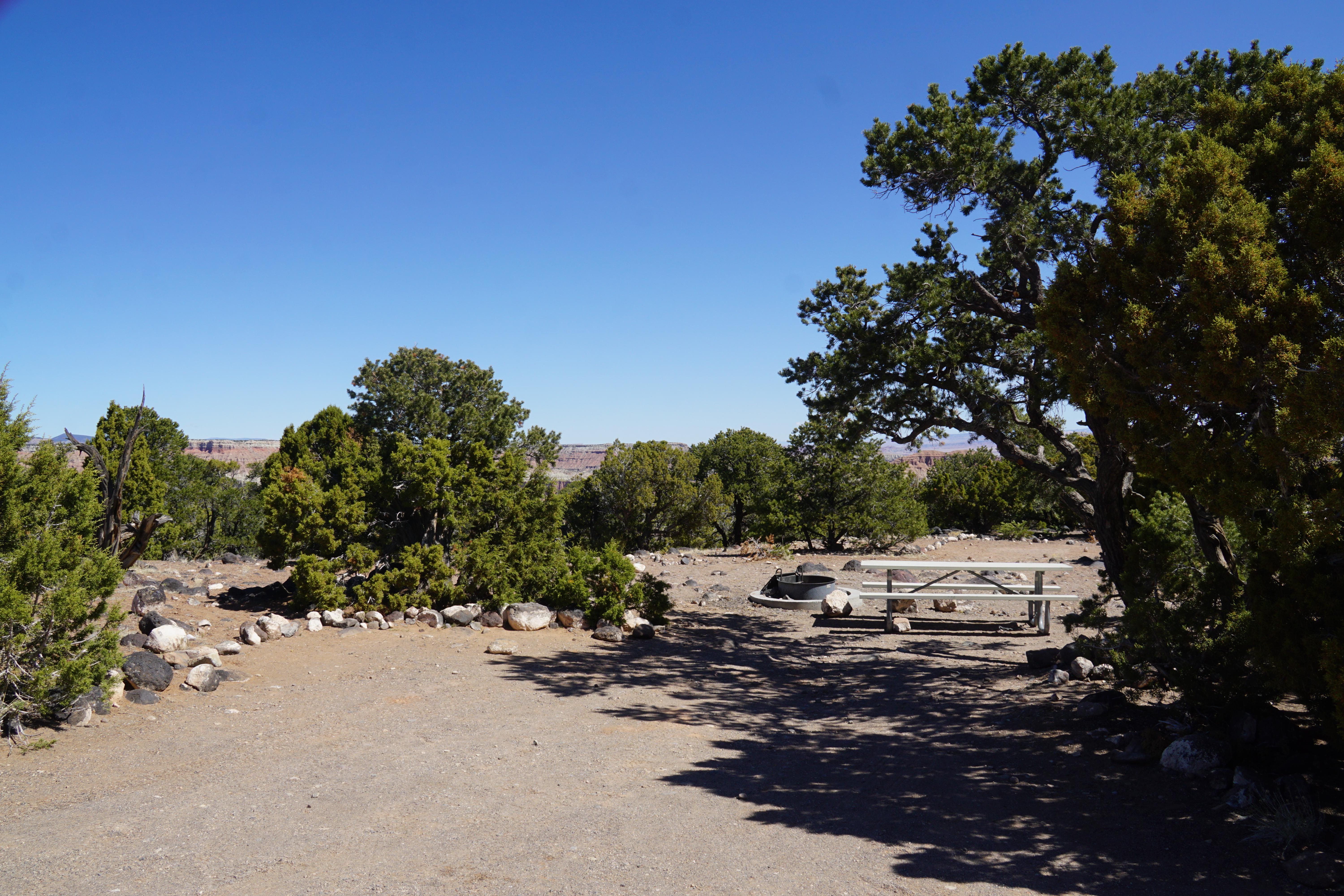
Primitive campsites at Cathedral Campground
Torrey, UT
It is located approximately halfway on the Cathedral Valley Loop Road. About 36 miles (57.9 km) from the visitor center, this primitive, no-fee campground has 6 sites, each with a picnic table and fire grate. There is a pit toilet, but no water available. The campground is open year-round; however, visitors should check road conditions with the Capitol Reef Visitor Center prior to planning an over
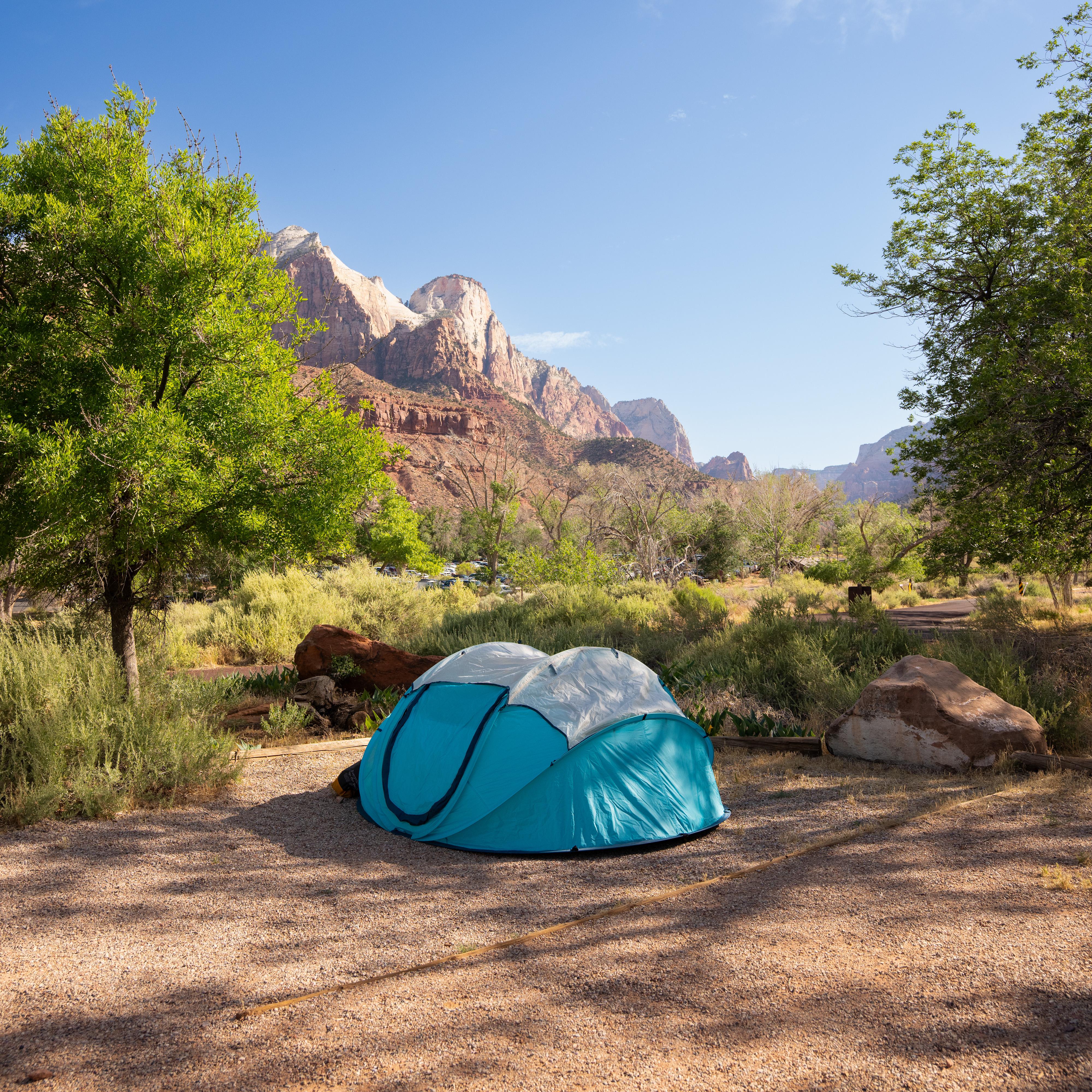
Watchman Campground
Springdale, UT
Watchman Campground is located next to the Zion Canyon Visitor Center, ¼ mile away from the South Entrance in Springdale, Utah. Tent, RV, and group campsites are typically available year-round. All sites include a parking space, a picnic table, a fire ring, and space for a tent or RV/camper. All campsites in Watchman Campground require reservations. Reservations can be made up to 6 months in advan
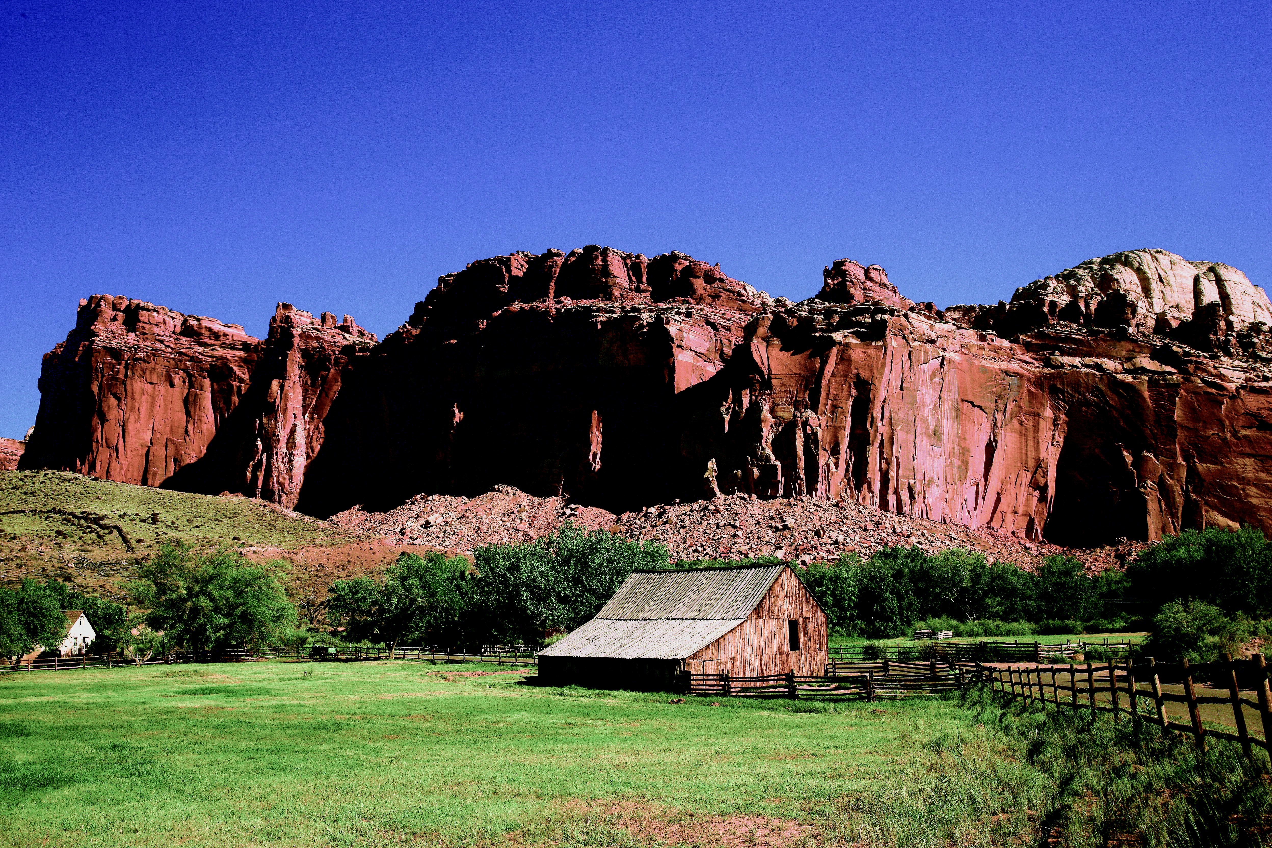
Fruita Campground
Torrey, UT
The 71 site Fruita campground is the only developed campground in the park, offering picnic tables, fire rings, restrooms, water and a dump station. A $25 nightly fee is charged. It is open year-round. Campsites are reservable year-round; visit www.recreation.gov to make a reservation. Reservations are accepted 6 months ahead of time. The busy season is mid March through October when the campgroun
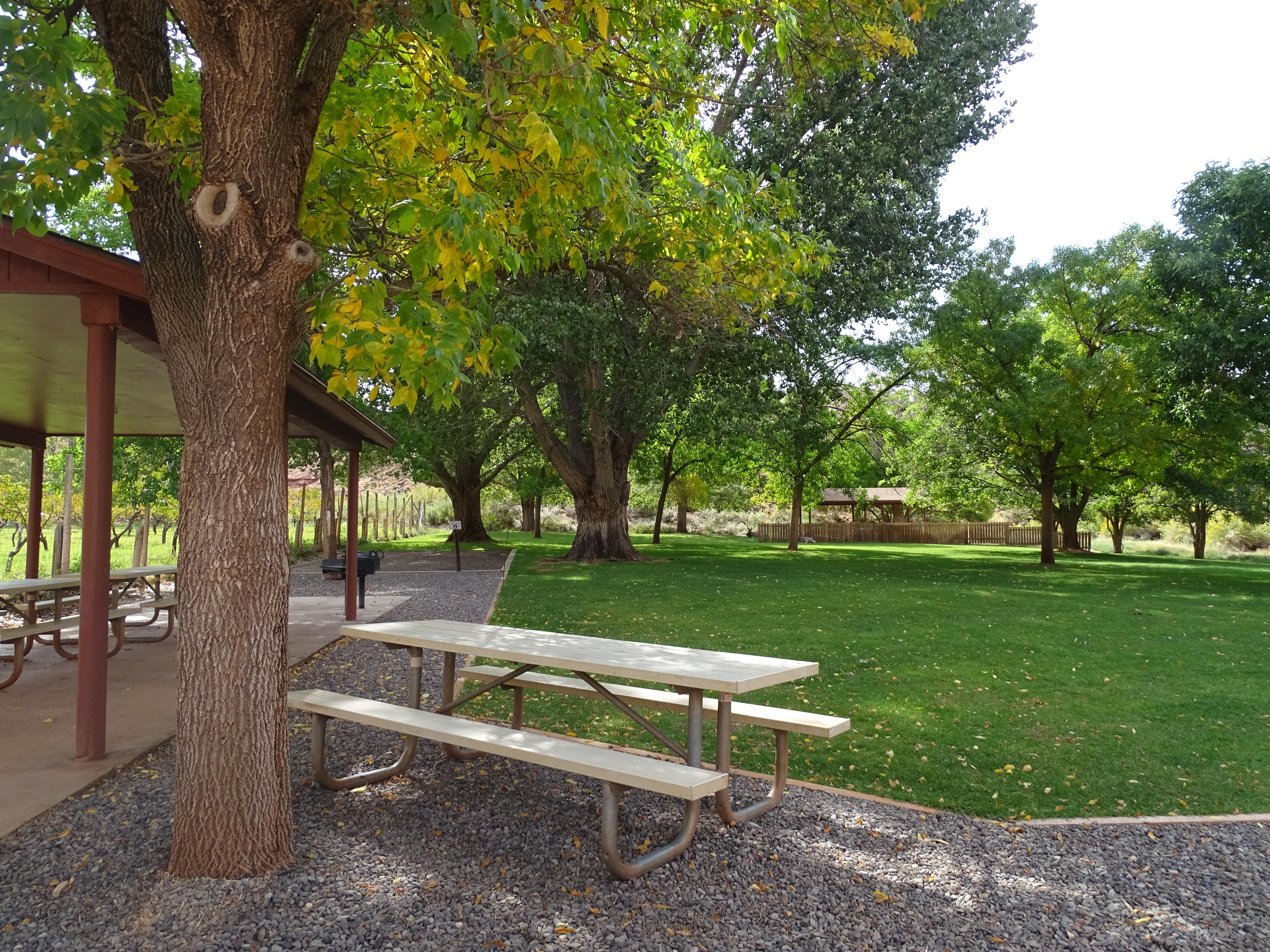
Group Campsite
Torrey, UT
The Group Campsite is a secluded site located near the Fruita Campground and can accommodate a maximum of 40 people. It may be reserved through www.recreation.gov up to one year in advance. The Fruita Group Campsite is open from mid-April to mid-October. It is closed every Tuesday and Wednesday nights for maintenance. The nightly rate is $125.
Deer Creek Campground
Boulder, UT
Deer Creek Campground is a small cozy campground nestled in Deer Creek Canyon at 5800 ft. There are 7 campsites and potable water is not available. This small campground is located along the scenic Burr Trail Road in the Grand Staircase/Escalante National Monument. The campground does not accommodate travel trailers due to site limitations.
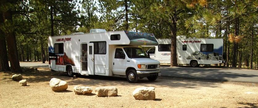
Sunset Campground
Tropic, UT
Located west of Sunset Point, approximately 1.5 miles south of the Bryce Canyon Visitor Center, and is comprised of 99 sites in 3 loops; Loop A is primarily for RVs; Loops B & C are tent-only. There are no sewer, water or electrical hook-ups available. A dump station is available in summer months near North Campground; use is included with campsite fee. Potable water is available near the dump sta
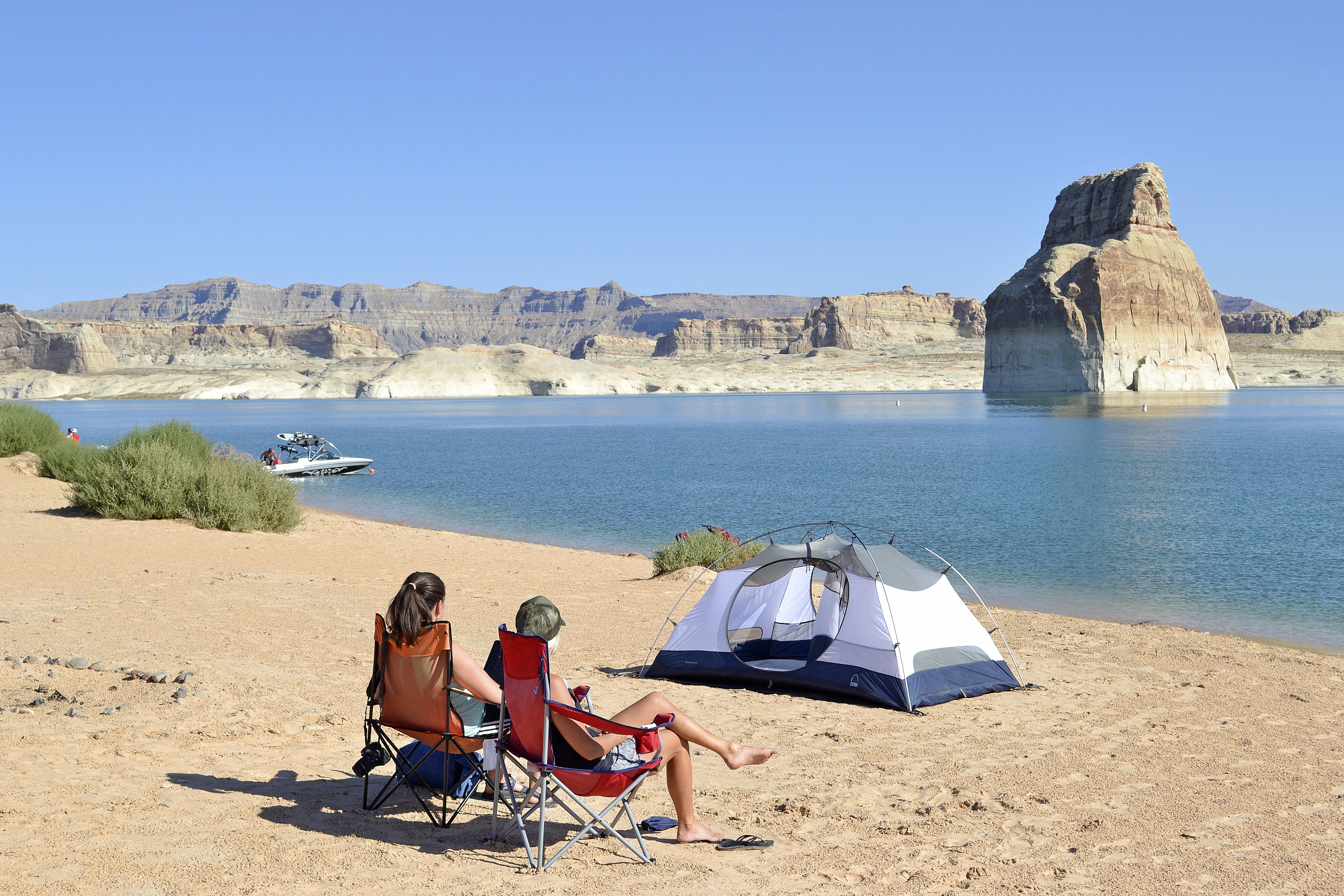
Lone Rock Beach Primitive Camping Area
Kanab, UT
No reservations. $14 per vehicle/per night in addition to entry fees. Primitive camping is on a sandy beach or in dunes. No designated campsites. Maximum two vehicles per site. Open fires permitted, must be within four-foot squared area. No glass containers. Quiet time 10pm-6am. 4 micro flush toilets, 6 vault toilets, 1 comfort station/wheelchair accessible, outdoor cold shower, Off Road Vehicle a
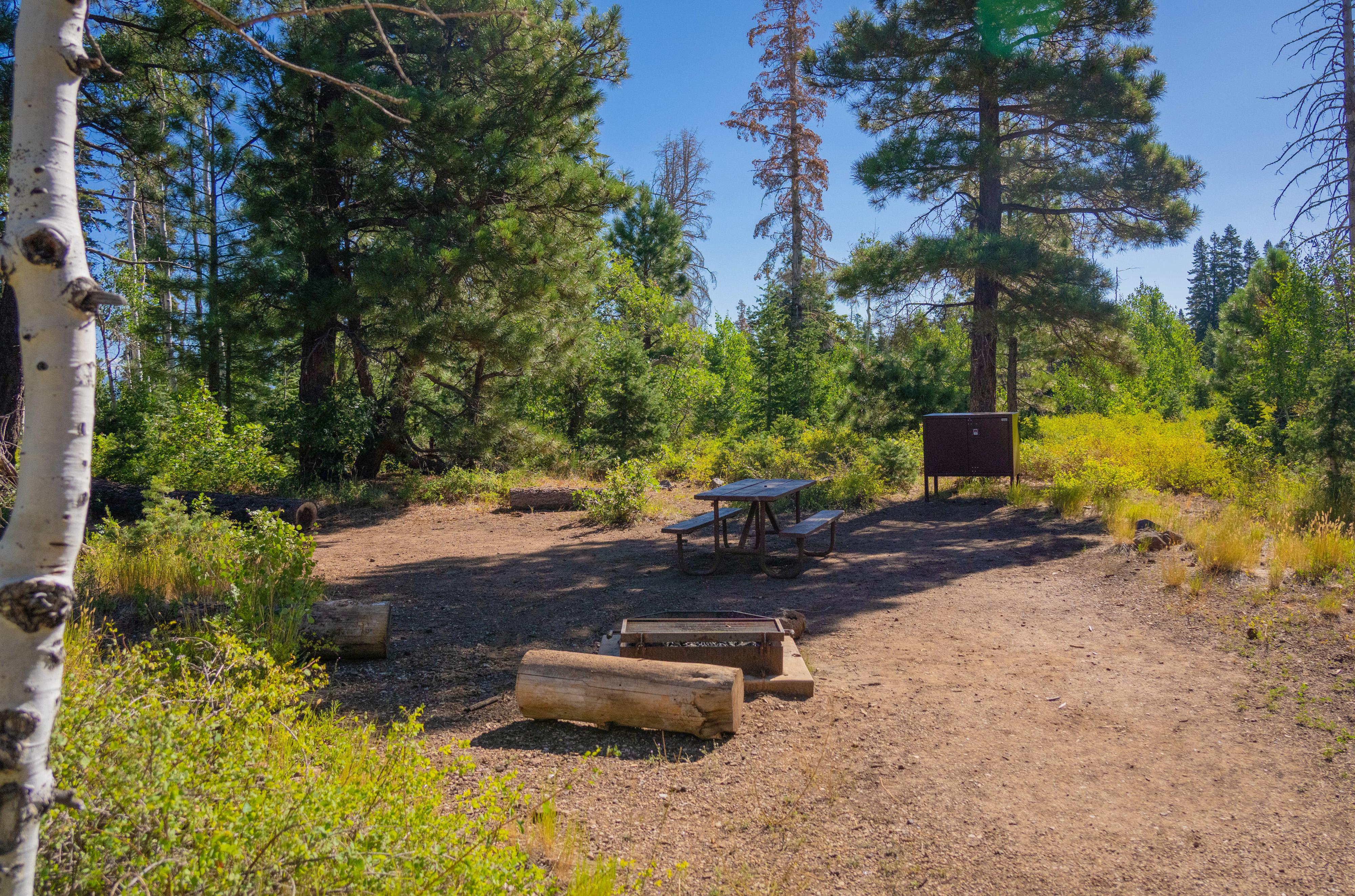
Lava Point Campground
Virgin, UT
Lava Point Campground is open as weather allows, typically from May through September. Situated at 7890 feet above sea level, the campground can be reached via the Kolob Terrace Road, 25 miles (45 minutes) north of the Virgin. It takes approximately 80 minutes to drive to the campground from the South Entrance of Zion Canyon. Six (6) primitive campsites are available for reservation. The campgroun
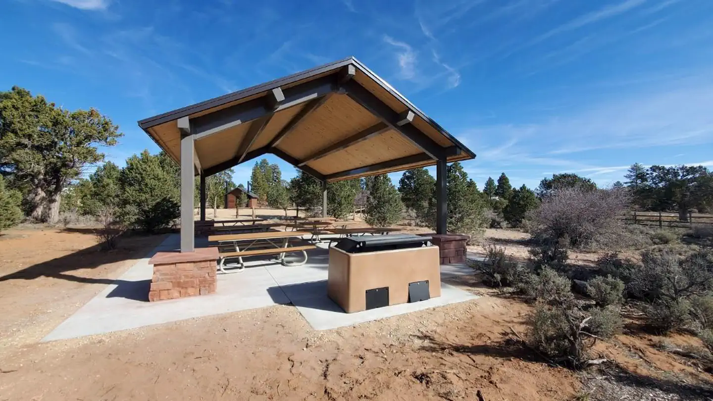
Ponderosa Grove Campground
Orderville, UT
Overview The Ponderosa Grove campground is situated approximately eight miles to the northwest of Kanab, Utah, at 6,300 feet in elevation and is named for the small canopy of ponderosa pine trees that shade its campsites. The climate in the area ranges from extremely cold in the winter to temperatures over 100 degrees Fahrenheit during the summer months.
Bowery Creek
Koosharem, UT
Overview Bowery Creek Campground is located next to Fish Lake in the Fishlake National Forest of central Utah. Visitors enjoy boating, fishing and exploring local trails.
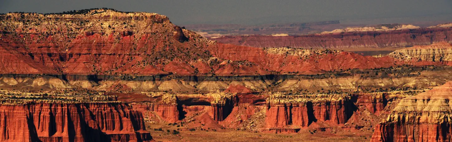
Capitol Reef Group Campground
Torrey, UT
Overview Located in south-central Utah in the heart of red rock country, Capitol Reef National Park is a hidden treasure filled with cliffs, canyons, domes and bridges in the Waterpocket Fold, a geologic monocline (a wrinkle on the earth) extending almost 100 miles (160 km).
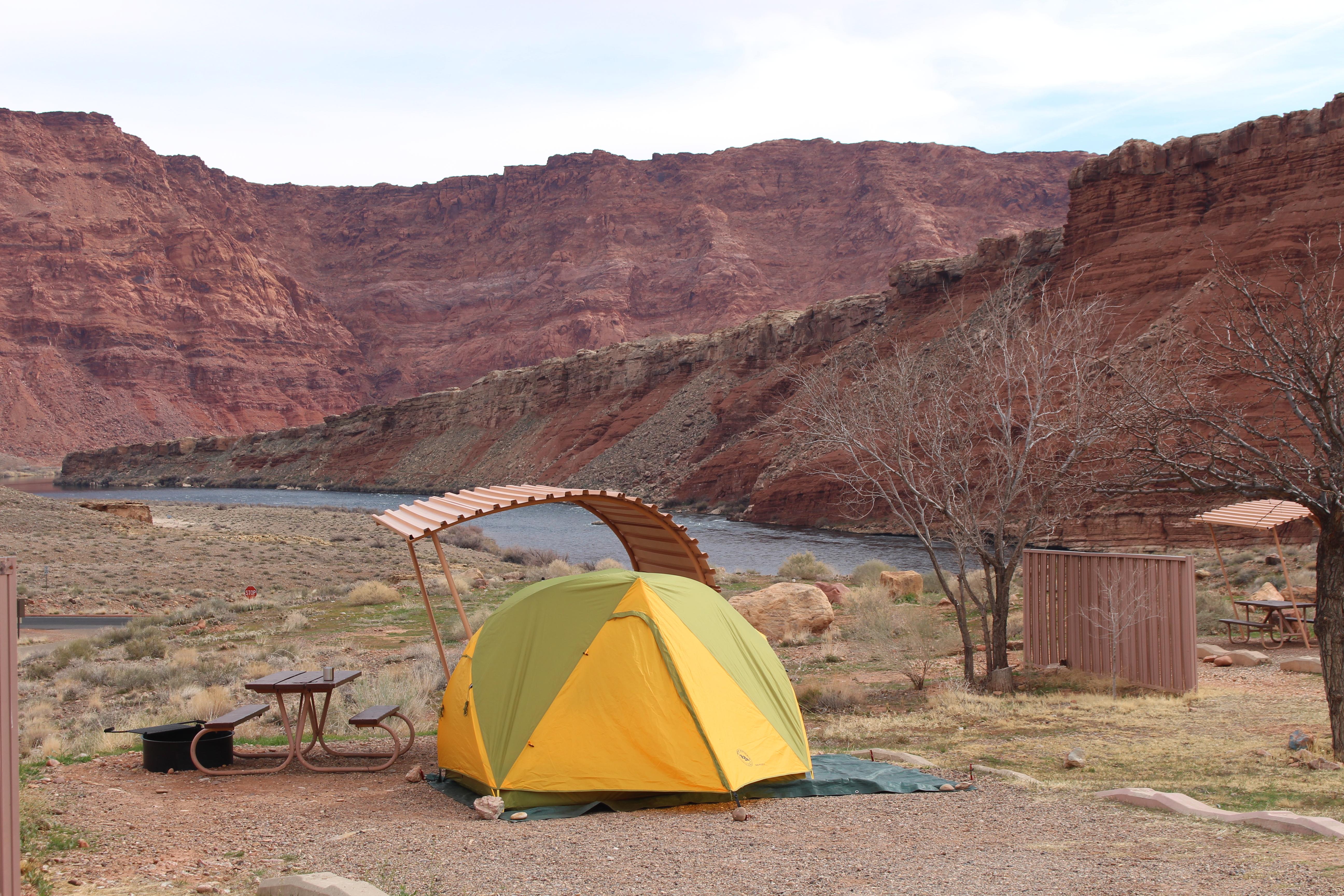
Lees Ferry Campground
Marble Canyon, AZ
No reservations. $26 per site/per night. 54 designated sites. No hookups. RV dump station. Grills provided, no open fires. Quiet time 10pm-6am. Modern bathroom/comfort station, potable water available, launch ramp 2 miles. Gas and supply store at Marble Canyon, about 5 miles away. Wow, views of Colorado River and Vermillion Cliffs.
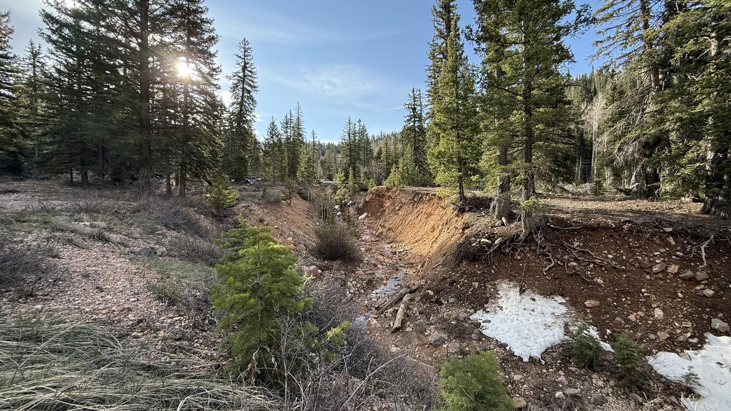
Cedar Canyon
Brian Head, UT
Cedar Canyon Campground is located conveniently close to Cedar City, Utah, only 11 miles east. Visitors can enjoy hiking, biking and day-tripping to nearby Cedar Breaks National Monument. Recreation Cedar Canyon is just 8 miles from Cedar Breaks National Monument, with hiking trails, guided tours and breathtaking scenery. Just outside Cedar Breaks is the Ashdown Gorge Wilderness Area, where hikers will find 10 miles of trails and the Twisted Forest, a stand of ancient bristlecone pine. The 34-mile Virgin River Rim Trail is located near the campground with a short drive for access and is open to hiking, mountain biking and horseback riding.
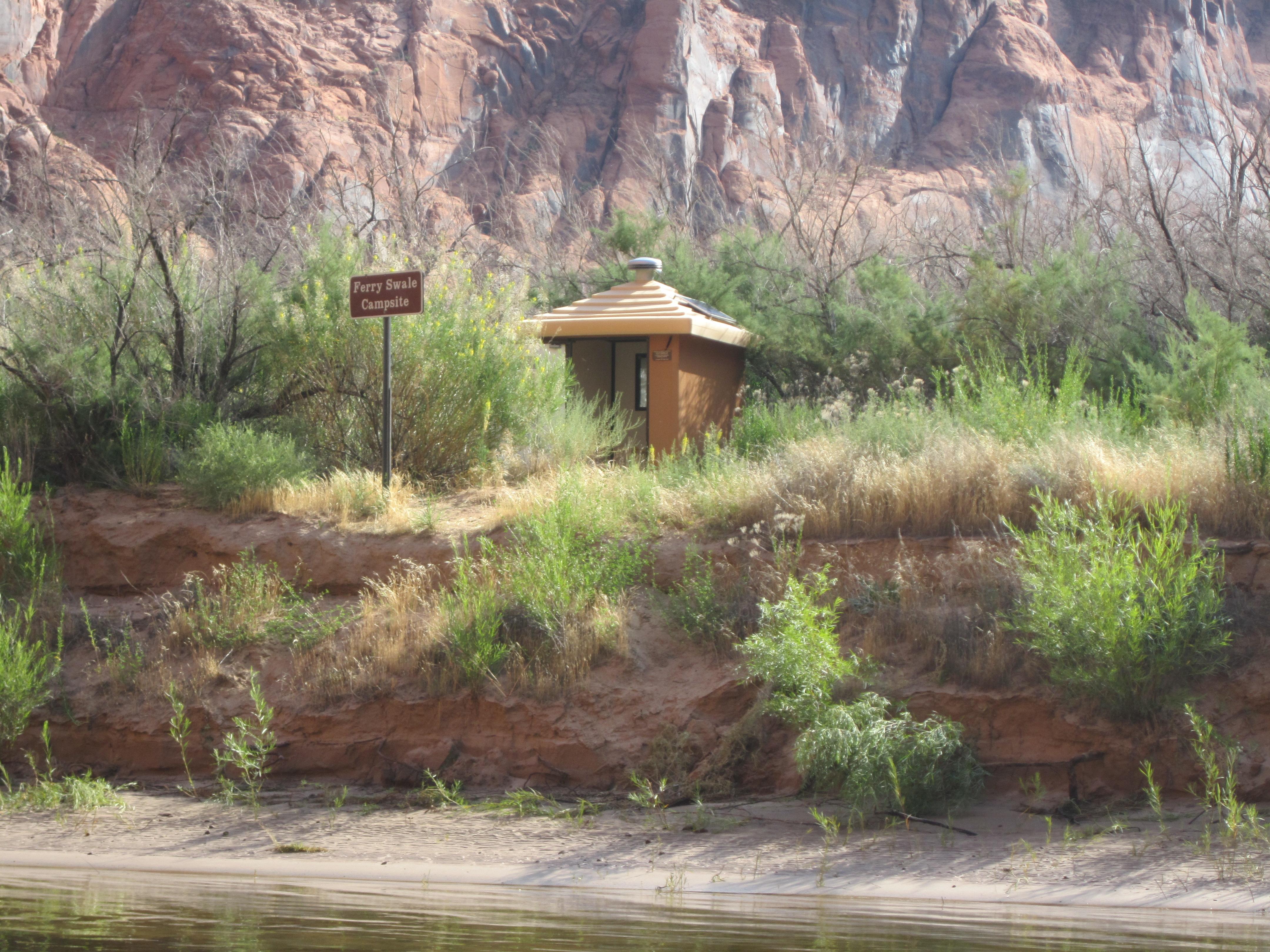
Colorado River Primitive Camping Between Glen Canyon Dam and Lees Ferry
Page, AZ
No reservations. Along the fifteen mile stretch of the Colorado River between Glen Canyon Dam and Lees Ferry, there are five primitive beaches set aside for camping, marked with signs, on a first-come, first-served basis. Camping is permitted in these areas only, as they are provided with toilets and fire pits. These sites can only be accessed by small vessel. All campsites are located well above
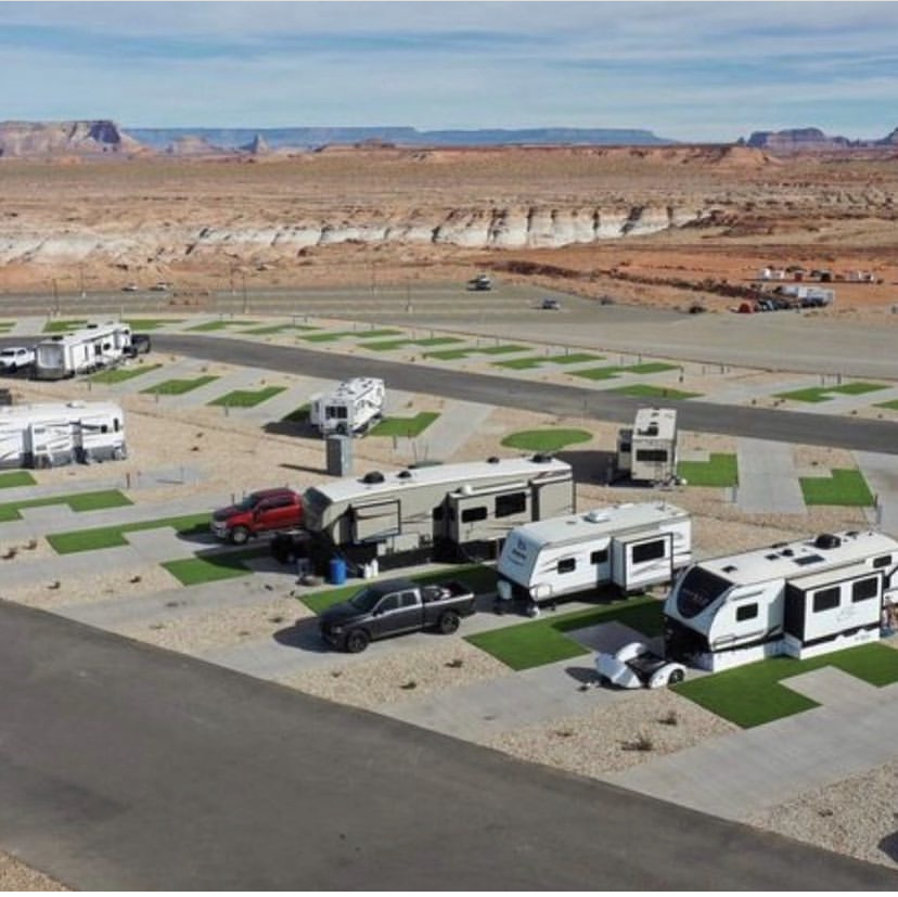
Antelope Point RV Park
Page, AZ
While the Antelope Point RV park is not physically within the boundaries of Glen Canyon National Recreation Area, it is operated by Antelope Point Marina. Make your reservation with them at https://antelopepointlakepowell.com/explore-lake-powell/rv-park/. This is an RV site only. 104 full hook-up spaces, 15 pull-through spaces. Maximum Length - 70ft. 2 RV dump stations
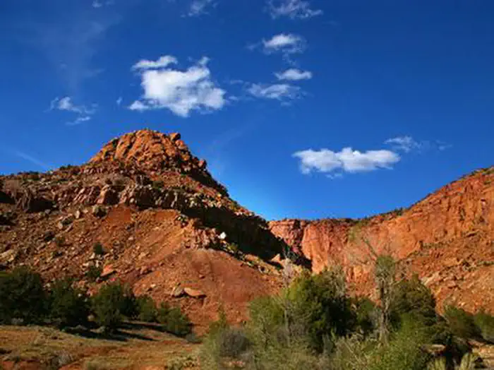
Sunglow Campground
Bicknell, UT
Overview Sunglow Campground is located in a scenic red rock box canyon just 2 miles from Bicknell, Utah. Visitors enjoy exploring local trails and day-tripping to Capitol Reef National Park.
Mount Trumbull Wilderness Area
Littlefield, AZ
The 7,880-acre Mount Trumbull Wilderness Area is 40 miles south of Colorado City, Arizona, just north of the Grand Canyon in Mohave County. It is located within the Grand Canyon-Parashant National Monument, which is jointly managed by the Bureau of Land Management and the National Park Service. Located at the southern end of the Uinkaret Plateau and part of the Uinkaret Mountains, Mt. Trumbull is a large, basalt-capped mesa with slopes dominated by pinyon pine and juniper trees interspersed with groves of aspen and Gambel oak. The summit or the plateau is covered with ponderosa pine. These vegetation communities provide homes for mule deer, wild turkey, and the Kaibab squirrel.
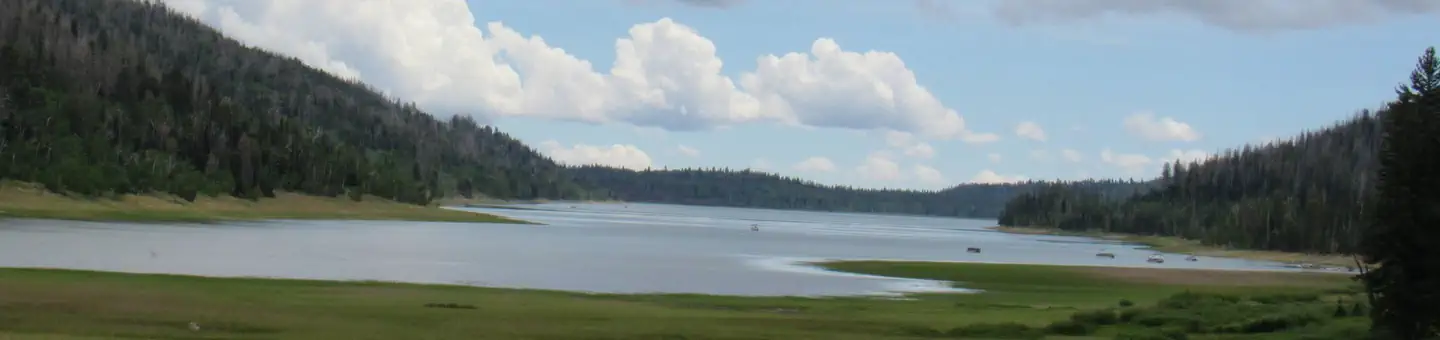
Te-Ah
Duck Creek Village, UT
Te-Ah Campground is located 28 miles east of Cedar City, Utah, in scenic Navajo Lake Basin. Touring bicycle groups commonly use Te-Ah as a stopover on their way through this beautiful corner of Utah. Fishing and canoeing on Navajo Lake are popular activities. Recreation Navajo Lake offers great canoeing, kayaking and fishing. Hiking and biking are popular activities as well. The Cascade Falls Trailhead is located in the campground. This beautiful trail has abundant wildlife and vegetation.
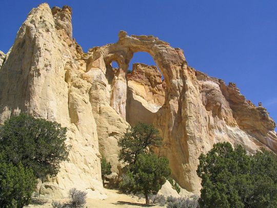
Kodachrome Basin State Park
Kanab, UT
Sixty-seven monolithic stone spires called sedimentary pipes accentuate multi-hued sandstone layers revealing 180 million years of geologic time. The color and beauty found here prompted a 1948 National Geographic Society expedition to name the area Kodachrome after the popular color film.
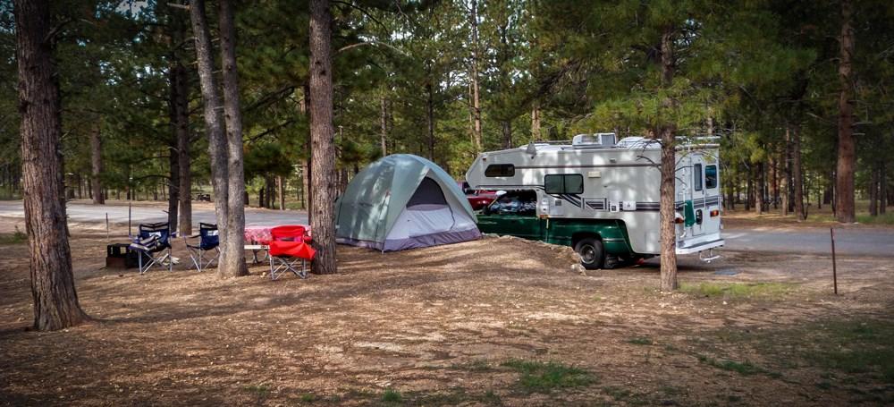
North Campground
Tropic, UT
Located across the road from the Visitor Center and is comprised of 100 sites in 4 loops; A, B, C, D. Loops A & B are for RV campers. Loops C & D are for tent campers and closed in freezing temperatures. There are no sewer, water or electrical hook-ups available. A dump station is available in summer months near North Campground; use is included with campsite fee. Potable water is available near t
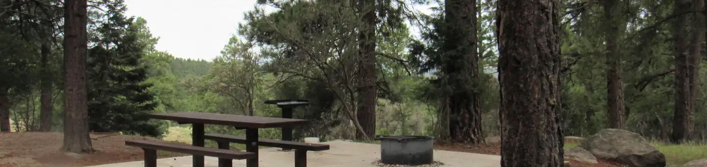
Pine Valley Recreation Area
Pine Valley, UT
Overview A location closure has been issued due to a wildfire that started by lightning, the facility is closed at this time. The area and facilities are under rehabilitation and closed to the public. Please consider visiting one of our many other amazing campgrounds on the Dixie National Forest including Duck Creek, Spruces, Navajo Lake, Te-Ah, Panguitch Lake and many more, Please see other locations on Recreation.gov or visit the Dixie National Forest webpage for additional details https://www.fs.usda.gov/r04/dixie . Please check back for location closure updates.
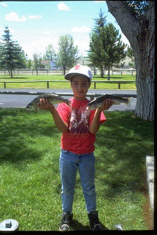
Otter Creek State Park
Antimony, UT
Otter Creek State Park is a perfect destination for ATVers, boaters, and birders. The park is a quiet, out-of-the-way respite located in south central Utah.
Poverty Kiosk
Orderville, UT
The Poverty Kiosk offes an unimproved staging area and a map kiosk. Water and other amenities are not available. This area is also used for grazing. Please be cautious and respectful of the wildlife and range improvements.
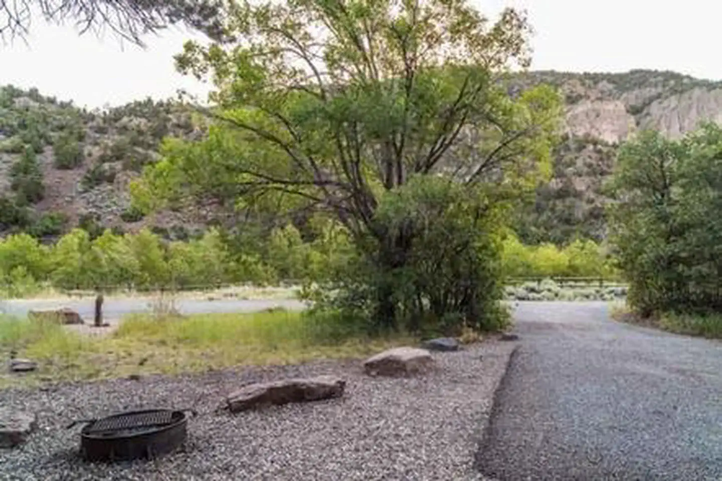
Little Cottonwood Campground
Beaver, UT
The Little Cottonwood Campground is conveniently located off Utah's I-15, adjacent to the Beaver River just outside of the community of Beaver in the Fishlake National Forest. At 6,500 feet in elevation, this is a great place to enjoy the mountains where recreation opportunities include stream fishing, hiking, and hunting. Recreation Enjoy fishing in the Beaver River; an accessible fishing path is located within the campground. The Piute ATV Trail is nearby; however there is no access directly from the campground. Be prepared to trailer ATVs to the nearby trailheads for access.
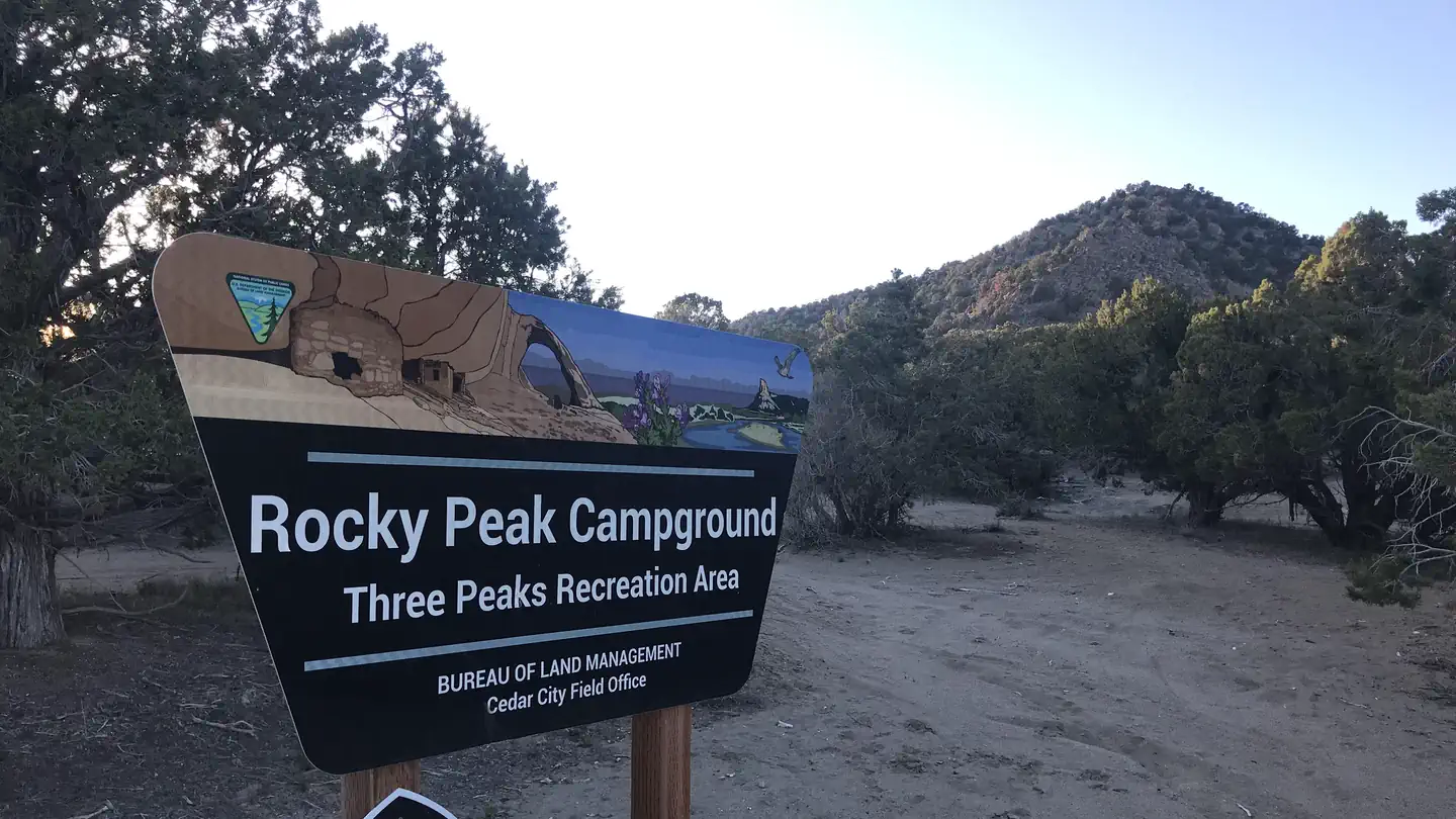
Rocky Peak Campground
Cedar City, UT
Overview The Rocky Peak Campground is located within Three Peaks Recreation Area, which is one of the largest designated recreation areas in Cedar City, UT. In 2006, Three Peaks was designated as a Special Recreation Management Area. What previously existed as a local open space playground has since been developed into a recreation area to meet the needs of almost any outdoor enthusiast.
Pine Spring Kiosk
Orderville, UT
The Pine Spring Kiosk offers an unimproved staging area and a map kiosk. Water and other amenities are not available. This area is also used for grazing. Please be cautious and respectful of the wildlife and range improvements.
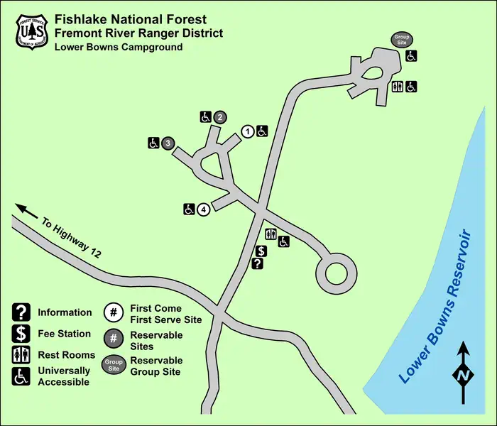
Lower Bowns
Boulder, UT
Overview Lower Bowns Campground is located on the east side of Boulder Mountain on the shore of Lower Bowns Reservoir at an elevation of 7,000 feet. Visitors enjoy boating, fishing and exploring local trails.
Doctor Creek
Koosharem, UT
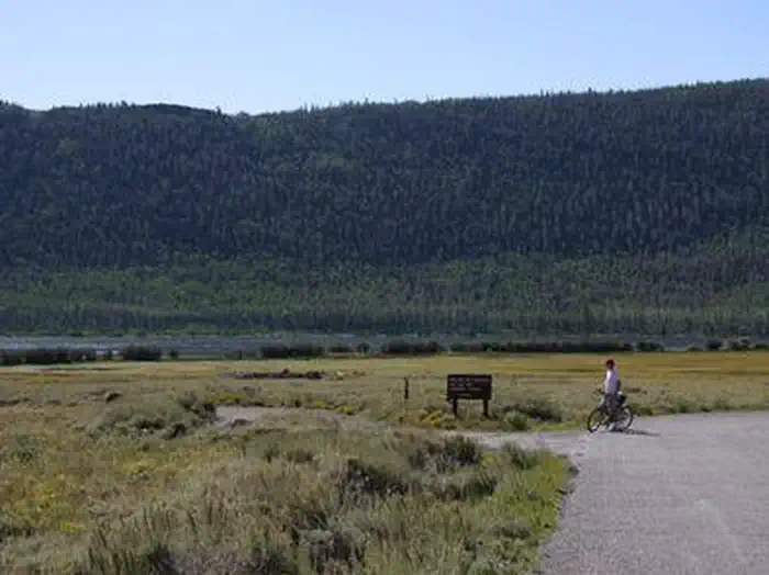
Overview Doctor Creek Campground is located next to Fish Lake in the Fishlake National Forest of central Utah. Visitors enjoy fishing, boating, wildlife viewing and exploring local trails. Located within the Aspen Pando Clone it is a great explore this world renound natural treasure.
White House Campground
Kanab, UT
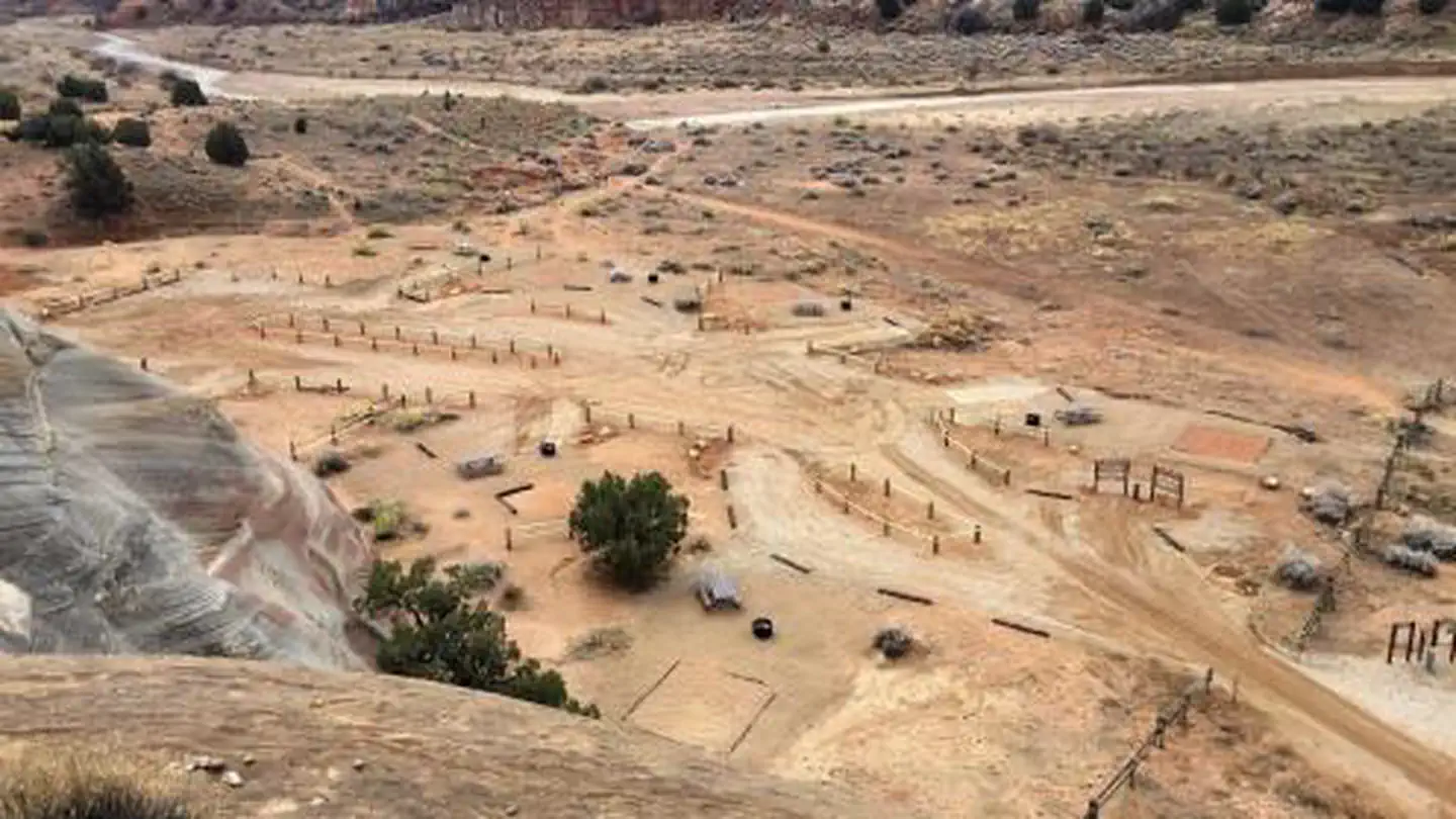
Overview White House campground is located approximately 43 miles east of Kanab, Utah, two miles to the south of Highway 89 and the Paria Contact Station, at the end of Monument Road 751 . The campground sits in a broad valley between the Paria River and scenic white-grey sandstone buttes. Individual campsites are available on a first-come, first-served basis; they cannot be reserved ahead of time. The campground was constructed in the 1970s, and, until it was reconstructed (2017- 2019), was combined with a trailhead accessing the Paria Canyon-Vermilion Cliffs Wilderness. The campground has been primarily used by hikers and backpackers as a staging area for trips into the Paria Canyon Vermilion Cliffs Wilderness, which is jointly managed by the KFO, Grand Staircase-Escalante National Monument (GSENM), and Vermilion Cliffs National Monument (VCNM)
Hog Canyon West Kiosk
Kanab, UT
The Hog Canyon West Kiosk is used as a staging area to access the Hog Canyon OHV System. You will find a beautifully built kiosk with the Kanab Field Office Transportation Map, Hog Canyon OHV System Map, and information provided by the BLM Kanab Field Office, the Canyon Country 4x4 Club, and Kane County. The Hog Canyon OHV System is suitable for four-wheel-drive jeeps, ATVs, UTVs, horseback, and hiking. These routes are not recommended for street or two-wheel-drive vehicles due to steep inclines, rocky surfaces, narrow routes, and deep sand. For more information, detailed maps, and current conditions, contact the Grand Staircase-Escalante National Monument Visitor Center in Kanab, UT.
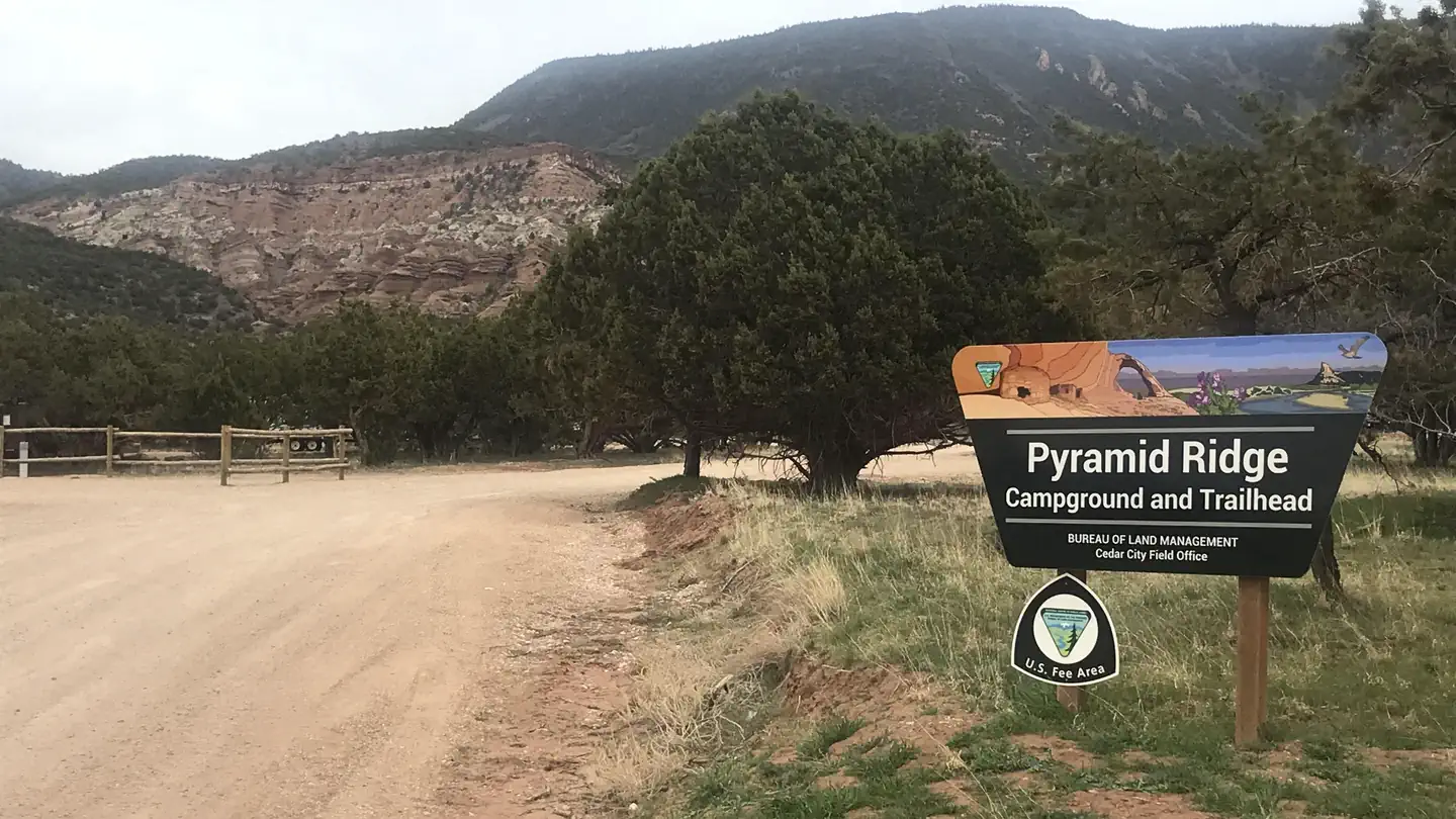
Pyramid Ridge Campground
Cedar City, UT
Overview Pyramid Ridge Campground sits at just over 6,000 feet above sea level and looks out to a backdrop of the red rock pyramids along the Hurricane Cliffs. This campground gives visitors a remote and backcountry feel while only being a few minutes drive from I-15 and the amenities of town. The campground also serves as one of the trailheads to the Iron Hills Trail System.

Twin Creeks Picnic
Koosharem, UT
Overview Twin Creeks Picnic Area is is a day-use site located next to Fish Lake, Twin Creeks and the Fishlake Scenic Byway at an elevation of 8,800 feet. Visitors enjoy fishing, boating, exploring local trails and viewing spawning salmon from the board walk that meanders along the creek. This takes place mid to late fall. Some fish can usually be found year round.
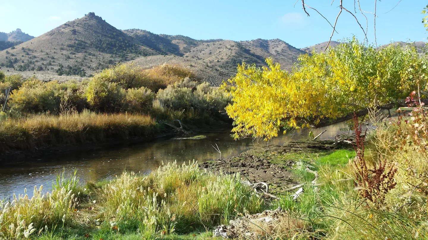
Hanging Rock Campground
Minersville, UT
Overview Hanging Rock Campground is located just off of Highway 21 between the towns of Beaver and Minerville, UT. The campground has six campsites all located alongside the scenic Beaver River. Along with the scenery that the river provides, it also offers what many consider to be the best fising in Beaver County.
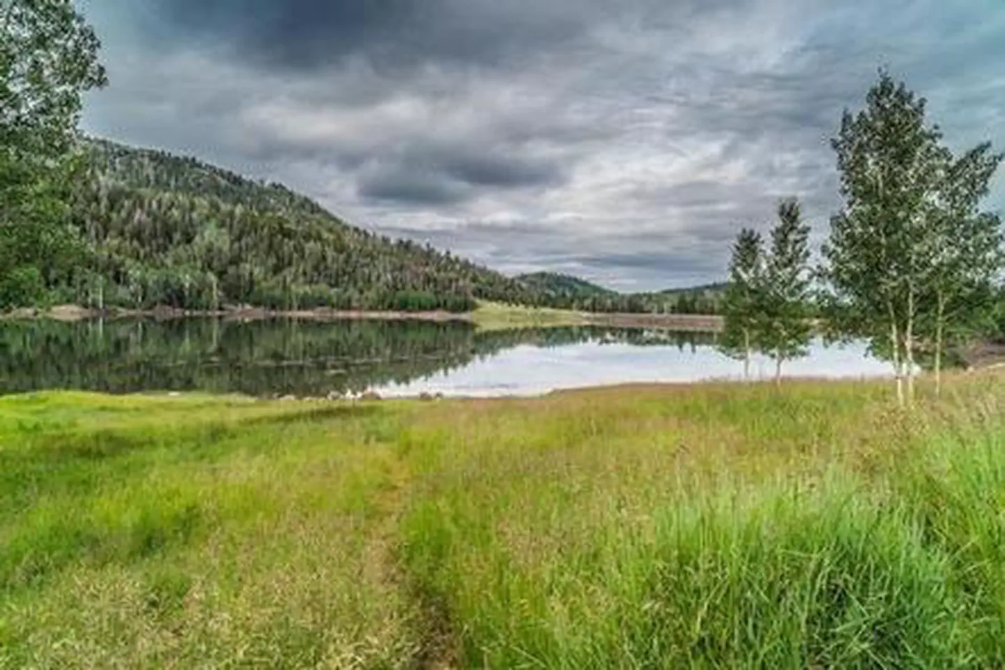
Kents Lake Campground
Beaver, UT
Kents Lake Campground has 28 single family campsites and two multiple family campsites. It is situated in a beautiful forested setting at an elevation of 8,800 feet. The campground is located adjacent to Kents Lake, which is approximately 50 acres in size and suitable for small fishing boats and canoes. Kents Lake is stocked with a variety of trout, all catchable from shore or boat.
Mount Logan Wilderness Area
Littlefield, AZ
The 14,650-acre Mount Logan Wilderness Area lies 45 miles south of Colorado City, Arizona, just north of the Grand Canyon in Mohave County. Hiking, camping, scenic vistas, watching wildlife and hunting are some of the prime recreational opportunities found in this wilderness. One example is the Mt. Logan Summit and Hells Hole Overlook.

Navajo Lake Campground
Duck Creek Village, UT
Navajo Lake Campground, located on the south shore of Navajo Lake, it provides a spectacular setting for boating, camping, fishing, hiking, biking and photography. Boat rentals, launching, and cabin lodging are available at nearby Navajo Lake Lodge. The Virgin River Rim Trail is accessible from the campground; it offers panoramic views of Zion National Park, Virgin River Rim and the Kolob Plateau. Recreation Navajo Lake offers great canoeing, kayaking and fishing. Hiking and biking are popular activities as well. The 32-mile Virgin River Rim Trail passes a short distance from the campground and is open to hiking, mountain biking, foot travel and horseback riding. The Navajo Lake loop trail is accessed from the campground on the Navajo Lake trail. The Navajo Lake Loop trail is very popular with cyclist and is an 11 mile loop.
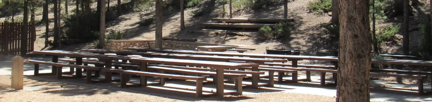
Kings Creek
Hatch, UT
Overview Kings Creek Campground is located on the west side of Tropic Reservoir, high on the Colorado Plateau at an elevation of 8,000 feet. Visitors enjoy boating, fishing, hiking, and exploring local ATV trails.
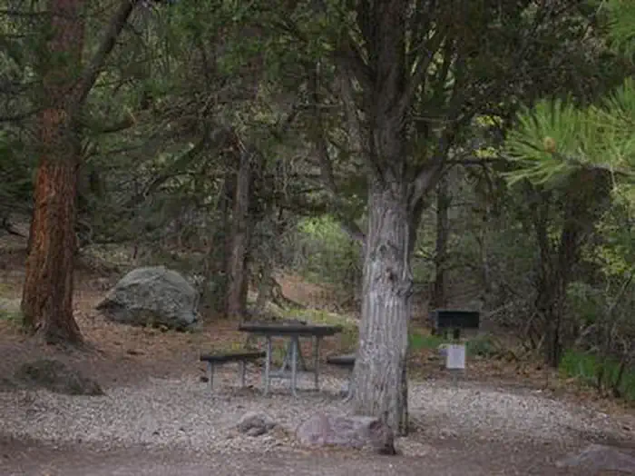
Mahogany Cove Campground
Beaver, UT
Mahogany Cove Campground is located in a grassy meadow along the Beaver Canyon Scenic Byway just 12 miles from Beaver, Utah, at an elevation of 7,200 feet. Visitors enjoy hiking, mountain biking and fishing in the nearby Beaver River. Recreation Fishing for rainbow and brook trout is popular on the Beaver River, which is just a short drive below the campground. Hiking, mountain biking and hunting are popular activities in the area.
Otter Creek, Fishermans Beach Rec Site
Antimony, UT
Otter Creek has an activity for almost everyone. The cold, clear water of this large reservoir offers year-round fishing for rainbow trout. For wildlife watchers, numerous waterfowl, raptors, deer, antelope, and elk abound. If you re an ATV rider, you ll want to try the Paiute ATV trail, which can be accessed from here. The primary activities are fishing and boating although it also serves as a regional staging site for extended and day trips into the surrounding National Forest, Utah State Lands and BLM managed lands by horse, foot, and vehicle. The Richfield Field Office manages day use facilities, dispersed and primitive camping facilities, and fishing access to the Reservoir at Fisherman's Beach, Tamarisk Point, and South Point along the west side of the reservoir. There is no potable water but picnic tables and pit toilets are available. Otter Creek Reservoir is located at the southeastern corner of Paiute County near the town of Antimony. A Utah State Park is located at the south
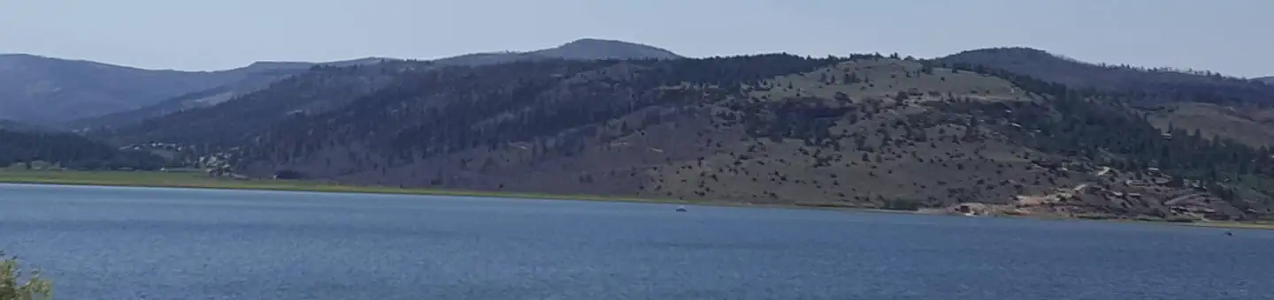
Panguitch Lake
Panguitch, UT
Panguitch Lake Campground is located 14 miles southwest of Panguitch, Utah. Some of the state's largest rainbow trout are fished from the lake each year, and aptly so; "Panguitch" comes from the Paiute word meaning "big fish." Visitors also enjoy canoeing and exploring the Panguitch Lake OHV Trail System. Recreation Panguitch Lake offers great fishing for rainbow, brook, cutthroat and brown trout. Canoeing and kyacking are a popular activity. Two public boat ramps are located on the lake, one on the south shore and the other on the north shore at Wildlife Point. The Markagunt OHV trail system at Panguitch Lake offers 300 miles of routes and trails. Other activities include hiking, biking, horseback riding and hunting.
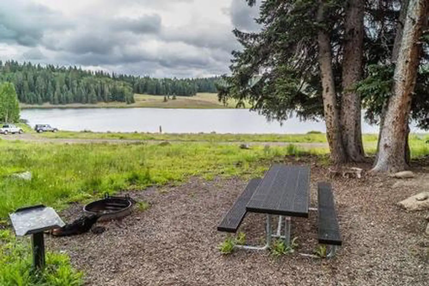
Lebaron Campground
Beaver, UT
LeBaron Campground is located in the Fishlake National Forest at an elevation of 9,900 feet. This beautiful high mountain retreat in Utah offers excellent fishing in LeBaron Lake and outstanding scenery. Recreation Anglers will enjoy fishing for brook and rainbow trout in LeBaron Lake from the shore or small non-motorized boat. The LeBaron ATV Trail is just west of LeBaron Campground on Forest Road #147 and is a jumping off point to numerous loop trails and ATV Forest Roads, including the Piute ATV trail.

Singletree
Torrey, UT
Overview Singletree Campground is located on the east side of Boulder Mountain in central Utah. Visitors enjoy hiking and sightseeing in this beautiful area.
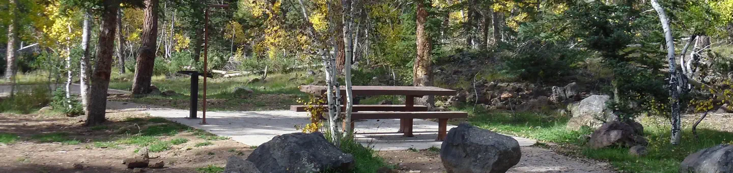
Duck Creek
Duck Creek Village, UT
Overview Duck Creek Campground is located 25 miles east of Cedar City, Utah. Visitors enjoy fishing in Duck Creek Pond and nearby Navajo Lake, exploring the Markagunt OHV Trail System and the many miles of non-motorized trails. Nearby sites to see are Cascade Falls, Cedar Breaks National Monument, the Ice Cave and Mammoth Caves. It is the perfect place to stay if your plans include visiting Bryce and Zions National Parks.
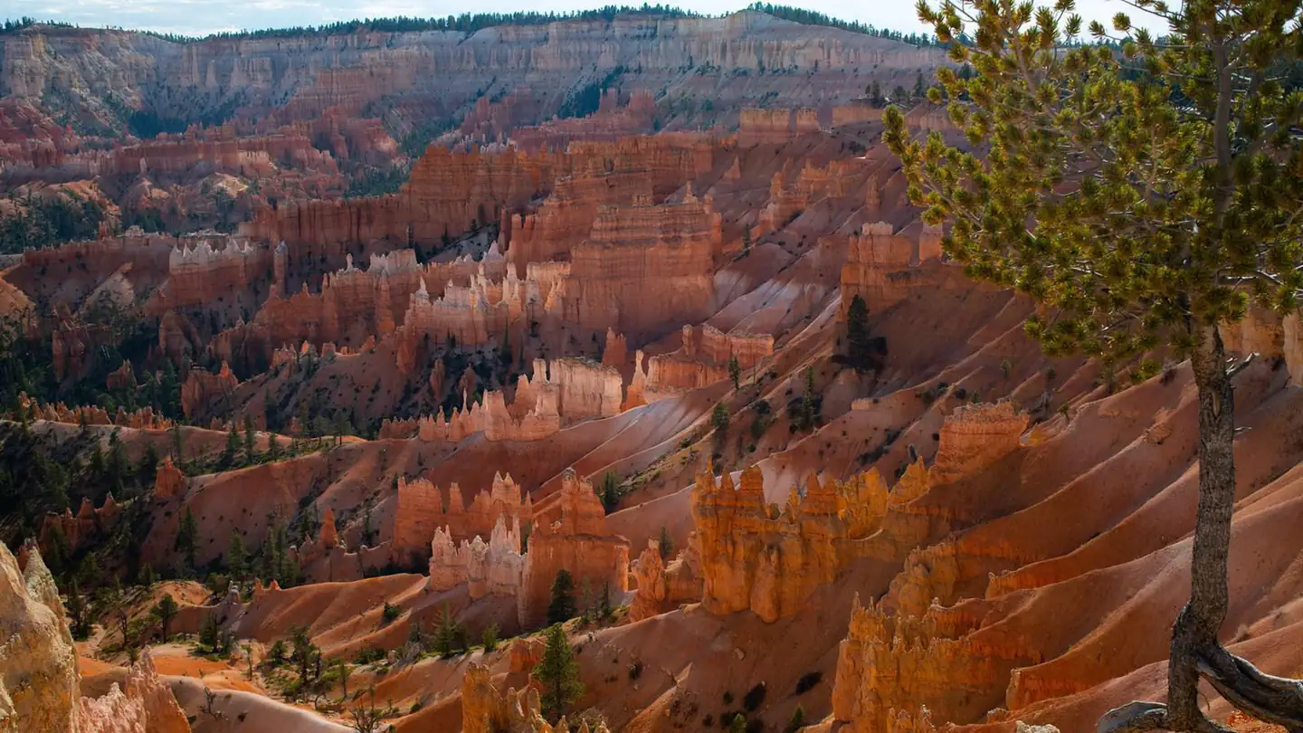
Sunset Campground
Tropic, UT
Overview Sunset Campground is located in beautiful and unique Bryce Canyon National Park. Known for its colorful rock spires and grand vistas that sweep out over the High Plateaus region of the Colorado Plateau, Bryce Canyon is the ultimate camping destination.
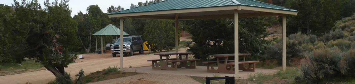
Stateline Campground
Kanab, UT
Stateline Campground is located on the border of Utah and Arizona on the House Rock Valley Road. The site also is where the northern terminus of the Arizona National Scenic Trail. The massive Paria Plateau provides a stunning, colorful, and rugged landscape and forms the scenic backdrop to Stateline Campground. This is a free, first-come, first-serve campground. It has 4 sites in Arizona and 4 sites in Utah, each has its own shade structure, designated graveled parking, and fire rings. The campground has 2 vault toilets and several interpretive signs.
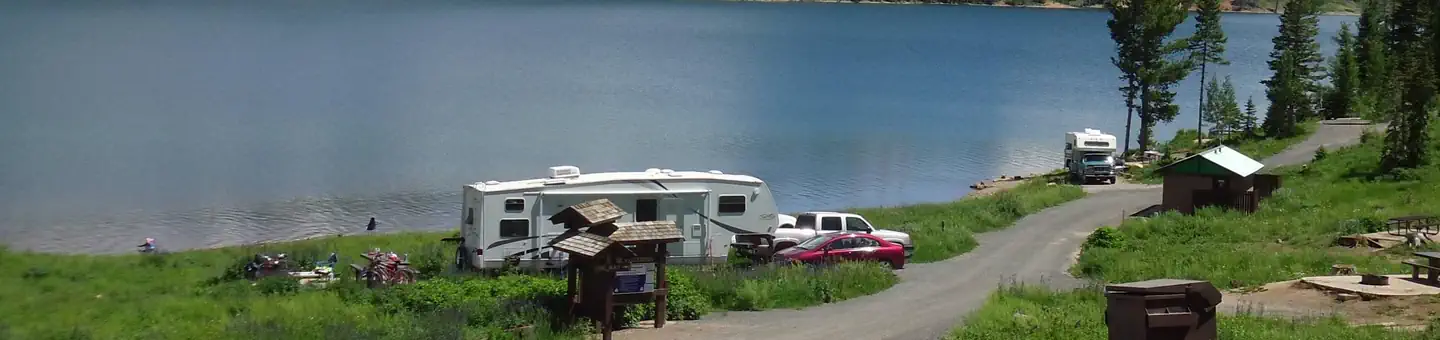
Spruces Campground (Dixie NF)
Duck Creek Village, UT
Overview Spruces Campground on the shores of Navajo Lake, provides a spectacular setting for boating, canoeing, camping, fishing, wildlife viewing, and photography. Take advantage of several outstanding hiking and biking trails or just relax and enjoy the cool, crisp mountain air.
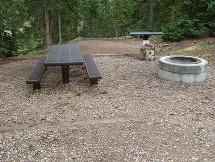
Anderson Meadow Campground
Beaver, UT
Anderson Meadow Campground is nestled above Anderson Meadow Reservoir in the Fishlake National Forest. The area boasts spectacular high mountain scenery and excellent fishing. Recreation Fishing for brook and rainbow trout in the eight-acre Anderson Meadow Reservoir is popular from either the shoreline or small non-motorized boat. Trailheads to the Piute ATV trail are close by.
Oak Creek Rec Site
Boulder, UT
Overview Oak Creek Campground is located high on the Colorado Plateau at an elevation of 8300 feet. Torrey, Utah is just 20 miles northwest. Visitors enjoy exploring miles of local ATV trails.
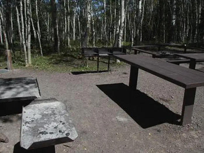
Elkhorn Campground
Fremont, UT
Overview Elkhorn Campground is located 20 miles northeast of Loa, Utah, on the scenic Thousand Lake Mountain at an elevation of approximately 9300 feet. Visitors enjoy exploring local trails on foot, bike or off-road vehicle.
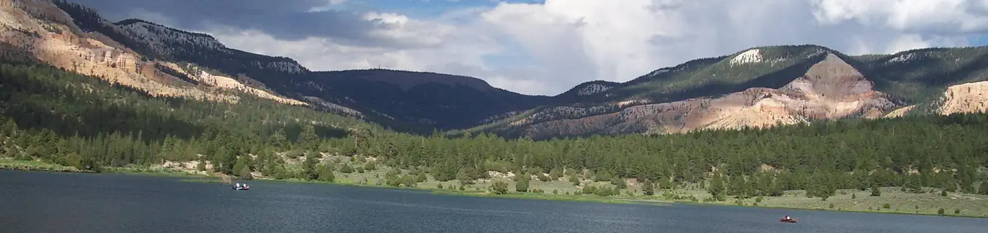
Pine Lake Campground
Tropic, UT
Pine Lake Campground is located next to its scenic namesake lake high on the Colorado Plateau at an elevation of 8,100 feet. Visitors enjoy canoeing, fishing and exploring local hiking and off-road vehicle trails. Recreation A short trail leads from the campground to Pine Lake, which offers excellent canoeing and kayaking, as well as fishing for rainbow, cutthroat and brook trout. Hiking and off-road vehicle trails are plentiful within the area, however off-road vehicles are not allowed in the campground.
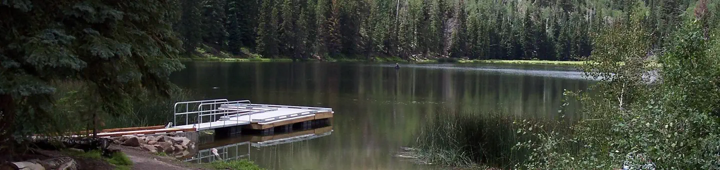
Posey Lake Campground
Boulder, UT
Posey Lake Campground is located next to its beautiful namesake lake high on the Colorado Plateau at an elevation of 8,800 feet. Visitors enjoy canoeing, fishing and exploring local trails. Recreation Posey Lake offers rainbow and brook trout fishing, canoeing, kayaking and non-motorized boating. Two hiking trails begin at the campground. The Posey Overlook Trail is a mile long and leads to a beautiful overlook. The Posey Spur Trail connects the campground to the Great Western Trail, which provides excellent hiking and mountain biking.
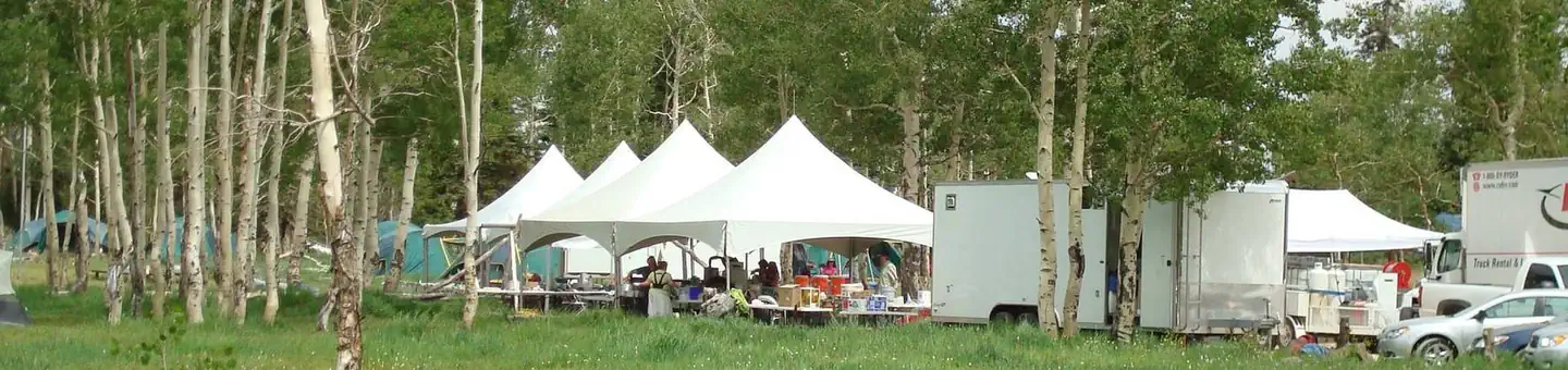
Deer Haven
Cedar City, UT
Deer Haven Campground is situated high on the western edge of the Colorado Plateau, close to Cedar City, Utah. Visitors enjoy hiking, biking and day-tripping to nearby Cedar Breaks National Monument. Recreation The 34-mile Virgin River Rim Trail passes near the campground and is open to hiking, mountain biking and horseback riding.
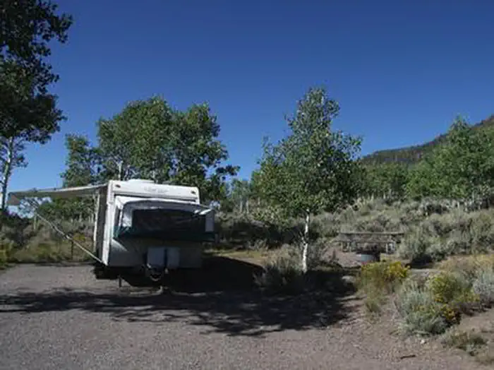
Mackinaw
Koosharem, UT
Mackinaw Campground is located next to Fish Lake and the Fishlake Scenic Byway in central Utah at an elevation of 9,000 feet. Visitors enjoy boating, fishing and exploring local trails. Recreation Fish Lake is Utah's largest natural mountain lake, covering 2,500 acres. It is famous for its 20-40 pound Mackinaw lake trout. Anglers also enjoy fishing for rainbow trout and splake. Boating, canoeing, swimming and scuba diving are popular activities.
Little Reservoir Campground
Beaver, UT
Little Reservoir is within sight of the campsites or a short walk. Good hunting, fishing, biking and spectacular mountain scenery is available. Winter activities in the area include ice fishing, snowmobiling and cross country skiing. Bird watching is also very popular. Overstory vegetation consisting mainly of ponderosa pine with pinion, juniper and scrub oak provides shade for about half of the area. There are eight single-family campsites. Sites are back-in sites and will accommodate RV's from 22 to 40 feet. All units have grills and/or fire rings and tables. Drinking water is available at three locations throughout the campground. There are three vault toilets including one that is barrier free. Campsite #4 is handicap accessibile. A paved trail leads to the reservoir for fishing.
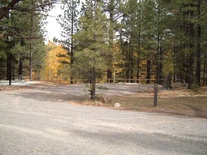
Rosebud ATV
Boulder, UT
Overview Rosebud ATV Campground is located high on the Colorado Plateau at an elevation of 8300 feet. Torrey, Utah is just 17 miles northwest. Visitors enjoy exploring miles of local ATV trails.
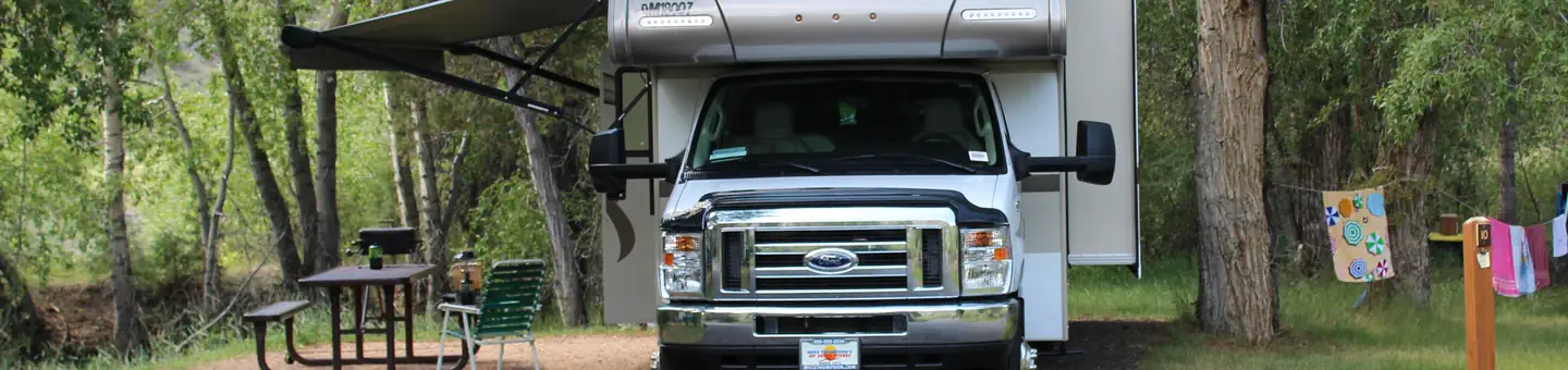
White Bridge
Panguitch, UT
White Bridge Campground is located just 12 miles southwest of Panguitch, Utah and 55 miles northeast of Cedar City. Visitors enjoy fishing, canoeing on nearby Panguitch Lake and exploring local trails. Recreation Campers enjoy fishing for rainbow trout in Panguitch Creek. Hiking and biking are popular activities around the campground. The Panguitch Lake ATV Trail System offers 100+ miles of trails and can be accessed nearby.
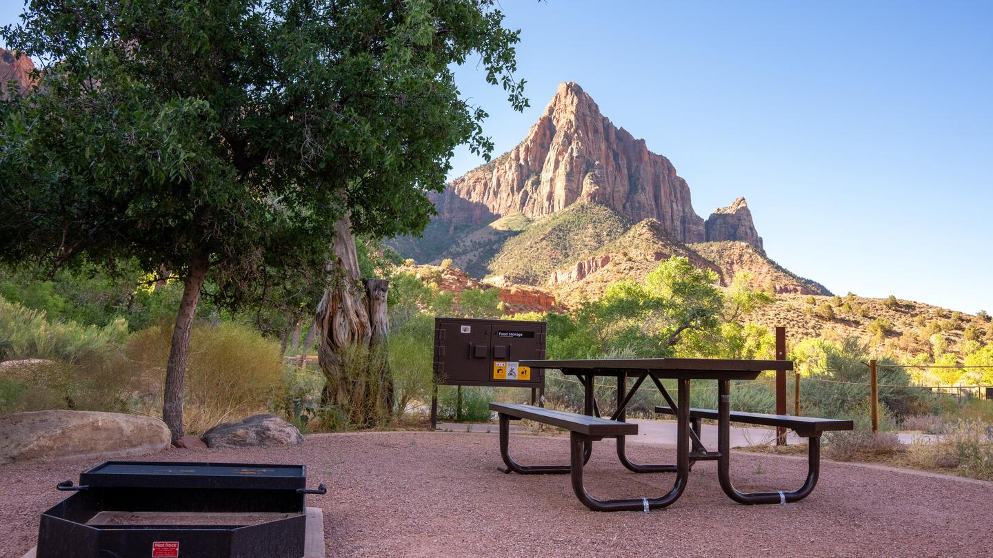
South Campground
Springdale, UT
Overview Reservations for South Campground are available up to 14 days before your arrival and may extend up to two days beyond this 14-day booking window.
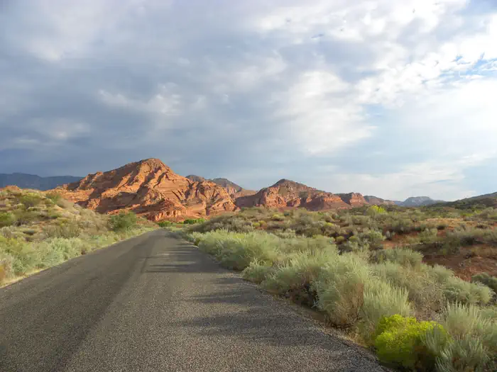
Red Cliffs Campground
Washington, UT
Overview Red Cliffs Recreation Area includes a campground, day use areas, a non-motorized trail system, and interpreted public use sites. Dinosaurs left their footprints, now visible in the sandstone. Ancestral Puebloans lived here in the 10th century, growing corn, beans, and squash along Quail and Leeds Creek. Mid-19th century pioneers farmed here, supplying the area’s silver miners with food. Located within the Red Cliffs
Tushar Lakeside Campground
Beaver, UT
Overview Located within the majestic Tushar Mountain Range, Tushar Lakeside Campground is nestled in a forest of aspen and mixed conifer. This is a popular destination for large youth groups. The lake and small meadow offer ample recreation opportunities to visitors.
Park units in Greater Zion & Bryce (Southwest)
- Bryce Canyon National ParkNational Park
- Capitol Reef National ParkNational Park
- Cedar Breaks National MonumentNational Monument
- Glen Canyon National Recreation AreaNational Recreation Area
- Old Spanish National Historic TrailNational Historic Trail
- Rainbow Bridge National MonumentNational Monument
- Zion National ParkNational Park
What people do here
- Hiking Destinations43 campgroundsCampgrounds with trailheads inside walking distance.
- Wildlife Viewing40 campgroundsCamp where the animals actually are.
- Mountain Biking Basecamps30 campgroundsCamp at the trailhead, ride before breakfast.
- Fishing Camping28 campgroundsCampgrounds within casting distance of Utah's best water.
Trails
Markagunt Plateau
ohv · hard · 312.0 mi
Markagunt Plateau - 502.2 km ohv trail on National Forest land in Greater Zion & Bryce (Southwest).
Navajo Lake - Deep Creek
ohv · hard · 21.7 mi
Navajo Lake - Deep Creek - 34.9 km ohv trail on National Forest land in Greater Zion & Bryce (Southwest).
Blubber Creek Connector
ohv · hard · 27.5 mi
Blubber Creek Connector - 44.3 km ohv trail on National Forest land in Greater Zion & Bryce (Southwest).
Little Coal Pit Loop
ohv · hard · 20.3 mi
Little Coal Pit Loop - 32.6 km ohv trail on National Forest land in Greater Zion & Bryce (Southwest).
Clear Cr To Kimberly
hiking · moderate · 15.2 mi
Clear Cr To Kimberly - 24.4 km hiking trail on National Forest land in Greater Zion & Bryce (Southwest).
Strawberry Loop
ohv · hard · 26.6 mi
Strawberry Loop - 42.8 km ohv trail on National Forest land in Greater Zion & Bryce (Southwest).
Sand Hill
hiking · easy · 1.7 mi
Sand Hill - 2.7 km hiking route in Greater Zion & Bryce (Southwest), mapped from OpenStreetMap.
Raven
hiking · easy · 1.0 mi
Raven - 1.6 km hiking route in Greater Zion & Bryce (Southwest), mapped from OpenStreetMap.
Great Western ATV Trail
ohv · moderate · 11.5 mi
Great Western ATV Trail - 18.6 km ohv route in Greater Zion & Bryce (Southwest), mapped from OpenStreetMap.
South Bullion To Gold Hill
horseback · moderate · 19.8 mi
South Bullion To Gold Hill - 31.8 km horseback trail on National Forest land in Greater Zion & Bryce (Southwest).
Duck Creek Snowmobile Trail
hiking · hard · 34.2 mi
Duck Creek Snowmobile Trail - 55.0 km hiking trail on National Forest land in Greater Zion & Bryce (Southwest).
Great Western Trail
ohv · hard · 29.2 mi
Great Western Trail - 46.9 km ohv trail on National Forest land in Greater Zion & Bryce (Southwest).
Slickrock Trail
hiking · moderate · 40.1 mi
Slickrock Trail - 64.5 km hiking trail on National Forest land in Greater Zion & Bryce (Southwest).
Fremont ATV Trail
ohv · moderate · 12.3 mi
Fremont ATV Trail - 19.8 km ohv trail on National Forest land in Greater Zion & Bryce (Southwest).
Milos - Pine Canyon
hiking · hard · 59.2 mi
Milos - Pine Canyon - 95.3 km hiking trail on National Forest land in Greater Zion & Bryce (Southwest).
Wildcat Trail
hiking · moderate · 30.0 mi
Wildcat Trail - 48.3 km hiking trail on National Forest land in Greater Zion & Bryce (Southwest).
Paunsaugunt ATV Trail
ohv · hard · 44.3 mi
Paunsaugunt ATV Trail - 71.3 km ohv trail on National Forest land in Greater Zion & Bryce (Southwest).
Grand View Trail
hiking · hard · 73.2 mi
Grand View Trail - 117.8 km hiking trail on National Forest land in Greater Zion & Bryce (Southwest).
Birch Spring-Pass Creek Loop
ohv · hard · 37.1 mi
Birch Spring-Pass Creek Loop - 59.8 km ohv trail on National Forest land in Greater Zion & Bryce (Southwest).
Pioneer Rim
hiking · easy · 1.6 mi
Pioneer Rim - 2.6 km hiking route in Greater Zion & Bryce (Southwest), mapped from OpenStreetMap.
Sandy-Caddy Creek Loop
ohv · hard · 35.3 mi
Sandy-Caddy Creek Loop - 56.7 km ohv trail on National Forest land in Greater Zion & Bryce (Southwest).
Virgin River Rim Trail
hiking · hard · 29.3 mi
Virgin River Rim Trail - 47.2 km hiking trail on National Forest land in Greater Zion & Bryce (Southwest).
Harris Rim Loop
ohv · hard · 22.3 mi
Harris Rim Loop - 35.8 km ohv trail on National Forest land in Greater Zion & Bryce (Southwest).
Panguitch Creek
ohv · moderate · 12.5 mi
Panguitch Creek - 20.1 km ohv trail on National Forest land in Greater Zion & Bryce (Southwest).
Boulder Swale ATV Trail
ohv · moderate · 10.2 mi
Boulder Swale ATV Trail - 16.4 km ohv trail on National Forest land in Greater Zion & Bryce (Southwest).
Joe Lott
hiking · moderate · 9.2 mi
Joe Lott - 14.8 km hiking trail on National Forest land in Greater Zion & Bryce (Southwest).
Rubys Inn Snowmobile Trail
hiking · hard · 19.8 mi
Rubys Inn Snowmobile Trail - 31.8 km hiking trail on National Forest land in Greater Zion & Bryce (Southwest).
Tommy Creek Loop
ohv · hard · 16.6 mi
Tommy Creek Loop - 26.7 km ohv trail on National Forest land in Greater Zion & Bryce (Southwest).
Monroe Peak
hiking · moderate · 11.4 mi
Monroe Peak - 18.4 km hiking trail on National Forest land in Greater Zion & Bryce (Southwest).
Turkey Track Loop
ohv · moderate · 12.9 mi
Turkey Track Loop - 20.7 km ohv trail on National Forest land in Greater Zion & Bryce (Southwest).
Lakeshore
hiking · moderate · 23.1 mi
Lakeshore - 37.2 km hiking trail on National Forest land in Greater Zion & Bryce (Southwest).
Skyline National Recreation Tr
mountain-biking · moderate · 11.0 mi
Skyline National Recreation Tr - 17.8 km mountain biking trail on National Forest land in Greater Zion & Bryce (Southwest).
Stout Ridge
ohv · hard · 19.0 mi
Stout Ridge - 30.5 km ohv trail on National Forest land in Greater Zion & Bryce (Southwest).
Willis Creek
ohv · moderate · 11.4 mi
Willis Creek - 18.4 km ohv trail on National Forest land in Greater Zion & Bryce (Southwest).
Red Canyon Bike Trail
hiking · hard · 16.0 mi
Red Canyon Bike Trail - 25.7 km hiking trail on National Forest land in Greater Zion & Bryce (Southwest).
Navajo Lake Snowmobile Trail
hiking · moderate · 10.8 mi
Navajo Lake Snowmobile Trail - 17.4 km hiking trail on National Forest land in Greater Zion & Bryce (Southwest).
Haycock Mountain
ohv · moderate · 14.1 mi
Haycock Mountain - 22.7 km ohv trail on National Forest land in Greater Zion & Bryce (Southwest).
Tanner Hollow - Big John
hiking · moderate · 12.5 mi
Tanner Hollow - Big John - 20.1 km hiking trail on National Forest land in Greater Zion & Bryce (Southwest).
Uinta Flat
ohv · moderate · 13.0 mi
Uinta Flat - 20.9 km ohv trail on National Forest land in Greater Zion & Bryce (Southwest).
Grass Lake ATV Trail
ohv · moderate · 12.5 mi
Grass Lake ATV Trail - 20.0 km ohv trail on National Forest land in Greater Zion & Bryce (Southwest).
Under-the-Rim Trail
hiking · hard · 21.8 mi
Under-the-Rim Trail - 35.1 km hiking route in Greater Zion & Bryce (Southwest), mapped from OpenStreetMap.
Great Western Trail - Pine Creek Section
hiking · hard · 15.1 mi
Great Western Trail - Pine Creek Section - 24.3 km hiking route in Greater Zion & Bryce (Southwest), mapped from OpenStreetMap.
Great Western Trail - Cameron Wash Section
hiking · hard · 15.0 mi
Great Western Trail - Cameron Wash Section - 24.1 km hiking route in Greater Zion & Bryce (Southwest), mapped from OpenStreetMap.
Great Western Trail - Arizona
hiking · hard · 191.6 mi
Great Western Trail - Arizona - 308.3 km hiking route in Greater Zion & Bryce (Southwest), mapped from OpenStreetMap.
Arizona Trail
mountain-biking · hard · 113.1 mi
Arizona Trail - 182.1 km mountain biking route in Greater Zion & Bryce (Southwest), mapped from OpenStreetMap.
Arizona Trail
hiking · hard · 85.3 mi
Arizona Trail - 137.3 km hiking route in Greater Zion & Bryce (Southwest), mapped from OpenStreetMap.
Zion Narrows Top-Down Hiking Route
hiking · moderate · 14.9 mi
Zion Narrows Top-Down Hiking Route - 23.9 km hiking route in Greater Zion & Bryce (Southwest), mapped from OpenStreetMap.
Candy Mountain Express Bike Trail
mountain-biking · hard · 15.9 mi
Candy Mountain Express Bike Trail - 25.6 km mountain biking route in Greater Zion & Bryce (Southwest), mapped from OpenStreetMap.
Forshea Mountain
hiking · moderate · 10.9 mi
Forshea Mountain - 17.5 km hiking trail on National Forest land in Greater Zion & Bryce (Southwest).
Hayduke Trail #10
hiking · hard · 73.3 mi
Hayduke Trail #10 - 118.0 km hiking route in Greater Zion & Bryce (Southwest), mapped from OpenStreetMap.
Grand View Trail
hiking · hard · 26.5 mi
Grand View Trail - 42.6 km hiking route in Greater Zion & Bryce (Southwest), mapped from OpenStreetMap.
Upper Death Hollow
hiking · hard · 17.2 mi
Upper Death Hollow - 27.7 km hiking route in Greater Zion & Bryce (Southwest), mapped from OpenStreetMap.
Summit Trail
hiking · hard · 33.3 mi
Summit Trail - 53.5 km hiking route in Greater Zion & Bryce (Southwest), mapped from OpenStreetMap.
South Boundary Trail
hiking · hard · 23.1 mi
South Boundary Trail - 37.1 km hiking route in Greater Zion & Bryce (Southwest), mapped from OpenStreetMap.
ADT - Utah - R - Seg 5
hiking · hard · 28.6 mi
ADT - Utah - R - Seg 5 - 46.1 km hiking route in Greater Zion & Bryce (Southwest), mapped from OpenStreetMap.
South Fork Of Pine Creek
hiking · moderate · 10.9 mi
South Fork Of Pine Creek - 17.5 km hiking trail on National Forest land in Greater Zion & Bryce (Southwest).
Boulder Mail Trail
hiking · moderate · 14.8 mi
Boulder Mail Trail - 23.8 km hiking route in Greater Zion & Bryce (Southwest), mapped from OpenStreetMap.
West Rim Trail
hiking · moderate · 14.3 mi
West Rim Trail - 23.1 km hiking route in Greater Zion & Bryce (Southwest), mapped from OpenStreetMap.
Casto Canyon Trail
hiking · moderate · 9.7 mi
Casto Canyon Trail - 15.6 km hiking trail on National Forest land in Greater Zion & Bryce (Southwest).
Swains Creek
hiking · moderate · 8.1 mi
Swains Creek - 13.1 km hiking trail on National Forest land in Greater Zion & Bryce (Southwest).
Rigger To Puffer Lake
hiking · moderate · 7.4 mi
Rigger To Puffer Lake - 11.9 km hiking trail on National Forest land in Greater Zion & Bryce (Southwest).
Hayduke Trail #13
hiking · moderate · 10.8 mi
Hayduke Trail #13 - 17.3 km hiking route in Greater Zion & Bryce (Southwest), mapped from OpenStreetMap.
East Rim Trail
hiking · moderate · 10.2 mi
East Rim Trail - 16.5 km hiking route in Greater Zion & Bryce (Southwest), mapped from OpenStreetMap.
Left Fork Bunker Creek
mountain-biking · moderate · 7.5 mi
Left Fork Bunker Creek - 12.0 km mountain biking route in Greater Zion & Bryce (Southwest), mapped from OpenStreetMap.
Lower Death Hollow
hiking · moderate · 6.8 mi
Lower Death Hollow - 10.9 km hiking route in Greater Zion & Bryce (Southwest), mapped from OpenStreetMap.
Hop Valley Trail
hiking · moderate · 6.4 mi
Hop Valley Trail - 10.3 km hiking route in Greater Zion & Bryce (Southwest), mapped from OpenStreetMap.
Great Western Trail - Griffin Top Section
hiking · easy · 5.5 mi
Great Western Trail - Griffin Top Section - 8.8 km hiking route in Greater Zion & Bryce (Southwest), mapped from OpenStreetMap.
White Rocks Trail
hiking · easy · 4.4 mi
White Rocks Trail - 7.1 km hiking route in Greater Zion & Bryce (Southwest), mapped from OpenStreetMap.
Spruce Trail
mountain-biking · moderate · 14.0 mi
Spruce Trail - 22.5 km mountain biking route in Greater Zion & Bryce (Southwest), mapped from OpenStreetMap.
Red Canyon Bicycle Trail
mountain-biking · moderate · 12.5 mi
Red Canyon Bicycle Trail - 20.1 km mountain biking route in Greater Zion & Bryce (Southwest), mapped from OpenStreetMap.
Red Reef
hiking · easy · 5.5 mi
Red Reef - 8.9 km hiking route in Greater Zion & Bryce (Southwest), mapped from OpenStreetMap.
Sulphur Creek Top-Down Route
hiking · easy · 5.8 mi
Sulphur Creek Top-Down Route - 9.3 km hiking route in Greater Zion & Bryce (Southwest), mapped from OpenStreetMap.
Nielson Canyon - Serviceberry
hiking · moderate · 10.5 mi
Nielson Canyon - Serviceberry - 17.0 km hiking trail on National Forest land in Greater Zion & Bryce (Southwest).
Bryce Canyon Multi-Use Path
mountain-biking · easy · 4.9 mi
Bryce Canyon Multi-Use Path - 7.9 km mountain biking route in Greater Zion & Bryce (Southwest), mapped from OpenStreetMap.
Virgin River Trail
mountain-biking · moderate · 11.5 mi
Virgin River Trail - 18.6 km mountain biking route in Greater Zion & Bryce (Southwest), mapped from OpenStreetMap.
Ice House
hiking · easy · 5.6 mi
Ice House - 9.1 km hiking route in Greater Zion & Bryce (Southwest), mapped from OpenStreetMap.
Lower Mammoth Creek
ohv · moderate · 10.5 mi
Lower Mammoth Creek - 17.0 km ohv trail on National Forest land in Greater Zion & Bryce (Southwest).
Cedar Creek
hiking · moderate · 9.2 mi
Cedar Creek - 14.8 km hiking trail on National Forest land in Greater Zion & Bryce (Southwest).
Pst 86
hiking · moderate · 7.2 mi
Pst 86 - 11.5 km hiking trail on National Forest land in Greater Zion & Bryce (Southwest).
Great Western Trail - Sweetwater Section
hiking · moderate · 9.5 mi
Great Western Trail - Sweetwater Section - 15.3 km hiking route in Greater Zion & Bryce (Southwest), mapped from OpenStreetMap.
La Verkin Creek Trail
hiking · moderate · 8.3 mi
La Verkin Creek Trail - 13.4 km hiking route in Greater Zion & Bryce (Southwest), mapped from OpenStreetMap.
Riggs Spring Loop
hiking · moderate · 8.3 mi
Riggs Spring Loop - 13.3 km hiking route in Greater Zion & Bryce (Southwest), mapped from OpenStreetMap.
Cottonwood Canyon
hiking · moderate · 8.1 mi
Cottonwood Canyon - 13.0 km hiking route in Greater Zion & Bryce (Southwest), mapped from OpenStreetMap.
Cottonwood-Harmon Trail
hiking · moderate · 7.9 mi
Cottonwood-Harmon Trail - 12.7 km hiking route in Greater Zion & Bryce (Southwest), mapped from OpenStreetMap.
The Box Trail
hiking · moderate · 8.9 mi
The Box Trail - 14.3 km hiking route in Greater Zion & Bryce (Southwest), mapped from OpenStreetMap.
Willow Creek Trail
hiking · moderate · 8.9 mi
Willow Creek Trail - 14.3 km hiking route in Greater Zion & Bryce (Southwest), mapped from OpenStreetMap.
Great Western Trail - McGath Section
hiking · moderate · 7.6 mi
Great Western Trail - McGath Section - 12.3 km hiking route in Greater Zion & Bryce (Southwest), mapped from OpenStreetMap.
Long Neck Trail
hiking · moderate · 11.1 mi
Long Neck Trail - 17.8 km hiking route in Greater Zion & Bryce (Southwest), mapped from OpenStreetMap.
Pine Valley Canal Trail
hiking · moderate · 6.7 mi
Pine Valley Canal Trail - 10.8 km hiking route in Greater Zion & Bryce (Southwest), mapped from OpenStreetMap.
Prospector
hiking · moderate · 6.3 mi
Prospector - 10.2 km hiking route in Greater Zion & Bryce (Southwest), mapped from OpenStreetMap.
Death Hollow
hiking · moderate · 10.4 mi
Death Hollow - 16.7 km hiking trail on National Forest land in Greater Zion & Bryce (Southwest).
Water Canyon Trail
hiking · moderate · 7.6 mi
Water Canyon Trail - 12.3 km hiking route in Greater Zion & Bryce (Southwest), mapped from OpenStreetMap.
Hayduke Trail #9
hiking · moderate · 7.6 mi
Hayduke Trail #9 - 12.2 km hiking route in Greater Zion & Bryce (Southwest), mapped from OpenStreetMap.
Wildcat Canyon Trail
hiking · easy · 5.7 mi
Wildcat Canyon Trail - 9.2 km hiking route in Greater Zion & Bryce (Southwest), mapped from OpenStreetMap.
Rim Trail
hiking · easy · 5.3 mi
Rim Trail - 8.5 km hiking route in Greater Zion & Bryce (Southwest), mapped from OpenStreetMap.
Lange's Dugway
hiking · easy · 4.8 mi
Lange's Dugway - 7.7 km hiking route in Greater Zion & Bryce (Southwest), mapped from OpenStreetMap.
Rim Trail
hiking · moderate · 10.3 mi
Rim Trail - 16.6 km hiking trail on National Forest land in Greater Zion & Bryce (Southwest).
Great Western Trail - Horse Creek Section
hiking · moderate · 7.5 mi
Great Western Trail - Horse Creek Section - 12.1 km hiking route in Greater Zion & Bryce (Southwest), mapped from OpenStreetMap.
Grass Lake ATV Trail
ohv · moderate · 6.2 mi
Grass Lake ATV Trail - 10.0 km ohv route in Greater Zion & Bryce (Southwest), mapped from OpenStreetMap.
Highline Trail
hiking · easy · 5.8 mi
Highline Trail - 9.3 km hiking route in Greater Zion & Bryce (Southwest), mapped from OpenStreetMap.
Gila
hiking · moderate · 7.6 mi
Gila - 12.2 km hiking route in Greater Zion & Bryce (Southwest), mapped from OpenStreetMap.
Meditation Rock
hiking · easy · 5.3 mi
Meditation Rock - 8.5 km hiking route in Greater Zion & Bryce (Southwest), mapped from OpenStreetMap.
Comanche Trail
hiking · easy · 5.7 mi
Comanche Trail - 9.2 km hiking route in Greater Zion & Bryce (Southwest), mapped from OpenStreetMap.
Whipple Trail
hiking · easy · 5.8 mi
Whipple Trail - 9.3 km hiking route in Greater Zion & Bryce (Southwest), mapped from OpenStreetMap.
Jubilee Trail
hiking · moderate · 6.3 mi
Jubilee Trail - 10.1 km hiking route in Greater Zion & Bryce (Southwest), mapped from OpenStreetMap.
Mineral Canyon Trail
hiking · easy · 5.5 mi
Mineral Canyon Trail - 8.8 km hiking route in Greater Zion & Bryce (Southwest), mapped from OpenStreetMap.
Goat Spring Trail
hiking · easy · 5.4 mi
Goat Spring Trail - 8.8 km hiking route in Greater Zion & Bryce (Southwest), mapped from OpenStreetMap.
Bracken's Loop
hiking · easy · 5.1 mi
Bracken's Loop - 8.1 km hiking route in Greater Zion & Bryce (Southwest), mapped from OpenStreetMap.
Asay Creek Loop
ohv · moderate · 9.8 mi
Asay Creek Loop - 15.8 km ohv trail on National Forest land in Greater Zion & Bryce (Southwest).
East Boulder Creek Trail
hiking · easy · 6.1 mi
East Boulder Creek Trail - 9.8 km hiking route in Greater Zion & Bryce (Southwest), mapped from OpenStreetMap.
Birch Creek ATV Trail
ohv · easy · 4.8 mi
Birch Creek ATV Trail - 7.8 km ohv route in Greater Zion & Bryce (Southwest), mapped from OpenStreetMap.
East Mesa Trail
hiking · easy · 4.3 mi
East Mesa Trail - 7.0 km hiking route in Greater Zion & Bryce (Southwest), mapped from OpenStreetMap.
Swamp Canyon Loop
hiking · easy · 4.3 mi
Swamp Canyon Loop - 7.0 km hiking route in Greater Zion & Bryce (Southwest), mapped from OpenStreetMap.
Pilot Peak Trail
hiking · easy · 4.1 mi
Pilot Peak Trail - 6.6 km hiking route in Greater Zion & Bryce (Southwest), mapped from OpenStreetMap.
Sidney Peak Trail
mountain-biking · easy · 4.1 mi
Sidney Peak Trail - 6.5 km mountain biking route in Greater Zion & Bryce (Southwest), mapped from OpenStreetMap.
Great Western Trail - Deer Creek Section
hiking · easy · 5.3 mi
Great Western Trail - Deer Creek Section - 8.5 km hiking route in Greater Zion & Bryce (Southwest), mapped from OpenStreetMap.
Mill Canyon Trail
hiking · easy · 4.0 mi
Mill Canyon Trail - 6.5 km hiking route in Greater Zion & Bryce (Southwest), mapped from OpenStreetMap.
Heath Trail
hiking · easy · 4.0 mi
Heath Trail - 6.4 km hiking route in Greater Zion & Bryce (Southwest), mapped from OpenStreetMap.
Tusher Ridge Trail
mountain-biking · moderate · 4.2 mi
Tusher Ridge Trail - 6.8 km mountain biking route in Greater Zion & Bryce (Southwest), mapped from OpenStreetMap.
Connector Trail
hiking · easy · 3.9 mi
Connector Trail - 6.2 km hiking route in Greater Zion & Bryce (Southwest), mapped from OpenStreetMap.
Sage Valley
ohv · moderate · 9.8 mi
Sage Valley - 15.8 km ohv trail on National Forest land in Greater Zion & Bryce (Southwest).
Trail Creek Trail
hiking · easy · 3.7 mi
Trail Creek Trail - 5.9 km hiking route in Greater Zion & Bryce (Southwest), mapped from OpenStreetMap.
Zion Narrows Bottom-Up Day-Hiking Route
hiking · easy · 3.5 mi
Zion Narrows Bottom-Up Day-Hiking Route - 5.7 km hiking route in Greater Zion & Bryce (Southwest), mapped from OpenStreetMap.
Equestrian Trail
horseback · easy · 3.6 mi
Equestrian Trail - 5.8 km horseback route in Greater Zion & Bryce (Southwest), mapped from OpenStreetMap.
Brown's Point Trail
hiking · easy · 3.6 mi
Brown's Point Trail - 5.8 km hiking route in Greater Zion & Bryce (Southwest), mapped from OpenStreetMap.
Middleton Powerline
hiking · easy · 3.5 mi
Middleton Powerline - 5.6 km hiking route in Greater Zion & Bryce (Southwest), mapped from OpenStreetMap.
Blake-Gubler Trail
hiking · easy · 3.5 mi
Blake-Gubler Trail - 5.6 km hiking route in Greater Zion & Bryce (Southwest), mapped from OpenStreetMap.
West Fork Trail
hiking · easy · 3.5 mi
West Fork Trail - 5.6 km hiking route in Greater Zion & Bryce (Southwest), mapped from OpenStreetMap.
Right Fork Bunker Creek
mountain-biking · easy · 3.2 mi
Right Fork Bunker Creek - 5.1 km mountain biking route in Greater Zion & Bryce (Southwest), mapped from OpenStreetMap.
Telephone Canyon
hiking · easy · 2.3 mi
Telephone Canyon - 3.6 km hiking route in Greater Zion & Bryce (Southwest), mapped from OpenStreetMap.
Pondersoa Loop
ohv · moderate · 9.4 mi
Pondersoa Loop - 15.2 km ohv trail on National Forest land in Greater Zion & Bryce (Southwest).
Strawberry Point Snowmobile Tr
hiking · moderate · 9.1 mi
Strawberry Point Snowmobile Tr - 14.7 km hiking trail on National Forest land in Greater Zion & Bryce (Southwest).
Dry Bench Trail
hiking · moderate · 9.8 mi
Dry Bench Trail - 15.8 km hiking trail on National Forest land in Greater Zion & Bryce (Southwest).
Lava Flow Trail
mountain-biking · easy · 3.2 mi
Lava Flow Trail - 5.2 km mountain biking route in Greater Zion & Bryce (Southwest), mapped from OpenStreetMap.
Cable Mountain Trail
hiking · easy · 3.1 mi
Cable Mountain Trail - 5.0 km hiking route in Greater Zion & Bryce (Southwest), mapped from OpenStreetMap.
Deertrap Mountain
hiking · easy · 3.1 mi
Deertrap Mountain - 5.0 km hiking route in Greater Zion & Bryce (Southwest), mapped from OpenStreetMap.
Rusty Cliffs
hiking · easy · 3.3 mi
Rusty Cliffs - 5.3 km hiking route in Greater Zion & Bryce (Southwest), mapped from OpenStreetMap.
Lava Flow Trail
hiking · easy · 3.3 mi
Lava Flow Trail - 5.3 km hiking route in Greater Zion & Bryce (Southwest), mapped from OpenStreetMap.
Great Western Alternate
ohv · moderate · 9.4 mi
Great Western Alternate - 15.2 km ohv trail on National Forest land in Greater Zion & Bryce (Southwest).
Padre Canyon
hiking · easy · 3.1 mi
Padre Canyon - 5.0 km hiking route in Greater Zion & Bryce (Southwest), mapped from OpenStreetMap.
Burnt Flat To Langdon Cr
hiking · easy · 9.4 mi
Burnt Flat To Langdon Cr - 15.1 km hiking trail on National Forest land in Greater Zion & Bryce (Southwest).
Griffin Point Trail
mountain-biking · moderate · 9.2 mi
Griffin Point Trail - 14.8 km mountain biking trail on National Forest land in Greater Zion & Bryce (Southwest).
Little Creek Peak Trail
mountain-biking · easy · 3.0 mi
Little Creek Peak Trail - 4.9 km mountain biking route in Greater Zion & Bryce (Southwest), mapped from OpenStreetMap.
Barker Lakes Loop
hiking · easy · 3.0 mi
Barker Lakes Loop - 4.9 km hiking route in Greater Zion & Bryce (Southwest), mapped from OpenStreetMap.
Mustang Pass
hiking · easy · 3.0 mi
Mustang Pass - 4.9 km hiking route in Greater Zion & Bryce (Southwest), mapped from OpenStreetMap.
Santa Clara River Trail
mountain-biking · easy · 2.8 mi
Santa Clara River Trail - 4.5 km mountain biking route in Greater Zion & Bryce (Southwest), mapped from OpenStreetMap.
Cottonwood Hills
hiking · easy · 2.8 mi
Cottonwood Hills - 4.5 km hiking route in Greater Zion & Bryce (Southwest), mapped from OpenStreetMap.
Scout Cave
hiking · easy · 2.8 mi
Scout Cave - 4.5 km hiking route in Greater Zion & Bryce (Southwest), mapped from OpenStreetMap.
Historic Babylon
hiking · easy · 2.7 mi
Historic Babylon - 4.3 km hiking route in Greater Zion & Bryce (Southwest), mapped from OpenStreetMap.
Little Purgatory
hiking · easy · 2.6 mi
Little Purgatory - 4.3 km hiking route in Greater Zion & Bryce (Southwest), mapped from OpenStreetMap.
Mill Creek
hiking · easy · 2.6 mi
Mill Creek - 4.3 km hiking route in Greater Zion & Bryce (Southwest), mapped from OpenStreetMap.
City Creek
hiking · easy · 2.6 mi
City Creek - 4.2 km hiking route in Greater Zion & Bryce (Southwest), mapped from OpenStreetMap.
Dark Hollow Trail
hiking · moderate · 9.0 mi
Dark Hollow Trail - 14.4 km hiking trail on National Forest land in Greater Zion & Bryce (Southwest).
Navajo Lake Loop Trail
hiking · moderate · 8.3 mi
Navajo Lake Loop Trail - 13.4 km hiking trail on National Forest land in Greater Zion & Bryce (Southwest).
Thunder Mountain Trail
mountain-biking · easy · 0.8 mi
Thunder Mountain Trail - 1.3 km mountain biking route in Greater Zion & Bryce (Southwest), mapped from OpenStreetMap.
Stair Canyon Trail
horseback · moderate · 8.0 mi
Stair Canyon Trail - 12.8 km horseback trail on National Forest land in Greater Zion & Bryce (Southwest).
Grapevine
hiking · easy · 2.4 mi
Grapevine - 3.8 km hiking route in Greater Zion & Bryce (Southwest), mapped from OpenStreetMap.
Canaan Mountain Trail
mountain-biking · moderate · 7.3 mi
Canaan Mountain Trail - 11.7 km mountain biking trail on National Forest land in Greater Zion & Bryce (Southwest).
Trail Canyon - Lower Fish Cree
hiking · moderate · 8.6 mi
Trail Canyon - Lower Fish Cree - 13.8 km hiking trail on National Forest land in Greater Zion & Bryce (Southwest).
Jubilee Trail
mountain-biking · moderate · 8.3 mi
Jubilee Trail - 13.3 km mountain biking trail on National Forest land in Greater Zion & Bryce (Southwest).
Thompson Hollow Loop
hiking · moderate · 7.9 mi
Thompson Hollow Loop - 12.8 km hiking trail on National Forest land in Greater Zion & Bryce (Southwest).
Lost Hunter Trail
hiking · easy · 2.3 mi
Lost Hunter Trail - 3.6 km hiking route in Greater Zion & Bryce (Southwest), mapped from OpenStreetMap.
Clay Creek Connector
ohv · moderate · 9.1 mi
Clay Creek Connector - 14.6 km ohv trail on National Forest land in Greater Zion & Bryce (Southwest).
Cassidy Trail
hiking · moderate · 8.4 mi
Cassidy Trail - 13.5 km hiking trail on National Forest land in Greater Zion & Bryce (Southwest).
Syler Spring Trail
hiking · easy · 5.1 mi
Syler Spring Trail - 8.1 km hiking route in Greater Zion & Bryce (Southwest), mapped from OpenStreetMap.
Blue Lake
hiking · moderate · 6.8 mi
Blue Lake - 10.9 km hiking trail on National Forest land in Greater Zion & Bryce (Southwest).
Grizzley Ridge - Big John
hiking · moderate · 6.6 mi
Grizzley Ridge - Big John - 10.6 km hiking trail on National Forest land in Greater Zion & Bryce (Southwest).
Angels Landing Trail--West Rim Trail
hiking · easy · 2.1 mi
Angels Landing Trail--West Rim Trail - 3.3 km hiking route in Greater Zion & Bryce (Southwest), mapped from OpenStreetMap.
Horse Trail Route
horseback · easy · 2.0 mi
Horse Trail Route - 3.3 km horseback route in Greater Zion & Bryce (Southwest), mapped from OpenStreetMap.
Church Rocks
mountain-biking · easy · 2.2 mi
Church Rocks - 3.6 km mountain biking route in Greater Zion & Bryce (Southwest), mapped from OpenStreetMap.
Alger Hollow
hiking · easy · 2.1 mi
Alger Hollow - 3.3 km hiking route in Greater Zion & Bryce (Southwest), mapped from OpenStreetMap.
Sandstone Mountain
hiking · easy · 1.9 mi
Sandstone Mountain - 3.1 km hiking route in Greater Zion & Bryce (Southwest), mapped from OpenStreetMap.
Winchester
hiking · easy · 1.6 mi
Winchester - 2.6 km hiking route in Greater Zion & Bryce (Southwest), mapped from OpenStreetMap.
Deer Creek Lake Trail
hiking · easy · 1.6 mi
Deer Creek Lake Trail - 2.6 km hiking route in Greater Zion & Bryce (Southwest), mapped from OpenStreetMap.
Watchman Trail
hiking · easy · 1.9 mi
Watchman Trail - 3.1 km hiking route in Greater Zion & Bryce (Southwest), mapped from OpenStreetMap.
Griffin Spur Trail
hiking · easy · 1.9 mi
Griffin Spur Trail - 3.0 km hiking route in Greater Zion & Bryce (Southwest), mapped from OpenStreetMap.
Timberline
mountain-biking · easy · 1.8 mi
Timberline - 2.9 km mountain biking route in Greater Zion & Bryce (Southwest), mapped from OpenStreetMap.
Yellow Knolls
hiking · easy · 1.9 mi
Yellow Knolls - 3.0 km hiking route in Greater Zion & Bryce (Southwest), mapped from OpenStreetMap.
T-Bone
hiking · easy · 1.9 mi
T-Bone - 3.0 km hiking route in Greater Zion & Bryce (Southwest), mapped from OpenStreetMap.
Bone Wash
hiking · easy · 1.8 mi
Bone Wash - 2.9 km hiking route in Greater Zion & Bryce (Southwest), mapped from OpenStreetMap.
White Reef
hiking · easy · 1.8 mi
White Reef - 2.8 km hiking route in Greater Zion & Bryce (Southwest), mapped from OpenStreetMap.
Dino Cliffs Trail
hiking · easy · 1.8 mi
Dino Cliffs Trail - 2.8 km hiking route in Greater Zion & Bryce (Southwest), mapped from OpenStreetMap.
Black Knolls
horseback · easy · 1.7 mi
Black Knolls - 2.8 km horseback route in Greater Zion & Bryce (Southwest), mapped from OpenStreetMap.
Delong Creek Trail
hiking · easy · 2.0 mi
Delong Creek Trail - 3.2 km hiking route in Greater Zion & Bryce (Southwest), mapped from OpenStreetMap.
Road 575 To Big Flat
horseback · moderate · 9.1 mi
Road 575 To Big Flat - 14.6 km horseback trail on National Forest land in Greater Zion & Bryce (Southwest).
Highland Trail
mountain-biking · easy · 1.7 mi
Highland Trail - 2.7 km mountain biking route in Greater Zion & Bryce (Southwest), mapped from OpenStreetMap.
Red Sands
hiking · easy · 1.7 mi
Red Sands - 2.7 km hiking route in Greater Zion & Bryce (Southwest), mapped from OpenStreetMap.
Cedar Breaks Snowmobile Trail
hiking · moderate · 8.5 mi
Cedar Breaks Snowmobile Trail - 13.7 km hiking trail on National Forest land in Greater Zion & Bryce (Southwest).
Clear Creek-Mill Creek
hiking · moderate · 8.3 mi
Clear Creek-Mill Creek - 13.3 km hiking trail on National Forest land in Greater Zion & Bryce (Southwest).
Pa'rus Trail
hiking · easy · 1.6 mi
Pa'rus Trail - 2.5 km hiking route in Greater Zion & Bryce (Southwest), mapped from OpenStreetMap.
Vista Trail
hiking · moderate · 1.4 mi
Vista Trail - 2.3 km hiking route in Greater Zion & Bryce (Southwest), mapped from OpenStreetMap.
Mineral/Willow Trail
hiking · easy · 1.5 mi
Mineral/Willow Trail - 2.5 km hiking route in Greater Zion & Bryce (Southwest), mapped from OpenStreetMap.
Great Western Trail - Barker Section
hiking · easy · 1.5 mi
Great Western Trail - Barker Section - 2.4 km hiking route in Greater Zion & Bryce (Southwest), mapped from OpenStreetMap.
Equestrian Trail
horseback · easy · 1.4 mi
Equestrian Trail - 2.3 km horseback route in Greater Zion & Bryce (Southwest), mapped from OpenStreetMap.
Sheep Creek Trail
hiking · easy · 1.4 mi
Sheep Creek Trail - 2.2 km hiking route in Greater Zion & Bryce (Southwest), mapped from OpenStreetMap.
Leeds Reef
hiking · easy · 1.4 mi
Leeds Reef - 2.3 km hiking route in Greater Zion & Bryce (Southwest), mapped from OpenStreetMap.
Whiterocks
hiking · easy · 1.4 mi
Whiterocks - 2.3 km hiking route in Greater Zion & Bryce (Southwest), mapped from OpenStreetMap.
Beck Hill
hiking · easy · 1.4 mi
Beck Hill - 2.3 km hiking route in Greater Zion & Bryce (Southwest), mapped from OpenStreetMap.
Navajo Loop Trail
hiking · easy · 1.3 mi
Navajo Loop Trail - 2.0 km hiking route in Greater Zion & Bryce (Southwest), mapped from OpenStreetMap.
Dry Lakes Trail
hiking · easy · 1.1 mi
Dry Lakes Trail - 1.8 km hiking route in Greater Zion & Bryce (Southwest), mapped from OpenStreetMap.
Hidden Canyon
hiking · easy · 0.9 mi
Hidden Canyon - 1.5 km hiking route in Greater Zion & Bryce (Southwest), mapped from OpenStreetMap.
High Point
hiking · easy · 1.3 mi
High Point - 2.1 km hiking route in Greater Zion & Bryce (Southwest), mapped from OpenStreetMap.
Paradise Rim
hiking · easy · 1.2 mi
Paradise Rim - 1.9 km hiking route in Greater Zion & Bryce (Southwest), mapped from OpenStreetMap.
Tipple
hiking · easy · 1.0 mi
Tipple - 1.6 km hiking route in Greater Zion & Bryce (Southwest), mapped from OpenStreetMap.
Birch Creek ATV Trail
hiking · moderate · 8.4 mi
Birch Creek ATV Trail - 13.5 km hiking trail on National Forest land in Greater Zion & Bryce (Southwest).
West Hunt Trail
hiking · moderate · 7.8 mi
West Hunt Trail - 12.6 km hiking trail on National Forest land in Greater Zion & Bryce (Southwest).
Sidewinder Trail
hiking · easy · 1.3 mi
Sidewinder Trail - 2.0 km hiking route in Greater Zion & Bryce (Southwest), mapped from OpenStreetMap.
Berm
hiking · easy · 1.2 mi
Berm - 2.0 km hiking route in Greater Zion & Bryce (Southwest), mapped from OpenStreetMap.
Quail Creek
hiking · easy · 1.0 mi
Quail Creek - 1.7 km hiking route in Greater Zion & Bryce (Southwest), mapped from OpenStreetMap.
Red Tail
hiking · easy · 0.9 mi
Red Tail - 1.5 km hiking route in Greater Zion & Bryce (Southwest), mapped from OpenStreetMap.
Cemetary Trail
hiking · easy · 1.2 mi
Cemetary Trail - 2.0 km hiking route in Greater Zion & Bryce (Southwest), mapped from OpenStreetMap.
Reeds Valley
ohv · moderate · 7.5 mi
Reeds Valley - 12.0 km ohv trail on National Forest land in Greater Zion & Bryce (Southwest).
Northgate Peaks
hiking · easy · 1.1 mi
Northgate Peaks - 1.8 km hiking route in Greater Zion & Bryce (Southwest), mapped from OpenStreetMap.
Aspen Mirror Trail
hiking · easy · 0.9 mi
Aspen Mirror Trail - 1.4 km hiking route in Greater Zion & Bryce (Southwest), mapped from OpenStreetMap.
Turtle Wall
hiking · easy · 1.0 mi
Turtle Wall - 1.5 km hiking route in Greater Zion & Bryce (Southwest), mapped from OpenStreetMap.
Grotto Trail
hiking · easy · 0.7 mi
Grotto Trail - 1.2 km hiking route in Greater Zion & Bryce (Southwest), mapped from OpenStreetMap.
Dougherty Basin Trail
hiking · easy · 0.7 mi
Dougherty Basin Trail - 1.2 km hiking route in Greater Zion & Bryce (Southwest), mapped from OpenStreetMap.
Red Reef East
hiking · easy · 0.9 mi
Red Reef East - 1.4 km hiking route in Greater Zion & Bryce (Southwest), mapped from OpenStreetMap.
Johnson Canyon
hiking · easy · 0.9 mi
Johnson Canyon - 1.4 km hiking route in Greater Zion & Bryce (Southwest), mapped from OpenStreetMap.
Chuckwalla
hiking · easy · 0.9 mi
Chuckwalla - 1.4 km hiking route in Greater Zion & Bryce (Southwest), mapped from OpenStreetMap.
Arch
hiking · easy · 0.9 mi
Arch - 1.4 km hiking route in Greater Zion & Bryce (Southwest), mapped from OpenStreetMap.
Cinder Cone Trail
hiking · easy · 0.8 mi
Cinder Cone Trail - 1.3 km hiking route in Greater Zion & Bryce (Southwest), mapped from OpenStreetMap.
Hidden Pinyon
hiking · easy · 0.8 mi
Hidden Pinyon - 1.3 km hiking route in Greater Zion & Bryce (Southwest), mapped from OpenStreetMap.
Red Mountain
hiking · easy · 0.7 mi
Red Mountain - 1.2 km hiking route in Greater Zion & Bryce (Southwest), mapped from OpenStreetMap.
West Cinder Knoll
hiking · easy · 0.7 mi
West Cinder Knoll - 1.2 km hiking route in Greater Zion & Bryce (Southwest), mapped from OpenStreetMap.
Coachwhip
hiking · easy · 0.7 mi
Coachwhip - 1.2 km hiking route in Greater Zion & Bryce (Southwest), mapped from OpenStreetMap.
Lower Emerald Pool Trail
hiking · easy · 0.7 mi
Lower Emerald Pool Trail - 1.1 km hiking route in Greater Zion & Bryce (Southwest), mapped from OpenStreetMap.
Pioneer Hills
hiking · easy · 0.7 mi
Pioneer Hills - 1.1 km hiking route in Greater Zion & Bryce (Southwest), mapped from OpenStreetMap.
Bear Valley/Willow Creek Trail
hiking · easy · 0.7 mi
Bear Valley/Willow Creek Trail - 1.1 km hiking route in Greater Zion & Bryce (Southwest), mapped from OpenStreetMap.
Huntress Canyon
hiking · easy · 0.7 mi
Huntress Canyon - 1.1 km hiking route in Greater Zion & Bryce (Southwest), mapped from OpenStreetMap.
Indian Hollow Trail
hiking · easy · 0.7 mi
Indian Hollow Trail - 1.1 km hiking route in Greater Zion & Bryce (Southwest), mapped from OpenStreetMap.
Kayenta Trail
hiking · easy · 0.6 mi
Kayenta Trail - 1.0 km hiking route in Greater Zion & Bryce (Southwest), mapped from OpenStreetMap.
Kolob Arch
hiking · easy · 0.5 mi
Kolob Arch - 0.8 km hiking route in Greater Zion & Bryce (Southwest), mapped from OpenStreetMap.
Cottontail
hiking · easy · 0.7 mi
Cottontail - 1.1 km hiking route in Greater Zion & Bryce (Southwest), mapped from OpenStreetMap.
Toe Trail
hiking · easy · 0.6 mi
Toe Trail - 1.0 km hiking route in Greater Zion & Bryce (Southwest), mapped from OpenStreetMap.
Spanish Wash
hiking · easy · 0.6 mi
Spanish Wash - 0.9 km hiking route in Greater Zion & Bryce (Southwest), mapped from OpenStreetMap.
Butterfly
hiking · easy · 0.6 mi
Butterfly - 0.9 km hiking route in Greater Zion & Bryce (Southwest), mapped from OpenStreetMap.
Petrified Dunes
hiking · easy · 0.5 mi
Petrified Dunes - 0.9 km hiking route in Greater Zion & Bryce (Southwest), mapped from OpenStreetMap.
Kestral
hiking · easy · 0.5 mi
Kestral - 0.9 km hiking route in Greater Zion & Bryce (Southwest), mapped from OpenStreetMap.
Hell Hole Trail
mountain-biking · easy · 0.5 mi
Hell Hole Trail - 0.8 km mountain biking route in Greater Zion & Bryce (Southwest), mapped from OpenStreetMap.
Brianhead Snowmobile Trail
hiking · moderate · 7.3 mi
Brianhead Snowmobile Trail - 11.7 km hiking trail on National Forest land in Greater Zion & Bryce (Southwest).
Mitchell Sawmill
ohv · moderate · 6.9 mi
Mitchell Sawmill - 11.0 km ohv trail on National Forest land in Greater Zion & Bryce (Southwest).
Pines Horse Trail
hiking · moderate · 6.7 mi
Pines Horse Trail - 10.8 km hiking trail on National Forest land in Greater Zion & Bryce (Southwest).
Sargent Mtn. - Bear Hollow
hiking · moderate · 7.2 mi
Sargent Mtn. - Bear Hollow - 11.7 km hiking trail on National Forest land in Greater Zion & Bryce (Southwest).
Bunker Creek
hiking · moderate · 7.4 mi
Bunker Creek - 11.9 km hiking trail on National Forest land in Greater Zion & Bryce (Southwest).
Main Snow Trail
hiking · moderate · 7.2 mi
Main Snow Trail - 11.6 km hiking trail on National Forest land in Greater Zion & Bryce (Southwest).
Antimony Lake ATV Trail
ohv · moderate · 7.1 mi
Antimony Lake ATV Trail - 11.5 km ohv trail on National Forest land in Greater Zion & Bryce (Southwest).
Three-Mile Creek
ohv · moderate · 6.9 mi
Three-Mile Creek - 11.1 km ohv trail on National Forest land in Greater Zion & Bryce (Southwest).
Lars Fork Snowmobile Trail
hiking · moderate · 6.9 mi
Lars Fork Snowmobile Trail - 11.1 km hiking trail on National Forest land in Greater Zion & Bryce (Southwest).
Strawberry Ridge
ohv · moderate · 6.8 mi
Strawberry Ridge - 10.9 km ohv trail on National Forest land in Greater Zion & Bryce (Southwest).
Hancock Peak Trail
hiking · moderate · 6.6 mi
Hancock Peak Trail - 10.6 km hiking route in Greater Zion & Bryce (Southwest), mapped from OpenStreetMap.
Pine Lake ATV Trail
ohv · moderate · 6.4 mi
Pine Lake ATV Trail - 10.4 km ohv trail on National Forest land in Greater Zion & Bryce (Southwest).
Blowhard Trail
hiking · moderate · 6.7 mi
Blowhard Trail - 10.8 km hiking trail on National Forest land in Greater Zion & Bryce (Southwest).
Sage Valley Snowmobile Trail
hiking · moderate · 6.4 mi
Sage Valley Snowmobile Trail - 10.3 km hiking trail on National Forest land in Greater Zion & Bryce (Southwest).
Cottonwood
ohv · easy · 5.7 mi
Cottonwood - 9.2 km ohv trail on National Forest land in Greater Zion & Bryce (Southwest).
Oak Creek Trail
horseback · moderate · 6.1 mi
Oak Creek Trail - 9.8 km horseback trail on National Forest land in Greater Zion & Bryce (Southwest).
Rock Creek Trail
hiking · moderate · 6.6 mi
Rock Creek Trail - 10.6 km hiking trail on National Forest land in Greater Zion & Bryce (Southwest).
Van Fleet
hiking · moderate · 6.4 mi
Van Fleet - 10.2 km hiking trail on National Forest land in Greater Zion & Bryce (Southwest).
Pine Canyon Trail
hiking · easy · 5.5 mi
Pine Canyon Trail - 8.8 km hiking trail on National Forest land in Greater Zion & Bryce (Southwest).
Marysvale #02 West
hiking · moderate · 5.2 mi
Marysvale #02 West - 8.3 km hiking trail on National Forest land in Greater Zion & Bryce (Southwest).
Poison Creek - So Fk Bullion
hiking · moderate · 6.0 mi
Poison Creek - So Fk Bullion - 9.7 km hiking trail on National Forest land in Greater Zion & Bryce (Southwest).
Duncan Spring Trail
hiking · moderate · 6.5 mi
Duncan Spring Trail - 10.4 km hiking route in Greater Zion & Bryce (Southwest), mapped from OpenStreetMap.
Paunsaugut ATV Connector
ohv · easy · 5.8 mi
Paunsaugut ATV Connector - 9.4 km ohv trail on National Forest land in Greater Zion & Bryce (Southwest).
North Hills ATV Trail
ohv · moderate · 6.4 mi
North Hills ATV Trail - 10.3 km ohv trail on National Forest land in Greater Zion & Bryce (Southwest).
Bare Spot
hiking · moderate · 6.1 mi
Bare Spot - 9.8 km hiking trail on National Forest land in Greater Zion & Bryce (Southwest).
Pole Canyon
hiking · moderate · 5.8 mi
Pole Canyon - 9.3 km hiking trail on National Forest land in Greater Zion & Bryce (Southwest).
South Marathon Trail
hiking · easy · 6.1 mi
South Marathon Trail - 9.8 km hiking trail on National Forest land in Greater Zion & Bryce (Southwest).
Bullion Pasture - Miners Park
hiking · moderate · 5.0 mi
Bullion Pasture - Miners Park - 8.1 km hiking trail on National Forest land in Greater Zion & Bryce (Southwest).
Bull Rush ATV Trail
ohv · easy · 6.0 mi
Bull Rush ATV Trail - 9.7 km ohv trail on National Forest land in Greater Zion & Bryce (Southwest).
North Fork Cottonwood Trail
horseback · easy · 6.2 mi
North Fork Cottonwood Trail - 9.9 km horseback trail on National Forest land in Greater Zion & Bryce (Southwest).
Red Creek
ohv · easy · 6.1 mi
Red Creek - 9.9 km ohv trail on National Forest land in Greater Zion & Bryce (Southwest).
Mud Springs ATV Trail
ohv · easy · 5.7 mi
Mud Springs ATV Trail - 9.2 km ohv trail on National Forest land in Greater Zion & Bryce (Southwest).
Upper Road Canyon Loop
ohv · easy · 4.7 mi
Upper Road Canyon Loop - 7.6 km ohv trail on National Forest land in Greater Zion & Bryce (Southwest).
Jorgenson Trail
hiking · moderate · 4.5 mi
Jorgenson Trail - 7.2 km hiking trail on National Forest land in Greater Zion & Bryce (Southwest).
Second Left Hand
ohv · easy · 5.7 mi
Second Left Hand - 9.1 km ohv trail on National Forest land in Greater Zion & Bryce (Southwest).
Haycock Creek Trail
hiking · easy · 1.9 mi
Haycock Creek Trail - 3.1 km hiking route in Greater Zion & Bryce (Southwest), mapped from OpenStreetMap.
Mineral Canyon Trail
hiking · easy · 4.6 mi
Mineral Canyon Trail - 7.4 km hiking trail on National Forest land in Greater Zion & Bryce (Southwest).
Dry Hollow
hiking · moderate · 5.6 mi
Dry Hollow - 9.0 km hiking trail on National Forest land in Greater Zion & Bryce (Southwest).
Rock Canyon - South
hiking · easy · 5.4 mi
Rock Canyon - South - 8.7 km hiking trail on National Forest land in Greater Zion & Bryce (Southwest).
Trail 2341
hiking · easy · 5.3 mi
Trail 2341 - 8.6 km hiking trail on National Forest land in Greater Zion & Bryce (Southwest).