
National Park
Capitol Reef National Park
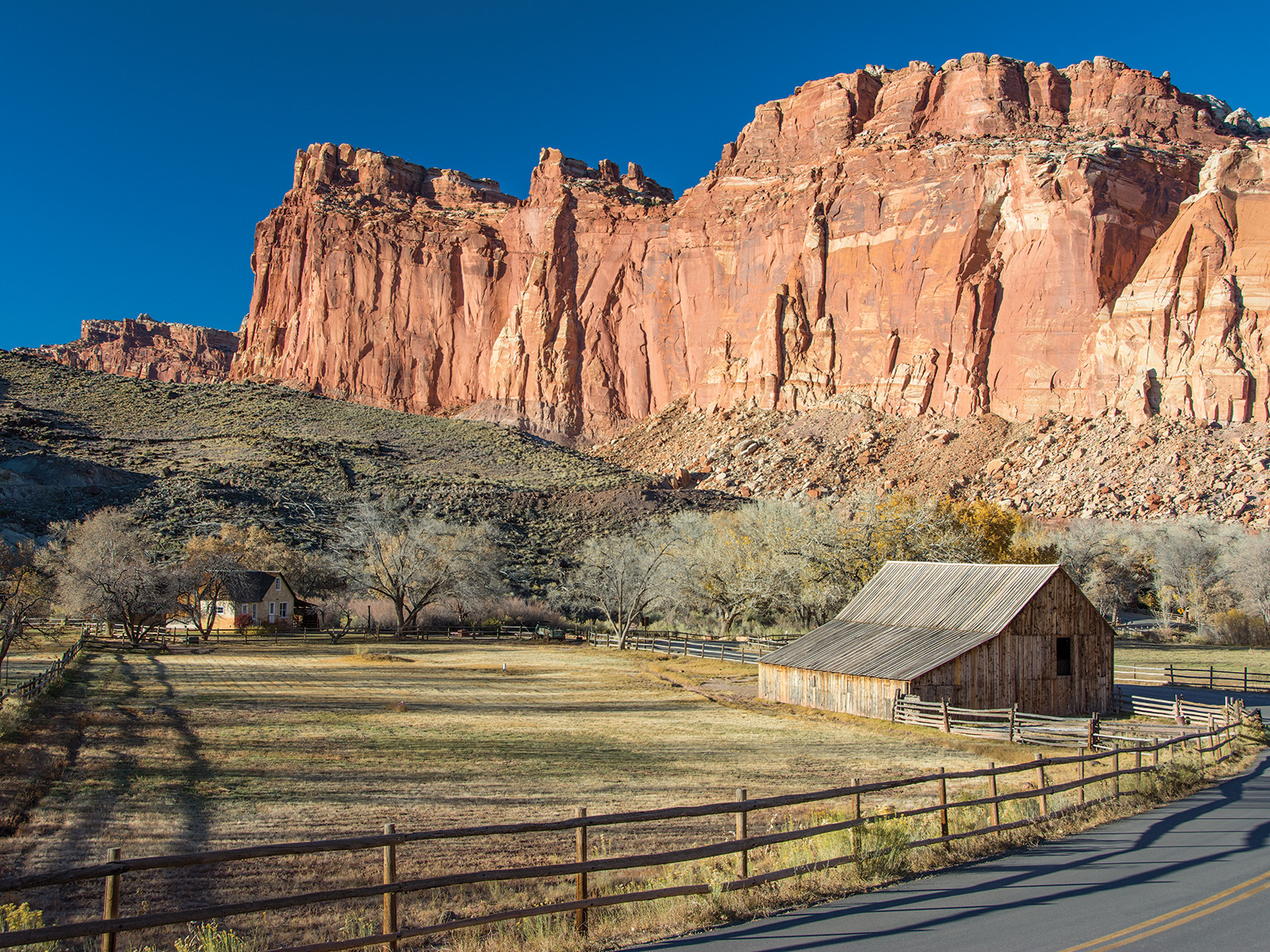
Located in south-central Utah in the heart of red rock country, Capitol Reef National Park is a hidden treasure filled with cliffs, canyons, domes, and bridges in the Waterpocket Fold, a geologic monocline (a wrinkle on the earth) extending almost 100 miles.
Official NPS pageCaution: Monsoon Season & Flash Floods
Heavy rains can cause sudden flooding, especially in canyons and washes. Do not drive or hike through flood waters. Get to high ground and wait for floods to subside. Some roads may close temporarily; closures are posted at the visitor center.
Information: Stage II Fire Restrictions
Stage II fire restrictions are in effect until further notice. Campfires including charcoal are not permitted, even in established fire rings. Smoking is only permitted within an enclosed vehicle. Gas or liquid fueled portable camp stoves are still permitted.
Caution: Elevated E. Coli levels - Fremont River
Recent water quality testing shows elevated E. coli levels in the Fremont River. Use caution if entering the water. Do not get water in your mouth, do not swim. Wash hands with soap and water.
Park Closure: Annual/Seasonal Canyoneering Closures
The following are closed to entry through 8/31/2026 to protect sensitive resources: the heads of Fivemile Wash & Burro Wash descending east 2 miles; Shinob Canyon + all routes descending into Shinob (including Na-gah, Nighthawk, & Timpie); and Arch Nemesis Canyon, including the route exiting at Capitol Gorge + all direct tributary canyons.
Information: Reef Ride Bike Days 2026
For this special event in honor of National Public Lands Day, the Scenic Drive will be closed to motor vehicles for part of the day on Saturday, September 19 and Saturday, September 26, 2026. The road will be closed to vehicles from sunrise to 3 pm to allow for bicycles and pedestrians to enjoy the road at a more leisurely pace. The main road through the park (UT highway 24) - will remain open and unaffected by this closure.
Hours
Capitol Reef is a 24 hour park, open all day, every day. The visitor center is open daily, except for some major holidays. Visitor center hours vary, call 435-425-3791 and follow the prompts for current visitor center information.
Entrance fees
Entrance - Private Vehicle: $20.00 · Entrance - Motorcycle: $15.00 · Entrance - Per Person: $10.00
Getting there
From I-70: Take exit 149, then take UT-24 west toward Hanksville; continue for 43.8 miles (70.5 km). Turn right to continue on UT-24 west and continue for 37.3 miles (60 km). From I-15: take exit 188 then US-50 east toward Scipio. Left on UT-50; continuing 0.7 miles (1.1 km). Turn right onto US-50 east; continue for 24.4 miles (39.3 km). Turn right onto UT-260 south and continue 4.2 miles (6.8 km), then right on UT-24 for 71.3 miles. UT-12: North on highway 12 to Torrey, UT. Right onto UT-24.
Camping in this park
Primitive campsites at Cathedral Campground
It is located approximately halfway on the Cathedral Valley Loop Road. About 36 miles (57.9 km) from the visitor center, this primitive, no-fee campground has 6 sites, each with a picnic table and fire grate. There is a pit toilet, but no water available. The campground is open year-round; however, visitors should check road conditions with the Capitol Reef Visitor Center prior to planning an over
Primitive campsites at Cedar Mesa Campground
It is located approximately 23 miles (37.0 km) south of Utah State Highway 24 on the Notom-Bullfrog Road and is at 5,500 feet (1,676 m) in elevation. This primitive, no-fee campground has five sites, each with a picnic table and fire grate. There is also a pit toilet, but no water is available. The campground is open year-round, but visitors should check with the Capitol Reef Visitor Center for ro
Fruita Campground
The 71 site Fruita campground is the only developed campground in the park, offering picnic tables, fire rings, restrooms, water and a dump station. A $25 nightly fee is charged. It is open year-round. Campsites are reservable year-round; visit www.recreation.gov to make a reservation. Reservations are accepted 6 months ahead of time. The busy season is mid March through October when the campgroun
Group Campsite
The Group Campsite is a secluded site located near the Fruita Campground and can accommodate a maximum of 40 people. It may be reserved through www.recreation.gov up to one year in advance. The Fruita Group Campsite is open from mid-April to mid-October. It is closed every Tuesday and Wednesday nights for maintenance. The nightly rate is $125.
Backcountry Camping
A free backcountry permit, available at the visitor center, is required for camping outside of campgrounds. Capitol Reef offers many hiking options for serious backpackers and those who enjoy exploring remote areas. For more information on possible backpacking routes, route descriptions and maps are available on our hiking and backpacking page.
Things to do
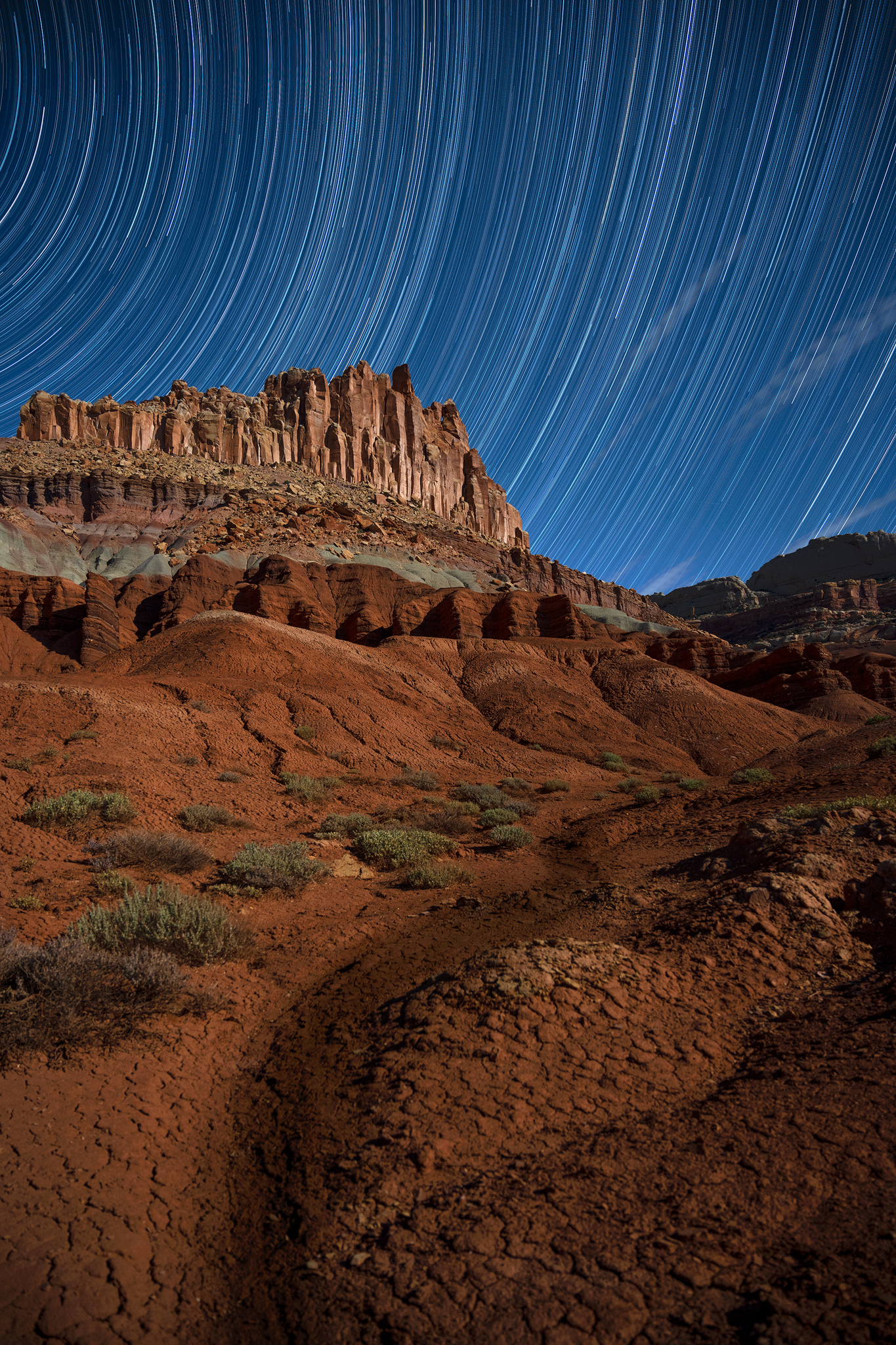
Stargaze
Capitol Reef protects extremely dark night skies, and is a wonderful place to stargaze.
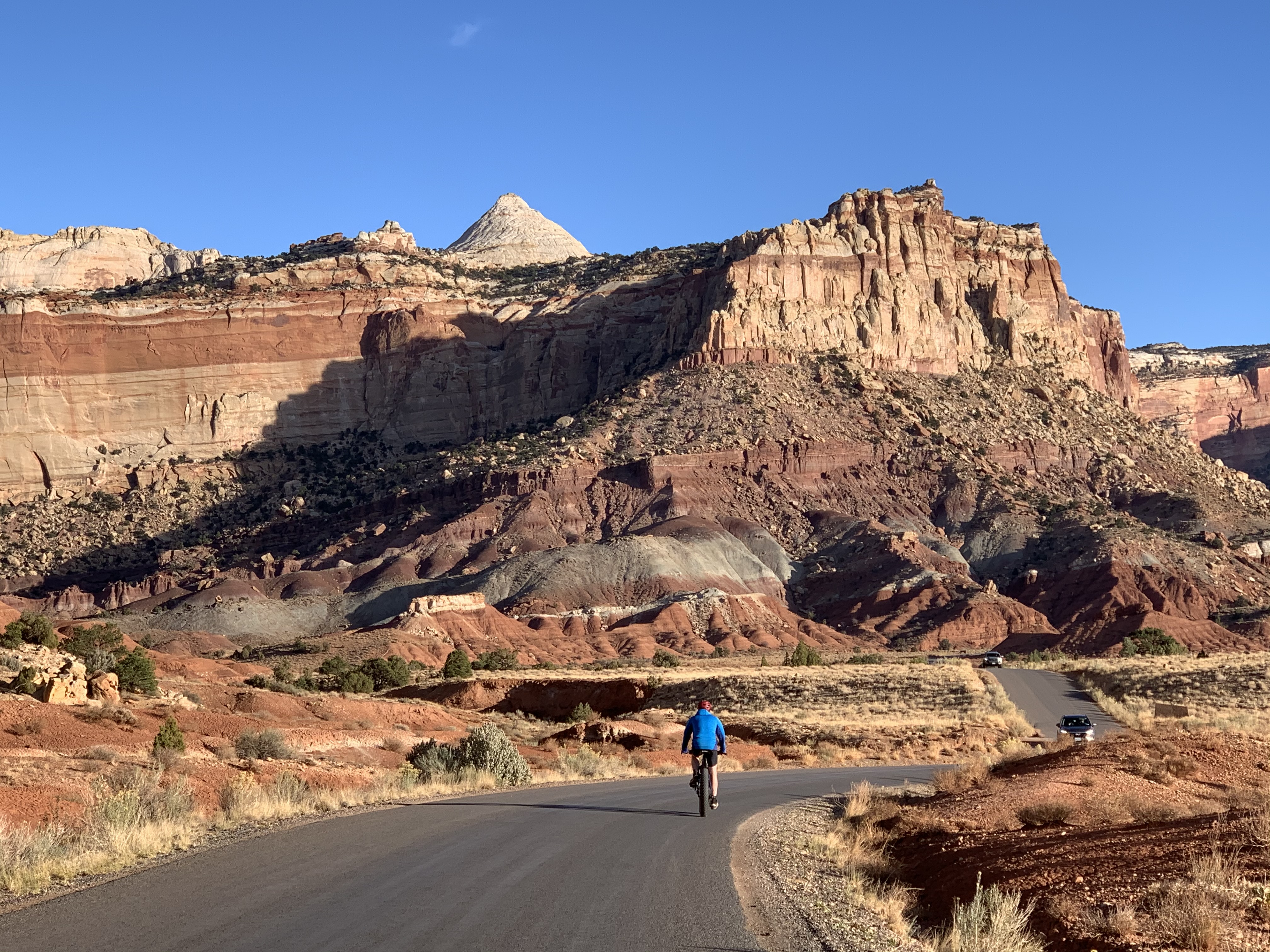
Bicycle Touring
Bicycling touring in Capitol Reef offers opportunities to explore paved and unpaved roads throughout the park. Explore colorful canyons, beautiful vistas of red rock country, and the verdant Fruita Historic District by bicycle.
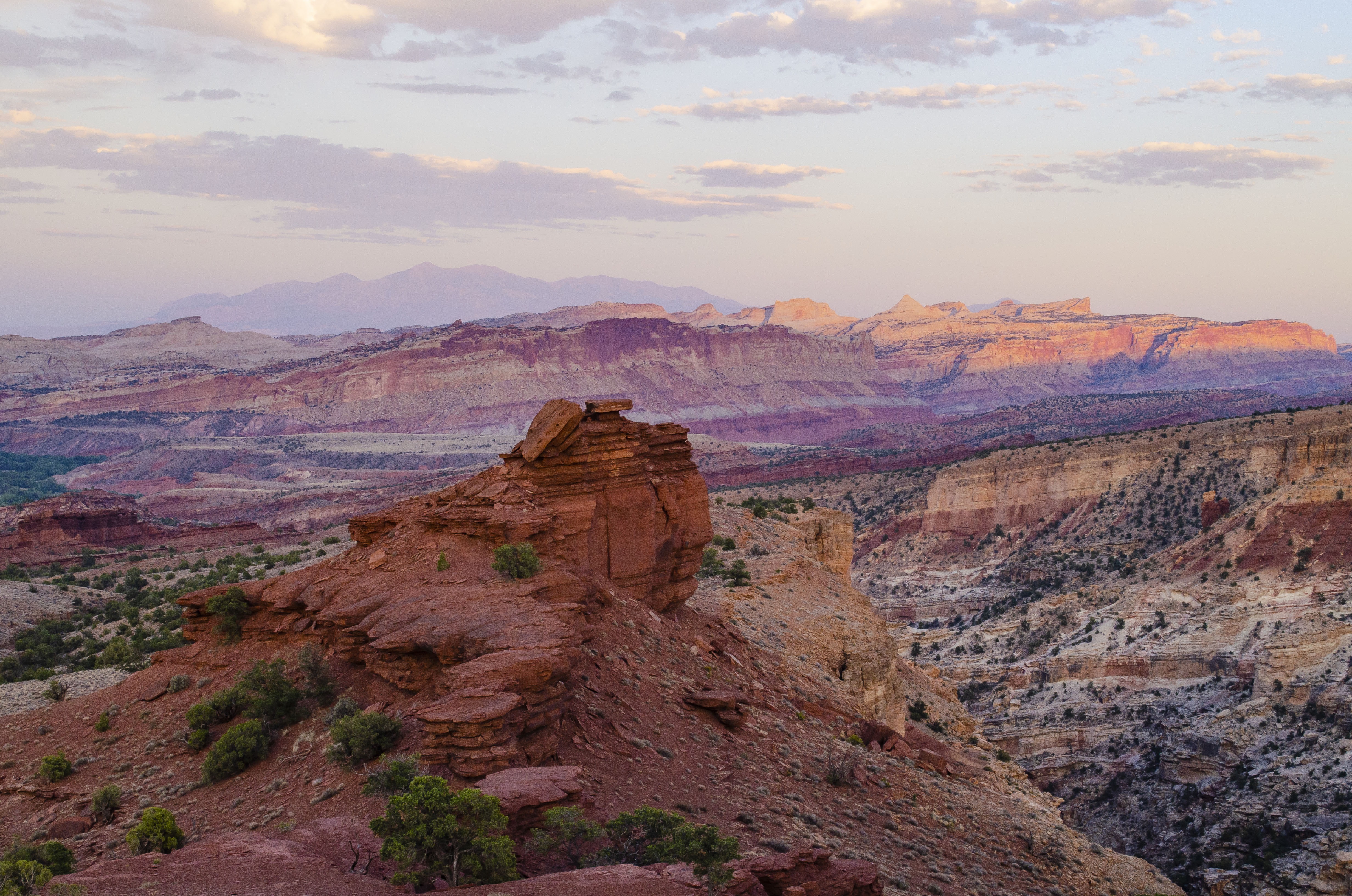
Watch the Sunset
Watch the sunset from various scenic points in Capitol Reef. Take an easy stroll or a strenuous hike as the sun goes down. Don't forget to bring a headlamp.
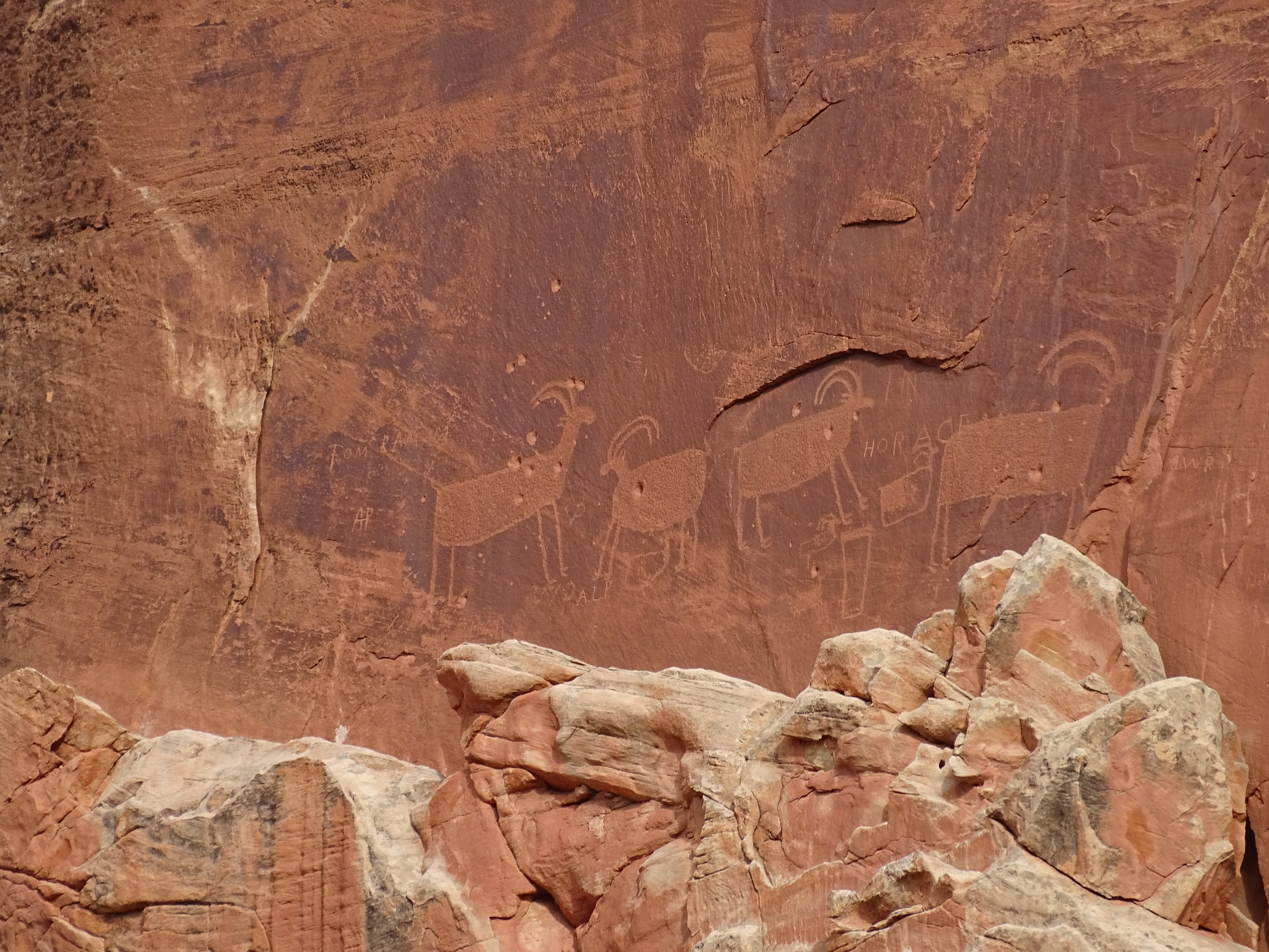
Visit the Petroglyph Panel
From 600 to 1300 C.E., native people of the Fremont Culture made their home at Capitol Reef. Petroglyphs carved into the Wingate sandstone remind us of their time.
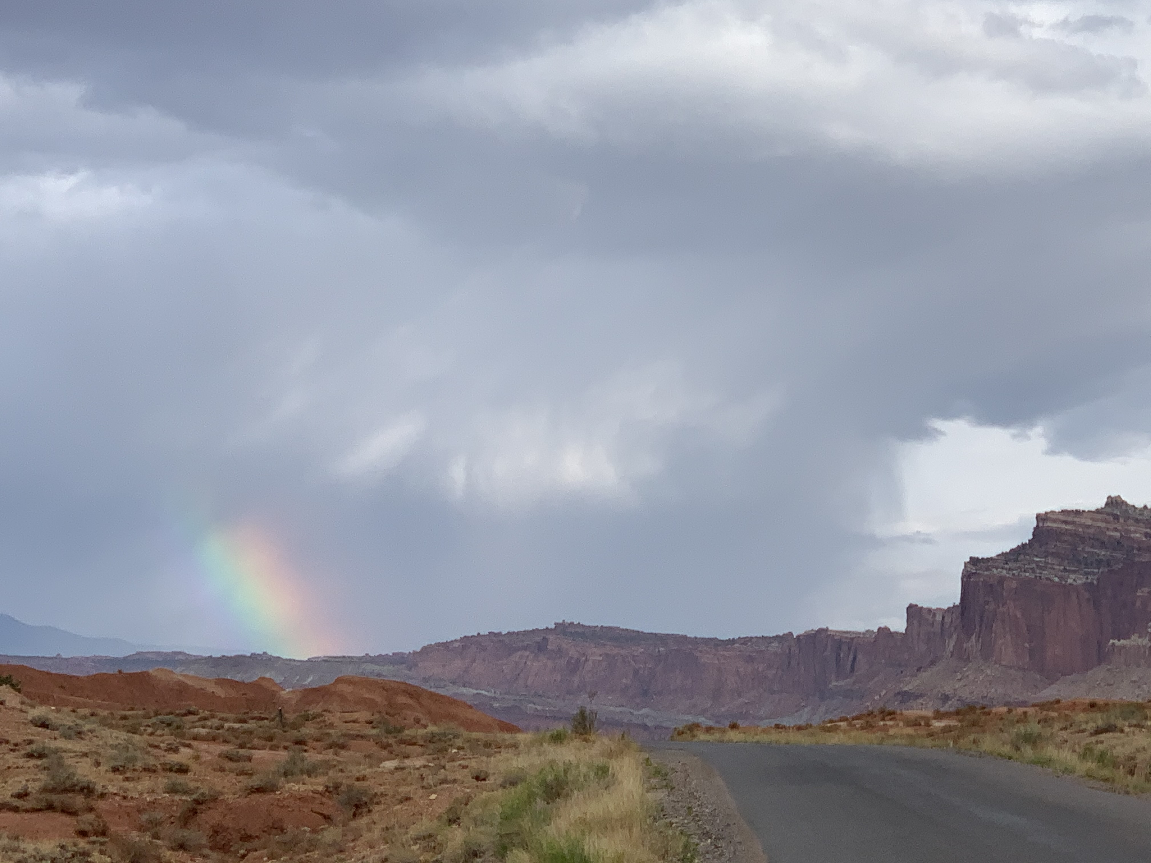
Scenic Drive Tour
Take Capitol Reef's Scenic Drive, and experience colorful cliffs and deep narrow canyons from the comfort of your vehicle.
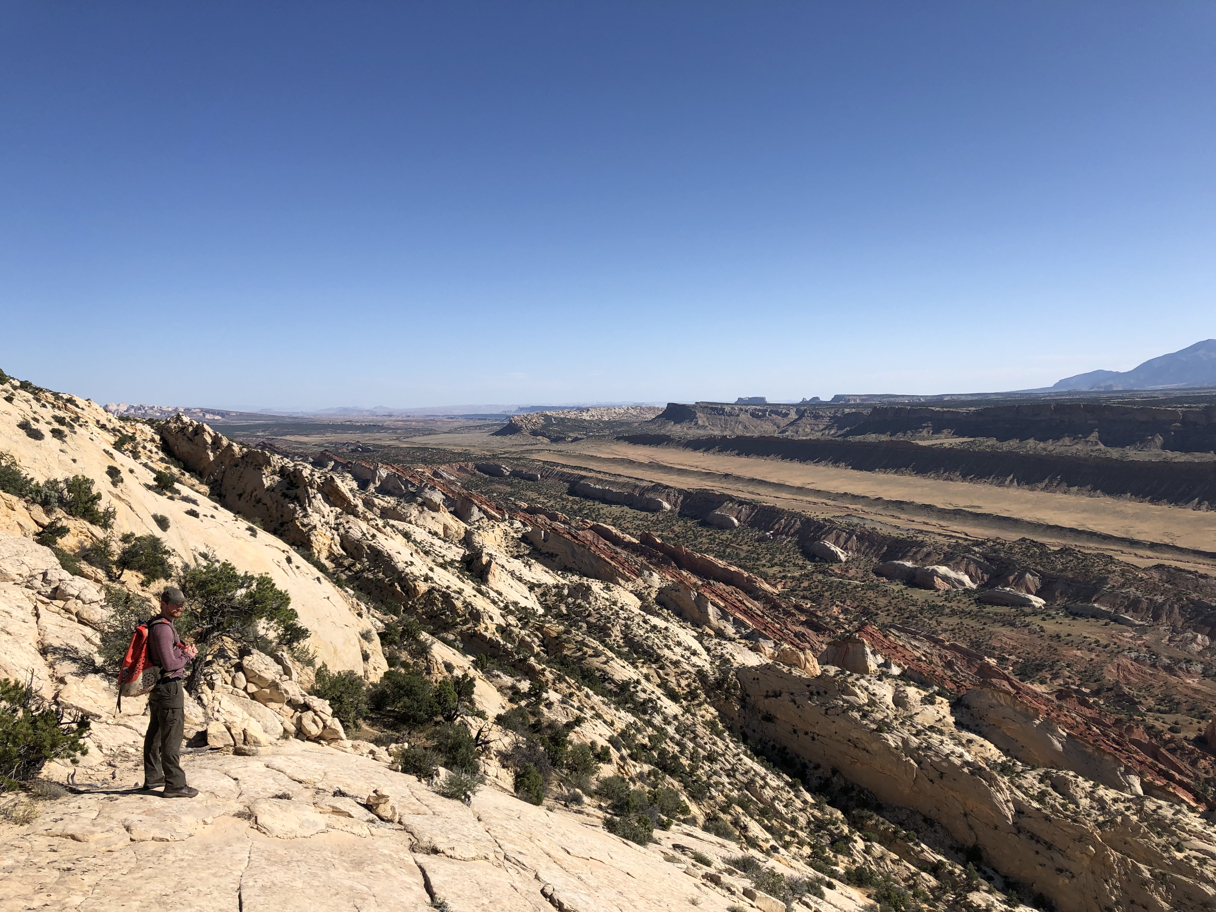
Hike in the South (Waterpocket) District
Get to know the South (Waterpocket) District on foot by hiking an easy trail or strenuous backcountry route. Many of these hikes are accessible only by unpaved roads.
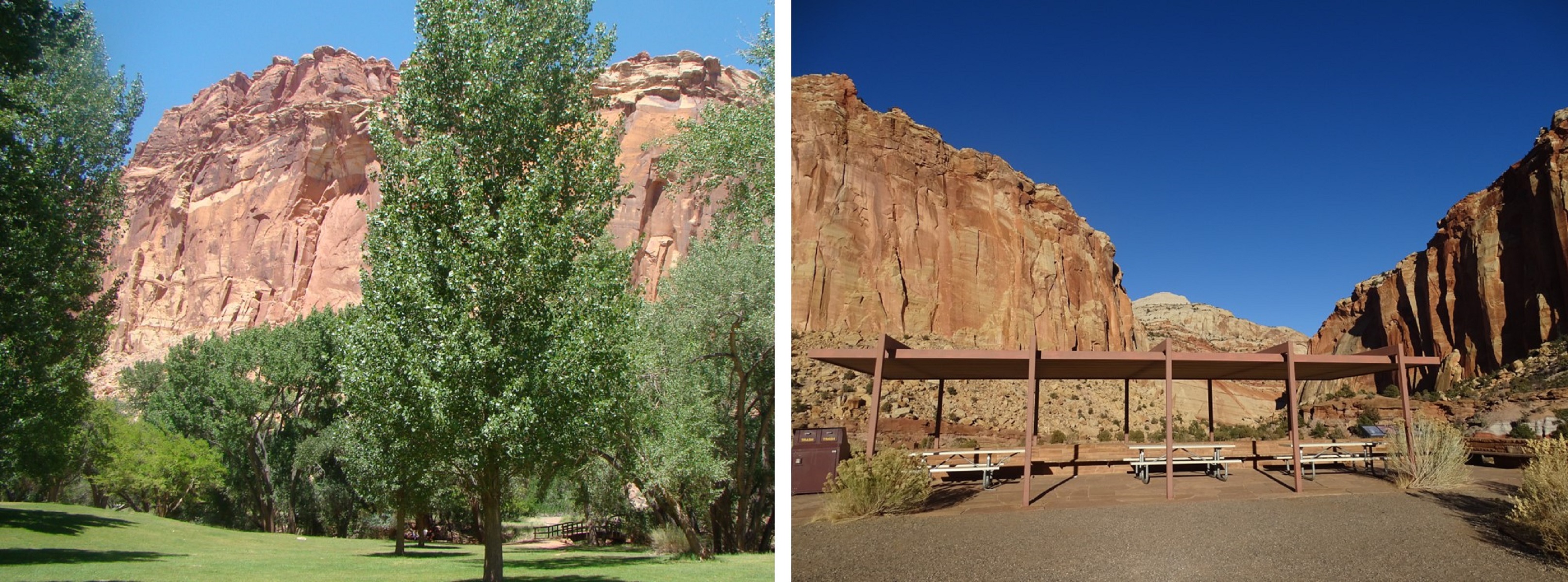
Picnic
Enjoy a picnic in Capitol Reef National Park! In the Fruita Historic District, look for the Doc Inglesby and Chesnut picnic areas, as well as tables and a water fountain near the Gifford House. At the end of Capitol Gorge Road, off the Scenic Drive, there are covered picnic tables as well as a pit toilet.
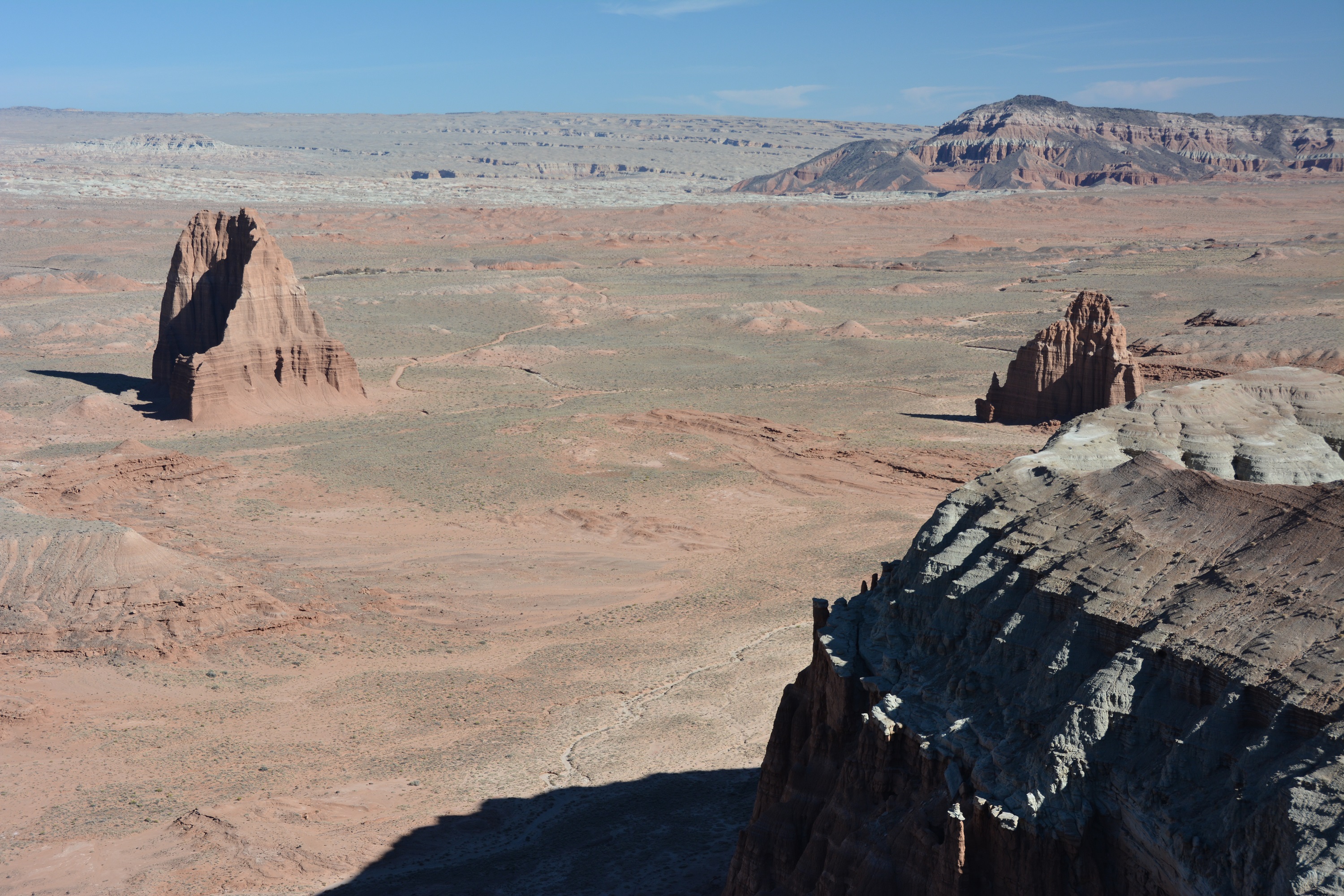
Hike Cathedral Valley
Explore Cathedral Valley by foot. These hikes are accessible only by rough unpaved roads. A high clearance vehicle is necessary and four-wheel drive is recommended at times.
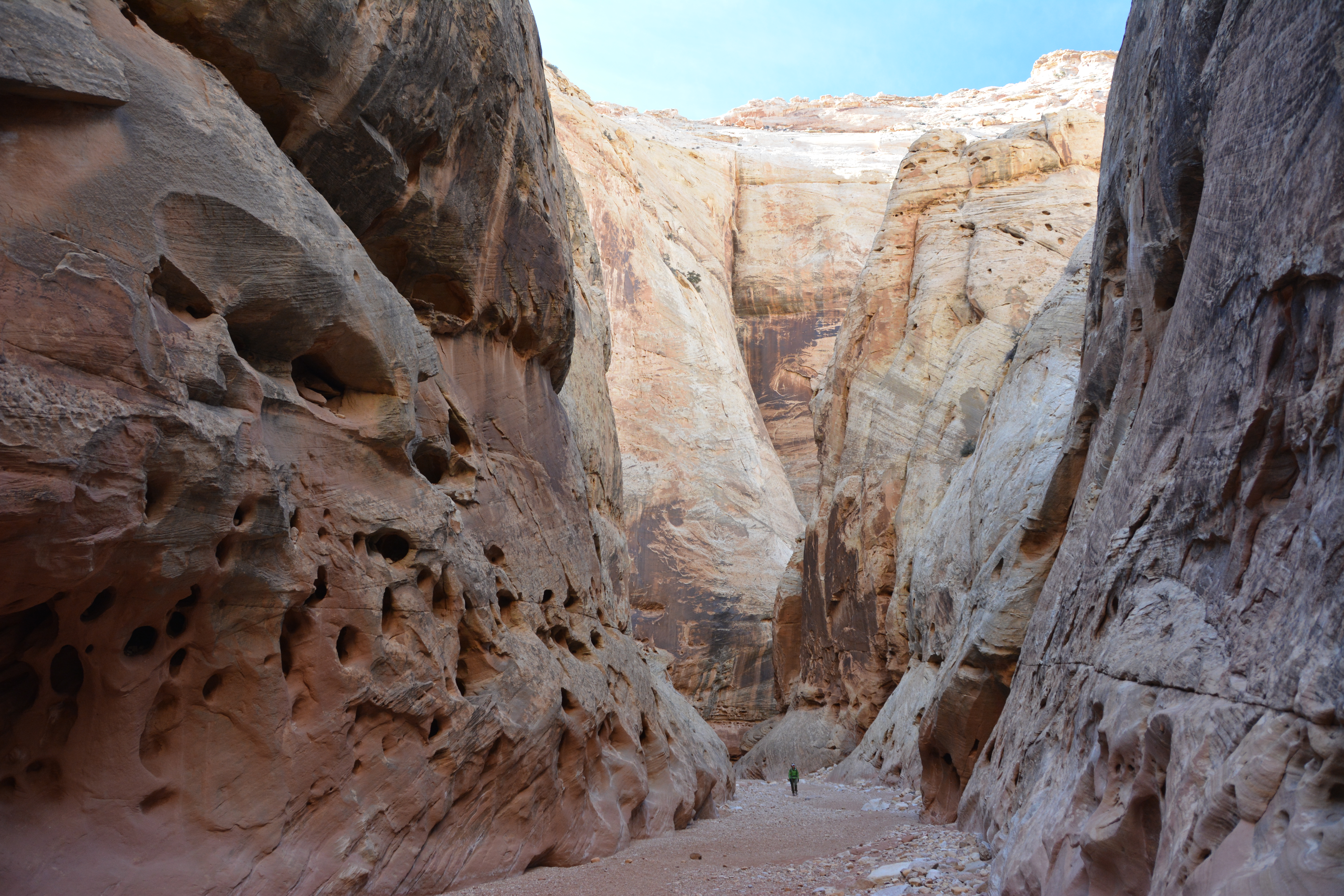
Hike an Easy or Moderate Trail
Hike an easy or moderate trail to see panoramic views or to experience a deep sandstone canyon.
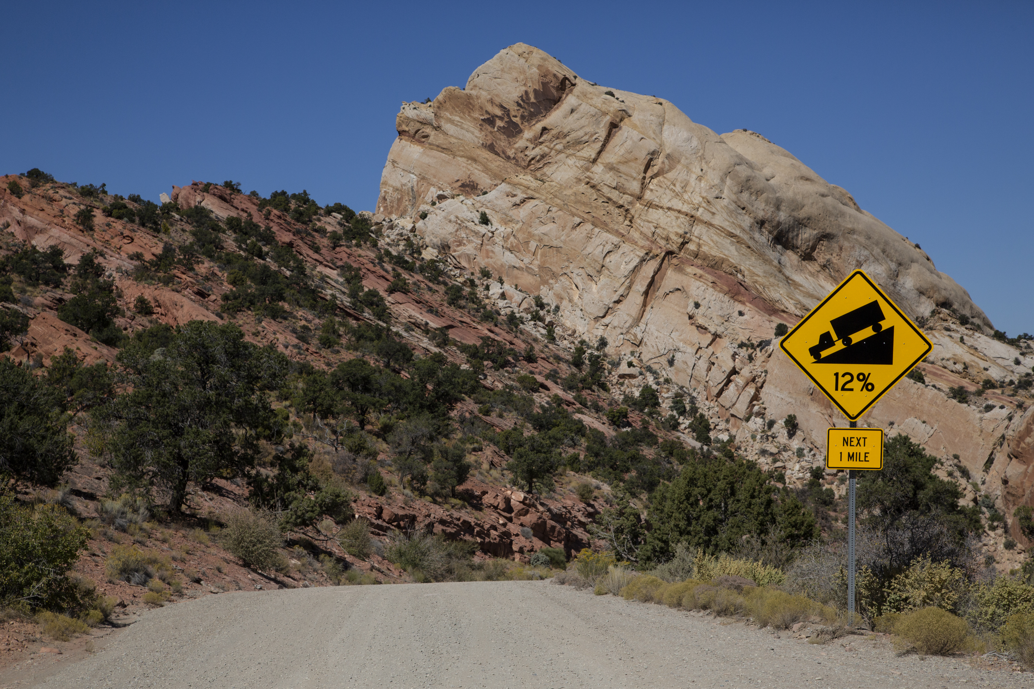
Driving the Burr Trail
Drive the scenic Burr Trail from Glen Canyon's Bullfrog district, along the bottom of Capitol Reef, through Grand Staircase, to Boulder, UT. Distance: 67 miles (108 km) one-way Mix of paved and dirt roads, impassable when wet Four-wheel drive sometimes required. No RVs.
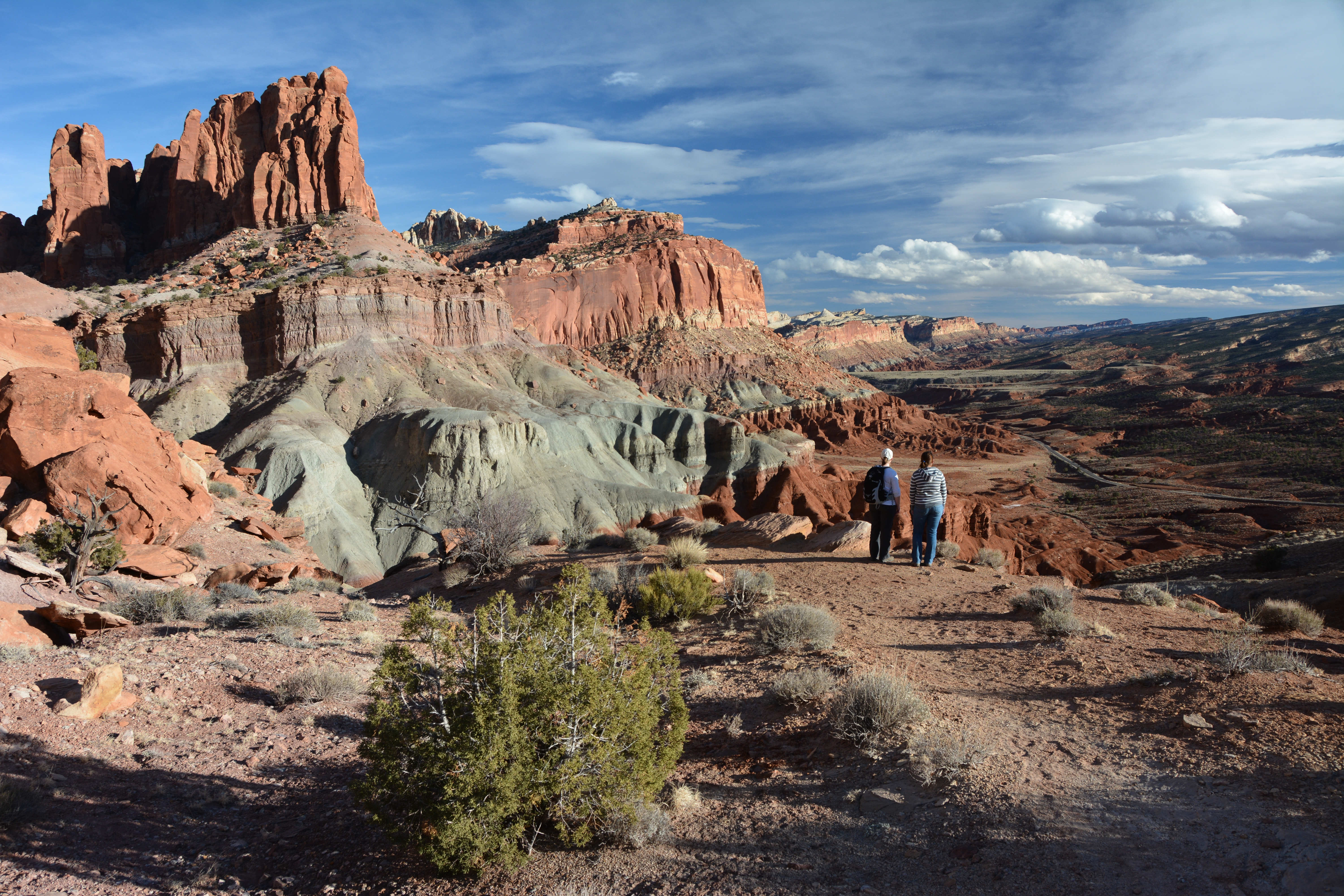
Hike a Strenuous Trail
Hike a strenuous trail to view dramatic geologic formations and spectacular vistas.
Places to see
Pioneer Register
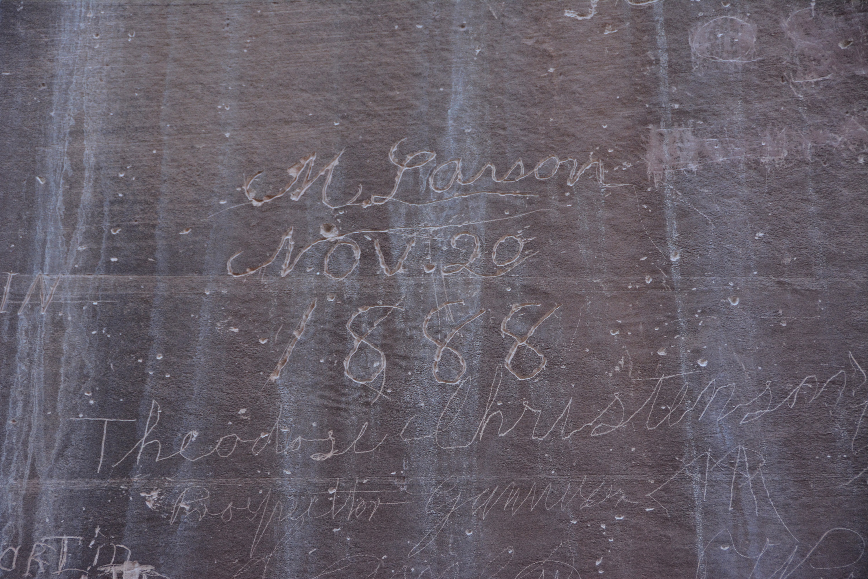
At the end of the Scenic Drive, take an easy stroll down Capitol Gorge, and about half a mile (0.8 km) from the trailhead, look at the north side of the canyon wall (left). Notice the many names, dates, and places carved, painted, and in one case, shot, into the sandstone. Prospectors, explorers, surveyors, cowboys, area settlers, and early visitors would often stand on their wagons to carve their names into the canyon wall. They were leaving their mark above flash flood danger, likely hoping their names would survive for centuries. These inscriptions provide an important log of those who passed through the region, and they offer insight into the men and women who left their names behind. The earliest inscriptions belong to two mineral prospectors, J.A. Call and Wal. Bateman. These men were probably in search of economic wealth from mining and travelled through Capitol Gorge September 20, 1871. Aside from their names, the date, and “PROSSPECTER,” very little is known about these two men. If they hadn’t left their mark, no one would know they were likely the earliest Euro-American presence in the Capitol Reef region. They were not part of a large, government-sponsored expedition, like the 1872 trip through Capitol Reef lead by Almon Thompson, under the larger J.W. Powell Expedition. It is now illegal to carve, paint, scratch, or otherwise deface any canyon wall, historic, or archeological site. The names of many early Fruita and Wayne County residents can be found on the register: E.P. Pectol, Aaron Holt, Walter and E.J. Hanks as well as members of the Oyler, Smith, Carrell, and Cook families. Other notable local people include Hanksville shop owner C.A. Gibbons who supposedly furnished Zane Gray with the story of Wildfire, his 1915 novel. A group of French archeologists looking at ruins in the area also left their names behind: G. Guiraud, A. Pillaud, P. Brossard, and T. Breard on January 30, 1893. As you return to the parking lot, look for four inscriptions towards the top of the cliff, on the south side of the canyon walls. These names belong to surveyors. One of their descendants, Pam Stewart, provides the story behind them. Her great-uncle, John R. Stewart, and his half-brother Quinby, worked for the state of Utah as land surveyors in 1912. They had contracted a crew of University of Utah geology students to help them over the summer. According to Pam and her family, “It is said that Quinby got the idea of fooling the new bunch, commenting on the speed of erosion in the Reef. One evening, leaning on the buck board, he said to his youthful and unexperienced crew, "My how it erodes down here." After a pause he consulted John R., "Isn't this the place we were at this time last year?" Later, after dark, when the rest of the camp were asleep, Quinby and John R. took some ropes, hammers, and chisels and snuck off down the draw to where canyon wall was a sheer rock face about 50 feet high. There, they climbed to the top where Quinby was lowered over the edge and down the face. There he dangled in a rope chair, while he chiseled their names and last year's date in good engineering letters two feet high on the rock face. The next day as they were working in the canyon, Quinby remarked, "I think we were standing about here when we carved our names in some rock face..." He then pointed out the names and date to his hapless audience, with the comment that he had stood on the bed of a wagon to do the inscribing. This would have required about 40 feet of erosion in one year. The tale stops there, leaving it to the reader to imagine the amazement of the University crew, and the ensuing confusion when they confidently informed their professors of the rapid erosion in the southern deserts. One can only hope that some kind mentor set them straight before the joke went too far.” As you continue to explore, help protect Capitol Reef National Park by not leaving your mark. Make memories, take photos & leave no trace.The Archaeological Resources Protection Act of 1979 (ARPA) states that all acts of vandalism are illegal and are punishable by up to 2 years in prison and/or a $20,000 fine. Help spread the word and let others know that these activities are illegal. Anyone with information concerning vandalism within Capitol Reef National Park should immediately contact the National Park Service. Report all crimes or suspicious activity to the Visitor Center or a National Park Service employee, or call the Capitol Reef tip line at (435) 425-4134. Find the Pioneer Register and Capitol Gorge on the Fruita Map and Guide.
Behunin Cabin
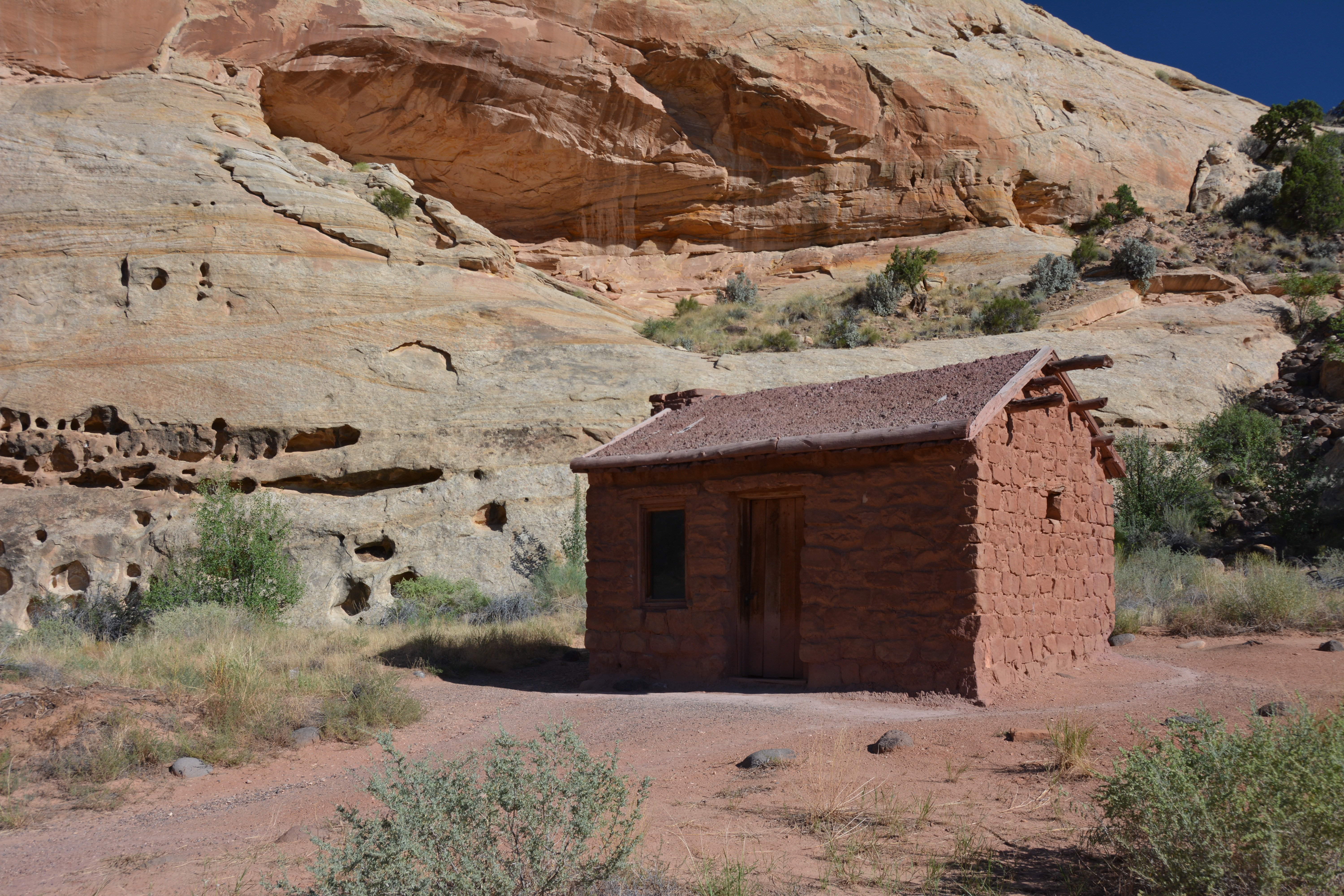
The Behunin Cabin can be seen from an unpaved, dirt parking lot off State Route 24, which is suitable for 2WD vehicles and RVs. There is limited parking for large vehicles. Tabitha Jane and Elijah Cutler Behunin were two of the early settlers to file a homestead claim around the Fremont River and Sulphur Creek. Even at this time, the Latter-Day Saint pioneers recognized that this land was useful for “ordinary farming, [but] most valuable for fruit raising.” Elijah and his family of 15 built this small sandstone cabin near the Fremont River in 1883, but only lived in it for about a year. It was not an easy place to homestead. The crops they planted were washed out by flash floods, and the cabin was only large enough for Elijah, Tabitha Jane, and their youngest children. The older boys slept in a sandstone alcove, while the older girls slept in a covered wagon box. After moving east to Caineville, the family moved back to the Capitol Reef region by 1893. They settled in the budding community of Junction (later renamed Fruita), where daughter Nettie began teaching her younger siblings. By 1896, the community worked together building a one-room schoolhouse to continue education opportunities for the children. Elijah, his sons, and other men in the community worked hard to keep a wagon road open through Capitol Gorge and up to Fruita. Summer thunderstorms, flash floods, and winter snow often made the route impassable. After about ten years, wanderlust struck Elijah, and he went east again with his family, settling in Notom. His oldest daughter, Mary Jane, stayed behind in Fruita, with her husband Nels Johnson, who is considered to be the very first settler in the area. From the National Historic Register: "The abandonment of the Behunin Cabin after only one year of occupation testifies to the tenuous nature of settlement patterns in the American West and the mobility demanded by environmental unpredictability."
Bentonite Hills
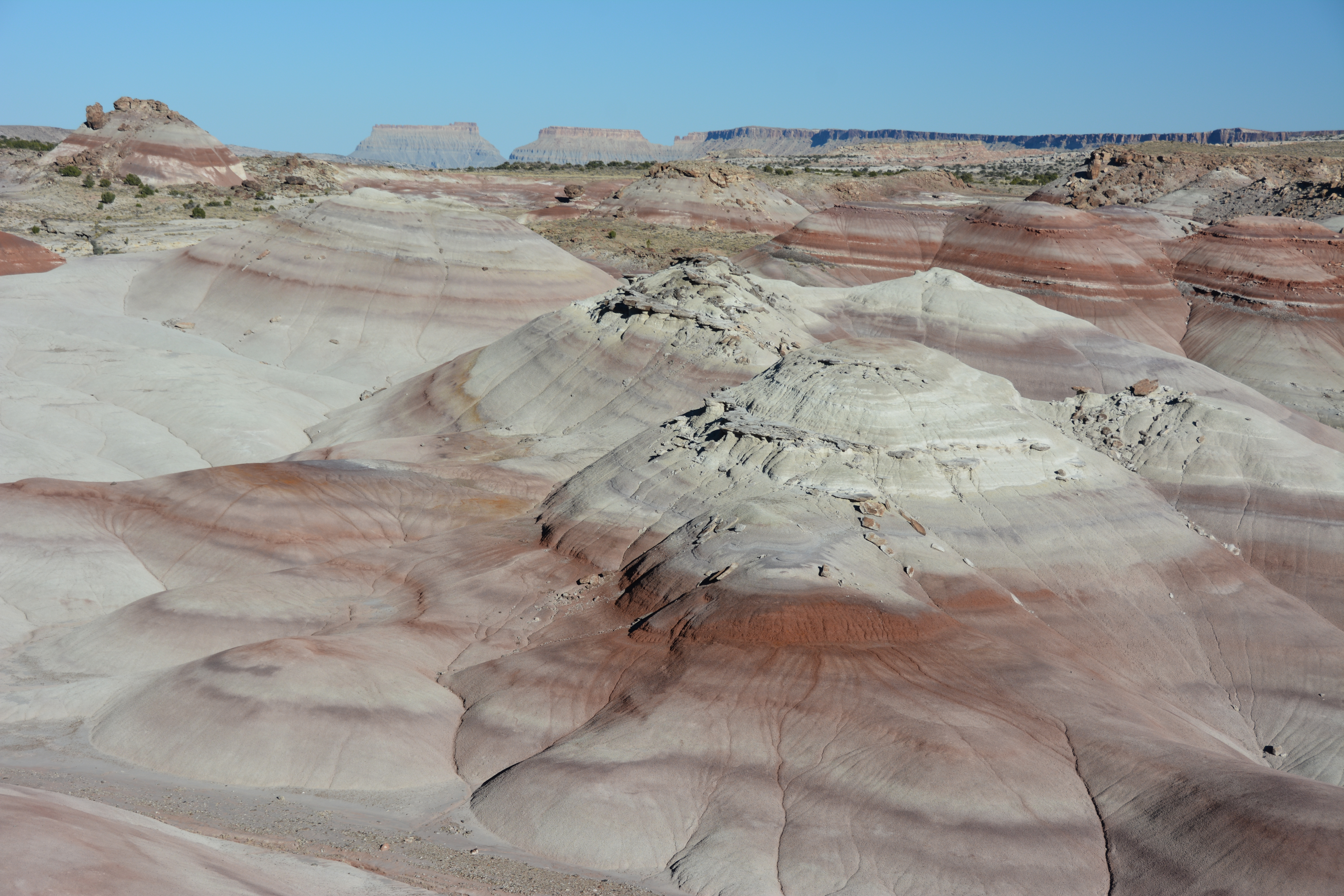
The Bentonite Hills are located outside the park boundary on Bureau of Land Management land. They are accessible by the Hartnet Road which requires a high clearance vehicle. Call 435-425-3791, press 1 for more information, and 4 for road conditions before visiting the Bentonite Hills. Visit the Cathedral Valley page for more information and check the forecast. The roads through the Bentonite Hills can become impassable when wet. The Bentonite Hills appear as softly-contoured, banded hills in varying hues of brown, red, purple, gray, and green. The hills are composed of the Brushy Basin shale member of the Morrison Formation. This layer was formed during Jurassic times when mud, silt, fine sand, and volcanic ash were deposited in swamps and lakes. Bentonite clay (altered volcanic ash) absorbs water and becomes very slick and gummy when wet, making vehicle or foot travel difficult or impossible. Repeated cycles of absorbing water and then drying results in a popcorn-like appearance on the clay's surface. There are no trails through the Bentonite Hills. The surface is easily damaged; scars from footprints and tire tracks take many years to heal. Please only drive on the road and limit foot travel to firm, previously disturbed areas and wash bottoms. Remember to leave no trace of your visit. Learn more about the geology of Cathedral Valley and of Capitol Reef's Waterpocket Fold.
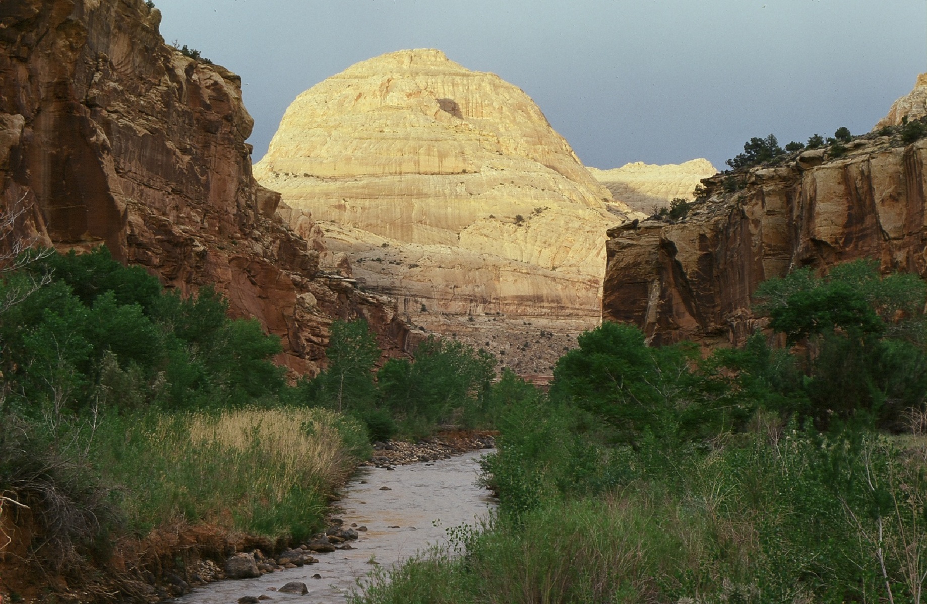
Capitol Dome
Capitol Dome is best viewed from the Hickman Bridge Trailhead, on Utah State Route 24, two miles (3.2 km) east of the visitor center. The trailhead parking area has a vault toilet and is suitable for passenger cars and a limited number of RVs. Capitol Dome is also visible from Hickman Bridge, Rim Overlook, Navajo Knobs, and Cohab Canyon trails. History Capitol Reef National Monument (established 1937) was focused on a small area around the Fremont River, known as Capitol Reef: capitol for the white domes of Navajo Sandstone that resemble capitol building domes, and reef for the rocky cliffs which are a barrier to travel, like an ocean reef. Local supporter Ephraim Portman Pectol and Yellowstone National Park Superintendent Roger Toll named the area in 1935, before it was established by President Franklin D. Roosevelt. Geology The white Navajo Sandstone dome known as “Capitol Dome,” isn’t actually a true dome. Capitol Dome is a series of fins that blend together, resembling a dome. This is why visitors can only see this iconic feature heading east on Utah State Route 24, and not heading west. The fins become noticeable in late afternoon light, when shadows appear. Navajo Sandstone was deposited about 180 million years ago, when most of Utah was covered by massive sand dunes. The dunes spanned such a large area, geologists call it a "sand sea" to convey the expanse. For Utah, this was an extremely arid time above ground, although a high water table below ground eventually helped solidify the sand dunes into stone. An even closer look at Capitol Dome reveals fine tilted layers, or cross bedding, created by ancient sand dunes. This sandstone played an important role in the protection of this landscape. When Capitol Reef National Monument was designated in 1937, the enabling legislation highlighted these “ancient sand dune deposits of unusual scientific value.” Learn more about the geology of Capitol Reef!
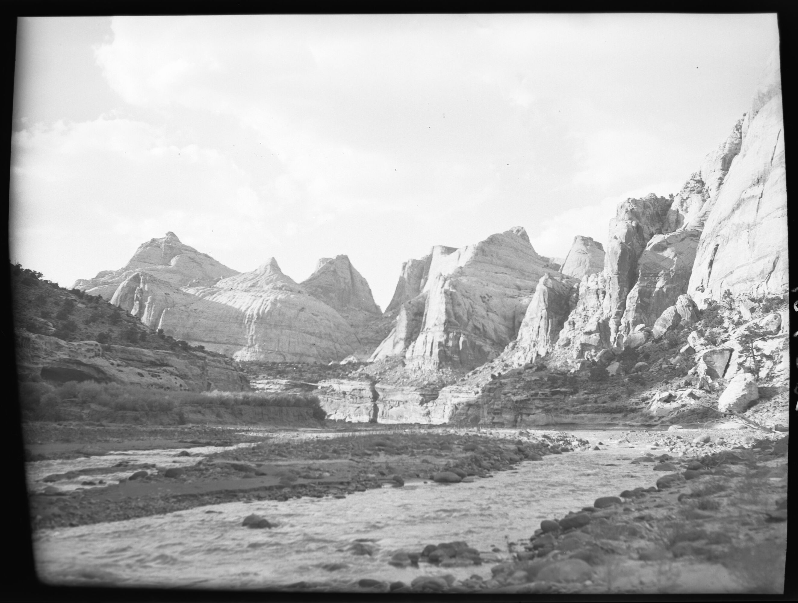
Capitol Reef East Entrance Wayside
This is the easternmost stop of the Utah Highway 24 self-guided audio tour. You find yourself at the eastern border of Capitol Reef National Park. From here, the road travels directly across the park for 15 miles (24 km) before crossing its western border. The park is relatively narrow—only 12 miles (19.3 km) wide east-to-west at this point—but it is nearly 75 miles (120.7 km) long north-to-south. To the east, the road crosses areas stewarded by the Bureau of Land Management. The Factory Butte Special Recreation Management Area is to the north. The Mt. Ellen-Blue Hills Wilderness Study Area is to the south. The soft, sloping gray badlands are mostly formed of the marine sediments of the Mancos Shale. This is the thickest layer of rock exposed in the park, at about 2,000 feet (609 meters) thick. Lined along the road from here to Hanksville are the ghosts of several settler towns. These cropped up along the river more than a century ago, as western colonists spread into the area. These include Aldridge, Clifton, Elephant, and Giles. They have mostly passed from modern maps and minds, their ends brought about long ago by slow depopulation or rapid destruction by floods. A few of these towns persist on the map, like Hanksville, Caineville, and Fruita—the historical legacy of the latter encased within the boundaries of Capitol Reef like a fossil in amber.
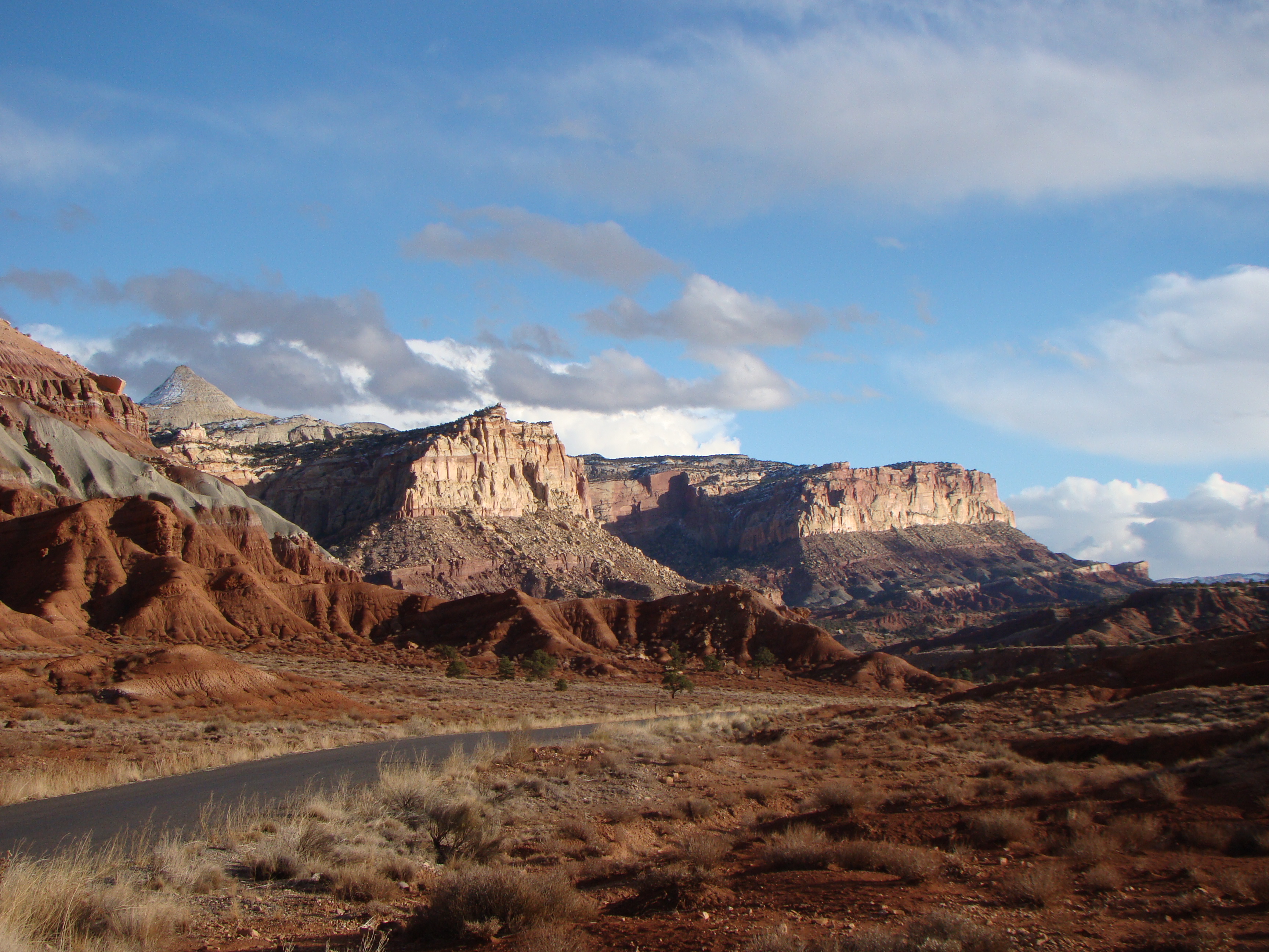
Capitol Reef National Park's Scenic Drive
The Scenic Drive starts at the park visitor center and provides access to Grand Wash Road, Capitol Gorge Road, and Pleasant Creek Road. The Scenic Drive is a 7.9 mile (12.7 km) paved road with dirt spur roads into Grand Wash and Capitol Gorge that, weather permitting, are accessible to all passenger vehicles and RV's up to 27 feet in length. The Scenic Drive is not a loop, so you must return on the same road. Parking in some lots can be limited, particularly for RV's. An entrance fee of $20 per vehicle is charged for the Scenic Drive. The self-pay entrance station is located just south of the campground on the Scenic Drive. There is no entrance fee for holders of the America the Beautiful - National Parks and Federal Recreation Lands passes. An inexpensive Guide to the Scenic Drive brochure is available at the visitor center bookstore or follow this link for a virtual tour of the Geology of the Scenic Drive. For more information, visit Capitol Reef National Park.
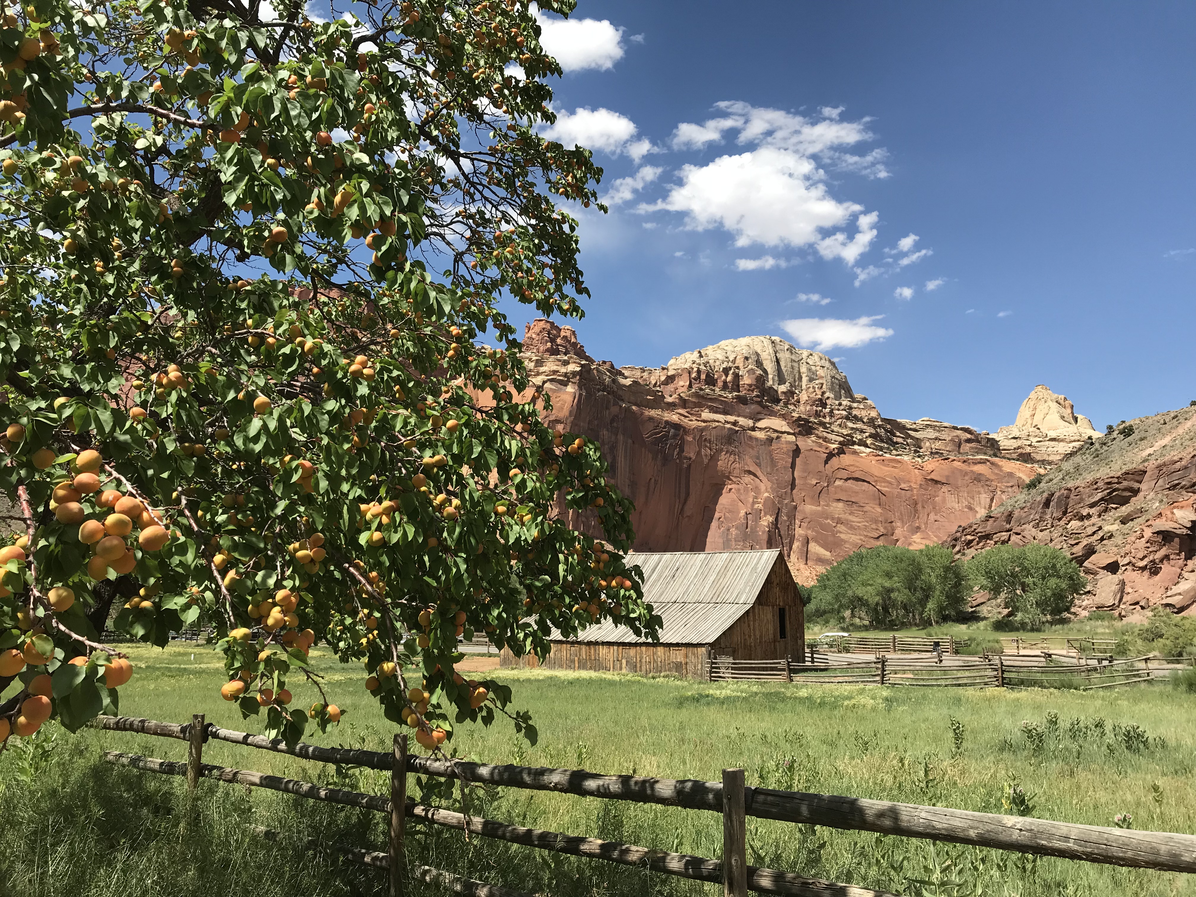
Capitol Reef Orchards
The Fruita Orchards The orchards along the Fremont River and Sulphur Creek are remnants of the pioneer community of Fruita, settled in 1880. These relics of the area’s history serve as a connection to Fruita’s pioneer agricultural tradition and embody a living connection between local residents and their history and culture. They also provide food to visitors and park employees. The trees survive due to a delicate balance between the local climate and the availability of irrigation water. As the climate changes, warmer and drier conditions increase concerns for water availablility, and add new challenges to the management of the historic orchards. History No more than 10 families lived in Fruita at any one time; the last resident moved away in 1969. These early settlers planted the orchards as a cash crop and for subsistence. Today, the orchards are preserved and protected as part of the Fruita Rural Historic District listed on the National Register of Historic Places. The orchards contain approximately 1,900 trees, including cherry, apricot, peach, nectarine, pear, apple, plum, mulberry, quince, almond, pecan, and walnut. Many are heirloom varieties. The National Park Service maintains the orchards year-round through pruning, mowing, pest management, planting, mapping, grafting, and historic irrigation methods. Harvest Check at the visitor center for information on orchards that are open for fruit picking. Fruit may not be harvested and taken from the orchard until the orchard is posted as open for picking. You are welcome to stroll in any unlocked orchard. You may sample ripe fruit in any unlocked orchard. There is no charge for fruit consumed in the orchards. Fruit taken from the orchards must be paid for. A self-pay station with scales, plastic bags, and signs listing fruit prices is located near the entrance of orchards open for fruit harvest. Please select only ripe fruit and leave the rest to ripen for other visitors. Read and follow the ladder safety signs posted in the orchards.
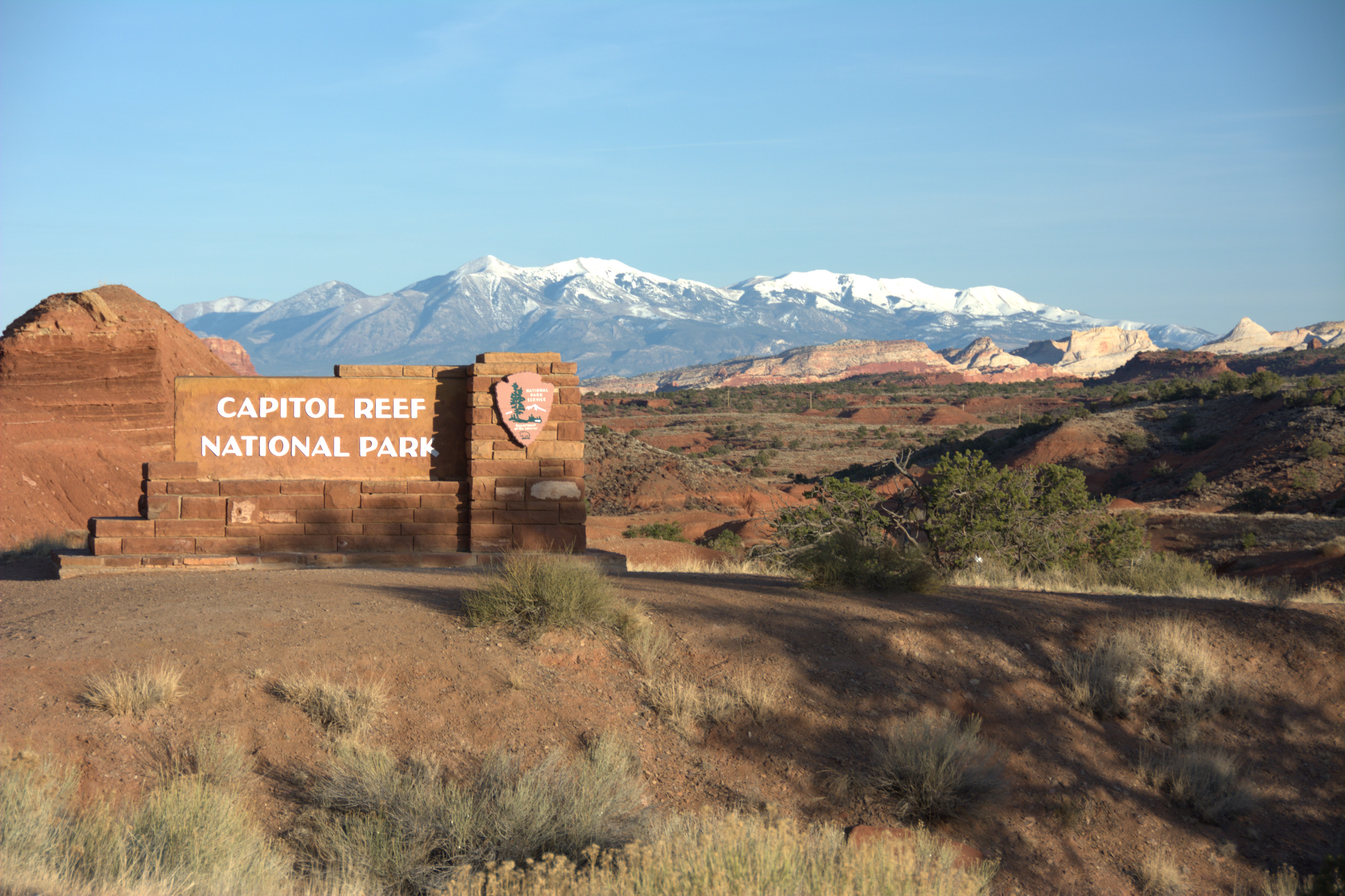
Capitol Reef West Entrance Pulloff
This is the westernmost stop of the Utah Highway 24 self-guided audio tour. You find yourself at the western border of Capitol Reef National Park. From here, the road travels directly across the park for 15 miles (24 km) before crossing its eastern border. The park is relatively narrow—only 12 miles (19.3 km) wide east-to-west at this point—but it is nearly 75 miles (120.7 km) long north-to-south. Your current elevation is around 6,400 ft (1,950 m). The highway descends to Fruita, which sits at around 5,400 ft (1,650 m). To the east, Chimney Rock is visible. To the southeast is a glimpse of the yellow-white domes capping the Waterpocket Fold. The Henry Mountains, sometimes snowcapped, are farther behind. The Henry Mountains began as underground pockets of magma that swelled under the crust like pimples. The magma cooled and solidified without erupting. Erosion of the rock layers above exposed the tough igneous rocks, mostly a kind called diorite. A similar process formed Half Dome and the other gray peaks of Yosemite National Park. Capitol Reef also represents indigenous cultural landscapes. This area is part of the ancestral and current homelands of at least thirty-two Native American tribes and pueblos. These include the Hopi Tribe; the Pueblo of Zuni; Ute Tribes; bands of the Paiute Indian Tribe of Utah; the Southern Paiute; and the Navajo Nation. The oral traditions of several tribes tell us that people have lived in this area continuously for several thousand years. The entire landscape has been their home. While we draw borders on maps to show where certain places begin and end, many natives view land as more interconnected. All the pieces of the public lands puzzle are connected to each other, and to the people. What connection will you make with the park?
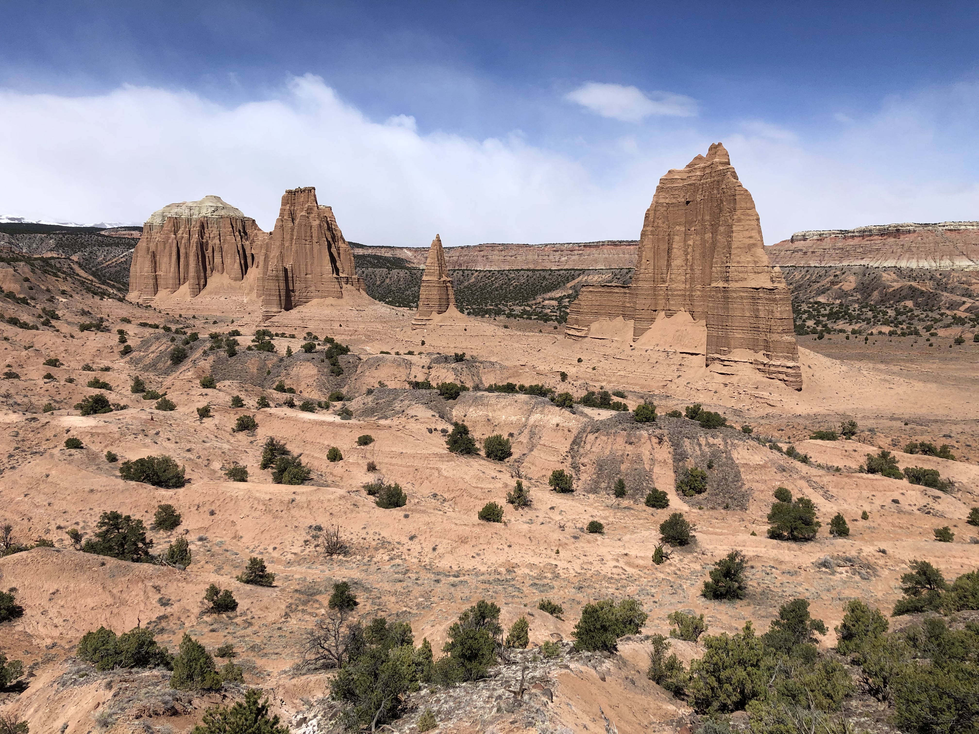
Cathedral Valley
Trip Planning and Safety The Cathedral Valley (North) District of Capitol Reef National Park is a remote, rugged region. Vehicles with high ground clearance, even those without four wheel drive, can usually negotiate the roads without difficulty. However, road conditions can vary greatly depending on recent weather conditions. Spring and summer rains and winter snows can leave the roads muddy, washed out, and impassable to the best high-clearance four wheel drive vehicle, so check at the visitor center, or call 435-425-3791. Press #1 for information, and then #4 for current road conditions. For weather conditions press #3. Foot and vehicle travel in the Cathedral Valley area is light, so be prepared for the unexpected. If you have problems, help may not arrive for hours or even days, depending on the time of year. Carry plenty of water, food, gas, adequate clothing, a shovel, and emergency supplies. No potable water is available in Cathedral Valley, although there is one primitive campground that has a pit toilet. Cell phone reception is usually poor to nonexistent. Cool or cold temperatures will accompany sudden storms or an unexpected night out in the backcountry. Daytime temperatures in the summer may reach the upper 90s°F (30s °C) and winter highs may stay below freezing, so prepare accordingly. Check this weather forecast specifically for Cathedral Valley. You are responsible for your own safety. Please leave no trace of your visit. The Cathedral Valley Driving Loop Tour This driving loop takes about 6-8 hours to complete. Most visitors to Cathedral Valley drive the 57.6 mile (92.7 km) loop clockwise, beginning on the Hartnet Road located 11.7 miles (18.8 km) east of the visitor center on Highway 24 and continuing on that for 27.8 miles (44.7 km) to Hartnet Junction. Turn right (north) onto Cathedral Road and driving 29.9 miles (48.0 km) back to Highway 24 will complete the loop. There are many side trips and hiking opportunities along the way. The south end of the Hartnet Road near Highway 24 requires fording the Fremont River; there is no bridge over the river. Do not attempt to cross the river during floods or other periods of high water. Ask at the visitor center about river ford conditions or call 435-425-3791. The ford has a hard packed, rocky bottom and water levels are normally a foot or less deep. The access road to the River Ford crosses private land. Please honor the posted no trespassing signs along the road near the ford by not parking off-road or camping in the vicinity.
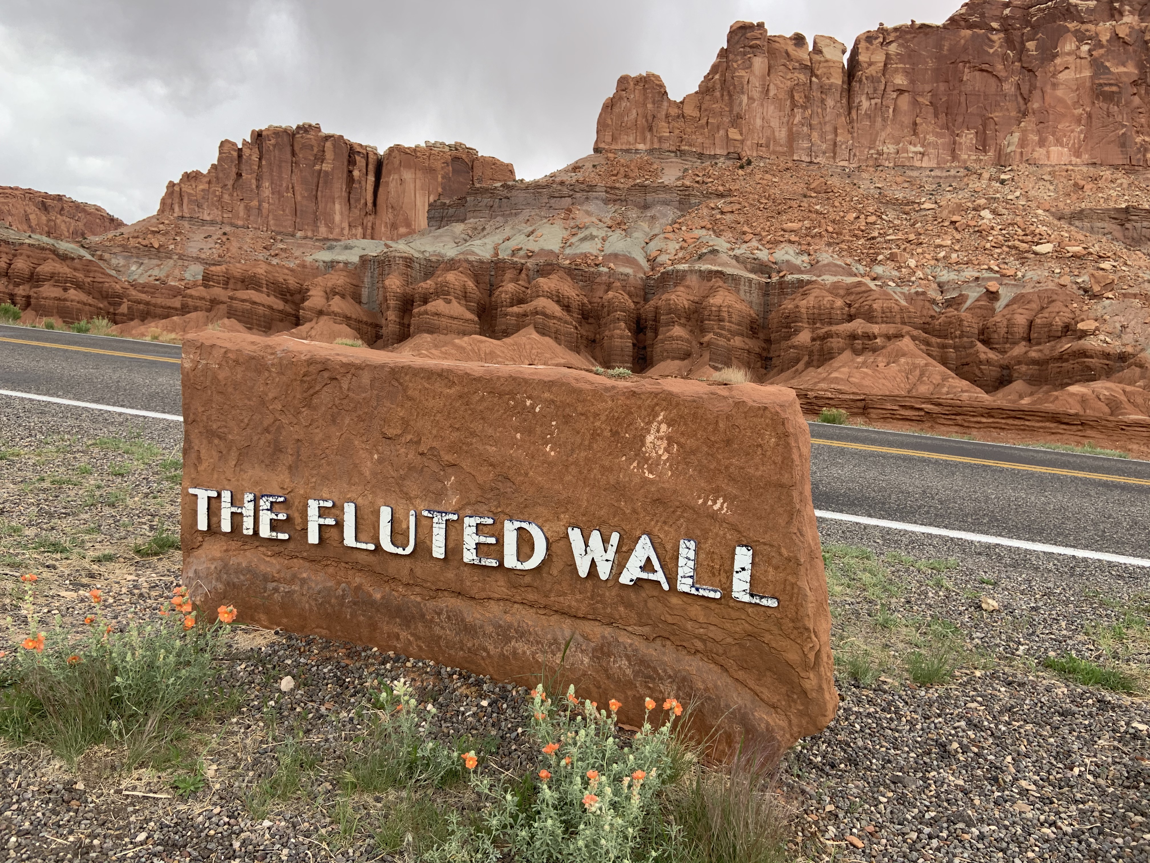
Fluted Wall Viewpoint
The Fluted Wall is composed of Moenkopi rocks that erosion has sculpted into a back-and-forth rank of pillars and alcoves. Capitol Reef has its fair share of fossils, though there are not many places to see them on trails. The Moenkopi Formation that surrounds you now, which is about 240 million years old, is well-known for trace fossils. A trace fossil is a preserved record of an organism’s behavior, rather than its body. For example, in the Moenkopi, we find many fossilized footprints. Imagine a Velociraptor-shaped dinosaur plodding across a stream, leaving tracks in the sand. Then a fish swims past, creating a furrow as it drags its back fin through the mud. By chance, these marks were buried soon after and turned into rock over millions of years. Even without a piece of its body, trace fossils teach us about an animal’s shape, motion, and lifestyle. Several other layers of rock in the park contain fossils. In some places, the Dakota Sandstone is full of marine fossils such as oyster shells. In the Navajo Sandstone, scientists discovered fossilized mats of marine algae, called stromatolites. This taught us that the ancient desert which created this rock layer was not dry 100% of the time. Fossils, like all natural and cultural resources within the park, are protected. It is illegal to take or deface fossils. Leave your park as beautiful as you find it—or better—and enjoy the discovery of these rare, precious pieces of the past.
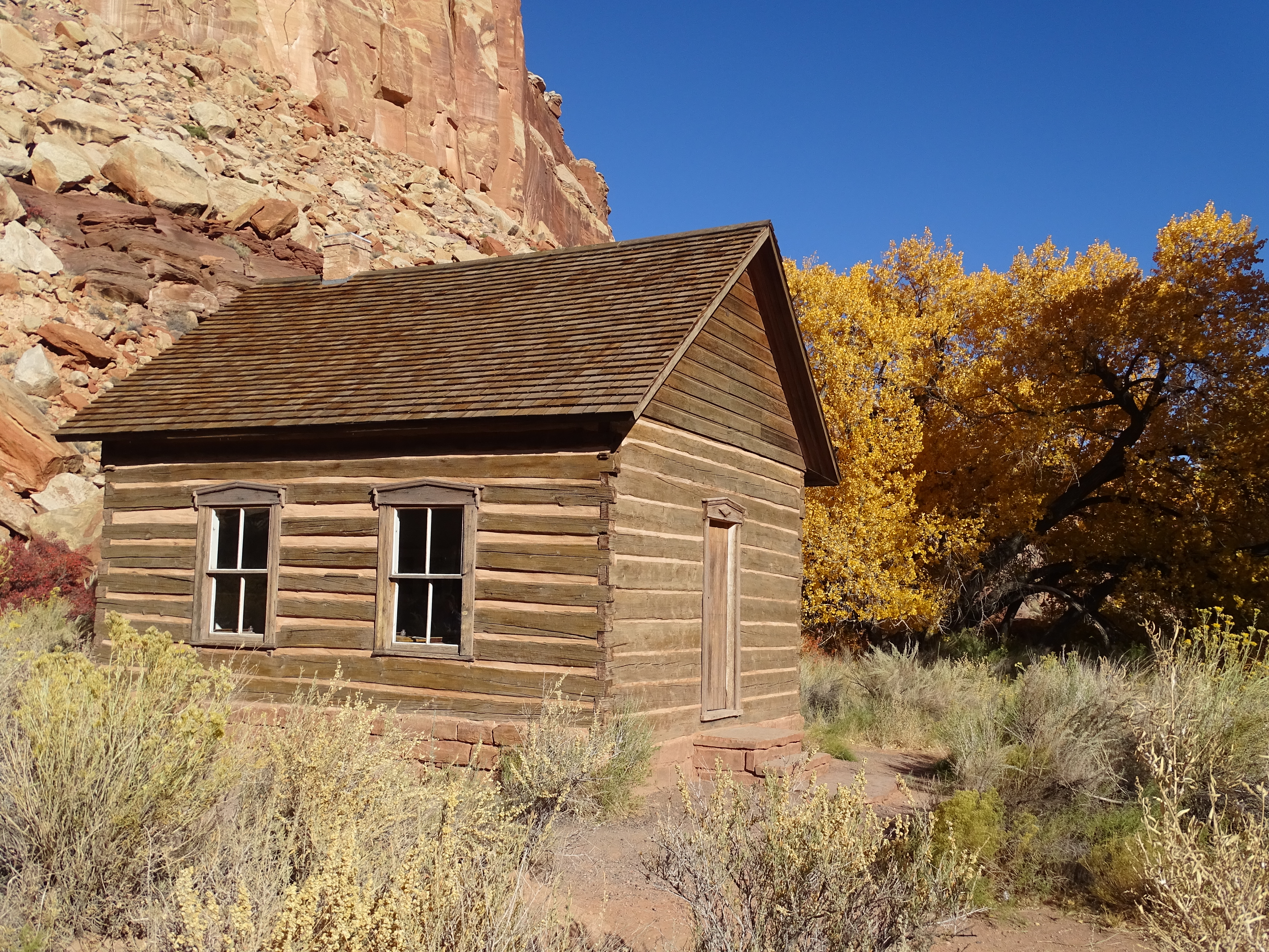
Fruita Schoolhouse
The Fruita Schoolhouse, sometimes called the Fruita Grade School, was used by the Fruita community from 1896-1941. The first teacher, Nettie Behunin, was just 12 years old. By 1941, there were not enough students to keep the school open, and it closed. The National Park Service nominated the school to the National Register of Historic Places, and it was restored to its 1930s appearance in 1989. Learn more about the schoolhouse, as well was the community of Fruita. Listen to Janice Oldroyd Torgerson, who taught at the Fruita Schoolhouse in 1934, or read the transcript.
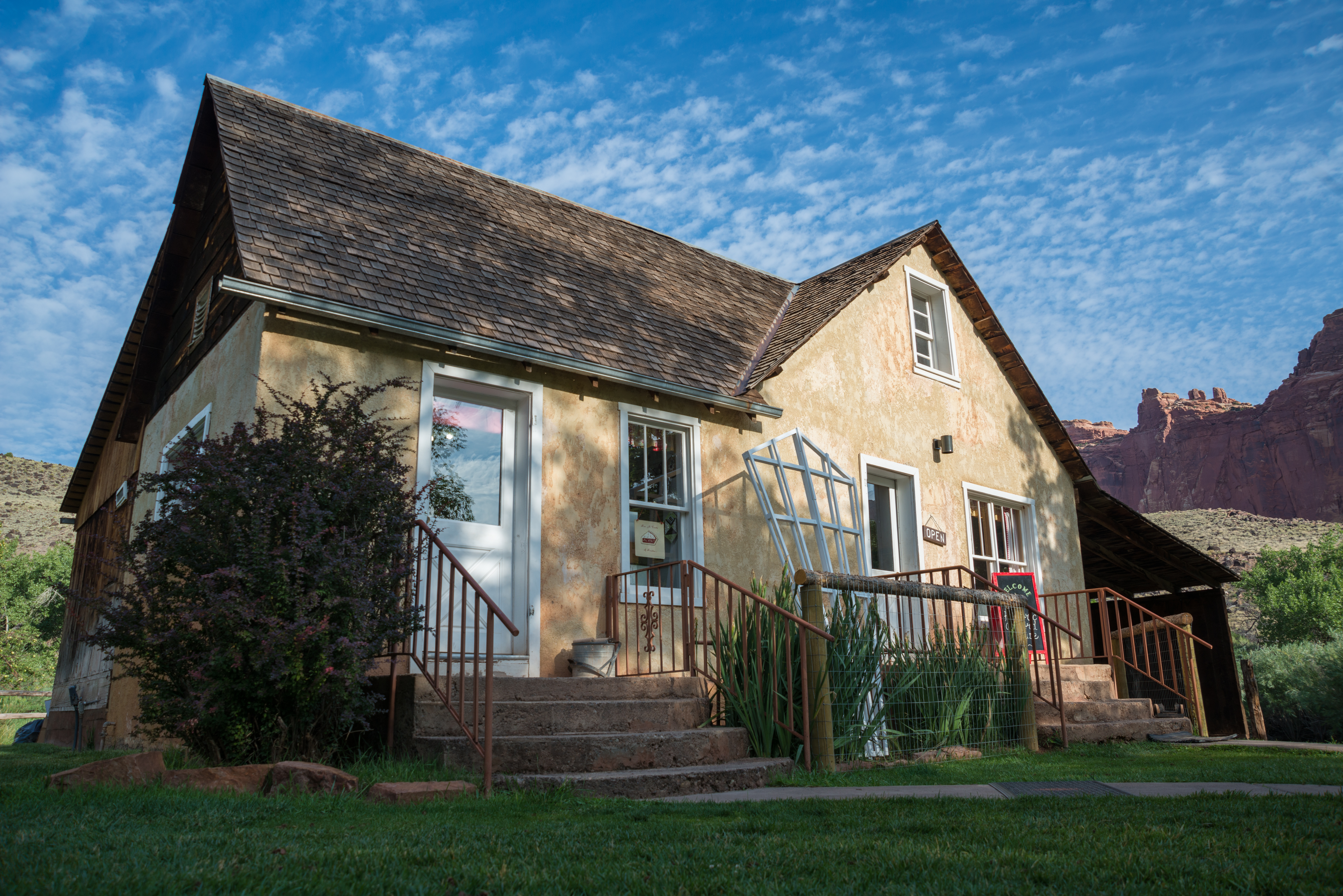
Gifford House
The Gifford farm lies in the heart of the Fruita valley, a desert oasis described by Wallace Stegner as "...a sudden, intensely green little valley among the cliffs of the Waterpocket Fold, opulent with cherries, peaches, and apples in season, inhabited by a few families who were about equally good Mormons and good frontiersmen and good farmers." The 200 acre Fruita Rural Historical District is listed on the National Register of Historic Places. The Capitol Reef Natural History Association, in cooperation with the National Park Service, has renovated and refurnished the Gifford farmhouse as a cultural demonstration site to interpret the early Mormon settlement of the Fruita valley. The house depicts the typical spartan nature of rural Utah farm homes of the early 1900s. In addition to the farmhouse, the Gifford homestead includes a barn, smokehouse, garden, pasture, and rock walls. The Gifford House is open seasonally from March 14 (Pi Day) through the end of November each year. The Gifford House typically closes the Saturday after Thanksgiving. Read a transcript of Dewy Gifford's recollections (audio file below).
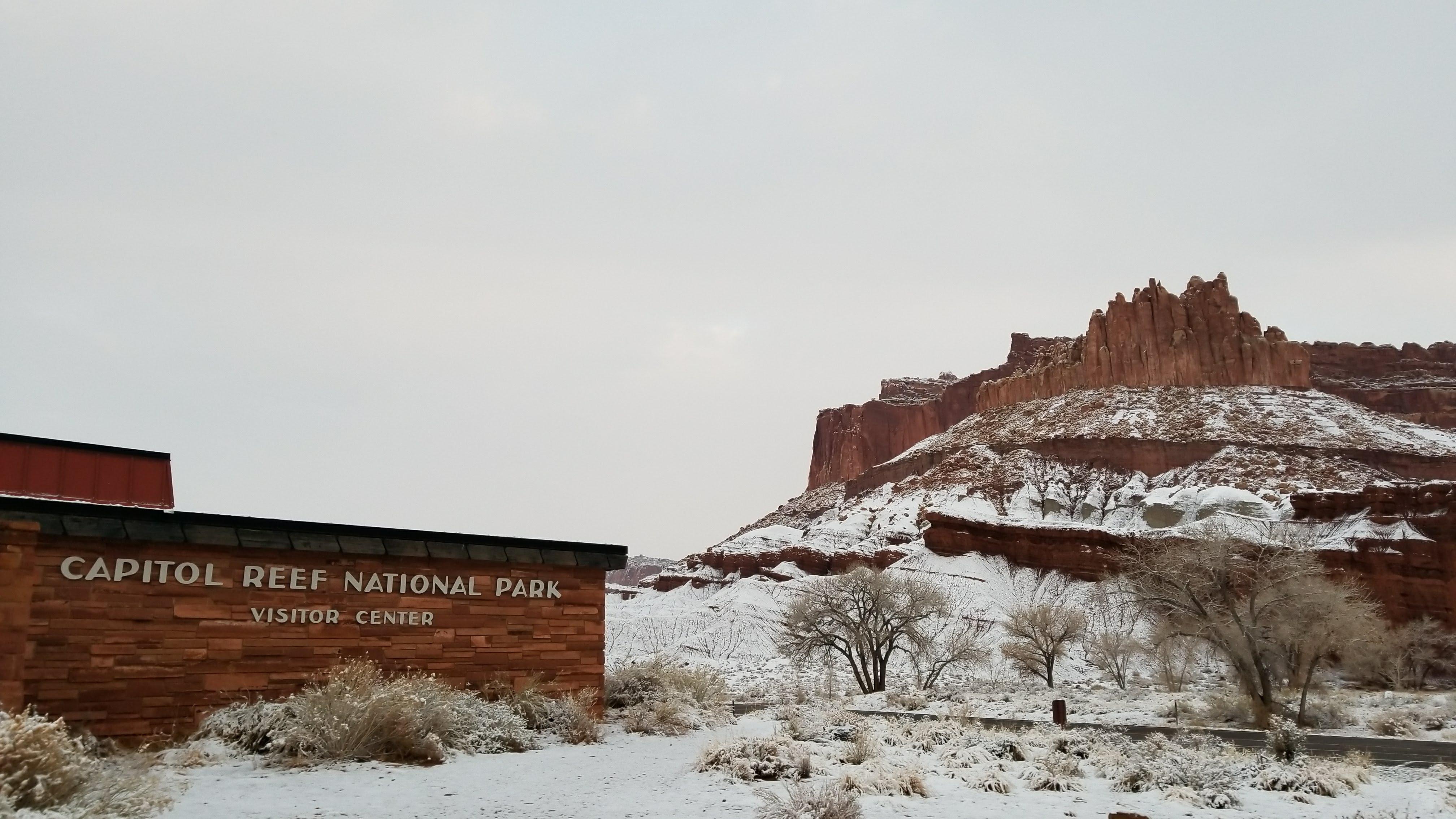
Visitor centers
Park stories
NPS Geodiversity Atlas—Capitol Reef National Park, Utah
Riparian Health on the Fremont River, Capitol Reef National Park, 2009–2021
Resisting, accepting, and directing change in parks
Short-term Forecasting of Vegetation Condition: Potential Management Uses
Rangeland restoration and the RAD framework at Capitol Reef National Park
Not Too Dense, Not Too Sparse: Pinyon-Juniper at Capitol Reef is Just about Right
Virtual Field Trip of Sleeping Rainbow Ranch in Capitol Reef National Park
What do a Tadpole Shrimp and a Mule Deer Have in Common? They Both Rely on the Water Resources of Capitol Reef
Helping Managers Plan for Climate Change with Remote Sensing at Capitol Reef National Park
Invasive Exotic Plant Monitoring at Capitol Reef National Park
Assessing the Condition of Fish in Capitol Reef
Condition of Selected Natural Resources at Capitol Reef: 2022 Assessment
Park information courtesy of the National Park Service Data API.