
National Historic Trail
Pony Express National Historic Trail
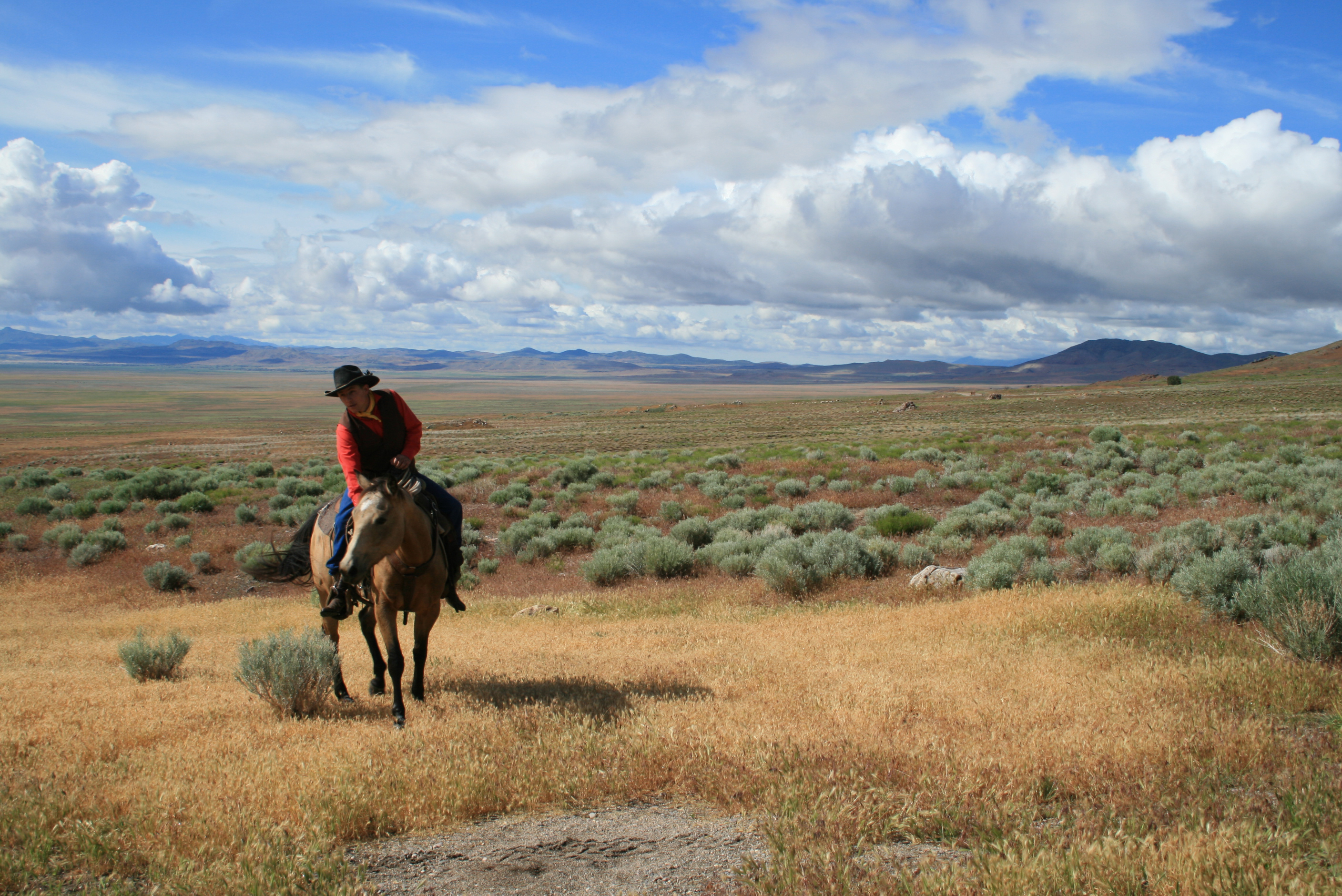
It is hard to believe that young men once rode horses to carry mail from Missouri to California in the unprecedented time of only 10 days. This relay system along the Pony Express National Historic Trail in eight states was the most direct and practical means of east-west communications before the telegraph.
Official NPS pageHours
The Pony Express National Historic Trail is not a clearly marked hiking trail. Instead it is a route that passes through communities, urban areas, public lands, and Wilderness. The route travels across a variety of land ownerships and management, including private land. Each location varies as to the hours of operations and access. Please contact individual trail sites before your visit for more information.
Entrance fees
No entrance fee listed.
Getting there
You can visit many sites of the Pony Express National Historic Trail over the 1,800-mile historic route that crosses 8 states.
Things to do
Become a Pony Express Trail Junior Ranger
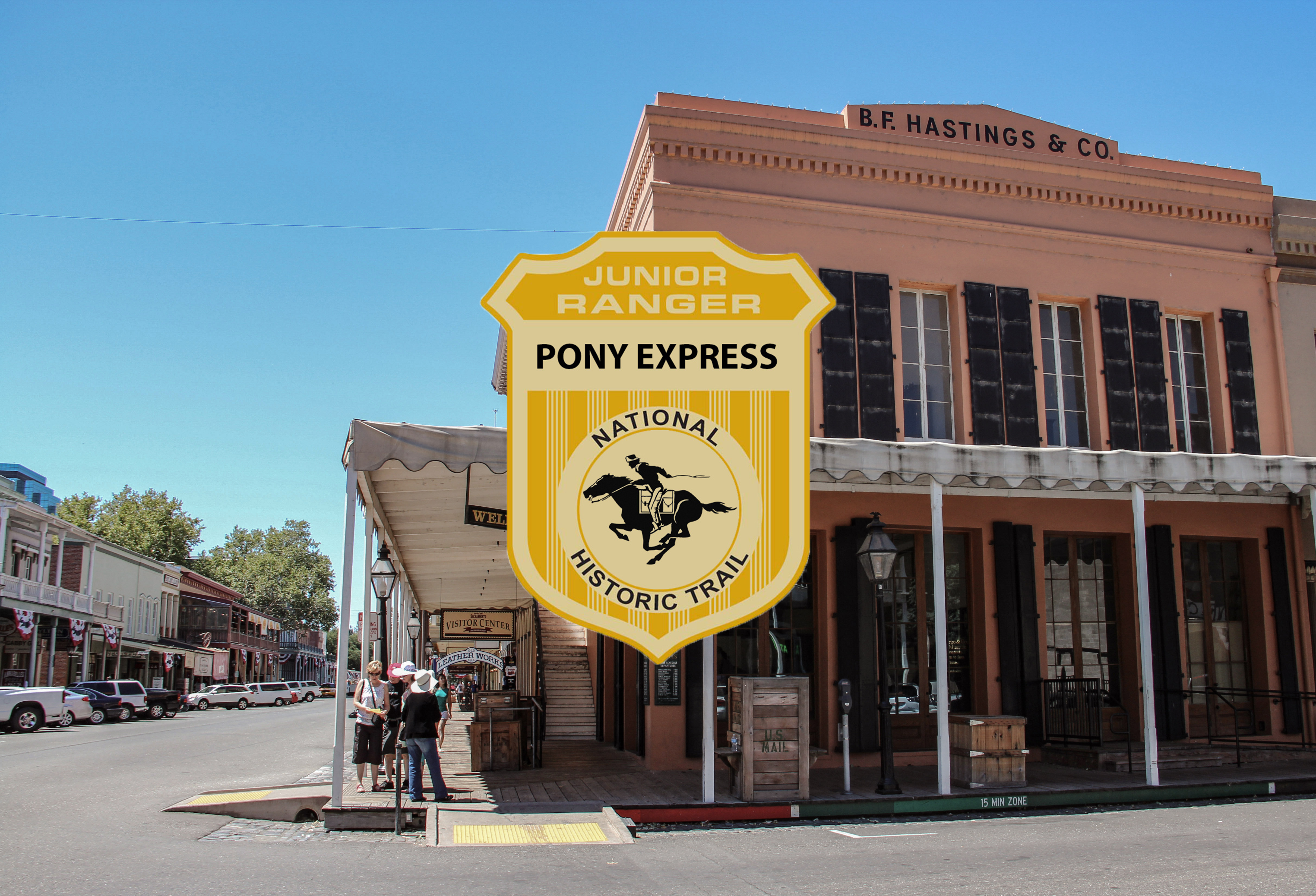
Learn about the Pony Express Trail and earn your junior ranger badge! This activity can be completed virtually or after visiting a site along the Pony Express National Historic Trail. Booklets can be submitted either electronically or by mail. Take a look and start exploring the trail today!
Walk on the Pony Express Trail
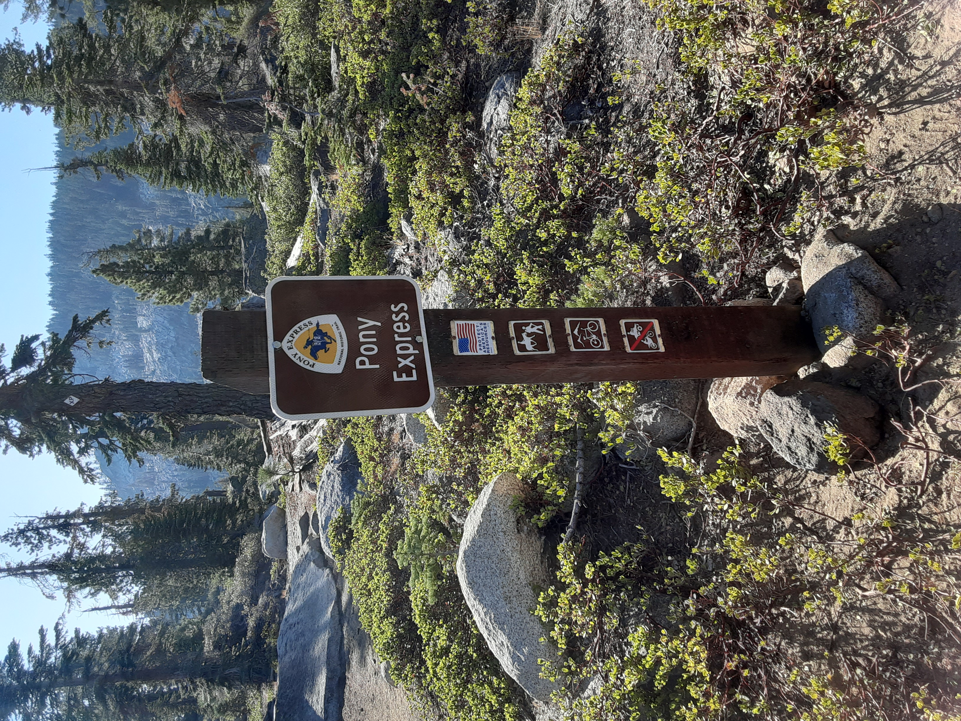
There are a variety of walking and hiking opportunities along the Pony Express Trail. In some places, you may find a modern-day hiking trail. In other places, the historic trail has been replaced by an dirt or asphalt road. The variety of opportunities will give you a chance to walk in the path of the pony riders and bring you closer to the historical landscape.
Check out Museums and Visitor Centers along the Pony Express Trail
There are a number of museums and visitor centers along the Pony Express Trail. In some places, you may find more interpretive exhibits, information, and programs. In other places, being in the location will enrich your experience, even with minimal facilities. Visit one of these locations to learn more about the history and culture of the Trail.
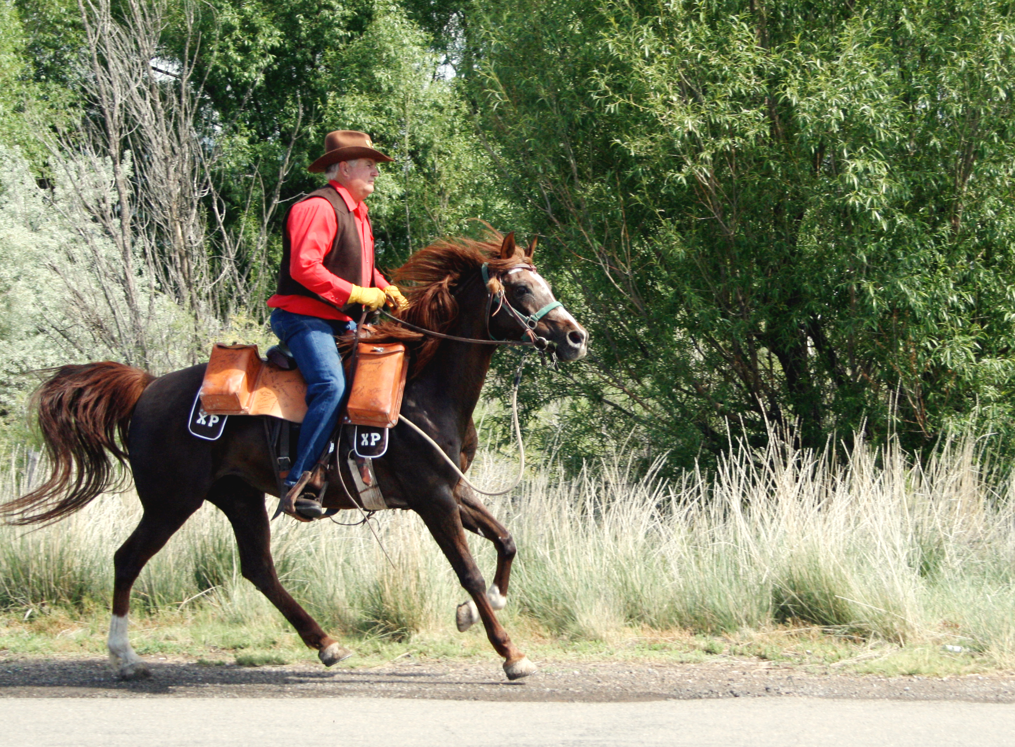
Horseback Riding on the Pony Express Trail
Take a ride back in time on the Pony Express Trail! The variety of opportunities ranges from historic landscapes to modern views, and from short to longer trail rides. Riding the Trail is a great way to connect to this fascinating story of transportation, tenacity and technology. Saddle up and imagine the riders traveling these trails, over 1,800 miles total, in ten days!
Places to see
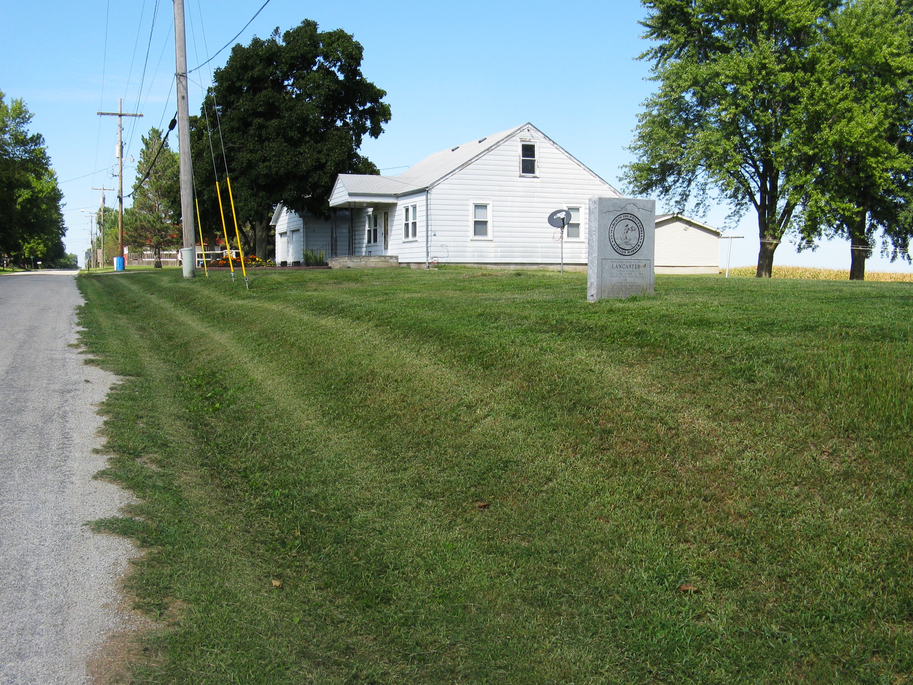
Lancaster Station
A rectangular granite monument at the northeast corner of 286 Rd and High St at Lancaster, Kansas, commemorates Lancaster Station, a relay station for stagecoaches carrying express mail during the final 6 weeks of Pony Express operations. By early September 1861, Civil War-related violence had left much of the city of St. Joseph, Missouri—the eastern terminus of the Pony Express—in ruins. In response, the Central Overland California & Pikes Peak Express (COC&PPE) moved its Pony Express offices from St. Joseph to Atchison, Kansas, in mid-September. Westbound express mail was still collected and postmarked in St. Joseph, then placed on a train bound for Atchison. There, COC&PPE employees transferred the mail to a company-operated stagecoach for transport to Fort Kearny, Nebraska. Lancaster Station, at the tiny town of Lancaster, was the first stagecoach stop/relay station west of Atchison. From the fort, the express mail continued westward by the familiar horse and rider relay. Eastbound Pony mail from California followed the reverse route, carried by Pony Express riders to Fort Kearny, then by stagecoach to Atchison. This system remained in place for the final 6 week of the Pony Express, until completion of the transcontinental telegraph rendered the service obsolete. Lancaster Station served the Pony Express from mid-September until November 20, 1861, when the operation shut down and the last mail mochila reached its destination. Nothing remains of the historic station. Site Information Location (Marker is at the northeast corner of 286th Rd and High St, Lancaster, KS. GPS 39.5657833333, -95.3028138889) Pony Express National Historic Trail
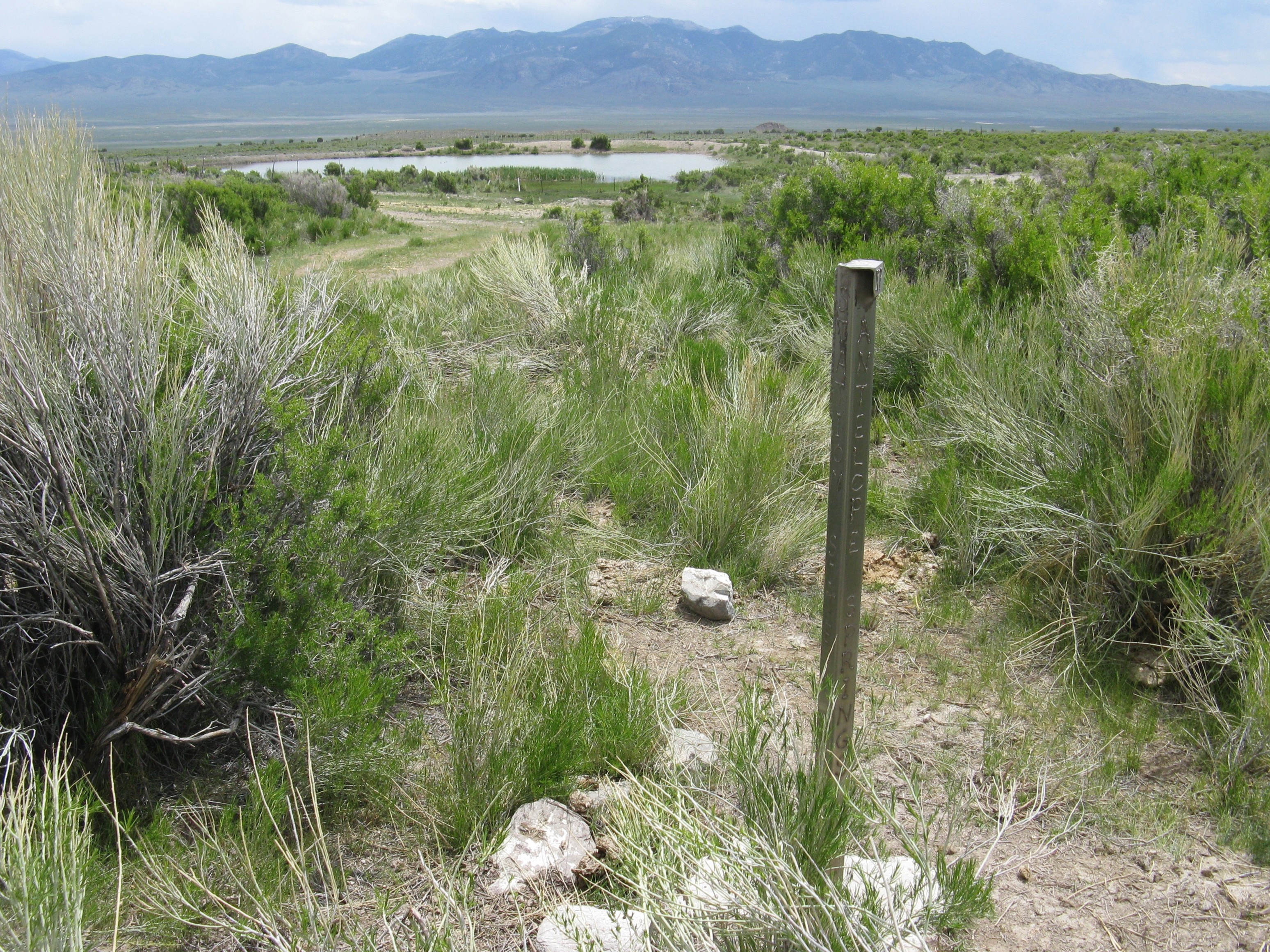
Antelope Spring Station
George Chorpenning built Antelope Springs Station in 1859 to support his own “Jackass Mail” operation, which used pack mules to carry the post between Utah and California. After the government annulled his contract for political reasons, the Pony Express took over Chorpenning’s route and stations. Remote Antelope Springs Station served the Pony Express as a relay station, where riders exchanged horses. The station also served the Overland Stage & Mail. In June 1860, during the Pyramid Lake War, Northern Paiute and Goshute Shoshone raiders burned the station. When British adventurer Sir Richard Burton passed through by stagecoach in October, it still had not been rebuilt. “Fortunately,” he noted, “the corral still stood: we found wood in plenty, water was lying in an adjoining bottom, and we used the two to brew our tea.” Antelope Springs Station was rebuilt after Burton’s visit, and it continued to serve stage line until 1869, when the transcontinental railroad was completed. A T-shaped trail marker alongside the road indicates its approximate location. To visit, from Ibapah, Utah, drive west on Pony Express Rd/Old Lincoln Hwy/UT-2 and (in Nevada) White Pine County Rd 32/Whiskey Rd for about 28 miles. There, signs at the intersection point right to Antelope Range and Pony Express Trail. Turn and continue 1.6 mile to the roadside trail marker on the left; the spring is to the south, on private land. These roads are remote and unpaved, and a cellular signal might be unavailable. Site Information Location (18 miles west of Utah state line in White Pine County, Nevada. It is on the unpaved Lincoln Highway about 3 miles southwest of unincorporated Tippett, Nevada, and 48 miles northeast of Ely, Nevada. Trails West marker gps 39.8306666667, -114.3892666667.) Safety Considerations Pony Express National Historic Trail
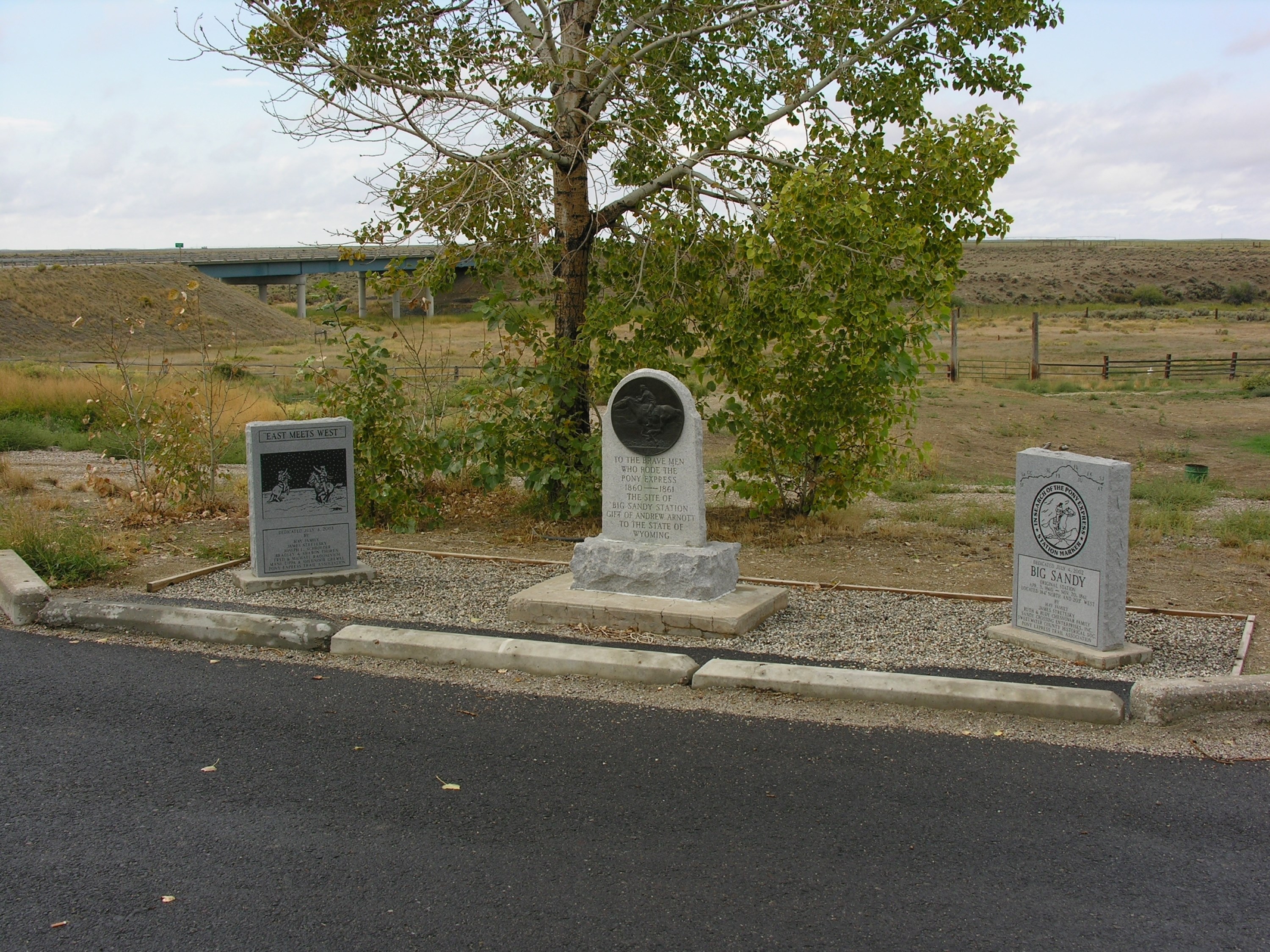
Big Sandy Station
Pony Express Wyoming No. 31 Relay Station (Big Sandy) With both the Big Sandy and Little Sandy creeks flowing nearby, and the crossing for the Big Sandy Creek being just a short distance north, Big Sandy station had a great location. It served as both a stage station and a Pony Express relay station until 1862. Site Information Location (Farson, Wyoming) Safety Considerations More Site Information Pony Express National Historic Trail
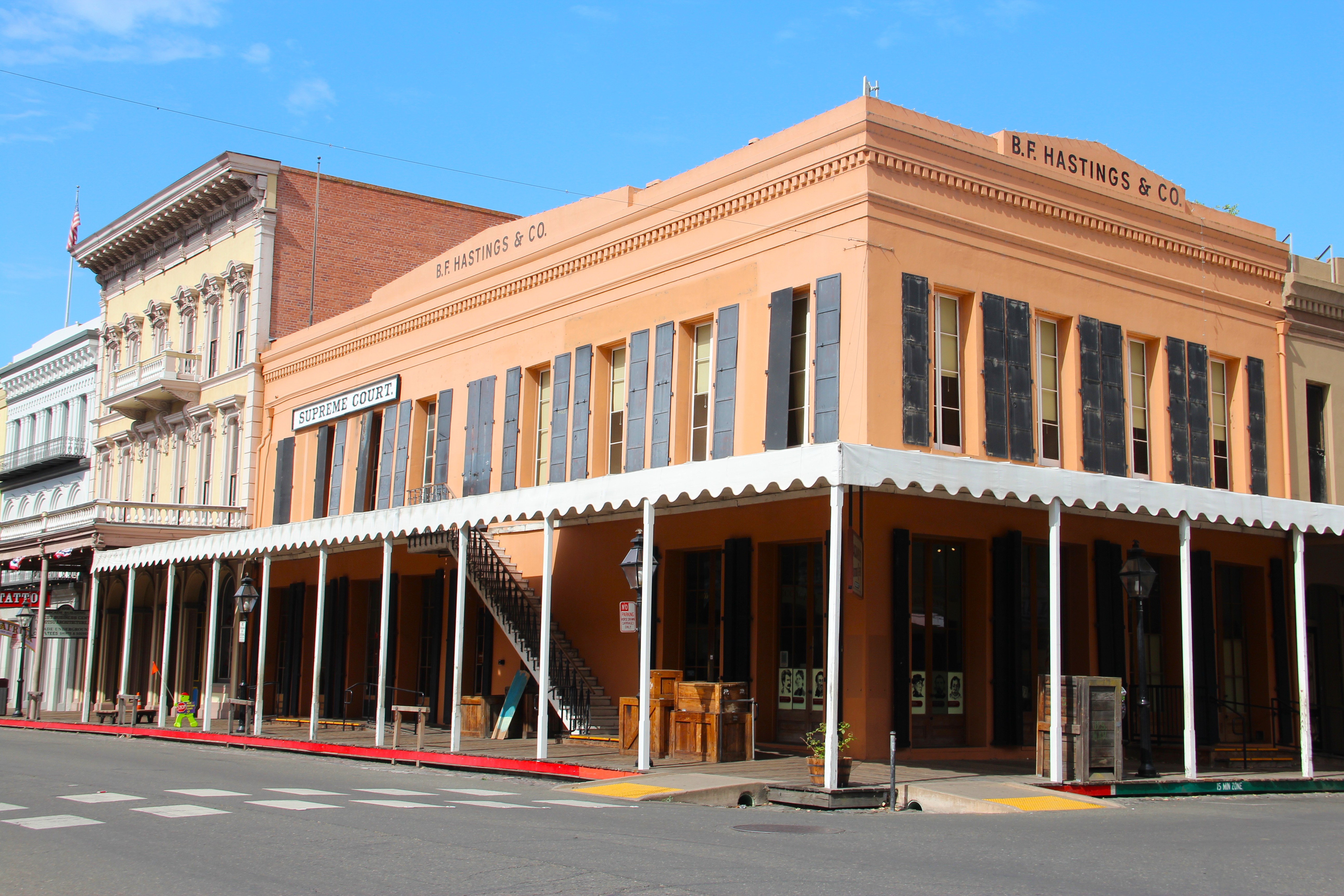
B.F. Hastings Building
The 1853 B.F. Hastings Building served as the western terminus of the overland Pony Express from April 3, 1860, through April 15, 1861, when operations moved to the historic Lady Adams Building. From this site, riders stabled their horses and boarded river steamboats that carried them down the Sacramento River and across the bay to San Francsico. Today, the Hastings and Lady Adams buildings stand side by side within Old Sacramento State Historic Park and Old Town Sacramento National Historic Landmark. Across the street, an iconic bronze statue depicts a galloping Pony Express horse and rider. Old Town includes more than 50 historic buildings, along with shops, monuments, and museums that line its Gold Rush-era streets. Visitors can also enjoy train, steamboat, and carriage rides. Entry to the park is free, though some individual venues charge admission. Attractions include: B.F. Hastings Building (2nd and J Sts), Pony Express office from April 3, 1860, through April 15, 1861. Lady Adams Building (119 K Street), the oldest building in the district and a Pony Express station from April 16, 1861, through November 20, 1861. Pony Express Plaza and monument depicting rider Sam Hamilton delivering the first westbound mochila into Sacramento (northeast corner of J and 2nd streets, near B.F. Hastings Building). The 1927 Delta King (Sacramento Riverfront off K Street), a historic sternwheeler riverboat similar to the river steamers that carried Pony Express riders to San Francisco. Monument to Theodore Judah, visionary and chief engineer for the transcontinental railroad survey (L and 2nd streets). California State Railroad Museum (111 I Street), featuring the famous 1869 Golden Spike, an original steam locomotive used in building the transcontinental railroad, and exhibits about the Chinese railroad workers of the Central Pacific Railroad. Sacramento History Museum (101 I Street), offering historical images, artifacts, and other exhibits about Sacramento history. Visit the museum’s website for current information and tours. For park hours, parking, and directions, visit the Old Town Sacramento State Historic Park website. Site Information Location (Corner of 2nd & J Streets Sacramento CA) Safety Considerations More Site Information Pony Express National Historic Trail
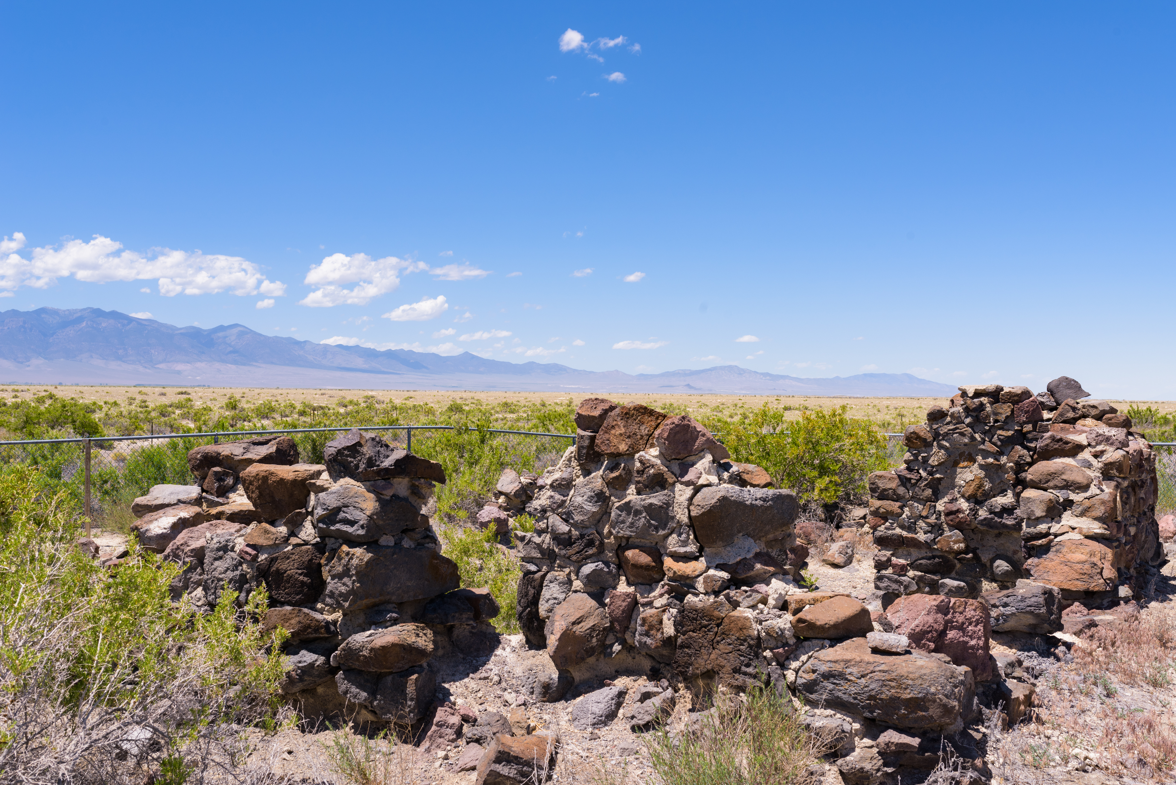
Boyd Station
Some researchers report that George Washington “Bid” Boyd established Boyd Station,also known as Butte Station and Half-way house, along a mail route across Utah’s West Desert around 1855. Pony Express rider Howard R. Egan, though, noted that Boyd Station did not yet exist when he rode past the site in 1860. The station building was designed with gunports for protection from Native American warriors, who had regularly attacked mail packtrains on the route between Salt Lake City and Carson City since the early 1850s. In 1860, the small stone building became a Pony Express relay station, where riders exchanged horses. After the Pony Express galloped into the sunset in 1861, Boyd is said to have continued living at the remote station, enjoying his solitude, until around 1900. His presence probably accounts for the fact that the station was not dismantled and hauled away stone by stone for other uses. Today’s visitors can explore the original ruins of the old station at its original location, with a Bureau of Land Management interpretive kiosk nearby. Traces of the original trail are clear on the ground there and on satellite imagery, heading northwest toward the next station at Willow Springs (present-day Callao). Continuing westbound along the Pony Express National Historic Trail Backcountry Byway, drive 14 miles along Pony Express Rd from Fish Springs National Wildlife Refuge. Where Granite Ranch Rd splits off to the left, keep right. The site is on the right (north) side of the road. Site Information Location (Boyd Station/Butte Station is 14 trail miles (8 miles as the crow flies) west of Fish Springs Station via Pony Express Rd. Interpretive turnout GPS 39.843583 -113.553285) Pony Express National Historic Trail
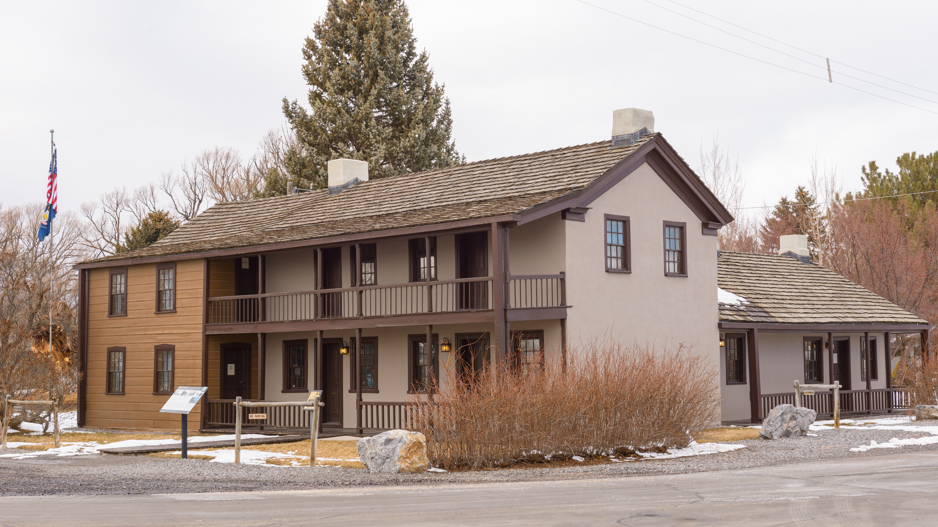
Camp Floyd State Park
Pony Express Utah No. 13 Contract Station (Camp Floyd – John Carson’s Inn / Fort Crittenden / Fairfield / Cedar City) Camp Floyd, established in 1858, was named for the secretary of war and commanded by Albert S. Johnston. It was the first military installation built in present-day Utah and formed the state's third largest community. At the time of the Pony Express, Camp Floyd provided troops for protection against Indian attacks and served to keep the trail open for the Pony Express, stage lines, and other travelers. The Pony Express Station was a small adobe building that stood several hundred feet northeast of John Carson's Inn. Though the Pony Express station has long since disappeared, the Inn still stands as the centerpiece of today's state park. The Inn has been restored and is open for visitation, the commissary building serves as a visitor center, and there is an interpretive wayside exhibit in the picnic area. Site Information Location (18035 W 1540 N, Cedar Valley, UT 84013) Safety Considerations More Site Information Pony Express National Historic Trail
Canyon Station
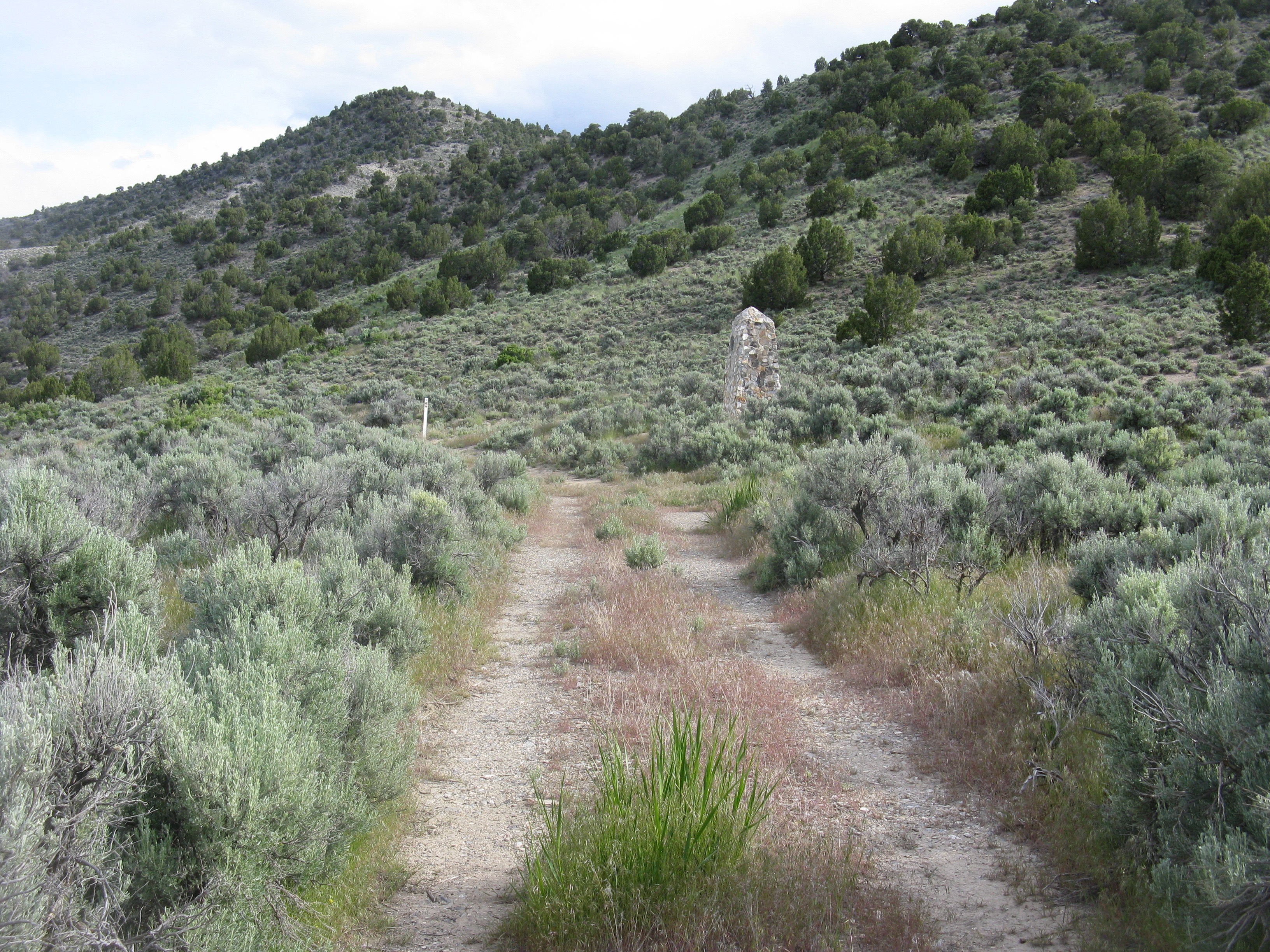
Canyon Station did not yet exist in September 1860, when Sir Richard Burton accompanied a Pony Express rider through Utah's Deep Creek Mountains. The ride through Overland Canyon gave Burton, an experienced British army officer, an eerie sense of unease. Several express riders and other travelers recently had been attacked there by Goshute Indians. “Nothing, certainly, could be better fitted for an ambuscade than this gorge,” wrote Burton, “with its caves and holes in snow cuts, earth drops, and lines of strata, like walls of rudely piled stone…” About a year later, though, someone—historians point to frontiersman and Pony Express district superintendent Howard Egan—chose the mouth of spooky Overland Canyon as the site of a new Pony Express station. Canyon Station consisted of a dugout used for preparing meals, a stable, and possibly a log house. Because it was a dry site, water had to be hauled from Deep Creek, 8 miles to the west. The Pony Express occupied the site until October 1861, when the mail relay operation shut down, but the Overland Stage continued using Canyon Station for 2 more years. In retaliation for destruction of a Goshute village by American soldiers, warriors attacked Canyon Station on Aug. 8, 1863, killing at least 5 Overland Stage emploees and soldiers and burning the station to the ground. The slain men were buried near the scene of the attack. Today a stone monument stands 190 yeards southeast of the original Canyon Station site, which became known as Burnt or Burnout Station. Within months, the stage company rebuilt the station at the other end of Overland Canyon, about 3.5 miles southeast of Burnt Station. This second Canyon Station is also called Round Station because it includes a low, circular stone wall with gunports for defense. Today, Round Station, part of the Canyon Station story, is a Bureau of Land Management interpretive site. To visit the two sites, from Willow Springs Station in Callao, follow Pony Express/Deep Creek Mountains Rd northwest for about 13 miles. The entrance to the second Canyon Station/Round Station interpretive site is on the left. Continue 3.5 miles to GPS coordinates 40.076886 -113.844154, on a slight curve in the road with a deep dry wash on your left. Look west across the wash to see the first Canyon Station/Burnt Station monument, standing among the sagebrush at the bottom of a mountainside where the canyon opens up. Continue north past the wash to a 2-track on the left. Drive or walk westerly along the curving track for about 200 yards to a second track that turns south. Follow it back toward the dry wash for about 379 yards to reach the monument. As the old tracks continue south from there, it overlies the original Pony Express Trail. Site Information Location (The site of Canyon Station is in Overland Canyon through the Deep Creek Mountains, Utah. It is 11.4 trail miles east of Ibapah, on the west side of Pony Express Rd/ Deep Creek Mountains Rd. Monument GPS: 40.076835 -113.845632 View from the road GPS: 40.076886 -113.844154) Pony Express National Historic Trail
Carson Station
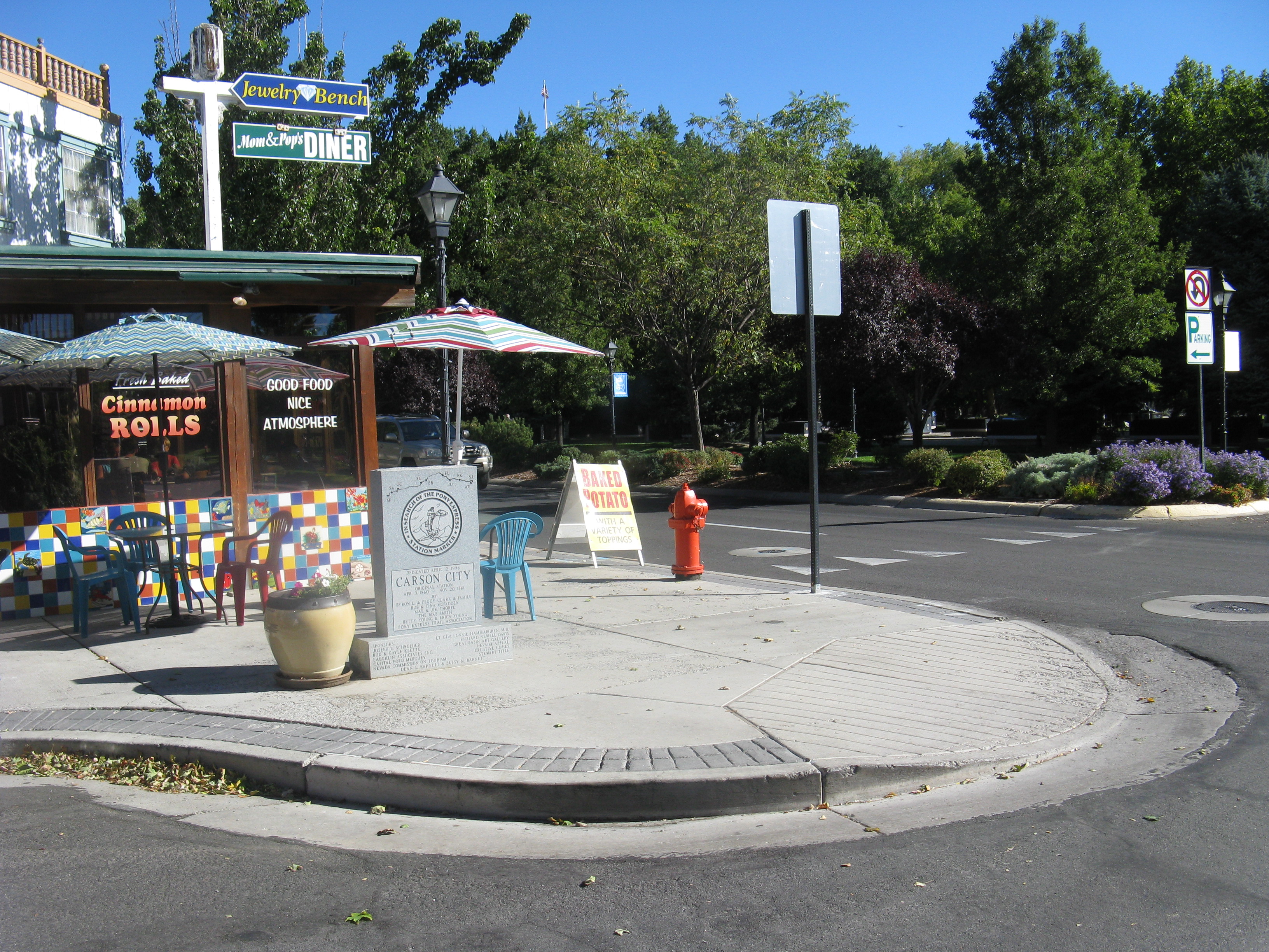
A Pony Express home station, where riders began and ended their “beat,” once stood along Carson Street between Fourth and Fifth streets in Carson City, Nevada. Today a granite monument with historical information commemorates the station, which served the Pony Express throughout the operation’s history (1860-1861). Little information is available about the station. Sir Richard Burton, nearing the end of his cross-country stagecoach trip, made notes in his journal about the character of this rough-edged mining town as he found it in 1860. On Oct. 8, he wrote, “My informants declared that in and about Carson a dead man for breakfast was the rule. . .they reckoned per annum fifty murders. In a peculiar fit of liveliness an intoxicated gentleman will discharge his revolver in a ball-room, and when a “shyooting” begins in the thin walled frame houses, those not concerned avoid bullets and splinters by jumping into their beds. During my three days’ stay at Carson City I heard of three murders.” Site Information Location (Granite Pony Express marker is on the sidewalk in front of a diner at 300 Carson St., Carson City, Nevada. GPS marker 39.1626, -119.7671666667.) Safety Considerations Pony Express National Historic Trail
Cold Springs Pony Express Station
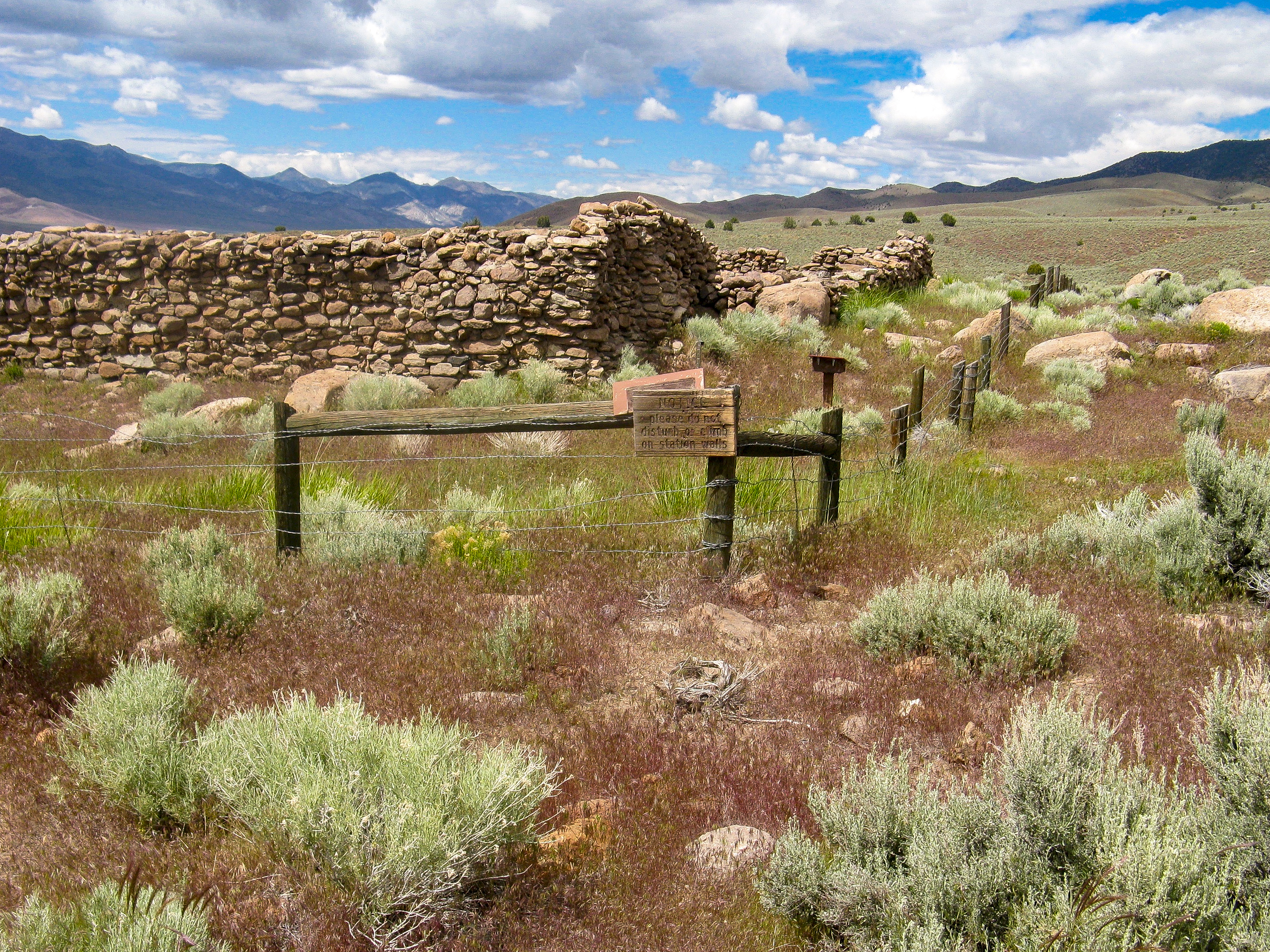
"I kept a bright lookout, and closely watched every motion of my poor pony's ears, which is a signal for danger in an Indian country. I was prepared for a fight, but the stillness of the night and the howling of the wolves and coyotes made cold chills run through me at times." Pony Bob Haslam, on his ride from Cold Springs to Sand Springs (Nevada) in May 1860. Accounts mention numerous Pony riders who were killed during the outbreak of the Pyramid Lake War with the Paiutes in 1860, but multiple sources may be referring to the same unnamed rider and some stories were clearly made up. So far, only three rider fatalities at the hands of warriors are securely documented including that of a Hispanic rider. The Hispanic rider was Jose Zowgaltz, who was ambushed as he crossed the thick aspen bottoms of Edwards Creek. Zowgaltz galloped to Cold Springs Station, south of the ambush site. Suffering a mortal abdominal wound, he slipped bleeding from his saddle upon entering the station and soon died. The rider's death was recorded by assistant station keeper J.G. Kelley, who had to ride Zowgaltz's return relay two days later. Kelley raced his pony through the leafy green tunnel of aspens "like a streak of greased lightning" and once clear, paused to look back. The bushes along the trail trembled suspiciously; Kelley suspected they concealed warriors who had been unable to get a clear shot at him. Intact, standing ruins of the Cold Springs Pony Express Station where Jose Zowgaltz died still remain. Viewing the site requires a two-mile round-trip hike on loose dirt through open sagebrush plains (where one is exposed to the elements) starting from Cold Springs Day-Use Area. Click on this link, A Socially Distance Excursion to Original Pony Express Stations in Nevada, to view a partial travel log and pictures for Cold Springs Station. If you visit, also stop at the ruins of Cold Springs No. 2 Pony Express Station. It’s just 0.2 miles further west on U.S. Route 50 from the day-use area. The station switched locations in July 1861 to accommodate the Overland Mail & Stage Company. Cold Springs Station is a National Park Service Vanishing Treasure. When visiting, please respect the site and do not climb on or disturb the ruins. This is critical for preserving the site and for providing the opportunity to experience the site, as you have experienced it, to other people. Site Information Location (South side of U.S. Route 50 about 50 miles west of Austin, NV and 60 miles east of Fallon, NV.) Available Facilities The day-use area consists of a gravel parking lot, wayside exhibits, vault toilets and the Cold Springs Pony Express Station Trailhead. At the station ruins are wayside exhibits that tell the story of the station and describe its layout. Safety Considerations More Site Information Pony Express National Historic Trail
Deep Creek Station
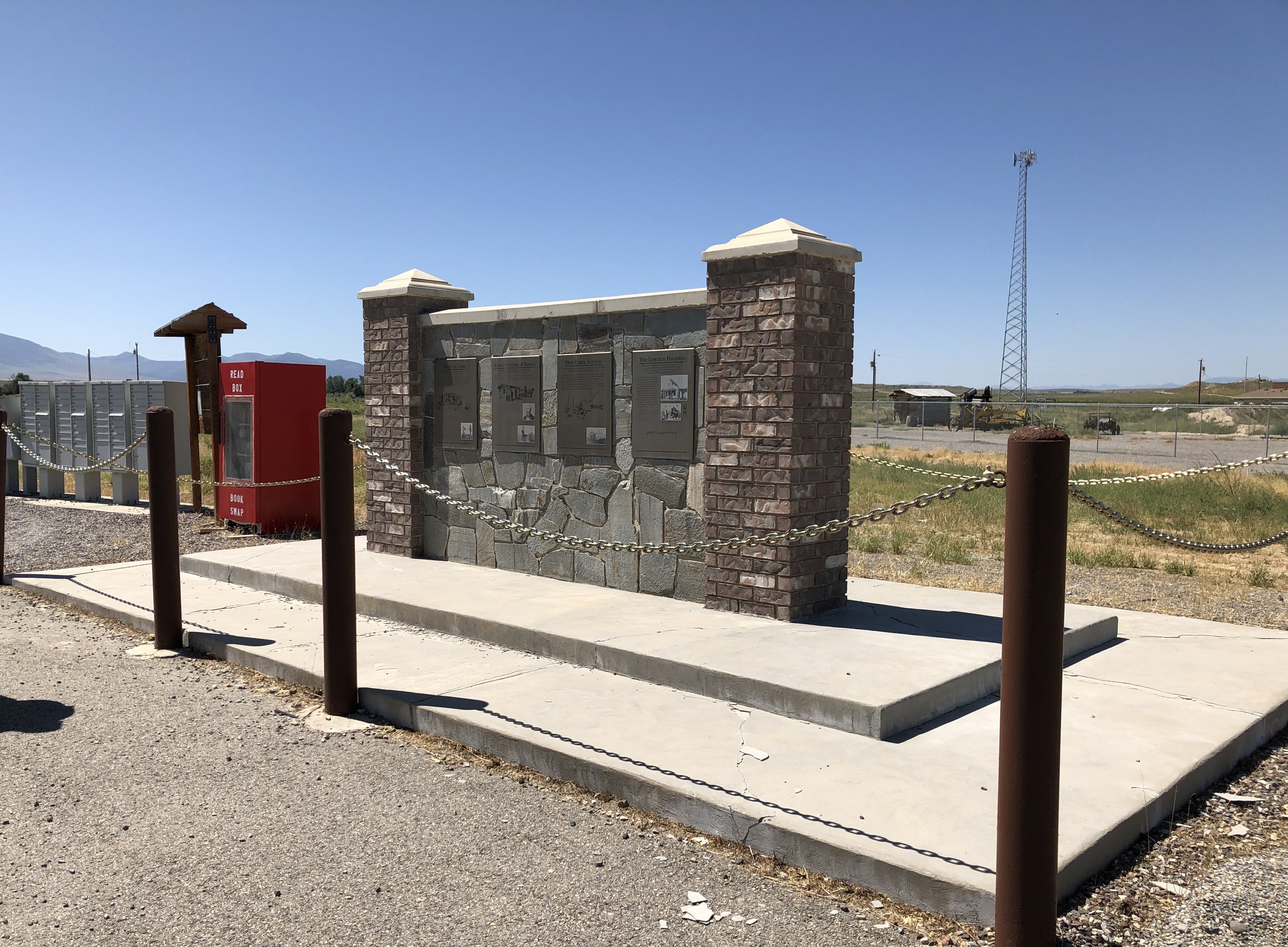
Maj. Howard Egan, a prominent Latter-day Saint pioneer who earned his military rank in the Church’s Nauvoo Legion, pioneered much of the mail and stage route across central Nevada. In 1858 or 1859, he established a ranch on Deep Creek in what is now western Utah, homeland of the Goshute people. During 1860-1861, the ranch hosted a home station for the Pony Express, and Egan—acting as a division superintendent—oversaw stations between Salt Lake City and Roberts Creek, Nev. Deep Creek Station also supported the Overland Stage. English adventurer Sir Richard Burton, whose stagecoach stopped there in 1861, described the site as consisting of “two huts and a station-house, and a large and respectable-looking building of unburnt brick, surrounded by fenced fields, water-courses, and stacks of good adobe.” Egan’s ranch was a thriving enterprise, producing hay, grain, mutton, and beef to supply other stations along the route. Burton noted that the field hands and station workers “were not wanting in kindness,” providing him and fellow travelers with food and hospitality. However, he observed, “the station was dirty to the last degree; the flies suggested the Egyptian plague, they could be brushed from the walls in thousands.” Completion of the transcontinental telegraph in October 1861 made the Pony Express obsolete, and a telegraph repeater station soon replaced the Pony operation at Deep Creek. Egan then worked for the overland mail and supplied hay, grain, and meat to stations along the line until 1869, when the transcontinental railroad was completed. The old Pony Express and stage station is long gone, but in the unincorporated community of Ibapah (Goshute, meaning “clay-colored water” or perhaps “deep-down water”), a large monument provides historical information about the area. It stands along the main highway in front of the elementary school. From there, continue south on Willow Rd for 0.7 mile to find a 1934 limestone monument among willows on the left at a sharp curve where the road turns west. Site Information Location (58 N Ibapah Co Rd, Ibapah, UT GPS interpretive monument 40.0375333333, -113.9838166667 GPS 1934 monument 40.0297624 -113.9866983) Pony Express National Historic Trail
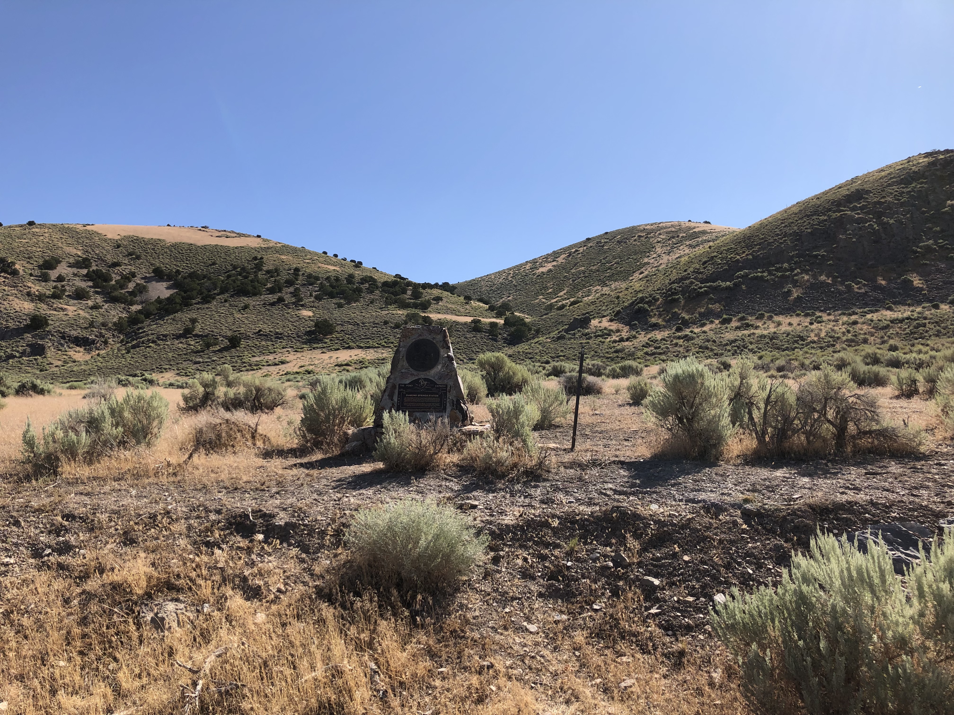
Diamond Springs Station
A harrowing ride through an ambush in Telegraph Canyon ended at Diamond Springs Station for Pony Express rider George Scovell. Scovell rode a sturdy Pony Express horse with a curious, question mark-shaped blaze on its face. He named the horse for its blaze, calling him “What?” Near dusk on Oct. 19, 1860, amid ongoing conflict along the Pony Express and Overland Stage trail, Scovell and What? picked their way warily down Telegraph Canyon, in the Diamond Mountains, heading toward Diamond Springs. “I remember well how uneasy he seemed to be, his ears working forward and backward, and I could feel him try to halt,” Scovell later wrote in his journal. The horse’s nervousness put him on edge. Suddenly, a swarm of arrows zinged out of the trailside brush. “I believe there were thirty or more [warriors],” Scovell recalled, “and they were right onto me . . . . Instantly I decided to make a run for the station and no pony on the line, I doubt, ever made faster time over the old trail than did that horse, even with arrows sticking form his side.” With 11 arrows piercing his body, What? charged 3 miles down Telegraph Canyon carrying Scovell—who himself carried 2 arrows in his leg—to the safety of Diamond Springs Station. After delivering his rider, What? collapsed. Scovell sorrowfully ended the animal’s suffering with a shot to the forehead. Although dead livestock were typically left for coyotes, he buried What? beside the station and then quit his job. It was his final ride for the Pony Express. Scovell kept a photograph of the brave horse with his journal, now held by a descendant. Today, a monument near the station site commemorates both horse and rider. The conflict in the area continued even after the Pony Express shut down in November 1861. Broken promises by an Indian agent to Paiute and Shoshone bands in the area fueled further tensions along the Overland Stage & Mail route. The agent had pledged to establish a reservation-farm at the springs, along with equipment and training, but the government failed to follow through. In a letter to friends, stationmaster Charles Hawley wrote that the Indian agent “ought to be hung for making promises to the natives and not fulfilling them: it is nothing more or less than signing the death warrant of the boys on the mail-line.” To visit the site, head north from Eureka, Nevada, on US-50. At the north end of town, turn right (east) on Reno Ave, then immediately turn left (north) onto narrow, paved County Rd 101. Drive 11.5 miles and turn right (east) at the stop sign onto 9th St/County Rd 101. In 1 mile turn left, staying on pavement, to continue on County Rd 101. Drive north for 5.6 miles. The monument will be on the right. The mouth of Telegraph Canyon lies about 0.66 mile farther north of the monument. Site Information Location (Twenty-seven miles north of Eureka, Nevada, south of the intersection of Eureka-Thompsons and Telegraph Canyon Rds. GPS monument 39.9014166667, -115.8669166667 (The station site is in the ranch yard across the road).) Safety Considerations Pony Express National Historic Trail
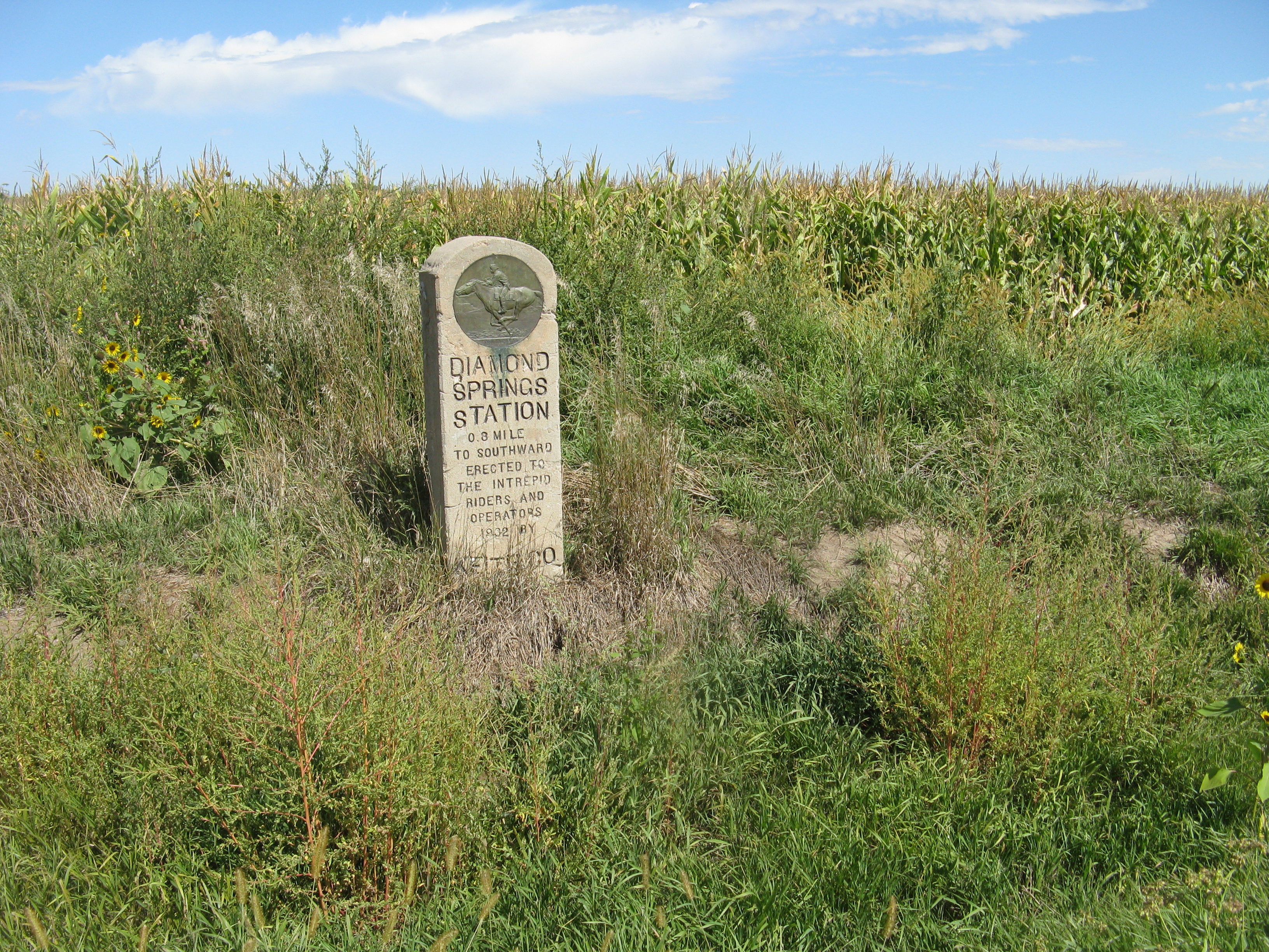
Diamond Springs Station - Nebraska
Diamond Springs Station was established in 1859 for the Central Overland California and Pike’s Peak Express, a stagecoach mail service that later launched the Pony Express. From April 3, 1860, to November 20, 1861, it served as a Pony Express relay stop where riders changed horses, until the transcontinental telegraph made rapid long-distance communication possible and the Pony Express, now obsolete, came to a close. Stagecoach “heavy mail” and passenger service continued. In 1863, Hester Ann Brown, the station managers wife, gave birth at Diamond Springs during a fierce thunderstorm. She described her delivery room as “an old adobe house with just part of a roof on it, which was conducted as a stage station.” Two Sioux women, the wives of chiefs Red Cloud and Spotted Tail, attended the birth. She recalled in her autobiography that they “took as good care of me as anyone could have.” By August 1865, all stage stations between Julesburg, Colorado, and Cottonwood Springs (later Ft. McPherson), Nebraska, were abandoned due to repeated harassment by Sioux and Cheyenne warriors. Employees fled with the livestock, leaving behind other property. Diamond Springs reported the loss of 28,000 sacks of feed corn and 15 tons of hay, altogether worth $6,200, the equivalent of about $127,000 in 2026 dollars. Personnel eventually returned, but stage and wagon travel dwindled over the next several years as construction of the transcontinental railroad progressed across Nebraska. No information specific to Diamond Springs Station is available for that time period, but most stage stations shut down in 1868-1869. Site Information Location (Three locations are associated with this station: 1932 Keith County station marker, 0.8 mile west of Brule on north side of US-30 and 0.8 mile north of the historical site, GPS 41.0909444444, -101.9045833333 2021 granite marker placed by the Pony Express Trail Association, about 4 miles west of Brule, highway turnout on north side of NE-30 at intersection with West County Rd M. The monument stands beside a Nebraska State historical sign for California Hill. GPS 41.0910333333 -101.97885. Diamond Springs site, 0.8 mile west of I-80 interchange 117 at Brule. Site is about 100 feet north of the freeway. GPS 41.078665 -101.905462) Pony Express National Historic Trail
Park stories
Nebraska Pony Express Stations
Nevada Pony Express Stations
Pony Express Stations
The Pony Express Re-Ride
California Pony Express Stations
Colorado Pony Express Stations
Kansas Pony Express Stations
Missouri Pony Express Stations
Utah Pony Express Stations
Wyoming Pony Express Stations
Pony Express Rider's Graze With Death
Weekly Trinity Journal Interview with a Pony Express Rider
Park information courtesy of the National Park Service Data API.