

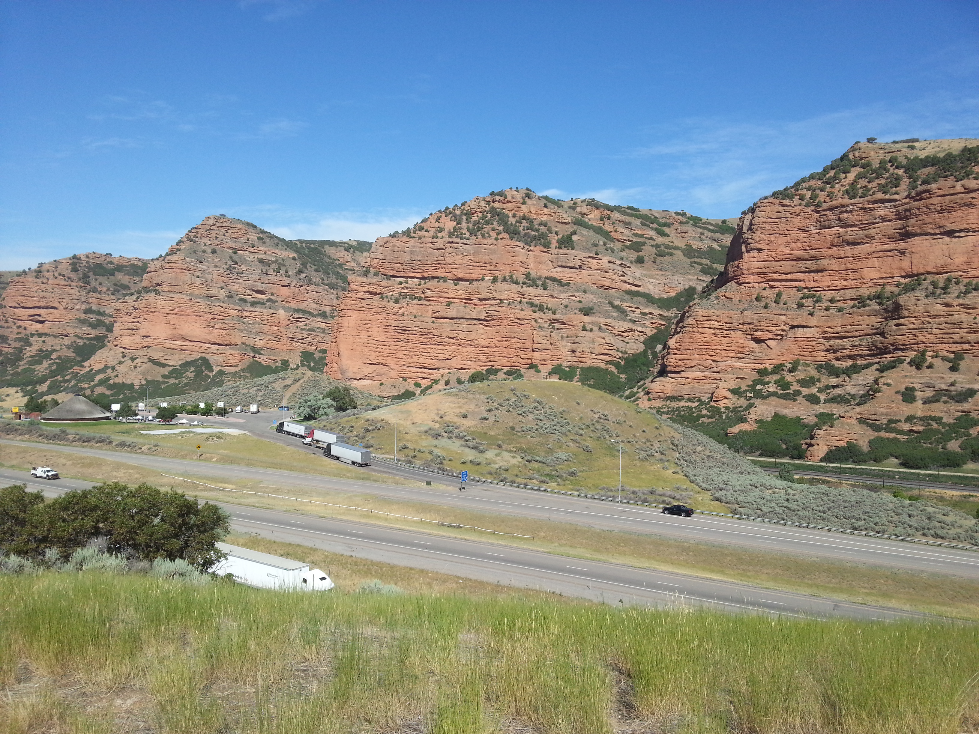
National Historic Trail
Mormon Pioneer National Historic Trail
Explore the Mormon Pioneer National Historic Trail across five states to see the 1,300-mile route traveled by Mormons who fled Nauvoo, Illinois, to the Great Salt Lake Valley in 1846-1847.
Official NPS pageHours
The Mormon Pioneer National Historic Trail is not a clearly marked hiking trail. Instead it is a corridor that passes through communities, urban areas, public lands, and Wilderness. The route travels across a variety of land ownerships and management, including private land. Each location varies as to the hours of operation and access. Please contact individual trail sites before your visit for more information.
Entrance fees
No entrance fee listed.
Getting there
The Mormon Pioneer National Historic Trail crosses five states following the route the Pioneer Company of 1846-1847 established from Nauvoo, Illinois, to Salt Lake City, Utah, covering about 1,300 miles.
Things to do
Places to see
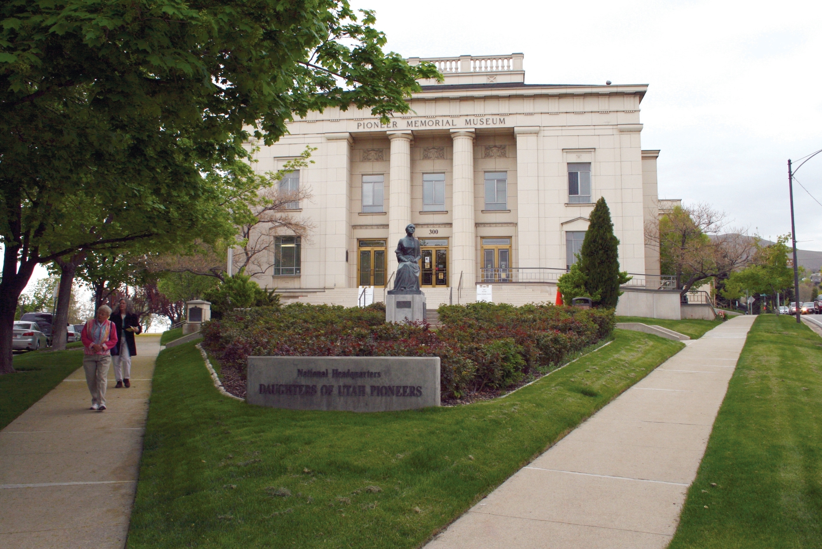
Pioneer Memorial Museum
The Daughters of the Utah Pioneers proudly proclaims the museum as “the world’s largest collection of artifacts on one particular subject.” The claim is easy to believe: this museum is packed with thousands of objects both mundane and fascinating, all part of Mormon history. Allow at least a couple of hours to visit. Objects of particular note include an Army supply wagon captured from Albert Sidney Johnston’s troops by the Mormon militia during the 1857 Utah War; and three feathers from the “Miracle of the Quail,” when a flock of quail fluttered into an encampment of starving Mormon refugees on the Mississippi River in 1846. Upon leaving the museum, walk out to the sidewalk and look north up Main Street for a view of Ensign Peak. Site Information Location (300 North Main Street, Salt Lake City) Safety Considerations More Site Information Mormon Pioneer National Historic Trail Mormon Pioneer Trail: Salt Lake City Itinerary This site is on the Salt Lake City Itinerary. Each site provides the opportunity to experience and learn about Salt Lake City, a pioneer waystation as well as a destination, and its rich combined history of the Mormon Pioneer, Pony Express, and California national historic trails.
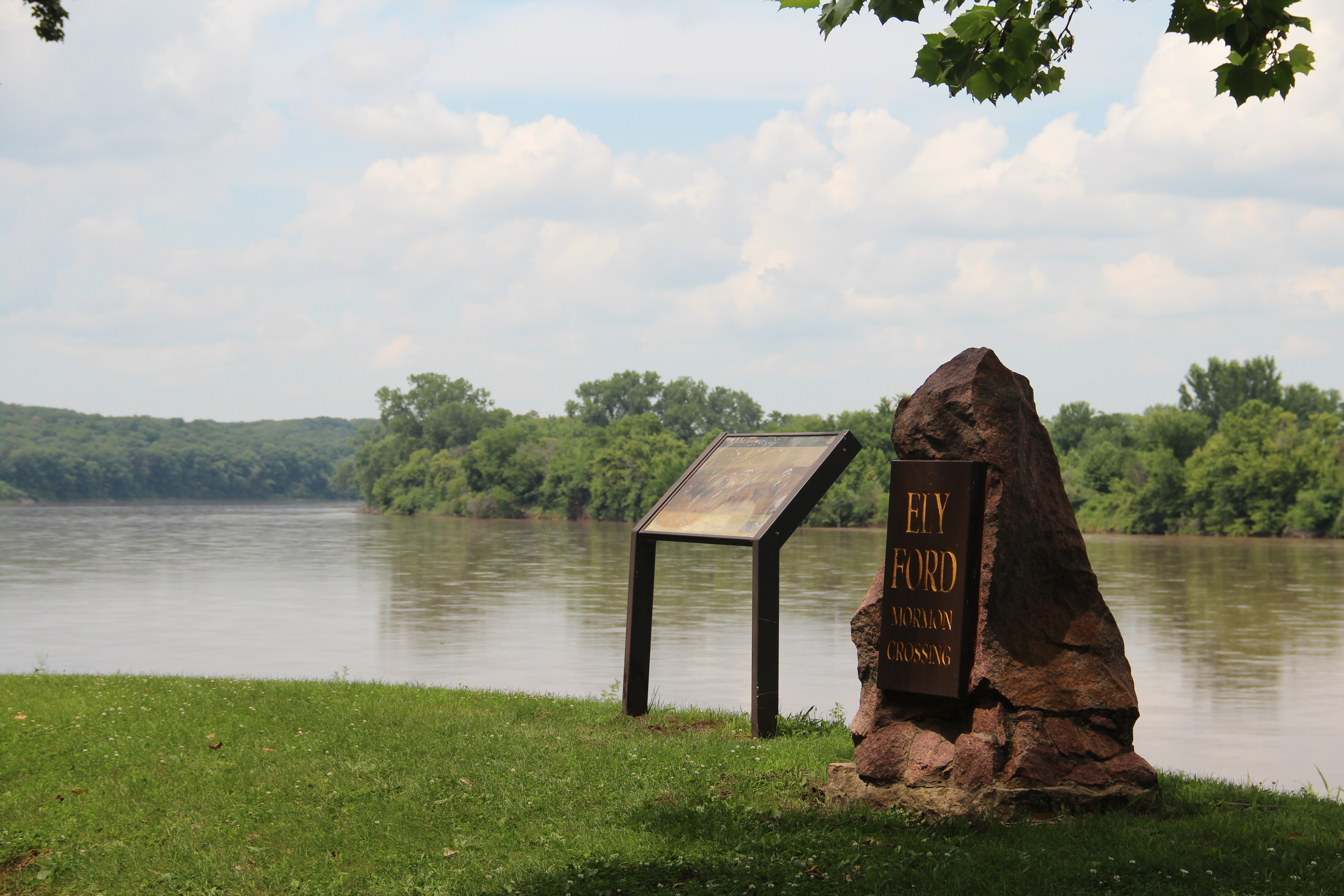
Lacey-Keosauqua State Park
At the north end of Lacey-Keosauqua State Park, at a horseshoe bend of the Des Moines River, stands a pink granite monument marking Ely Ford. This ford was shallow with a solid rock bottom, an excellent place for wagons and livestock to cross the river. Local lore holds that Mormon emigrants crossed the Des Moines River here. However, there is no record demonstrating use of the ford by the 1846 vanguard company wagons, which had crossed the Des Moines River earlier at Bonaparte. Trail historian Stanley Kimball states that later Mormon companies—likely those that departed Nauvoo later in spring 1846 and took a more northerly route across Iowa—used this ford. It is also possible that Pitt’s Brass Band, a musical group with Brigham Young’s company, crossed here as they traveled between the Richardson’s Point camp (March 7- 19) and Keosauqua to perform in exchange for supplies. Ely Ford would have been a practical crossing for those three trips, but journals do not specify the route taken by the band. To visit the monument, from Keosauqua, follow southbound Iowa Hwy 1 across the Des Moines River and immediately turn right into the park, as indicated by brown park signs. Follow the road past park buildings to a campground and turn right on Iris Trail. Follow the road to right turn to Ely Ford. Visitors can see the monument, a National Park Service interpretive wayside exhibit, and a clear view of the Des Moines River from this location. Site Information Location (22895 Lacey Trail, Keosauqua, Iowa.) Safety Considerations More Site Information Mormon Pioneer National Historic Trail
"Two Sides of the River" Wayside
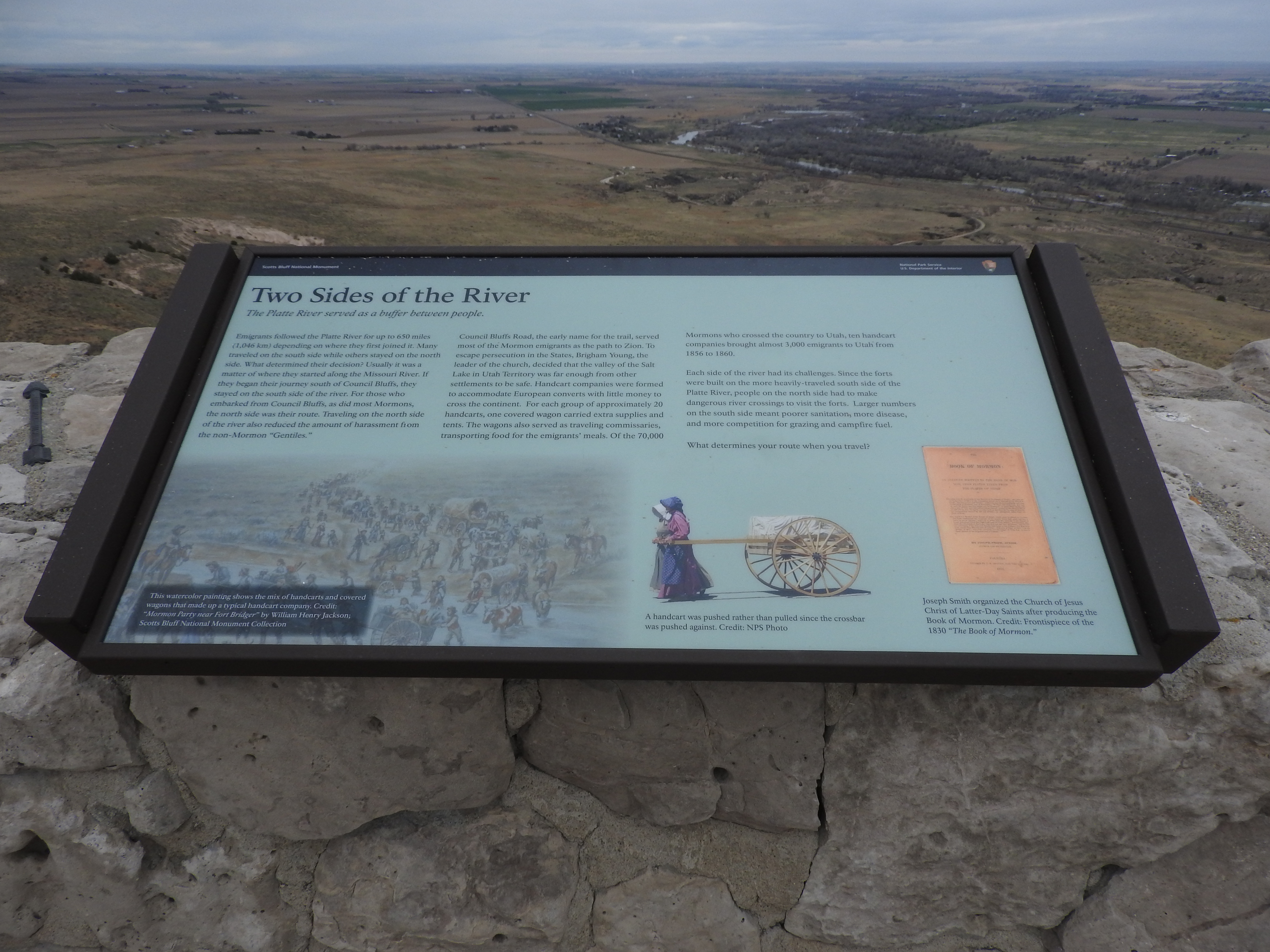
Description of Wayside: Low-profile wayside that is 42 x 24 inches. It has a brown rectangular base with two short rectangular pillars anchored into a stone wall supporting the wayside panel. The panel is framed in brown metal. The wayside is located at the far northern end of the North Overlook Trail overlooking the North Platte River. Wayside Layout: At the top of the wayside is a thin black banner with white text. Aligned to the left is "Scotts Bluff National Monument". Aligned to the right is the text "National Park Service U.S. Department of the Interior," and finally the National Park Service arrowhead. The title of the wayside is below the black banner in large black font. The panel has a light blue background. Black text is arranged in three columns on the upper half of the wayside. Below the text are three images. Wayside Title: Two Sides of the River Text: The Platte River served as a buffer between people. Emigrants followed the Platte River for up to 650 miles (1,046 km) depending on where they first joined it. Many traveled on the south side while others stayed on the north side. What determined their decision? Usually it was a matter of where they started along the Missouri River. If they began their journey south of Council Bluffs, they stayed on the south side of the river. For those who embarked from Council Bluffs, as did most Mormons, the north side was their route. Traveling on the north side of the river also reduced the amount of harassment from non-Mormon “Gentiles.” Council Bluffs Road, the early name for the trail, served most of the Mormon emigrants as the path to Zion. To escape persecution in the States, Brigham Young, the leader of the church, decided that the valley of the Salt Lake in Utah Territory was far enough from other settlements to be safe. Handcart companies were formed to accommodate European converts with little money to cross the continent. For each group of approximately 20 handcarts, one covered wagon carried extra supplies and tents. The wagons also served as traveling commissaries, transporting food for the emigrants’ meals. Of the 70,000 Mormons who crossed the country to Utah, ten handcart companies brought almost 3,000 emigrants to Utah from 1856 through 1860. Each side of the river had its challenges. Since the forts were built on the more-heavily traveled south side of the Platte River, people on the north side had to make dangerous river crossings to visit the forts. Larger numbers on the south side meant poorer sanitation, more disease, and more competition for grazing and campfire fuel. What determines your route when you travel? Image: A watercolor painting of a large group of emigrants crossing a river. Some of the emigrants push handcarts, while others walk beside covered wagons being pulled by oxen. Image Caption: This watercolor shows the mix of handcarts and covered wagons that made up a typical handcart company. Credit: “Mormon Party near Fort Bridger” by William Henry Jackson; Scotts Bluff National Monument Collection Image: Two women push a handcart with a small cover protecting its contents. Image Caption: A handcart was pushed rather than pulled, since the crossbar was pushed against. Credit: NPS Photo. Image: The cover of a book titled "Book of Mormon." Image Caption: Joseph Smith organized the Church of Jesus Christ of Latter-Day Saints after producing the Book of Mormon. Credit: Frontispiece of the 1830 “Book of Mormon.”
Pioneer Trail Museum
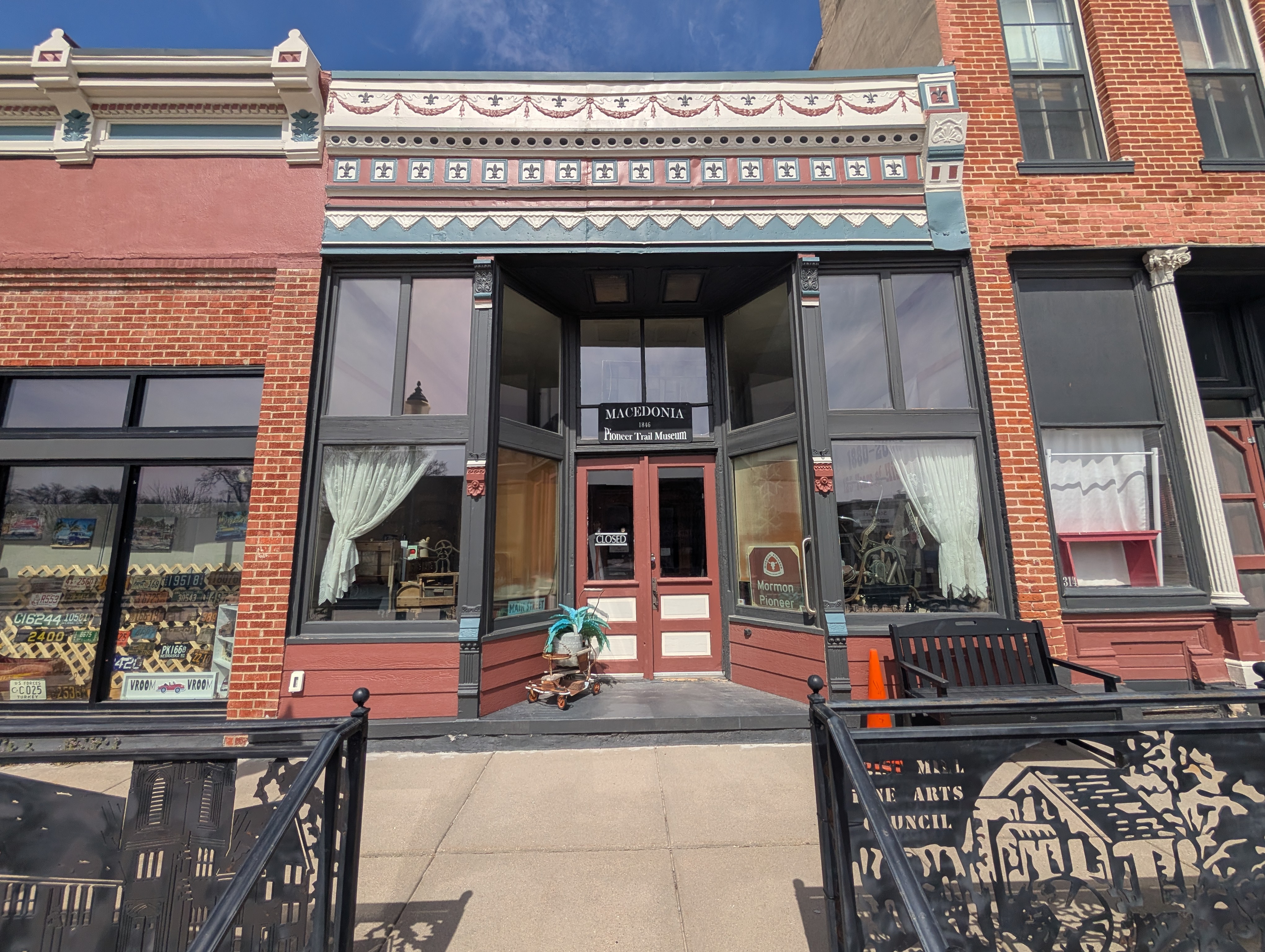
The Pottawattamie Indians had barely left the Territory of Iowa when the Mormon wave moved from Nauvoo, Illinois across the largely unsettled areas known as the Black Hawk Purchase or the Territory of Iowa. They blazed the “Mormon Trail” west, converging at what would become Old Town Macedonia where the limestone rock bottom made crossing the West Nishnabotna River safer. The West Nishnabotna was the largest and deepest river they had to cross since the Des Moines River. That crossing later became the site of Old Macedonia. The Mormons continued west to the Grand Encampment on the east side of the Missouri River in Iowa and Winter Quarters in Nebraska. Some pioneer Mormons settled in Old Macedonia. They gathered to hold their religious services in Stutsman’s Mill since they had no church. Elder Calvin Beebe delivered the first sermon. His topic was from the New Testament, Book of Acts 16:9, “And a vision appeared to Paul in the night: There stood a man of Macedonia, and prayed him, saying, “Come over into Macedonia, and help us.” The settlers being mostly Mormon had given biblical names to many of their communities. The settlement had been known only as Stutsman’s Mill. Someone remembered that first sermon, recalled the name Macedonia, and that was chosen when the petition to establish a post office was submitted on March 11, 1850. Site Information Location (316 Main Street, Macedonia, IA 51549) The Pioneer Trail Museum contains various items and artifacts from Mormon pioneers and Macedonia's past, such as a replica handcart, authentic oxen yoke, historical photographs, clothing items, fossils, and other local memorabilia. The oldest item in the museum is a loom that traveled across the ocean in a sailing ship and then across the plains in a covered wagon! The museum also has access to additional historical information at the request of visitors. Whether you have a direct tie to Macedonia or not, the museum gives you a glimpse of what life was like in a small western Iowa pioneer town during the height of the Mormon Trail and later throughout the decades. Safety Considerations Mormon Pioneer National Historic Trail
Mormon Trail County Park and Pote Farm Swales
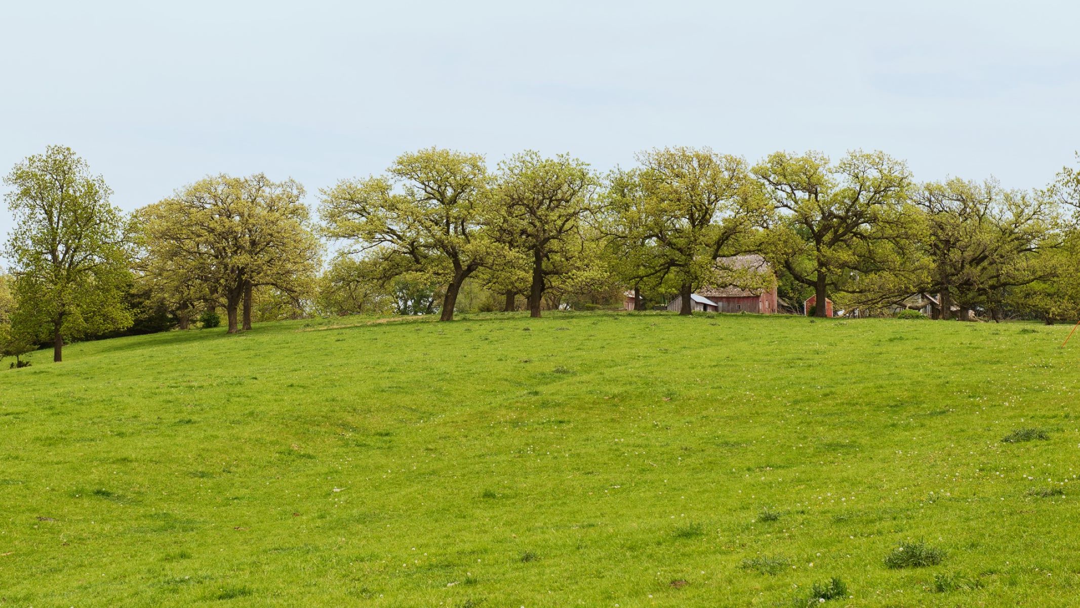
Brigham Young’s 1846 advance party rolled northwesterly from Pisgah as the weather continued cold, wet, and windy. Despite the hardships they faced while crossing Iowa, some emigrants remarked in their journals on the beauty of the prairie. Newel Knight wrote on May 11, “The rich & variegated prairie looks as if nature had done her best to Cheer the weary & attract the admiration of the traveler while our Children amuse themselves with the sweet & beautiful flowers which grow spontaneous.” A patch of native prairie, with a wayside exhibit describing the emigrant experience while crossing Iowa, can be viewed at Mormon Trail County Park, southeast of Bridgewater. Young’s company crossed this area on June 4, with others following over the coming weeks. Thousands of wagon wheels and hooves cut deep swales into the soft prairie soils, leaving scars—the Pote Farm Swales—that are still visible in a pasture southwest of the park. On June 5, a few miles beyond the swales, Brigham Young’s wagons struck and followed an Indian trail across the Potawatomi Indian reserve. The tribesmen, in the process of being removed by the government to a new reserve in eastern Kansas, welcomed the emigrants. They expressed curiosity and sympathy toward these white people who, like themselves, had been evicted from their home country. The following night, June 6, Young’s company circled its wagons for protection while camping on the south side of the West Nodaway River (in a field to the right of the junction of Victoria Road and 680th Street, Cass Co.), about 13 miles west of the Pote Farm Swales. However, the Potawatomi wished only to visit; they never threatened violence. The advance wagons moved on toward the Missouri River the following day. Seventeen days later, on June 23, Hosea Stout’s small family and other latecomers reached this camp by the West Nodaway, where they settled in for nearly a week while waiting for floodwaters to recede. Stout and his wife Louisa (nursing her infant born two months earlier at Camp Creek) trembled from illness and hunger, and their three-year-old son, William Hosea, wheezed and fretted with whooping cough. The second night in camp a violent storm tore down their tent, rain pounded in torrents, floodwaters lapped the wagon wheels, and all of the family’s belongings became soaked. Louisa found William Hosea lying in cold water, and the exposure aggravated his illness. The little boy grimaced, glared, writhed, and screamed in his torment, causing his father to worry that he was “troubled with evil spirits.” William Hosea lost his life on the morning of June 28. “Thus died my only son and one too on whom I had placed my own name and was truly the dearest object of my heart,” Stout grieved in his journal. The wagons pulled out of camp later that morning and crossed the West Nodaway. Hosea and Louisa laid their child to rest on a nearby hillside beside the grave of another emigrant baby before continuing west with their remaining child. Site Information Location (2828 Delta Ave, Bridgewater, Iowa.) Park is open; swales are on private land but may be viewed from public roadside. No amenities are provided at Pote Farm Swales, not even historical information or a parking turnout. Visitors must park along the road shoulder. In the park are: benches/seating, boat ramp, campground, dock/pier, electrical hookup-boat/RV, Fish-cleaning station, historical/interpretive info/exhibits, Information – kiosk/bulletin board, parking -auto, parking-bus/RV parking -boat trailer, picnic table, playground, restrooms, showers, fishing jetties, restrooms, fish cleaning station, playgrounds, trails. Safety Considerations More Site Information Mormon Pioneer National Historic Trail
Sugar Creek Camp
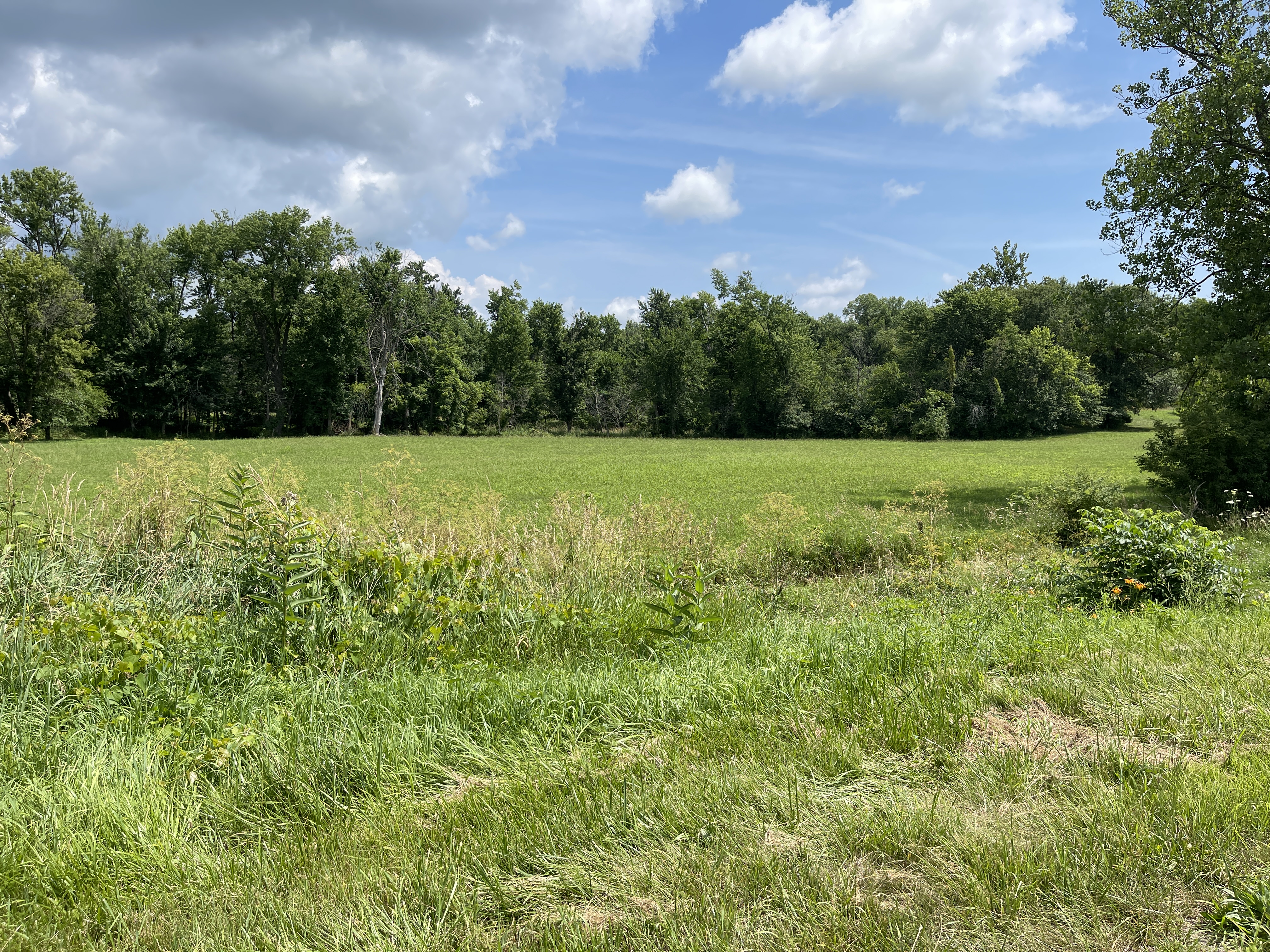
Brigham Young intended Sugar Creek Camp to be the staging area for a hand-picked, 1,800-member vanguard company, the “Camp of Israel,” that would start west in late winter 1846. On Feb. 4, he sent the first wagons to organize and wait there, about 7 miles west of Nauvoo, where their activities would not raise attention and anxiety among Church members. Other companies were to follow in the spring after travel conditions improved. However, as the Camp of Israel waited for Young to complete his business in Nauvoo and start the company west, temperatures dropped and the Mississippi River froze. Hundreds of Latter-day Saint families who feared being left behind crossed the ice to join the encampment at Sugar Creek. Many others crossed by boat or ferry as chunks of river ice threatened to capsize them into the river’s frigid waters. The Sugar Creek area offered plenty of wood and water, but the February weather was unusually harsh, with temperatures often dipping below zero. Few of the unexpected arrivals had carried adequate food, blankets, tents, or warm clothing for outdoor living in these conditions. People fell ill and suffered from exposure, and nine women reportedly gave birth on one particular night in that camp, although historians are skeptical of that claim. William Pace wrote Feb. 18, 1846, “Our camp was made in the snow about 8 inches deep and was a rather uncomfortable introduction to camp life without tent or any shelter save it be a wagon cover made from common sheeting.” Despite these hardships, faithful Latter-day Saints continued to drift into camp. By the time Brigham Young was able join them at the end of February, the company had grown to between 2,500 and 3,000 members. On March 1, 1846, some 500 vanguard wagons, inadequately supplied for the company’s numbers, rolled out of Sugar Creek on their way across Iowa. Today, the vicinity of the encampment, the first major stop on the Mormon Pioneer Trail, can be observed along both sides of 300th Street around the Sugar Creek bridge. Most camped on the east side of Sugar Creek, although the area west of the stream was used briefly before departure. The land is privately owned farmland, not open to visitors, but vehicles can pull over along the shoulder of the road to view the site. The bridge over Sugar Creek is is about a mile southeast of the original wagon crossing. The creek banks are heavily wooded, and adjoining lands where the camp was located show no visible trace of the 1846 camp. The area was probably more heavily wooded in the 1840s, but the views convey what the place was like for those who waited there in late winter 1846. No road signs or parking are provided. Park carefully along the shoulder of 300th St. east of the bridge to view the site from the roadside. Site Information Location (300th St., west of Montrose, Iowa, east of junction with 205th Ave., at 300th St. crossing of Sugar Creek.) The land is privately owned, and much of it is under cultivation. However, the area of the encampment can be viewed from 300th St. along both sides of the road. Amenities None. There is no signage and no turnout. Visitors must pull onto the road shoulder. Safety Considerations More Site Information Mormon Pioneer National Historic Trail
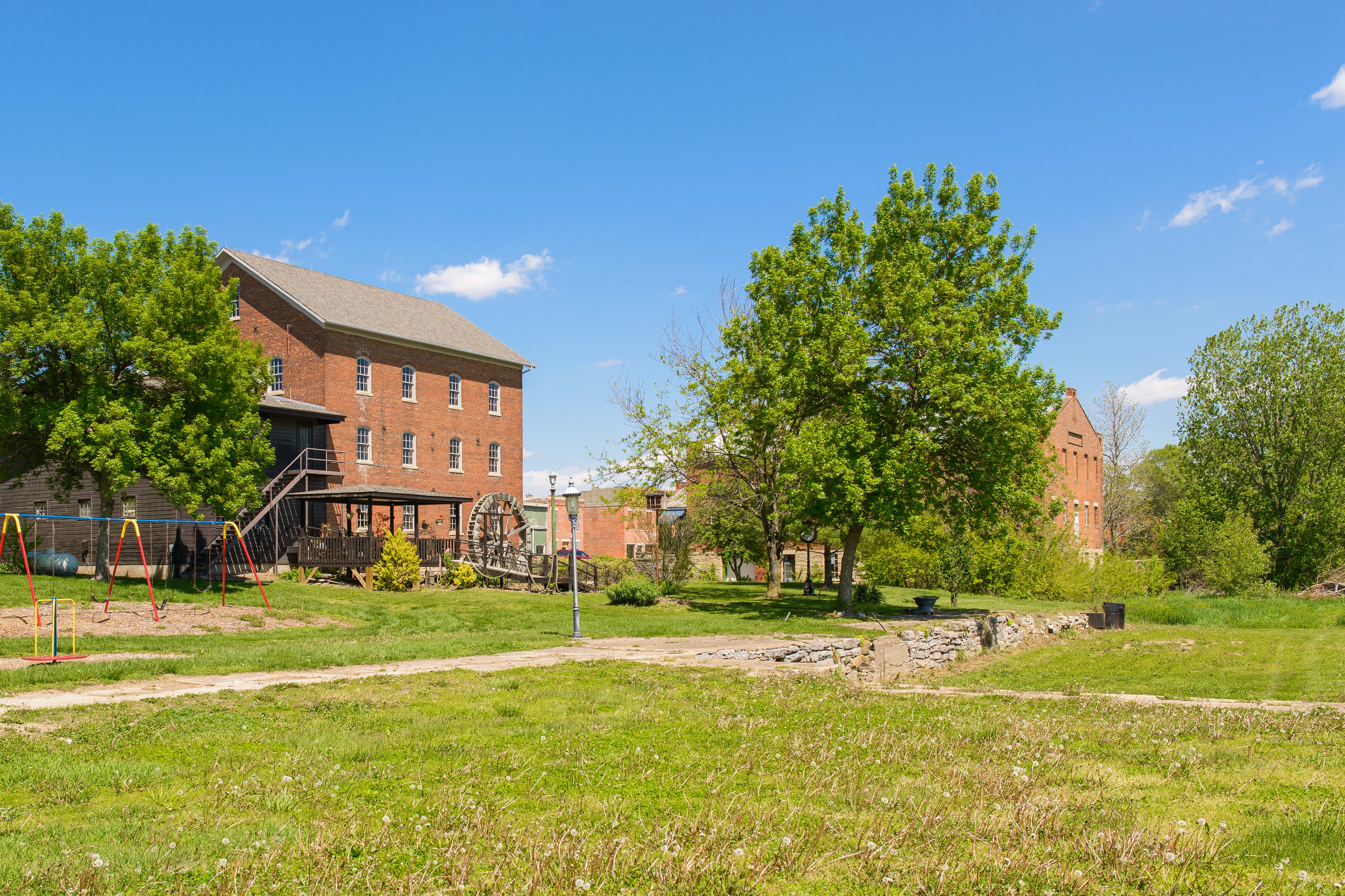
Bonaparte Riverfront Park
Emigrants who crossed the Des Moines River here in 1846, at the village of Bonaparte. The mill is now part of the Bonaparte Historic Riverfront District, listed on the National Register of Historic Places. Tours of the district are available. Bonaparte, Iowa was an established village when the Mormon pioneers departed Nauvoo in 1846. The emigrants visited the village, which required fording the Des Moines River. The wrote about Bonaparte in their journals, taking note of the "splendid Mill," a hotel, and several other buildings. Unfortunately, in 1886 a devastating fire along the north side of First Street burned down many of the Bonaparte's original buildings. Afterwards, the village rebuilt many of these buildings. But there are still a few "survivor" buildings. One is the the Farmers & Traders Bank building. Located on the south side of Main Street, it was far enough away from First Street to survive the fire. Constructed in the late 1840s, this building was standing when the Mormon pioneers visited the village. Several of the 1886 rebuilt buildings still remain as well. All together, they comprise the Bonaparte Historic Riverfront District, which is listed on the National Register of Historic Places. Site Information Location (Riverfront Park, Bonaparte, Iowa 52620) Available Facilities Historic buildings, intpretive exhibits, benches/seating. Safety Considerations More Site Information Exhibit with Audio Description available Mormon Pioneer National Historic Trail
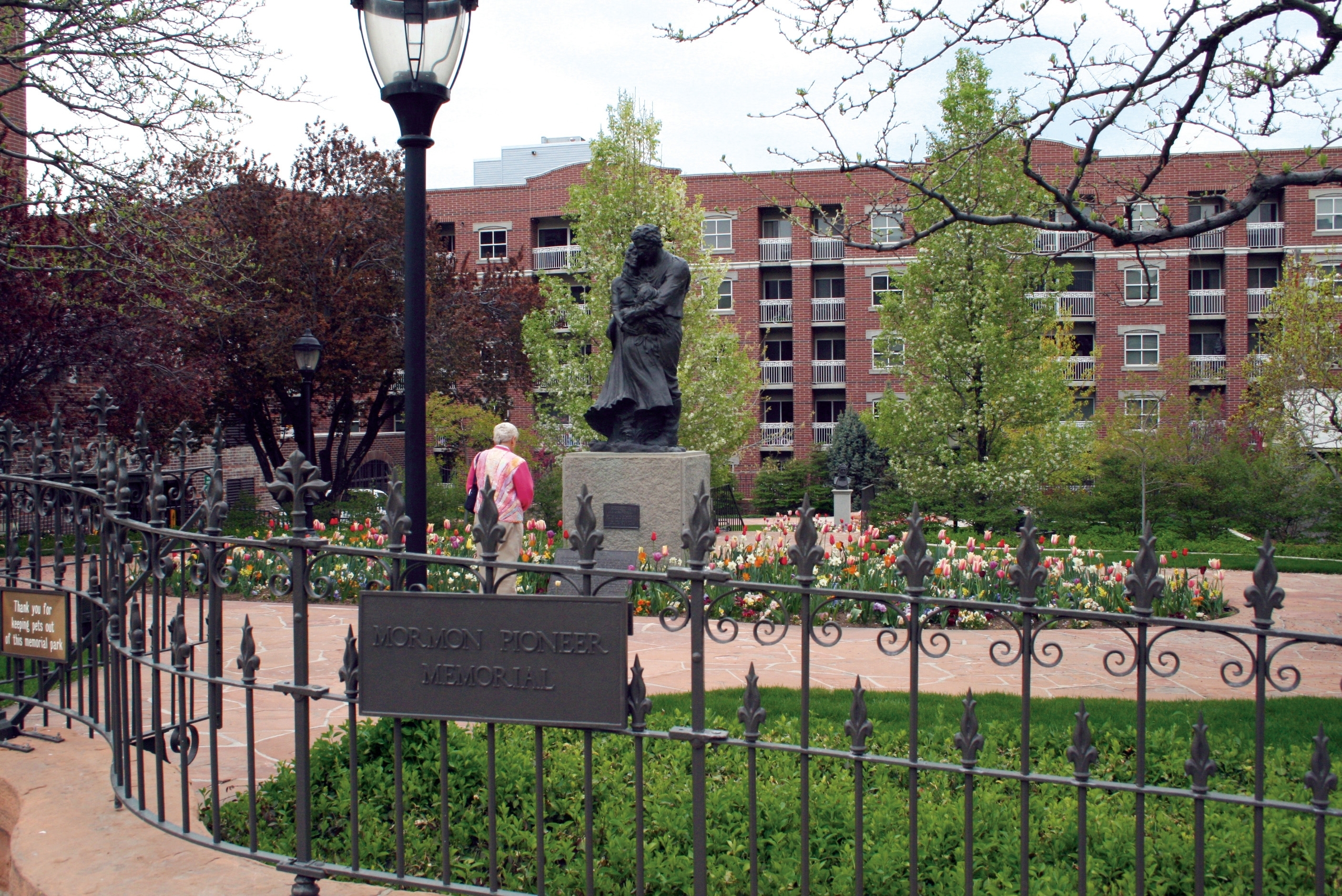
Brigham Young Cemetery
Note: not currently open to the public. The cemetery is a place of reverence and contemplation for Mormon visitors. In the outer garden stand sculptures of Mormon emigrants and monuments commemorating pioneers William Clayton and Eliza Roxcy Snow. Clayton wrote a detailed traveler’s guide to the Mormon Trail and composed the motivational hymn Come, Come, Ye Saints during his own 1846-47 trek from Nauvoo. Snow was a wife of church founder Joseph Smith and, after his death, of Brigham Young. She became a poet and songwriter of renown among the Mormon pioneers. Her grave, in the inner garden, is near that of Brigham Young and other members of his family. Site Information Location (140 East First Avenue, on the south side of 1st Avenue, Salt Lake City, Utah) Safety Considerations More Site Information Mormon Pioneer National Historic Trail Mormon Pioneer Trail: Salt Lake City Itinerary This site is on the Salt Lake City Itinerary. Each site provides the opportunity to experience and learn about Salt Lake City, a pioneer waystation as well as a destination, and its rich combined history of the Mormon Pioneer, Pony Express, and California national historic trails.
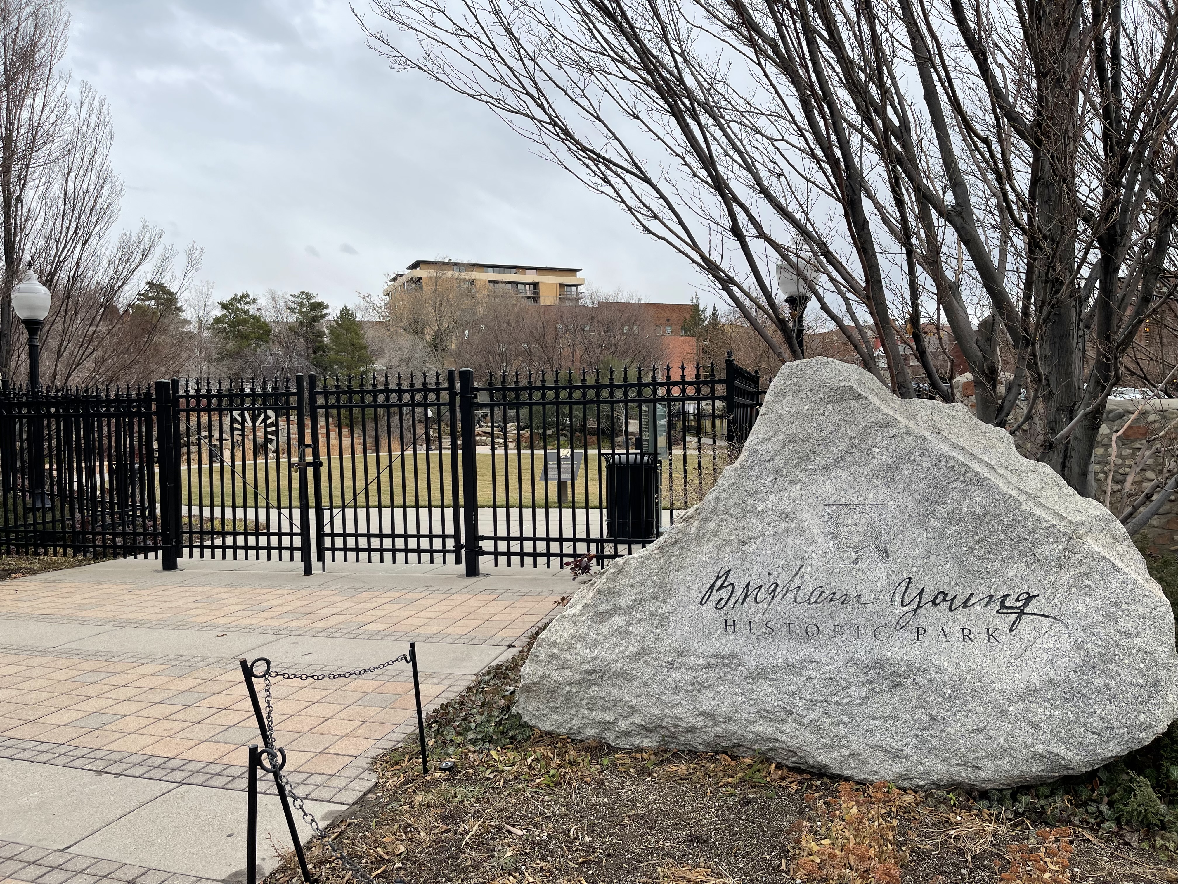
Brigham Young Historic Park
Brigham Young Historic Park represents a small portion of land once owned by the Brigham Young family in the center of Salt Lake City. On this property were farm barns and sheds, animals, orchards, and vegetable gardens. On the east side of the park, a rebuilt portion of cobblestone wall can be seen that once marked Brigham’s property. Today, the park features statues memorializing the lives and efforts of the Latter-day Saints who arrived in Salt Lake City in the 1840s. There is a stage on the north side of the lawn that is backed by a waterwheel powered by the flow of City Creek. Free evening concerts are sometimes held here. Located on the corner of two active downtown boulevards, Brigham Young Historic Park is surrounded by a fenced perimeter and a gated entrance. The park is open only for special events only. Site Information Location (100 N State Street, Salt Lake City, Utah 84150) Safety Considerations More Site Information Mormon Pioneer National Historic Trail Mormon Pioneer Trail: Salt Lake City Itinerary This site is on the Salt Lake City Itinerary. Each site provides the opportunity to experience and learn about Salt Lake City, a pioneer waystation as well as a destination, and its rich combined history of the Mormon Pioneer, Pony Express, and California national historic trails.
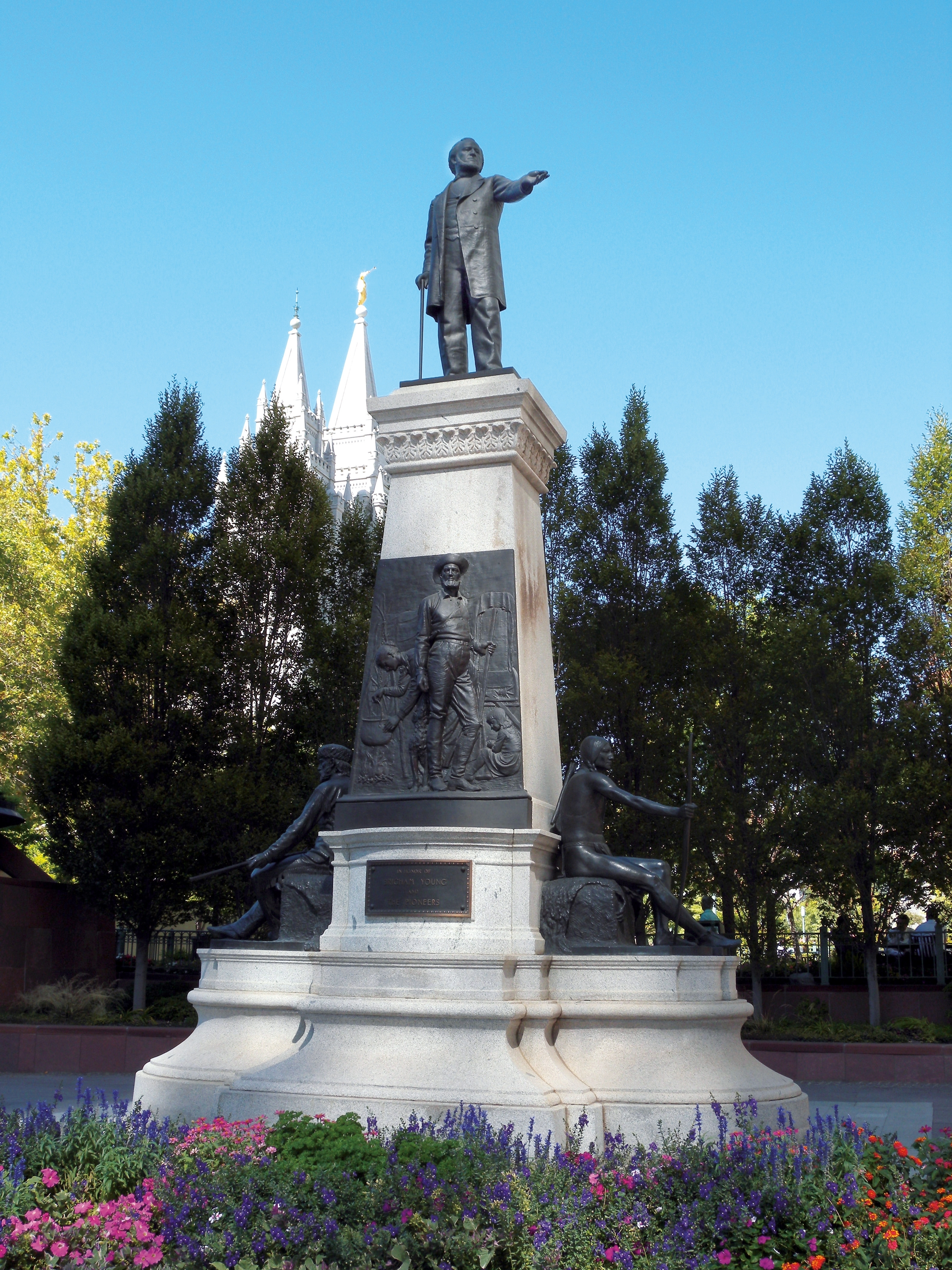
Brigham Young Monument, Salt Lake City
The monument features a heroic-sized statue of Young created for the 1893 World’s Fair in Chicago, along with smaller sculptures representing the Utah Indian tribes and fur trappers who preceded the pioneers. A plaque on the monument lists the members of the original Mormon advance company. Curbside parking is limited in this area; underground parking may be available at the Joseph Smith Memorial Building, the white building to the right (east) of the monument. Site Information Location (1 N Main St, Salt Lake City, UT 84150) Safety Considerations More Site Information Mormon Pioneer National Historic Trail Mormon Pioneer Trail: Salt Lake City Itinerary This site is on the Salt Lake City Itinerary. Each site provides the opportunity to experience and learn about Salt Lake City, a pioneer waystation as well as a destination, and its rich combined history of the Mormon Pioneer, Pony Express, and California national historic trails.
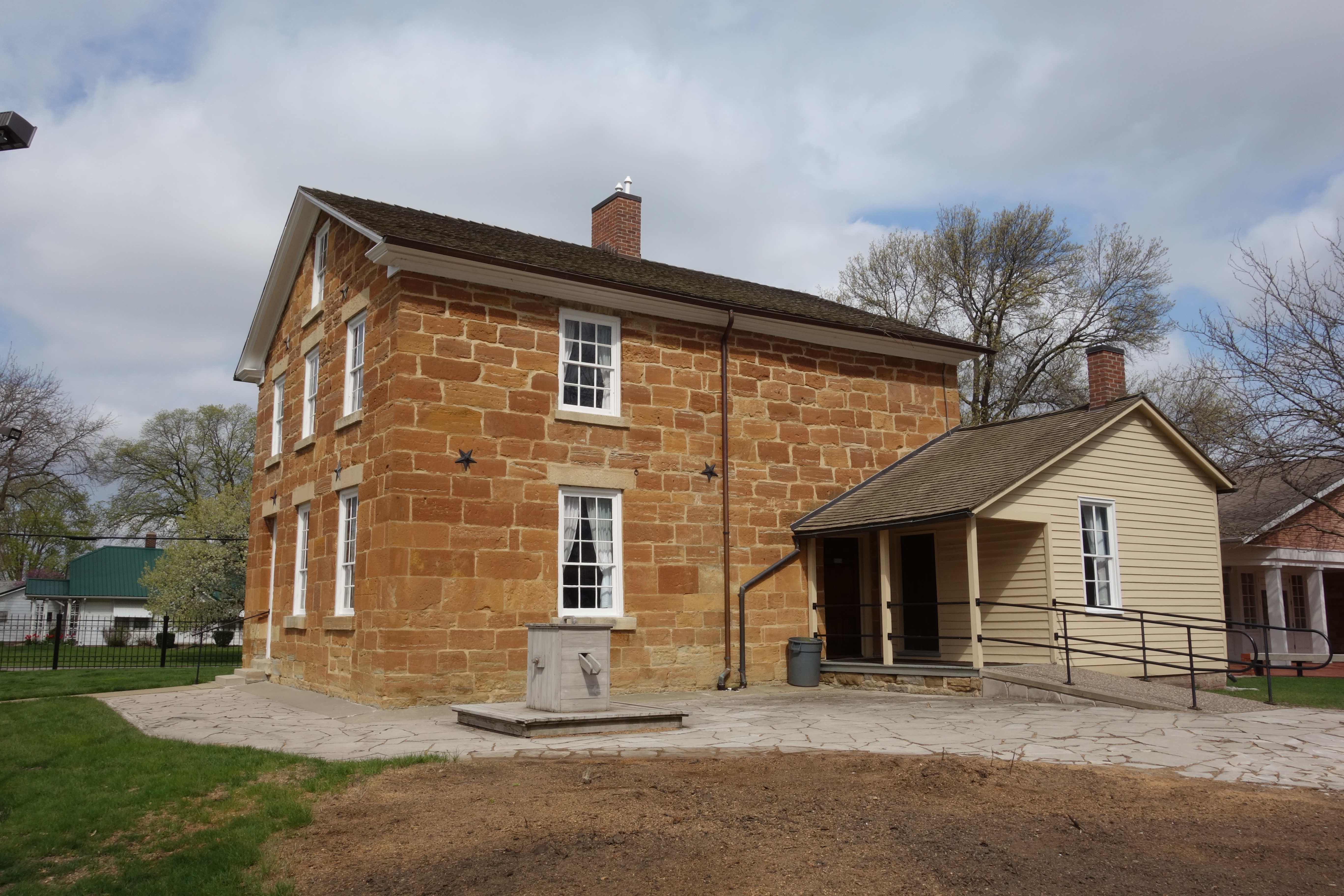
Carthage Jail
As converts to The Church of Jesus Christ of Latter-day Saints gathered to Nauvoo in the early 1840s, the community’s economic exclusiveness, political influence, and 2,000-man militia alarmed other residents of Hancock County, Illinois. On June 7, 1844, an opposition newspaper, the Nauvoo Expositor, publicly accused church founder Joseph Smith of secretly marrying other men’s wives, which Smith denied. By order of the Nauvoo City Council, the town marshal destroyed the paper’s press. When the State of Illinois issued a warrant for the arrest of Smith and others for destruction of the press, Smith declared martial law and called on his militia to defend Nauvoo. However, Joseph, his brother Hyrum, and other church leaders voluntarily submitted to authorities and were taken to the county jailhouse in neighboring Carthage, IL. There, the jailer permitted the men to use a second-floor bedroom while awaiting Smith’s court appearance on charges of treason for declaring martial law. On June 27, 1844, a mob of 150-200 armed men stormed the building, fatally shot Hyrum Smith through the bedroom door, and critically wounded 2 others. Joseph Smith was preparing to leap from a bedroom window when gunfire struck him and he fell to the ground outside. The mob propped the wounded man against a well in the side yard and killed him there. After the deaths of Joseph and Hyrum Smith, Brigham Young was called to lead the church and, facing pressure from state officials and rumors of more violence, began evacuating Nauvoo in February 1846. The route followed by Young’s vanguard party on the trek to Utah is commemorated today as the Mormon Pioneer National Historic Trail. Visitors can learn about events at the Carthage Jail at the missionary-operated Visitors’ Center and join a free guided tour of the rooms and grounds where events unfolded. Site Information Location (310 Buchanan St, Carthage, Illinois 62321.) Safety Considerations More Site Information Mormon Pioneer National Historic Trail
Chariton River Crossing
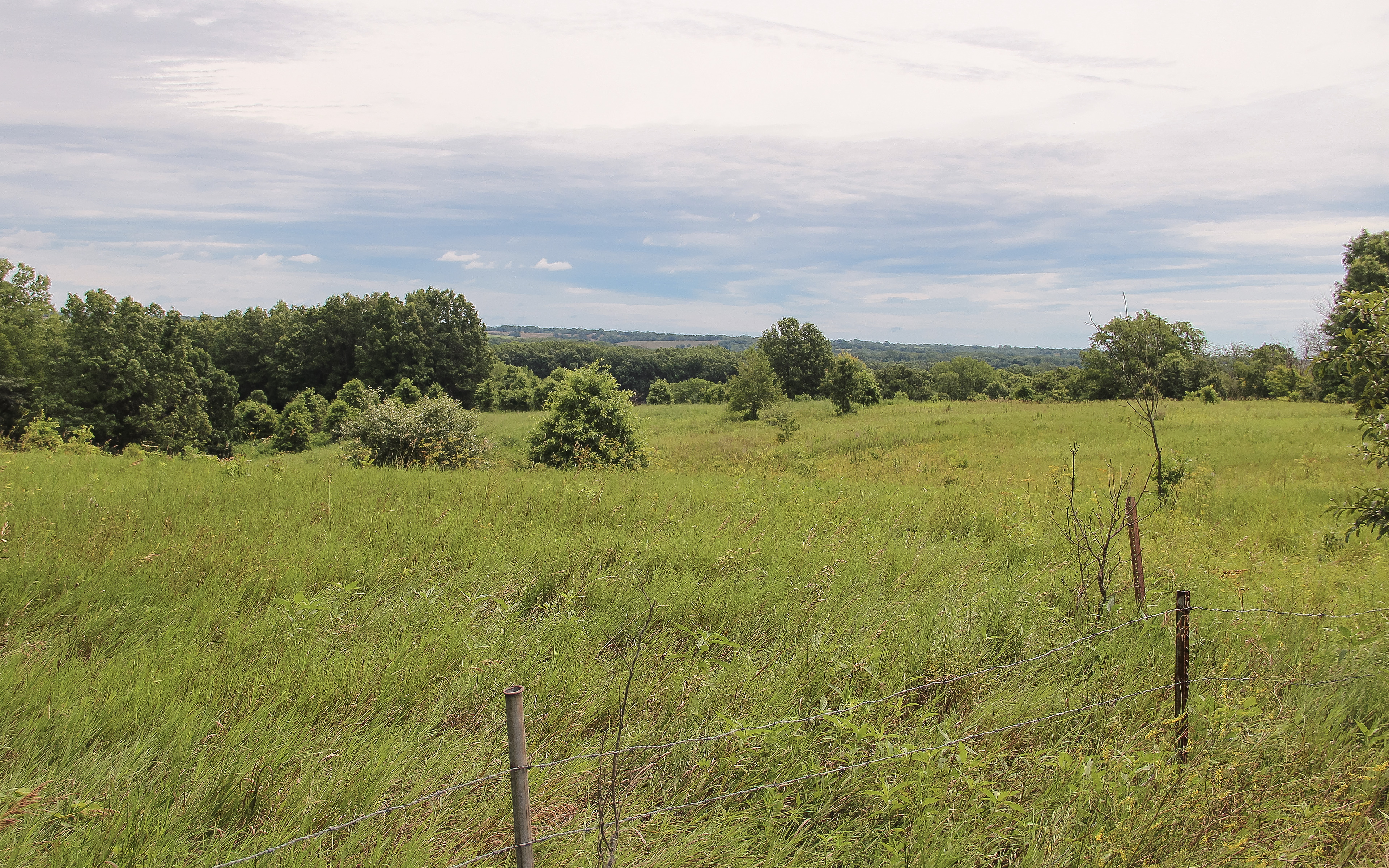
While crossing Iowa, some wagons became separated from the Mormon vanguard party and began camping apart. On March 22, 1846, the main body forded the Chariton River, a difficult crossing that required men to use ropes to lower the wagons down the steep riverbank. Once across the swift, 20-yard channel, the men used ropes to help haul the wagons up the opposite bank. The draft animals and wagons next struggled across flooded, boggy lowlands and up a steep, muddy ridge. Realizing that the rest of the day would be occupied by getting all 300 wagons to the ridgetop, the company encamped there, about a half-mile south of the river. Camp chronicler William Clayton wrote in his journal that evening, “I spent the day helping the teams till I was so sore and tired I could scarcely walk.” The wagons stayed at the Chariton Camp, spread across nearly a mile of ridgetop, for 9 days as the emigrants waited for the rain to stop. Orson Pratt wrote on March 22, 1846, “The heavy rains had rendered the praires [sic] impassable; and our several camps were very much separated from each other.….The heavy rains and snows, together with frosty nights, rendered our situation very uncomfortable.” According to one chronicler, “seas of mud” churned by the hooves of livestock lay between the wagons and sagging tents. The company had been on the road from Nauvoo for three weeks and traveled about 100 miles, a distance that under favorable conditions could be covered by ox-drawn wagons in five days. They had averaged only 3 to 4 miles a day since departing Sugar Creek. During the delay at Chariton Camp, Brigham Young called in the outlying wagons and organized the emigrants into three companies of 100 families each. These were sub-divided into fifties and then tens, with each unit led by a captain tasked to maintain travel order. The wagons departed camp on April 1. To reach the Chariton Camp area, today’s travelers drive 296th Avenue up an undulating ridge. A turnout with a National Park Service interpretive wayside exhibit lies on the north side of 269th Avenue, opposite a farm driveway. The Mormon wagons approached this area from the northeast and camped on both sides of the road. The site landowner has provided a path, which is not regularly maintained, to the river crossing site. Today, maps show the crossing as being on Pigeon Creek. This was the path of the Chariton River before it was channelized in the early 1900s. Site Information Location (27601-27999 269th Ave., 0.3 mile East of 582nd St., Exline, Iowa 52555.) Safety Considerations More Site Information Mormon Pioneer National Historic Trail
Park stories
Elizabeth “Lizzy” Flake, the Mormon Pioneer Trail
Richardson's Point Additional History: Mormon Pioneer Trail
Green Flake, the Mormon Pioneer Trail
Mormon Pioneer Trail Junior Ranger
Mormon Pioneer Trail Timeline
Locust Creek Campsite Exhibit Audio Description
Montrose Riverfront Park Exhibit Audio Description
Nauvoo Exhibits Audio Description
Grand Encampment Exhibit Audio Description
Bonaparte Riverfront Park Exhibit Audio Description
Garden Grove Exhibit Audio Description
Mount Pisgah Exhibits Audio Descriptions
Park information courtesy of the National Park Service Data API.