
National Park
Canyonlands National Park
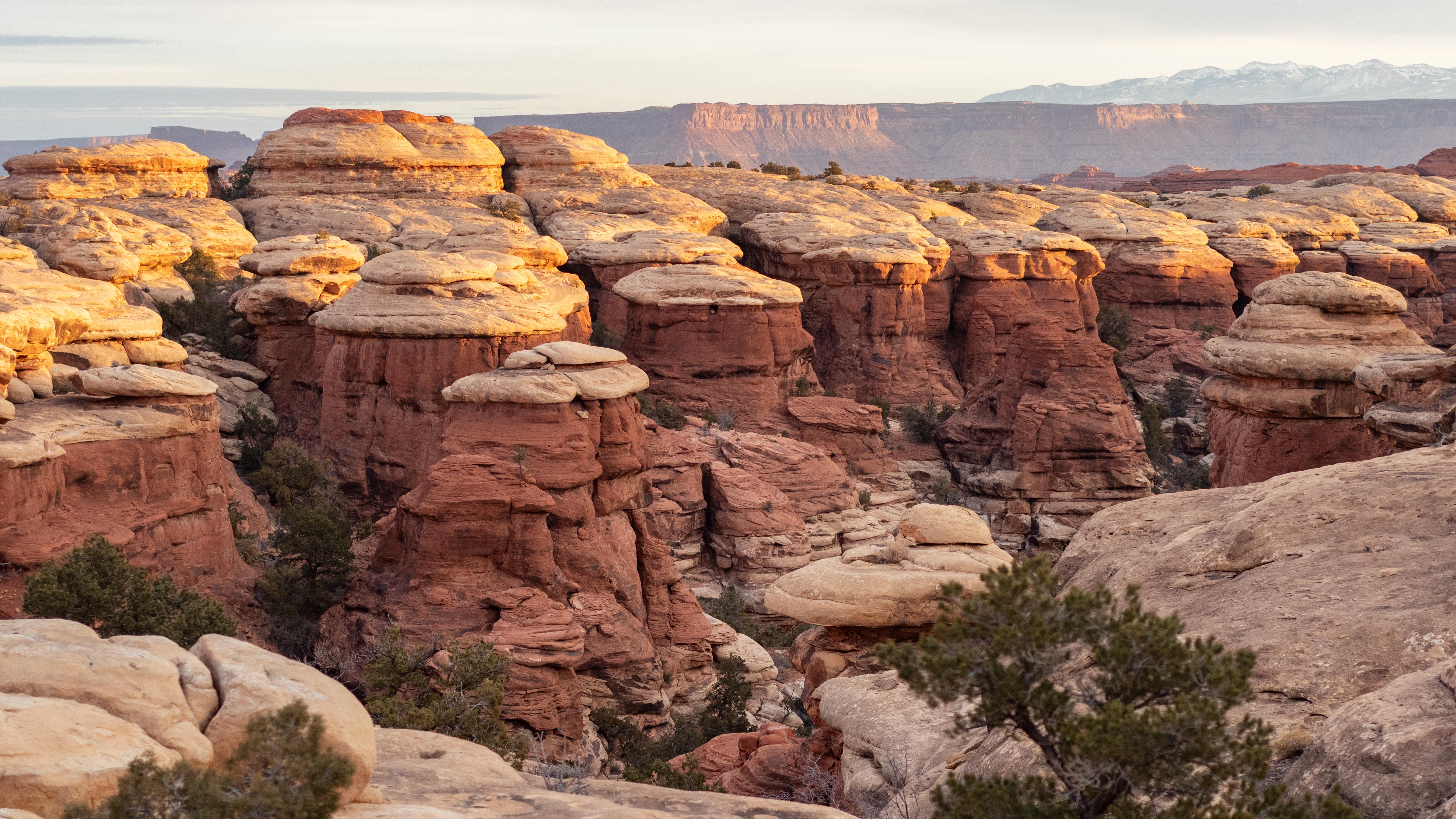
Canyonlands is a wilderness of canyons, buttes, and spires carved by the Colorado River and Green River. The park is divided into four distinct districts; no roads join them together. The districts share similar desert ecosystems, but each one provides unique opportunities for adventure and discovery.
Official NPS pageCaution: Trailhead Access at Horseshoe Canyon
Due to active search and rescue operations, visitors should refrain from accessing the main Horseshoe Canyon trailhead. Hans Flat Ranger Station and The Maze district are still accessible using dirt roads from UT 24 or Green River, Utah.
Park Closure: Grand View Point Closed for Construction Weekdays July 27 to Oct 1
Grand View Point Overlook, Grand View Point Trail, and 0.3 mi (0.5 km) of park road is closed Monday to Thursday. The closure applies to all uses, including vehicles, tour buses, motorcycles, bikes, & hikers. Parking is open but limited Friday to Sunday.
Caution: No Wood or Charcoal Fires Allowed - Stage 2 Fire Restrictions in Effect
All fires are prohibited. Only petroleum or propane-fueled stoves or grills are allowed in backcountry campsites, campgrounds, and picnic areas. Fireworks are never allowed. Smoke only inside vehicles or in developed areas over 3 feet from flammables.
Information: Trip-planning tips for 2026
Planning to visit Canyonlands this year? To ensure the best experience, please anticipate potentially long wait times at the entrance station. If overlook or trailhead parking is full, plan to return a little later. Please avoid parking on vegetation and roadways to help preserve this beautiful place for everyone to enjoy.
Hours
Canyonlands National Park is generally open 24 hours a day, year-round.
Entrance fees
Entrance - Private Vehicle: $30.00 · Entrance - Motorcycle: $25.00 · Entrance - Per Person: $15.00
Getting there
Canyonlands National Park is cut into three land districts by the Green and Colorado rivers. Island in the Sky, in the north of the park, is about 40 minutes from Moab, UT via UT 313. The Needles district is in the southeast corner of Canyonlands, about 90 minutes from Moab or an hour from Monticello, UT via UT 211. The Maze district, in the west of the park, is the most remote and challenging; its ranger station is down 46 miles of dirt road from UT 24. All roads in The Maze require high-clearance 4WD.
Camping in this park
The Needles Campground
The Needles Campground has 26 individual sites. Nightly camping fee for an individual site is $20. You can reserve some individual sites spring through fall. Other times of the year, individual sites are first-come, first-served. There are toilets, picnic tables, and fire rings in the campground. This park district also has three group campsites described on a separate page.
Island in the Sky (Willow Flat) Campground
Island in the Sky Campground (Willow Flat) has 12 sites, first-come, first-served. The campground is open year-round. The spectacular Green River Overlook is nearby. Nightly camping fee is $15 per site. Sites fill quickly spring through fall. There are toilets, picnic tables, and fire rings in the campground. There is no water at the campground. You can get drinking water outside the visitor cente
The Needles District Group Campsites
The Needles district has three group campsites in different locations, which can accommodate up to 15, 25, or 50 campers (respectively). Group campsites may be reserved for nights between mid-March and mid-November.
Things to do
Experience the Shafer Trail
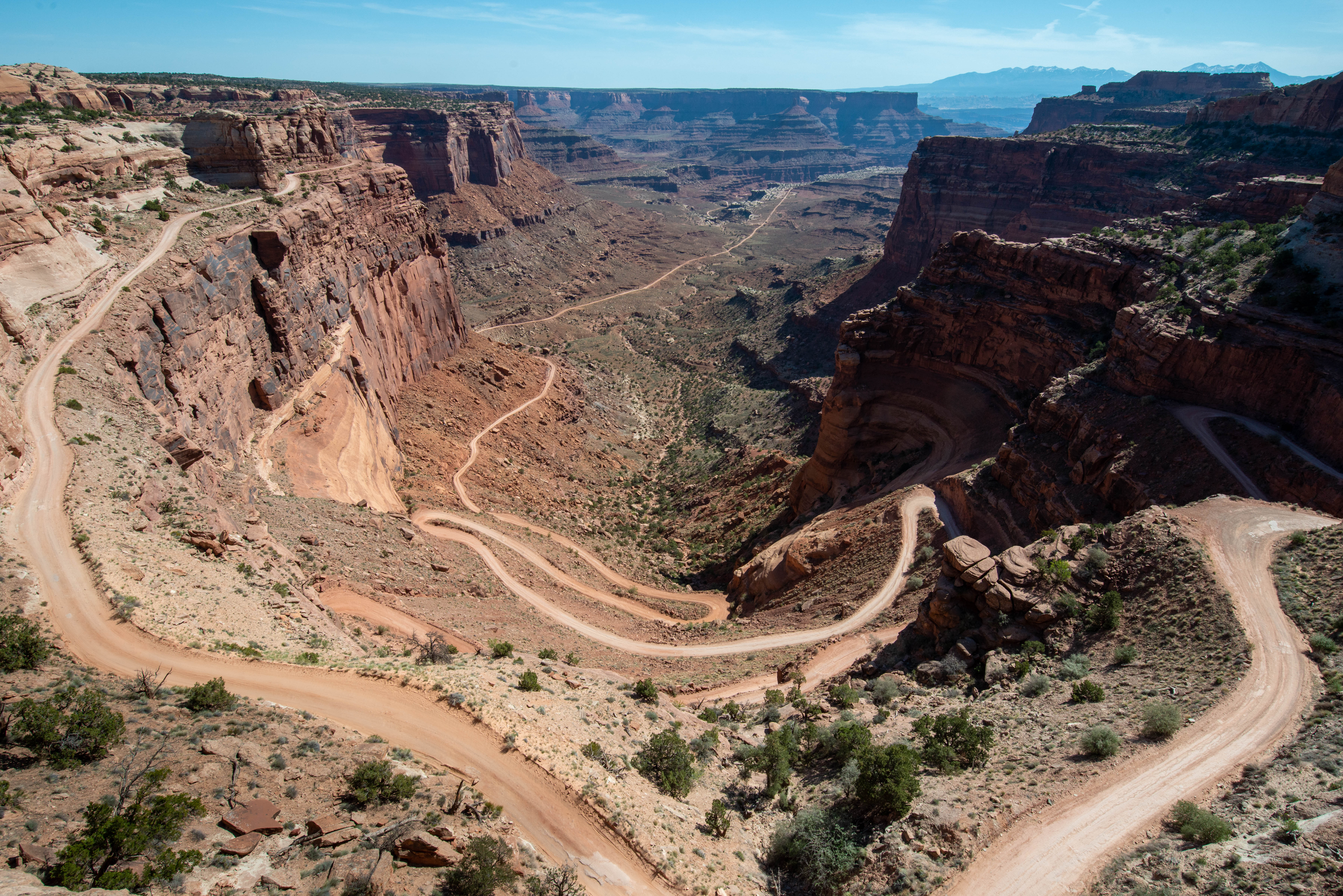
The Shafer Trail is a challenging, unpaved backcountry road for recreational users seeking the experience of a lifetime. High-clearance 4WD vehicles with a low range gear (4LO) are required. ATVs, OHVs, or UTVs are not permitted inside the park.
Hiking at Canyonlands
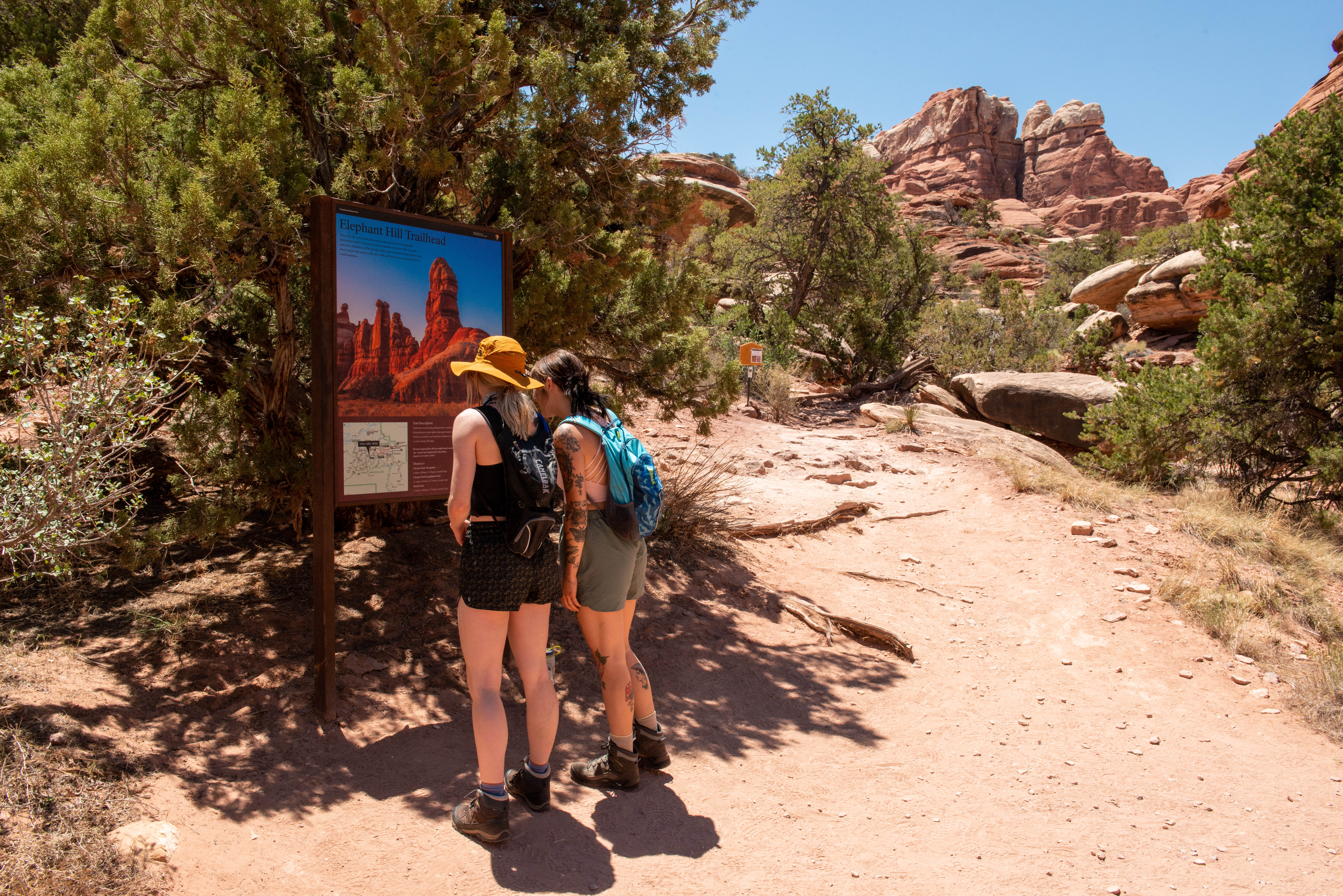
Canyonlands has hundreds of miles of hiking trails which explore the park’s natural and cultural features. Both Island in the Sky and The Needles provide ample opportunities for short walks, day hikes and backpacking trips. Due to its remoteness, The Maze is primarily a backpacking destination.
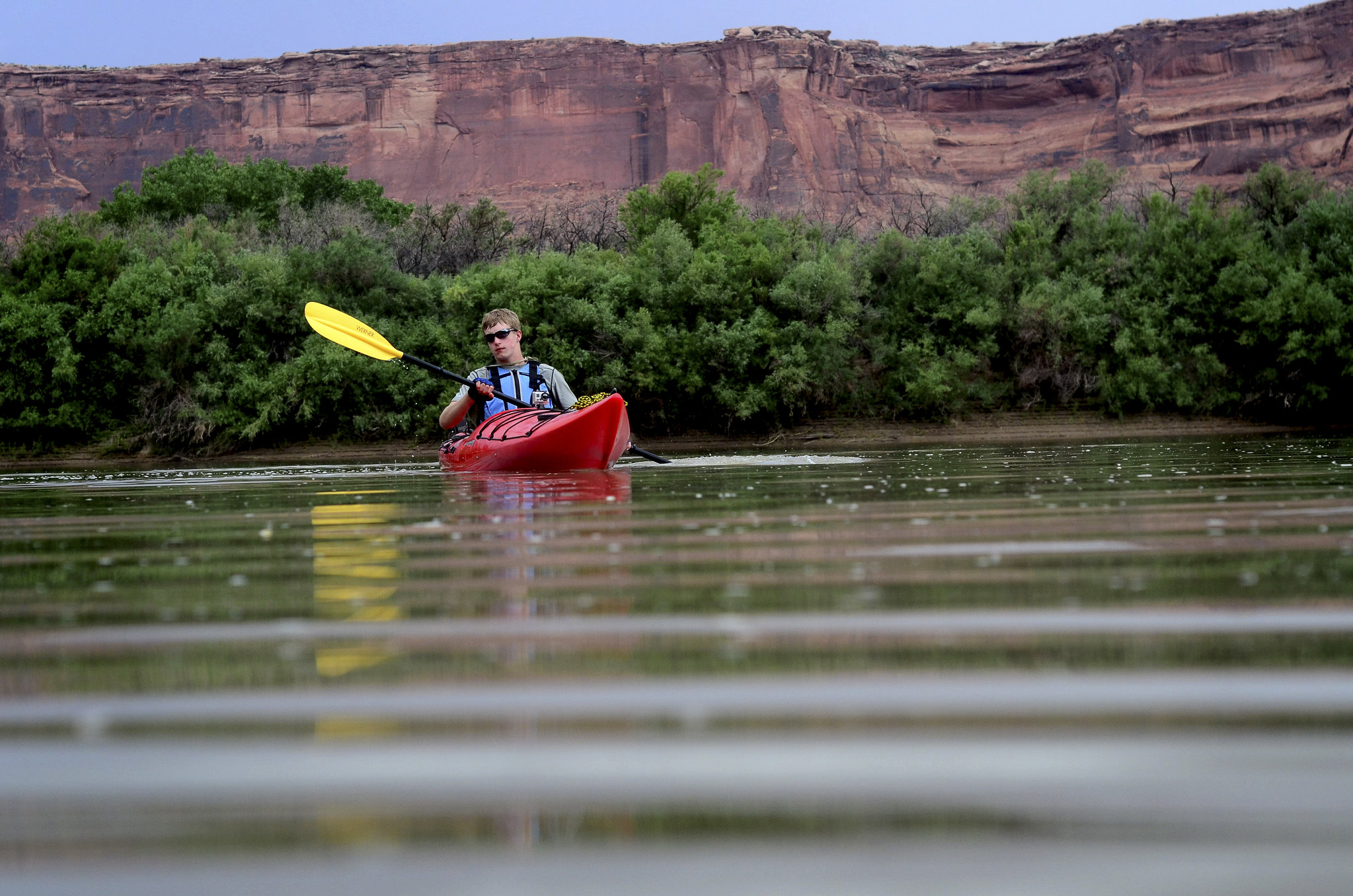
Boating in Canyonlands
The Colorado and Green rivers have played a significant role in shaping the landscape of Canyonlands. Boating is a great way to see the park from the bottom up, and affords boaters a unique perspective.
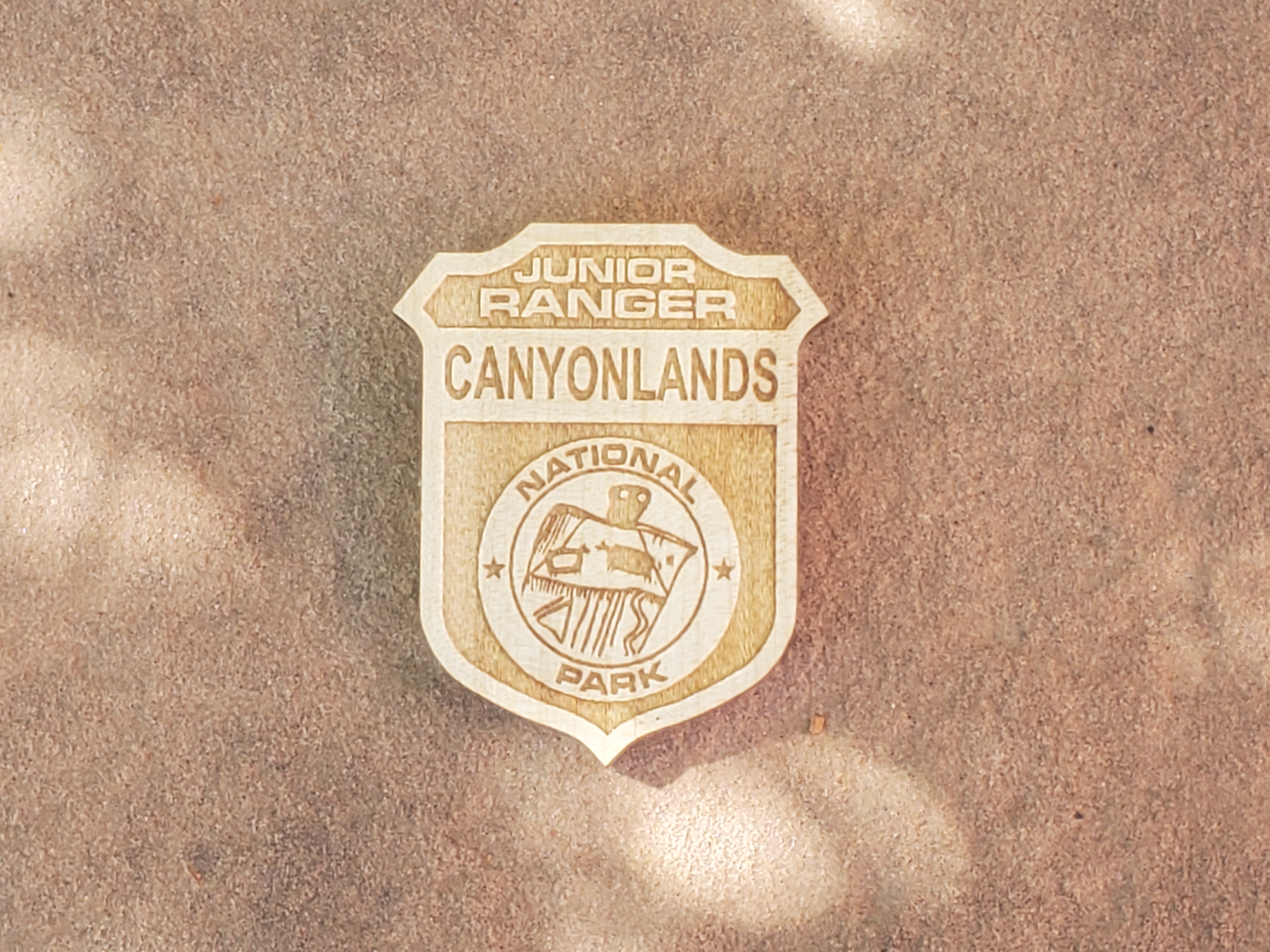
Canyonlands Junior Ranger Program
There are a few ways to become a junior ranger at Canyonlands. Free junior ranger booklets are available at park visitor centers, or you can download them from the park website. Filled with fun activities, these books reveal the wonders of Canyonlands to kids and parents alike. After completing certain exercises, you can earn a junior ranger badge and signed certificate.
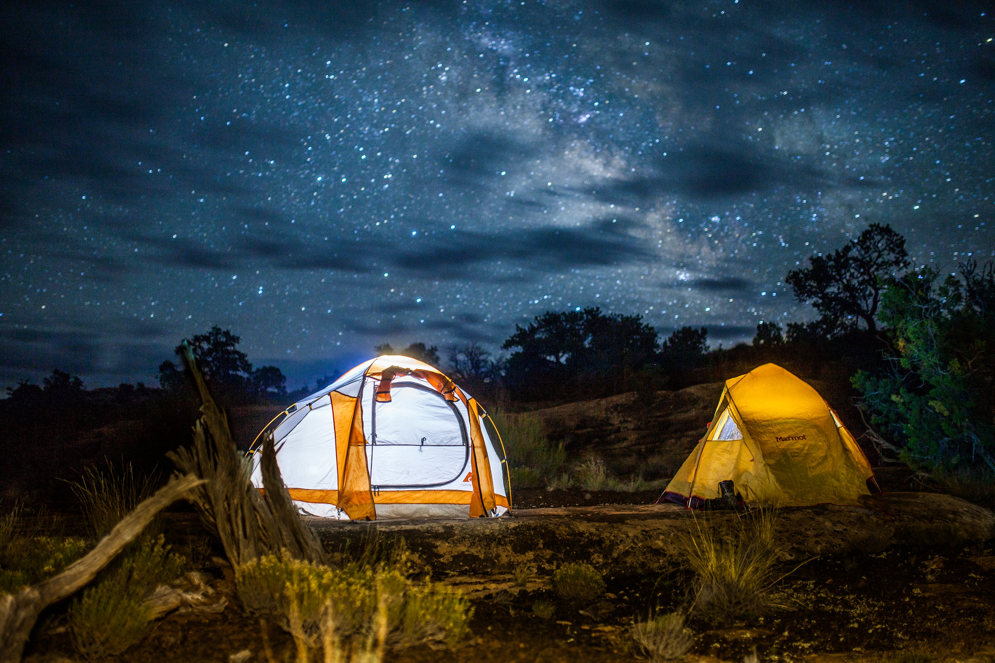
Backcountry Camping in Canyonlands
What better way to connect with this wilderness of countless canyons than on foot? Canyonlands offers hundreds of miles of hiking trails with designated campsites for overnight backcountry travel.
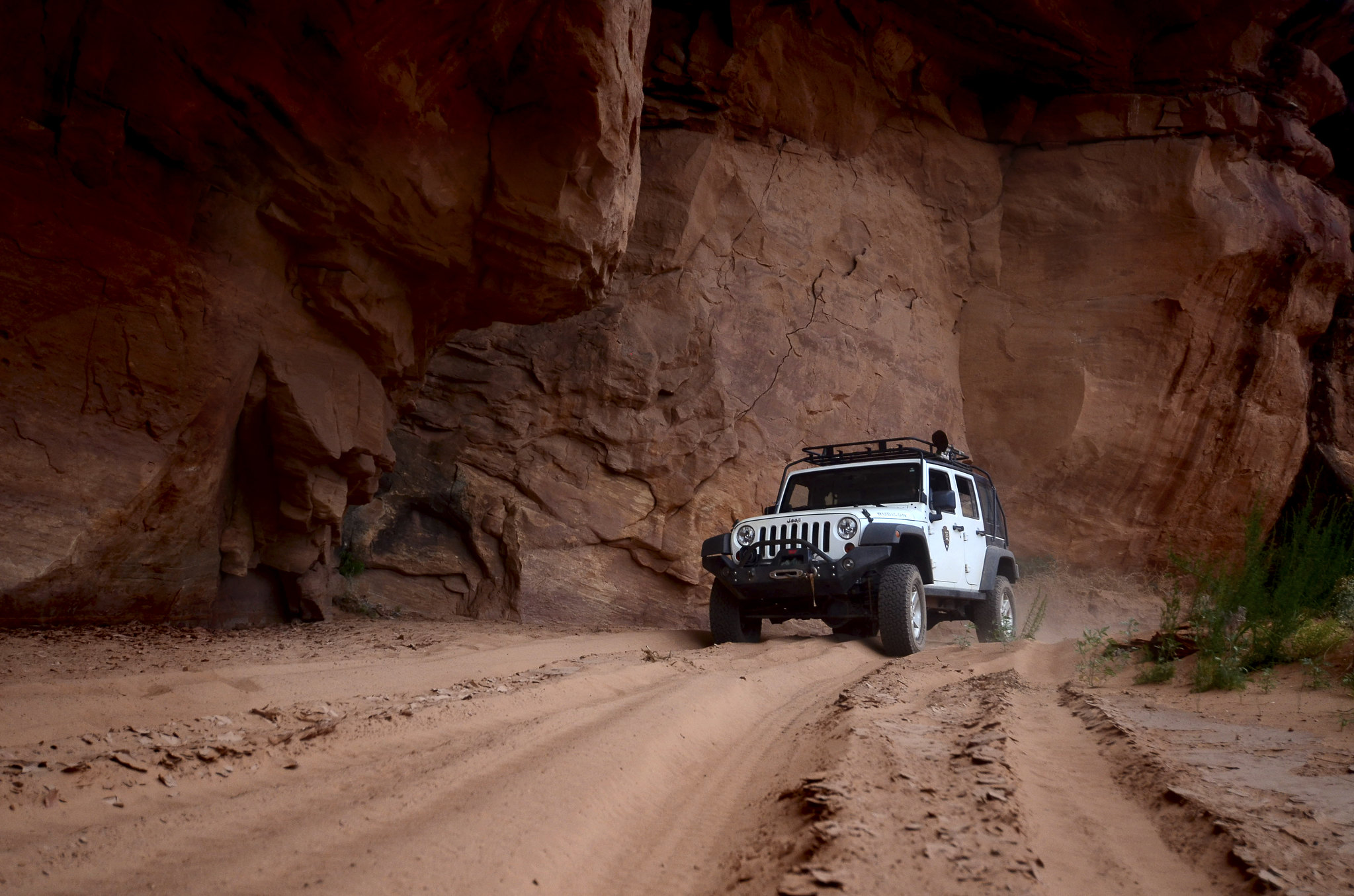
Auto Touring in Canyonlands
There are hundreds of miles of unpaved roads in Canyonlands, providing access to various campsites, trailheads, and viewpoints in the park's backcountry. Most roads require high-clearance, low range four-wheel-drive. Roads range in difficulty from intermediate to extremely technical. Research your route thoroughly before attempting these roads.
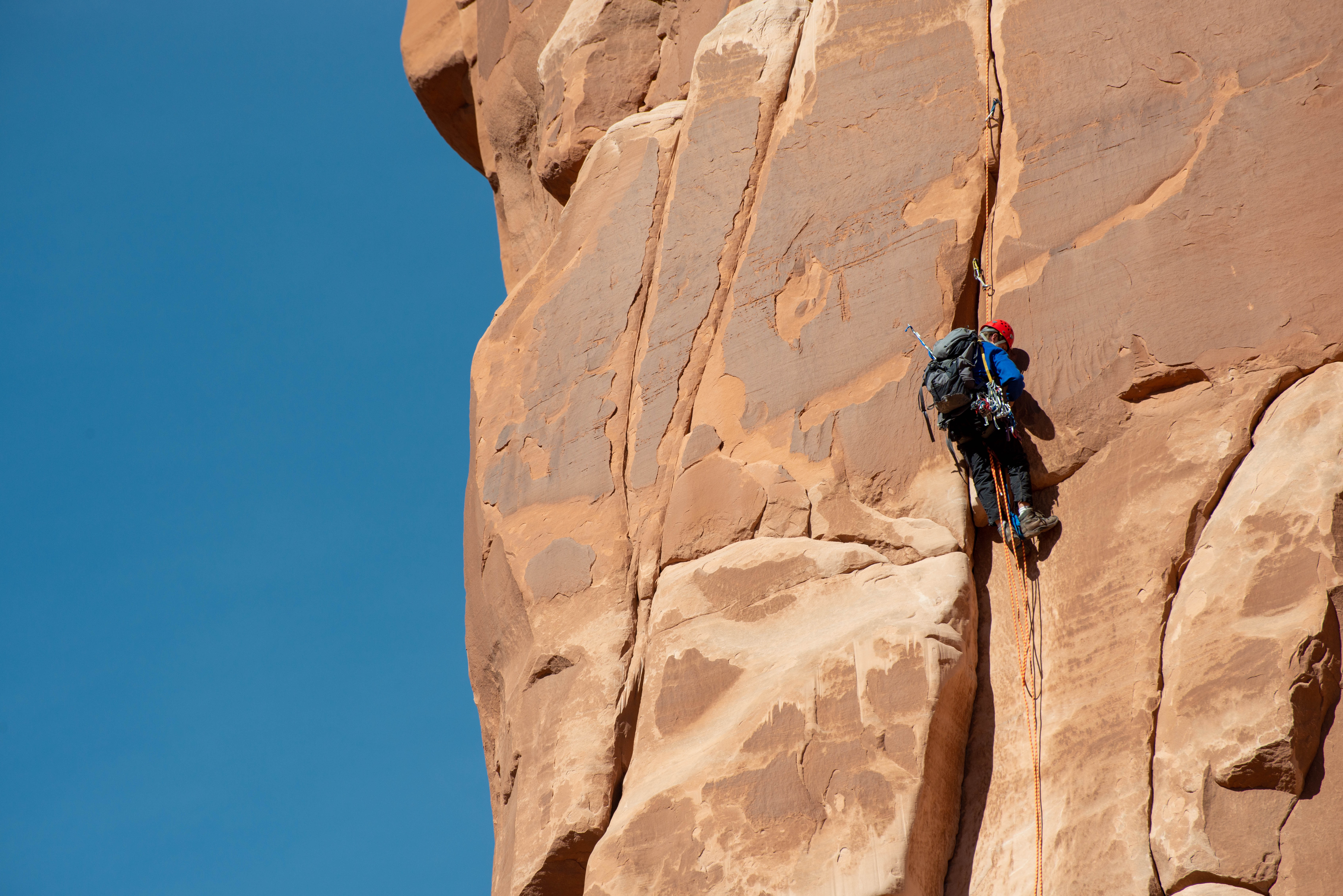
Rock Climbing at Canyonlands
The sandstone towers at the Island in the Sky attract the most rock climbers. We do not see many climbers in the rest of the park due to the poor rock quality and a lack of established routes.
Places to see
Horseshoe Canyon
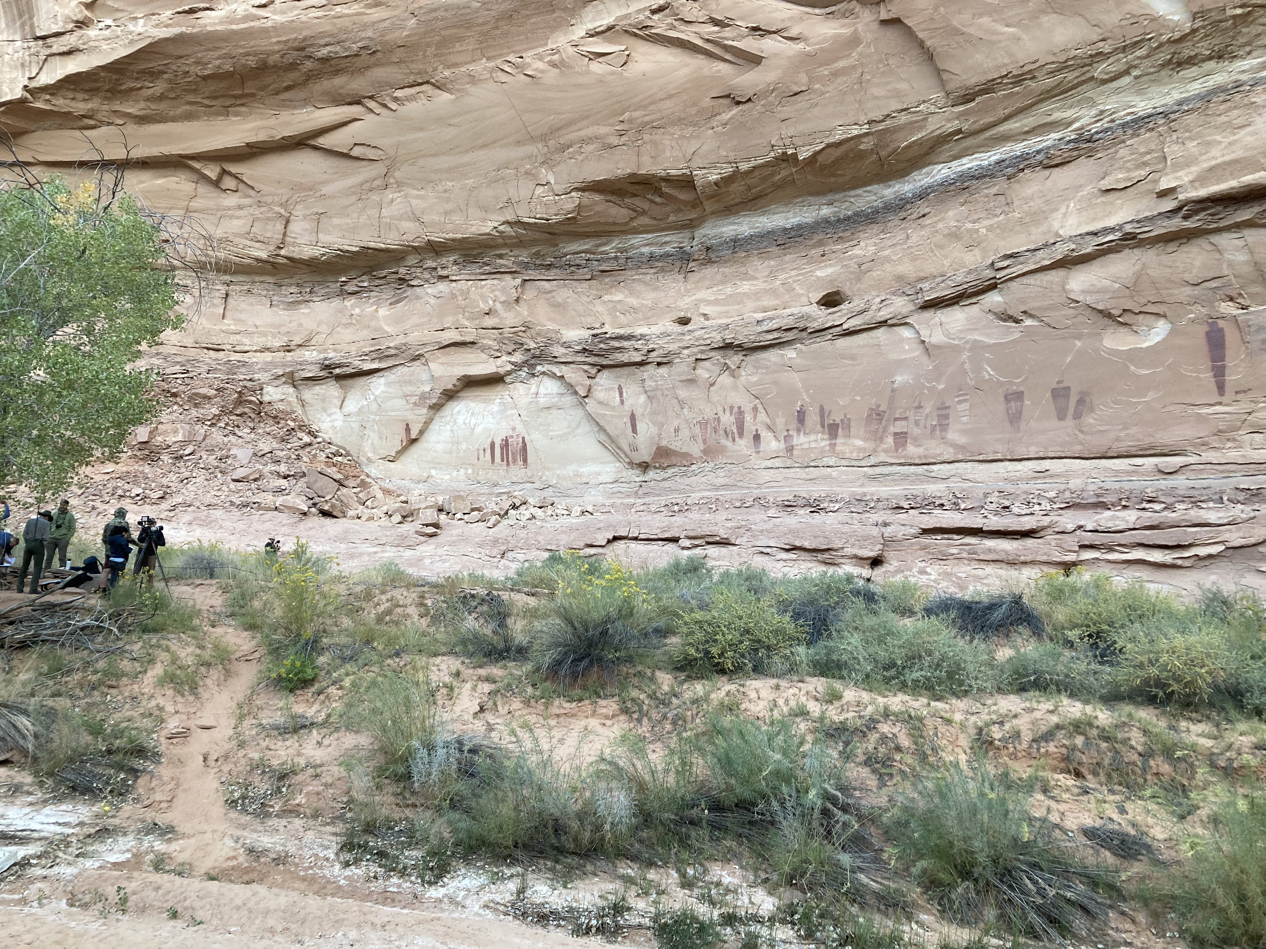
Horseshoe Canyon contains some of the most significant ancient rock markings in North America. The Great Gallery, the best known pictograph panel in Horseshoe Canyon, includes well-preserved, life-sized figures with intricate designs. Other impressive sights include spring wildflowers, sheer sandstone walls, and mature cottonwood groves along the intermittent stream in the canyon bottom. Horseshoe Canyon was added to Canyonlands National Park in 1971. The archeology of Horseshoe Canyon spans thousands of years of human history. Artifacts recovered from sites in this area date back as early as 9000-7000 BCE (Before Common Era), when Paleoindians hunted large mammals like mastodons and mammoths across the southwest. American Indian rock markings found in Horseshoe Canyon are most commonly painted in a style known as “Barrier Canyon.” This style is believed to date to the Late Archaic period, from 2000 BCE to 500 CE (Common Era). During this time, nomadic groups of hunter-gatherers made Horseshoe Canyon their seasonal home. During later periods, the Fremont-era and Ancestral Puebloan cultures left their own distinctive rock markings in the canyon, but their presence was brief in comparison, and final abandonment occurred by 1300 CE. The Great Gallery is the best known and most spectacular of the Horseshoe Canyon panels. This well preserved site includes both pictographs (painted figures) and petroglyphs (figures etched in the rock with a sharp stone). The tapered, life-size figures lack arms and legs but frequently contain intricate designs. These designs are characteristic of the Barrier Canyon style. Though Horseshoe Canyon is most famous for its rock markings, the canyon’s history has many chapters. After centuries of indigenous peoples passed through, European Americans arrived. Outlaws like Butch Cassidy made use of Horseshoe Canyon in the late 1800s, taking refuge in the confusing network of canyons, especially those around Robbers Roost to the southwest. In the early 1900s, ranchers built several stock trails into Horseshoe Canyon so livestock could reach water and feed in the canyon bottom. Eventually, the ranchers constructed a pumping operation to fill water tanks on the canyon rim. Many of these modifications are still visible today. Prospectors explored the area in the mid-1900s, improving many stock trails to accommodate vehicles and drill rigs. Though they searched the rock layers for oil and other minerals, no successful wells or mines were ever established around Horseshoe Canyon. After being added to Canyonlands National Park in 1971, grazing and mineral exploration in Horseshoe ended. Today, park visitors descend the old ranching trail and marvel at the history of this magnificent canyon. Visiting Horseshoe Canyon requires driving on unpaved roads, which can become impassable with changing weather. Visiting the rock painting and pecking panels requires a hike of up to seven miles roundtrip.
Lathrop Trail
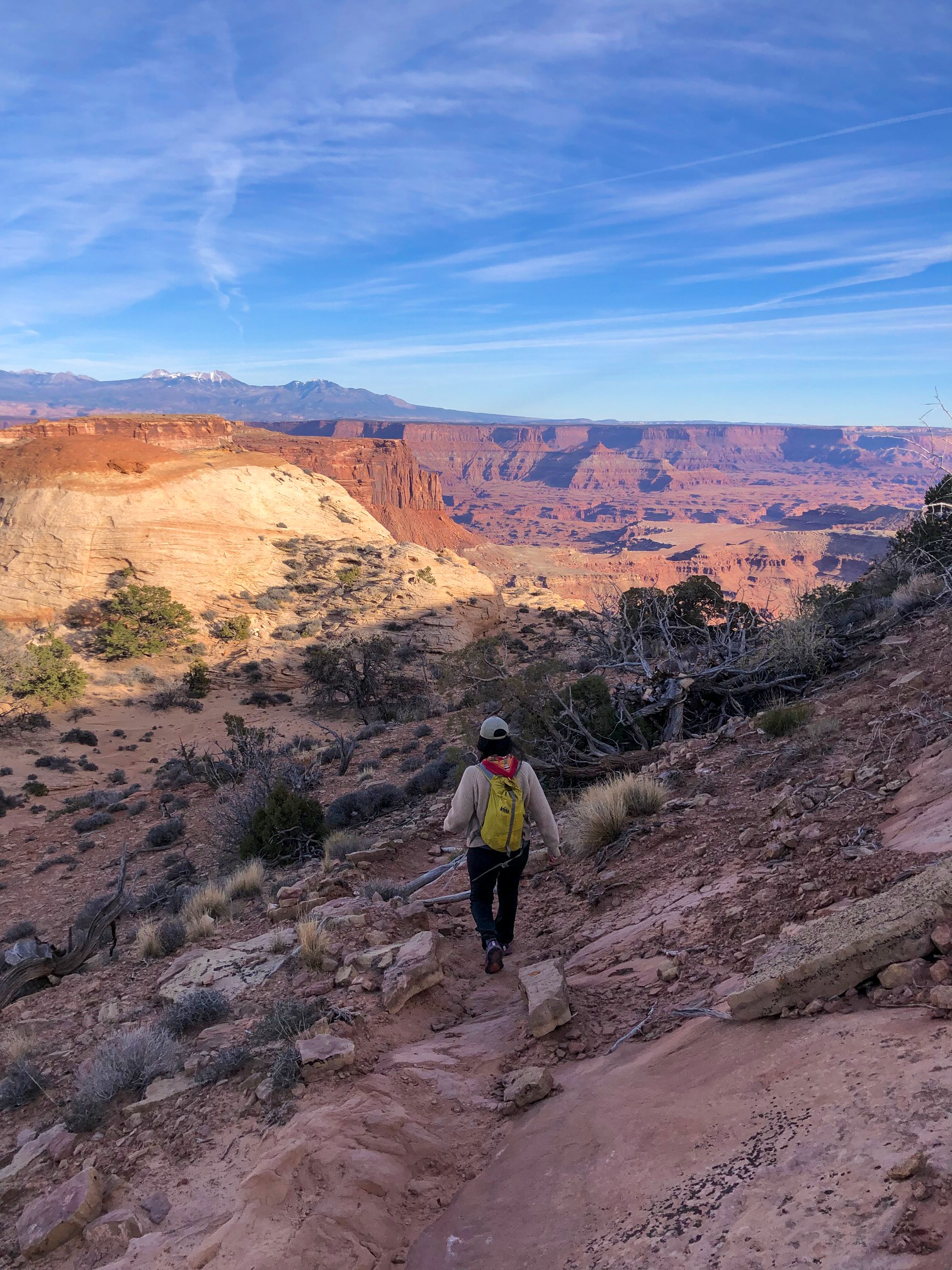
The Lathrop Trail crosses a wide grassland on the mesa top, enjoys views of Colorado River, then descends into the canyon below. For a moderate trail option, hikers often turn around at the canyon rim. Continuing down to the White Rim Road means a strenuous hike back out. Lathrop to Canyon Rim Roundtrip Distance: 5 mi (8 km) Time: 2-3 hrs Elevation Change: 158 ft (48 m) Difficulty: Moderate Hike Description: Trail crosses open grasslands, ending in spectacular views of Airport Tower & Colorado River. Bring: Water (1 L per person, per hour), snacks, sturdy footwear, headlamp, map, and be prepared for, sun, rain, heat, or cold. Accessibility: This trail can be rough, uneven, and requires walking up and down a rocky hill and stone steps. It is not accessible to wheelchairs. In winter, there may be snow or icy conditions; we recommend traction devices for hikers. Dogs are not allowed on this trail. Service animals are allowed in national parks. What is a service animal? Lathrop to White Rim Road Roundtrip Distance: 11.8 mi (19 km) Time: 5-7 hrs Elevation Change: 1,721 ft (525 m) Difficulty: Strenuous Hike Description: Trail crosses open grasslands, then drops 1,600 ft (488 m) into the canyon below. Enjoy views of the La Sal Mountains and fanciful sandstone knobs on this varied and challenging hike to the White Rim. Bring: Water (at least 1 L per person, per hour), snacks, sturdy footwear, headlamp, map, and be prepared for, sun, rain, heat, or cold. Accessibility: This trail can be rough, uneven, and requires walking up and down a rocky hill and stone steps. It is not accessible to wheelchairs. Dogs are not allowed on this trail. Service animals are allowed in national parks. What is a service animal?
Alcove Spring Trail
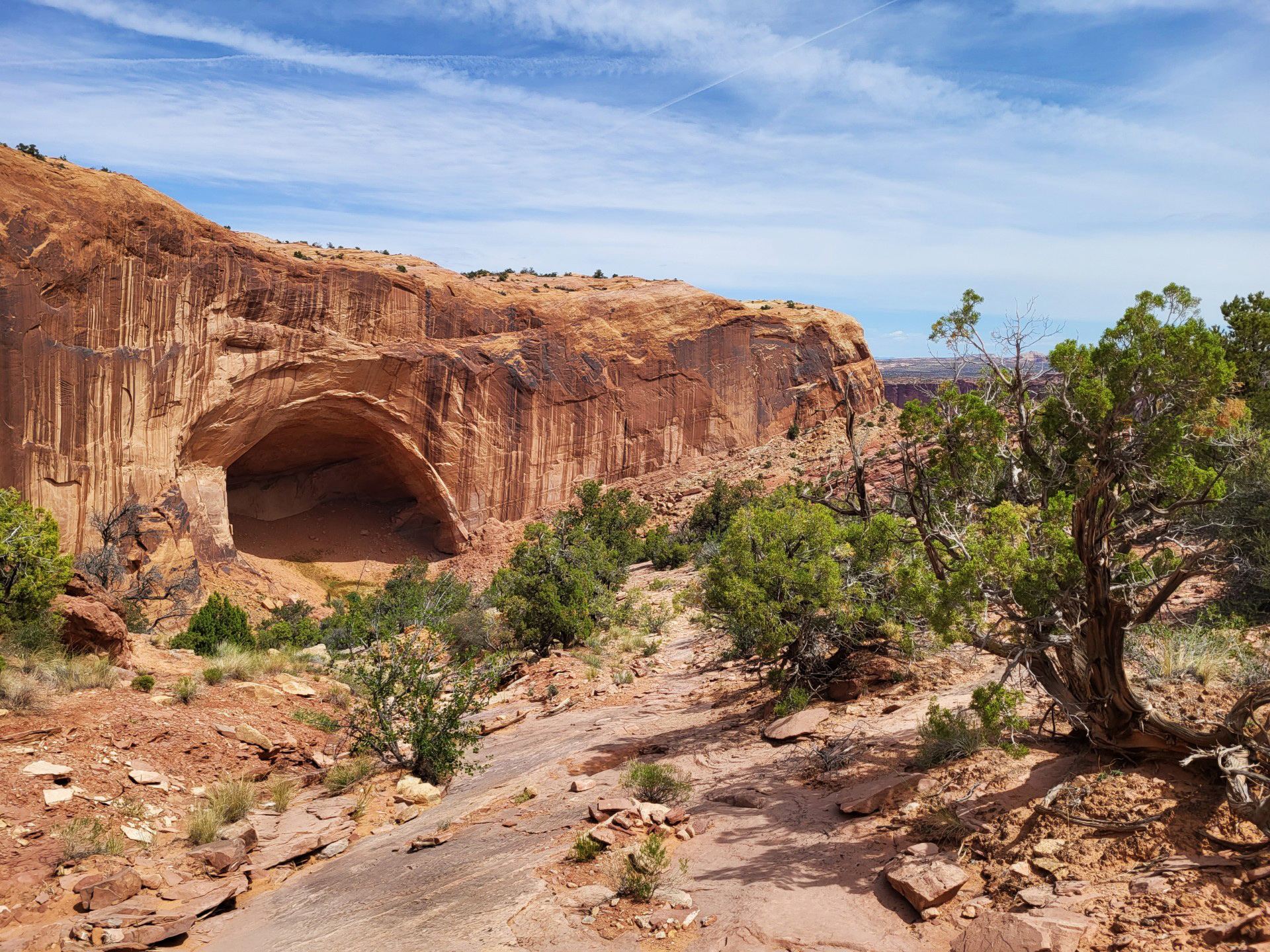
After descending 1,300 feet (396 m) past a large alcove, the trail meanders in a wide canyon to the base of the notable Moses and Zeus towers. Roundtrip Distance: 11.2 mi (18 km) Time: 6-7 hrs Elevation Change: 1,455 ft (444 m) Difficulty: Strenuous – Mesa Top to White Rim Hike Description: After descending 1,400 ft (4276 m) past a large alcove, the trail meanders in a wide canyon to the base of the notable Moses and Zeus towers. Bring: Water (1 L per person, per hour), snacks, sturdy footwear, headlamp, map, and be prepared for, sun, rain, heat, or cold. Accessibility: This trail can be rough, uneven, and requires walking up and down a rocky hill and stone steps. It is not accessible to wheelchairs. In winter, there may be snow or icy conditions; we recommend traction devices for hikers. Dogs are not allowed on this trail. Service animals are allowed in national parks. What is a service animal?
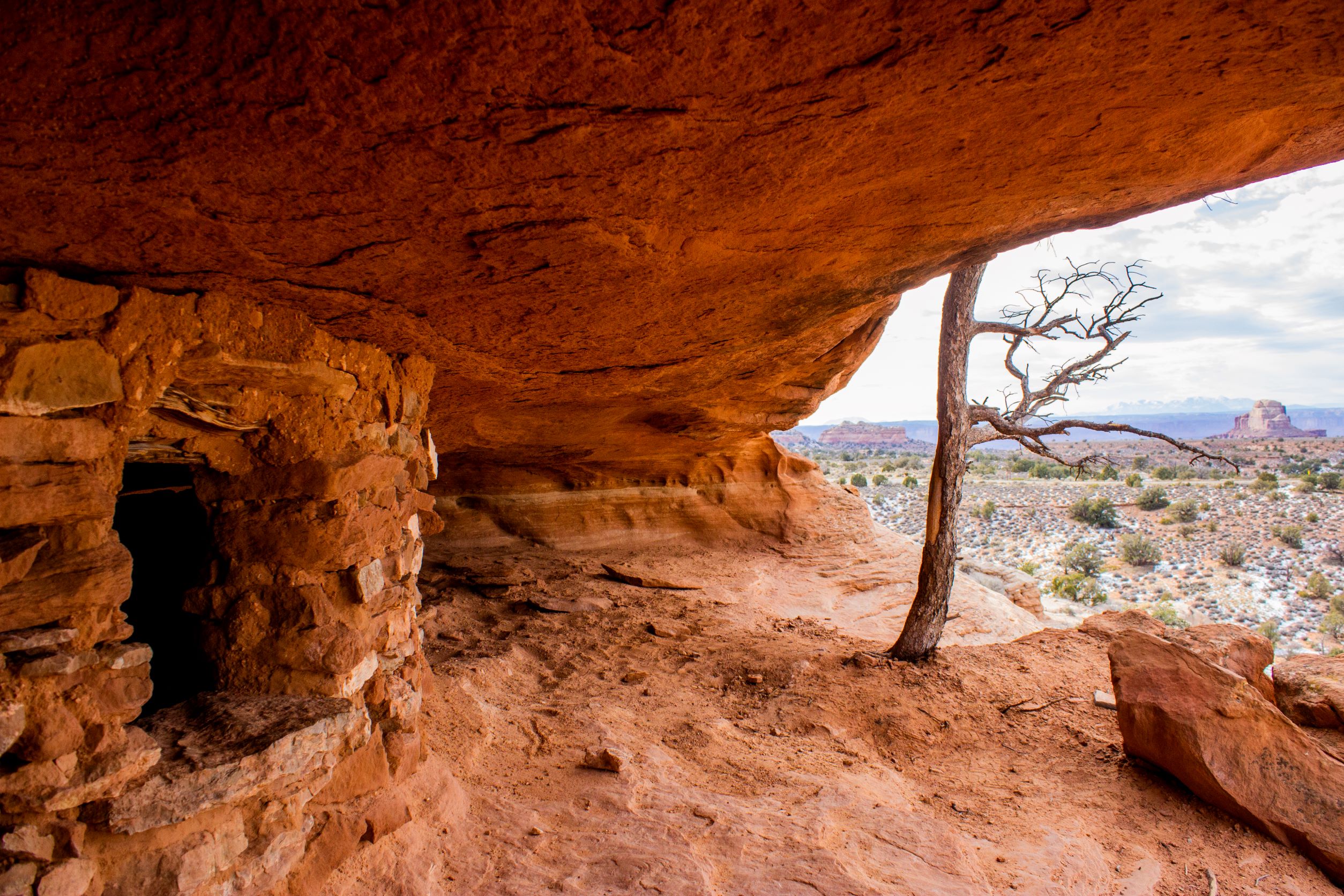
Aztec Butte Trail
Indigenous people once stored foods and medicines in rock structures, called granaries, built into alcoves here. Despite the current name, they were not part of the Aztec civilization. Do not touch or enter the extremely fragile ancient structures. Roundtrip Distance: 1.4 mi (2.3 km) Time: 1.5 hrs Elevation Change: 222 ft (68 m) Difficulty: Moderate – Mesa Top Hike Description: The trail follows a sandy wash, then splits. The eastern fork to your right ascends Aztec Butte for spectacular views. The western fork on the left climbs the smaller butte then drops below the rim to two granaries. Both trails require scrambling up slickrock and ledges. Entering, touching, or climbing on archeological sites is strictly prohibited. View structures from a distance to protect fragile walls. Accessibility: This trail can be rough, uneven, and requires walking up and down a rocky hill and stone steps. It is not accessible to wheelchairs. In winter, there may be snow or icy conditions; we recommend traction devices for hikers. Dogs are not allowed on this trail. Service animals are allowed in national parks. What is a service animal?

Aztec Butte: The Value of Storage
The human history of Canyonlands isn’t obvious to most visitors. However, people have traveled, traded, and thrived here for millennia. Tucked in a sheltered alcove below, two 900-year-old stone structures bear testament to the fortitude of these Indigenous people. What drew the ancient builders to this site? The rock overhanging provides protection from the elements, while the unobstructed view may imbue this place with power. The structures – which archeologist call granaries- may have had various uses over time, including storing ceremonial supplies, medicines, or caches of food gathered or grown nearby. Storage secures the hope of return. Items they stored here might have eased a traveler’s burdens. Those items also belonged here, imbued with the power of this place. Visit with Respect Entering, touching or climbing on archaeological sites is strictly prohibited. Stone and mortar walls that have stood for hundreds of years are crumbling today beneath the hands and feet of curious visitors. Leave no trace of your visit. Help ensure these structures keep standing, reflecting the strength of the people who lived in this desert long ago. Photo insert caption: Entries to granaries were typically covered by stone slabs. Mud and clay were added to seal the opening and camouflage the cache with the cliffs, hiding it from people passing nearby.
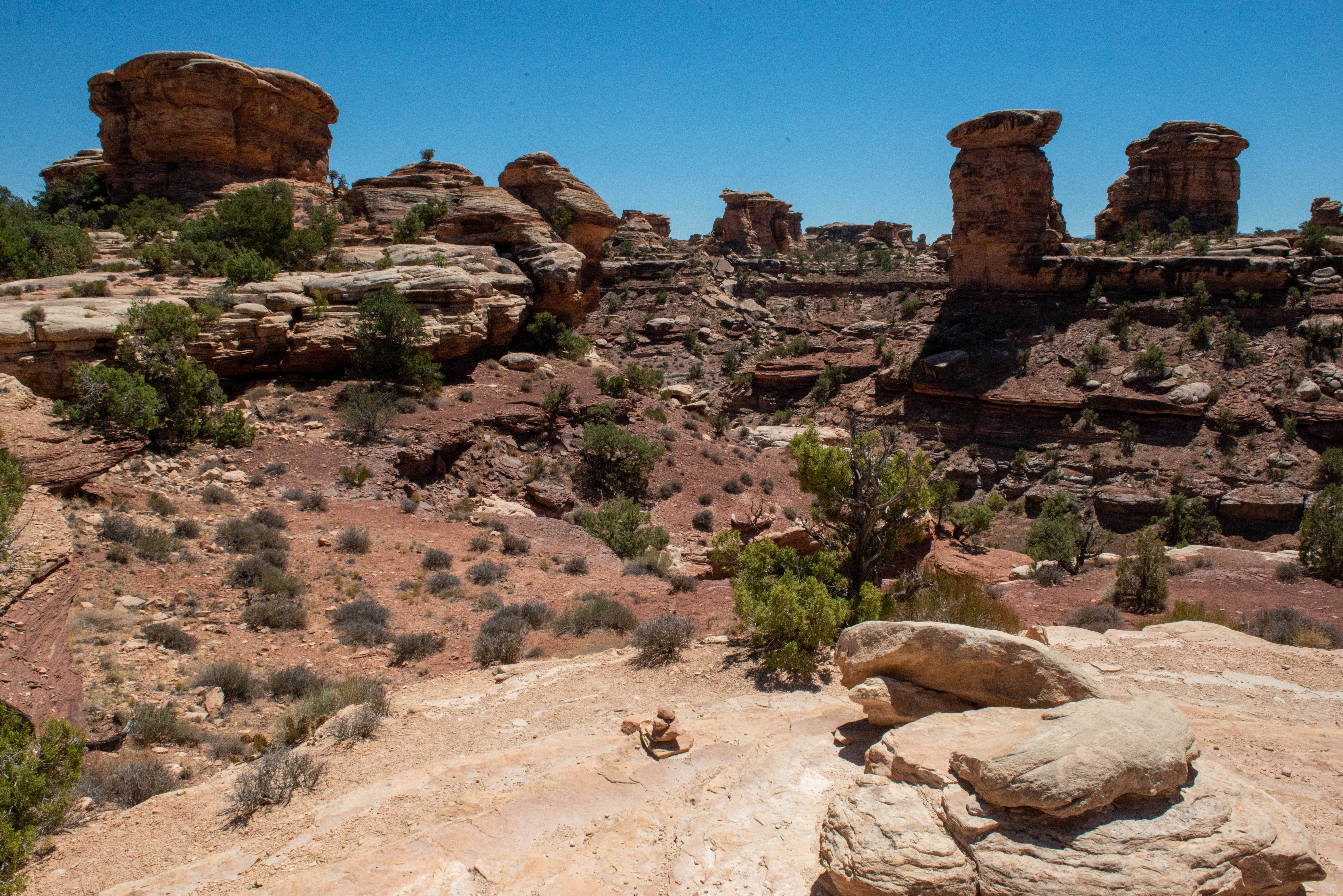
Big Spring Canyon Overlook and Trailhead
Overlook Big Spring rests at the end of the Needles Park Road. From the overlook, unique rock spires and multi-colored sandstone benches line the bend in the canyon. The presence of the spring allows trees and plants to flourish in the spring and summer months. Trailhead From the overlook, follow marked cairns down to the canyon to begin the Big Spring to Elephant Hill loop, a challenging hike which spans 10.8 miles (17 km). This loop features extended hiking on slickrock benches and mesa tops overlooking canyons. There are excellent views of sheer cliff walls and other rock formations. You will have to climb two ladders in the pass between the canyons, making this a particularly strenuous hike. Accessibility Portions of the canyon are visible from the paved parking area. The trail into and along the rim of the overlook include slopes and rocky, uneven surfaces. Parking The Trailhead and overlook are located at the end of the Needles park road, approximately 6.5 mi (10.5 km) past the Needles Visitor Center. Several parking spaces at the roundabout and alongside the last section of the park road are available.

Big Spring Canyon Overlook: Protecting Wilderness
You've come to the end of the road. Do you wonder what's out there? This curiosity has driven human exploration for millennia. A wild and untamed landscape begins where the pavement ends. We often refer to places where human impacts are minima. as "wilderness." What does that mean? The Wilderness Act of 1964 defined wilderness ass "...an area where the earth and its community of life are untrammeled by man, where man himself if a visitor who does not remain." The landscape ahead appears to fit that description. However, human impacts on air quality and climate are affecting the natural processes at work here. Does this change your view of Canyonlands' wildness? President Lyndon B. Johnson said of the Wilderness Act: "If future generations are to remember us with gratitude rather than contempt, we must leave them something more than miracles of technology. We must leave them a glimpse of the world as it was in the beginning, not just after we got through it." Here at the end of the road, we encourage you to step into the wilderness and explore what it means to you.

Big Spring Canyon to Elephant Canyon Loop Trail
This loop features extended hiking on slickrock benches and mesa tops overlooking canyons. Excellent views of sheer cliff walls and other rock formations. Roundtrip Distance: 10.5 mi (16.9 km) Time: 4-6 hrs Overall Elevation Change: 443ft (135m) Cumulative elevation gain on this route is much greater. Difficulty: Strenuous Hike Description: You will have to climb two ladders in the pass between the canyons. Bring: Water (at least 1 L per person, per hour), snacks, sturdy footwear, headlamp, map, and be prepared for, sun, rain, heat, or cold. Accessibility: This trail can be rough, uneven, and requires climbing two ladders. It is not accessible to wheelchairs. In winter, there may be snow or icy conditions; we recommend traction devices for hikers. Dogs are not allowed on this trail. Service animals are allowed in national parks. What is a service animal?
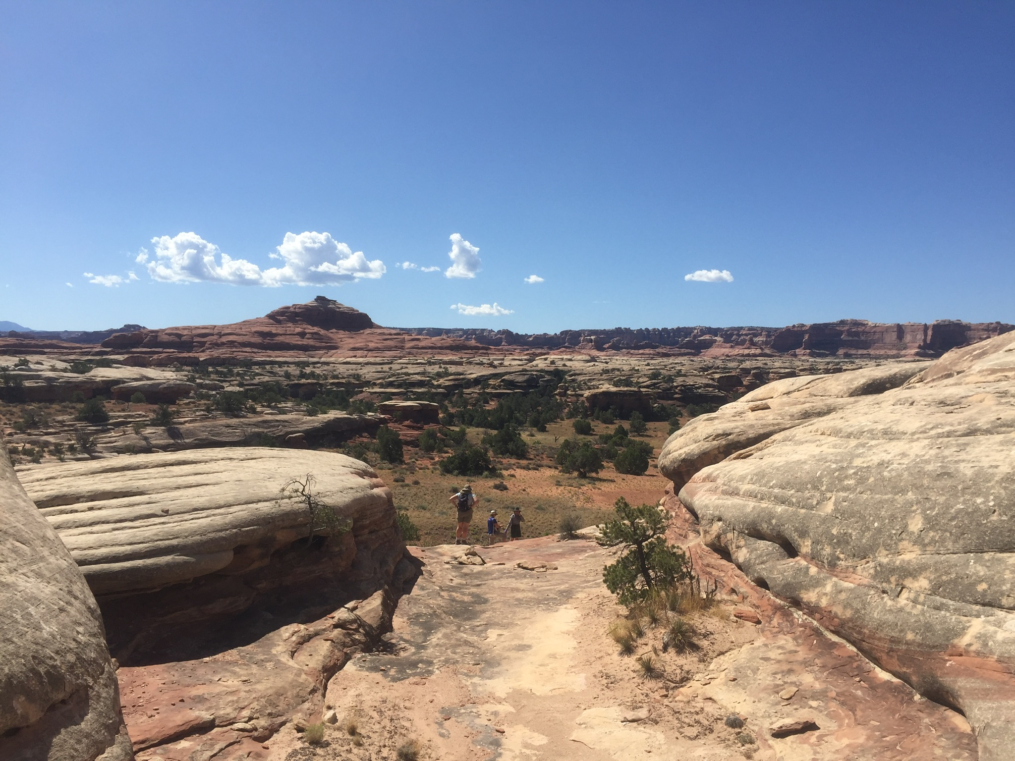
Big Spring Canyon to Wooden Shoe Canyon Loop Trail
A great introduction to the landscape of The Needles, this route connects two canyons for a loop across varied terrain. Roundtrip Distance: 7.5 mi (12 km) Time: 3-4 hrs Overall Elevation Change: 478 ft (146 m) Cumulative elevation gain on this route is much greater. Difficulty: Strenuous Hike Description: The route between the canyons climbs steep grades that are dangerous when wet and may make people with a fear of heights uncomfortable. Bring: Water (at least 1 L per person, per hour), snacks, sturdy footwear, headlamp, map, and be prepared for, sun, rain, heat, or cold. Accessibility: This trail can be rough, uneven, and requires walking up and down a rocky hill and stone steps. It is not accessible to wheelchairs. In winter, there may be snow or icy conditions; we recommend traction devices for hikers. Dogs are not allowed on this trail. Service animals are allowed in national parks. What is a service animal?
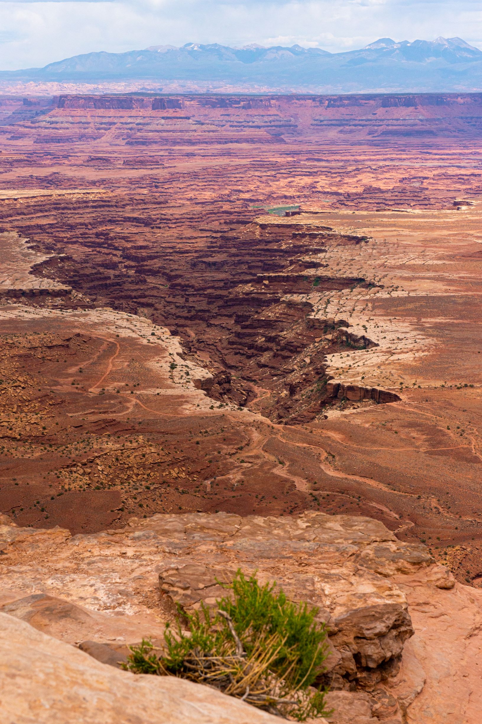
Buck Canyon Overlook
From a paved overlook at 6,240 feet (1,902 m) in elevation, enjoy sweeping vistas to the west and across the Colorado River canyon. Accessibility: A short paved walkway leads to the overlook. It is accessible to wheelchairs. Parking: Parking is limited.
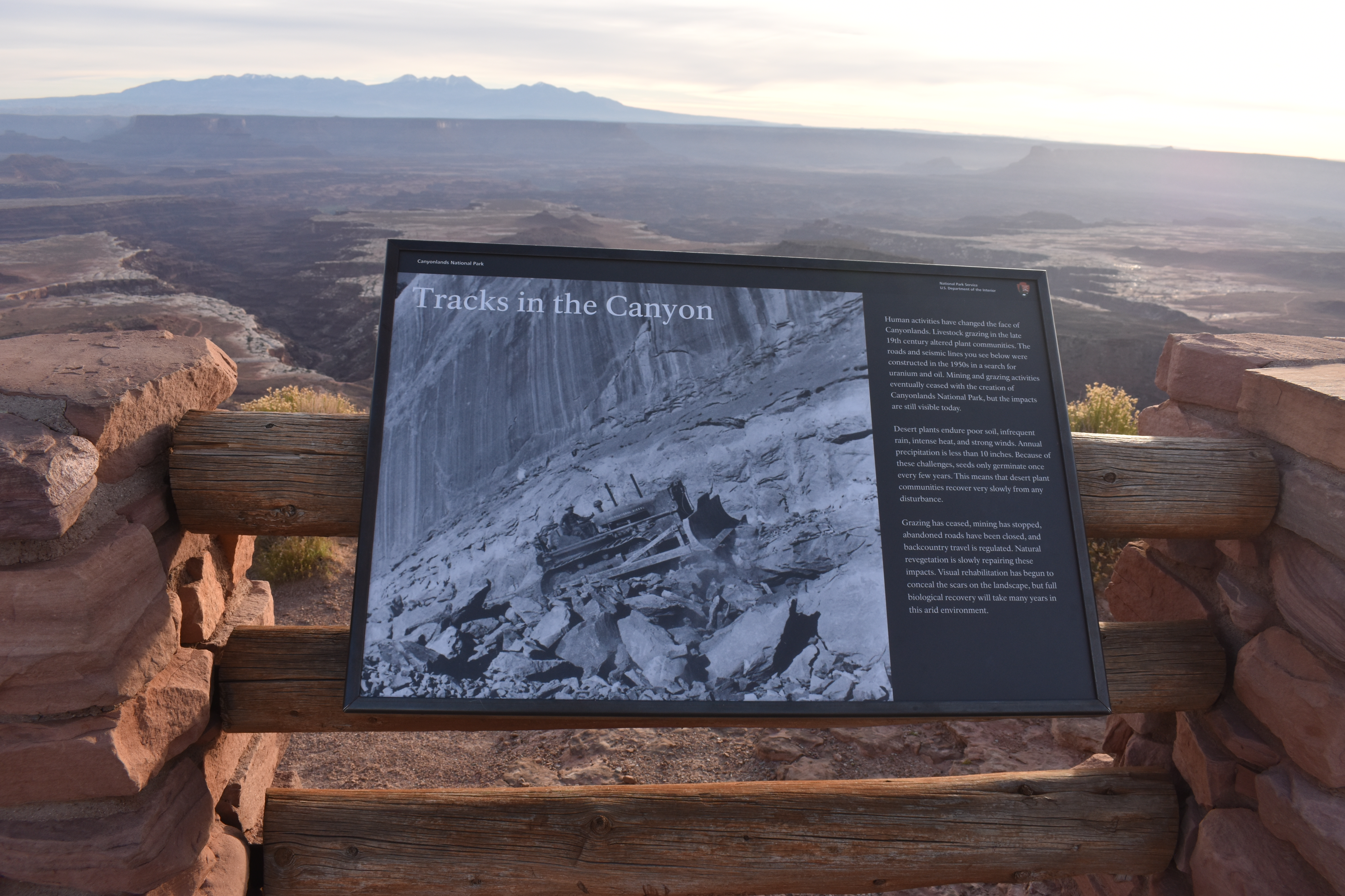
Buck Canyon: Tracks in the Canyon
Human activities have changed the face of Canyonlands. Livestock grazing in the late 19th century altered plant communities. The roads and seismic lines you see below were constructed in the 1950s in a search for uranium and oil. Mining and grazing activities eventually ceased with the creation of Canyonlands National Park, but the impacts of are still visible today. Desert plants endure poor soil, infrequent rain, intense heat, and strong winds. Annual precipitation is less than 10 inches. Because of these challenges, seeds only germinate once every few years. this means that desert plant communities recover very slowly from any disturbance. Grazing has ceased, mining has stopped, abandon roads have been closed, and backcountry travel is regulated. Natural revegetation is slowly repairing these impacts. Visual rehabilitation has begun to conceal the scars on the landscape, but full biological recovery will take many years in this arid environment.
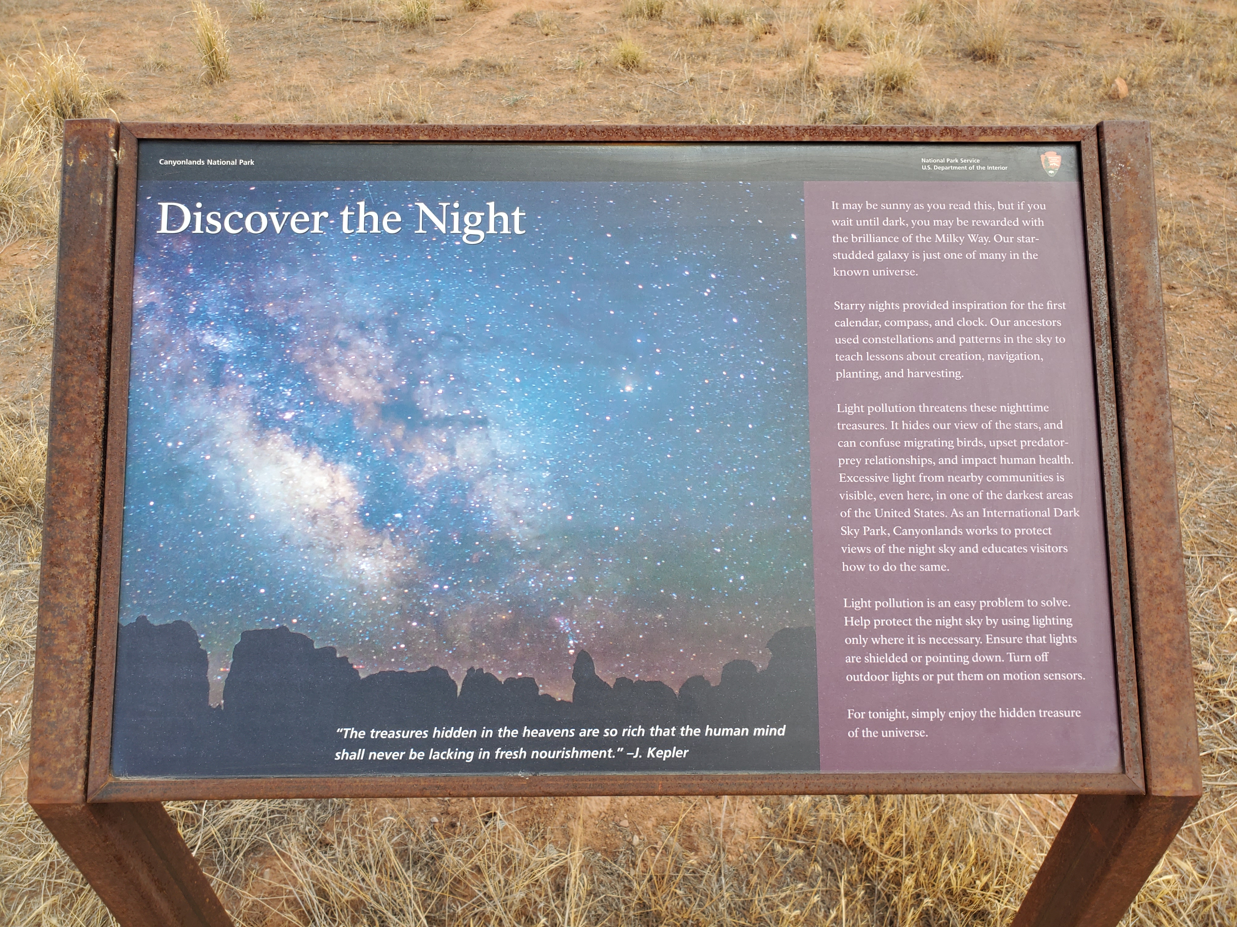
Campground Amphitheatre: Discover the Night
It may be sunny as you read this, but if you wait until dark, you may be rewarded with the brilliance of the Milky Way. Our star studded galaxy is just one of many in the known universe. Starry nights provided inspiration for the first calendar, compass, and clock. Our ancestors used constellations and patterns in the sky to teach lessons about creation, navigation, planting, and harvesting. Light pollution threatens these nighttime treasures. It hides our view of the stars, and can confuse migrating birds, upset predator-prey relationships, and impact human health. Excessive light from nearby communities is visible, even here, in one of the darkest areas of the United States. As an International Dark Sky Park, Canyonlands works to protect views of the night sky and educates visitors how to do the same. Light pollution is an easy problem to solve. Help protect the night sky by using lighting only where it is necessary. Ensure that lights are shielded or pointing down. Turn off outdoor lights or put them on motion sensors. For tonight, simply enjoy the hidden treasure of the universe. A quotation on top of a vibrant image of the milky way reads, "The treasures hidden in the heavens are so rich that the human mind shall never be lacking in fresh nourishment." - J. Kepler
Visitor centers
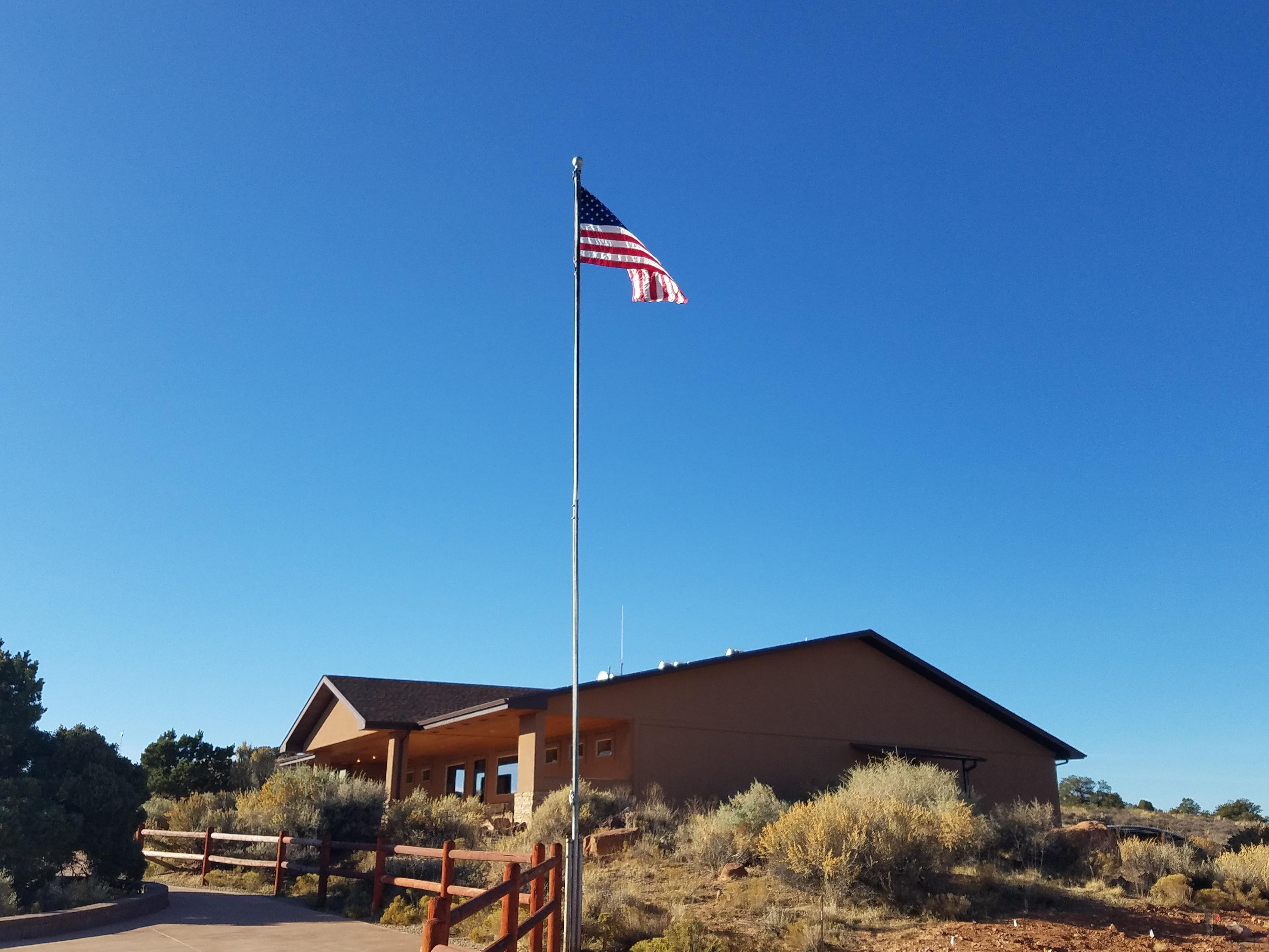
Island in the Sky Visitor Center
The Island in the Sky Visitor Center offers exhibits, book & map sales, park orientation film, backcountry permits, general information, vault toilets, and park rangers on duty. You can get drinking water inside (during open hours) or outside (24 hours a day) during summer and fall. Water is only available inside (during open hours) in winter.
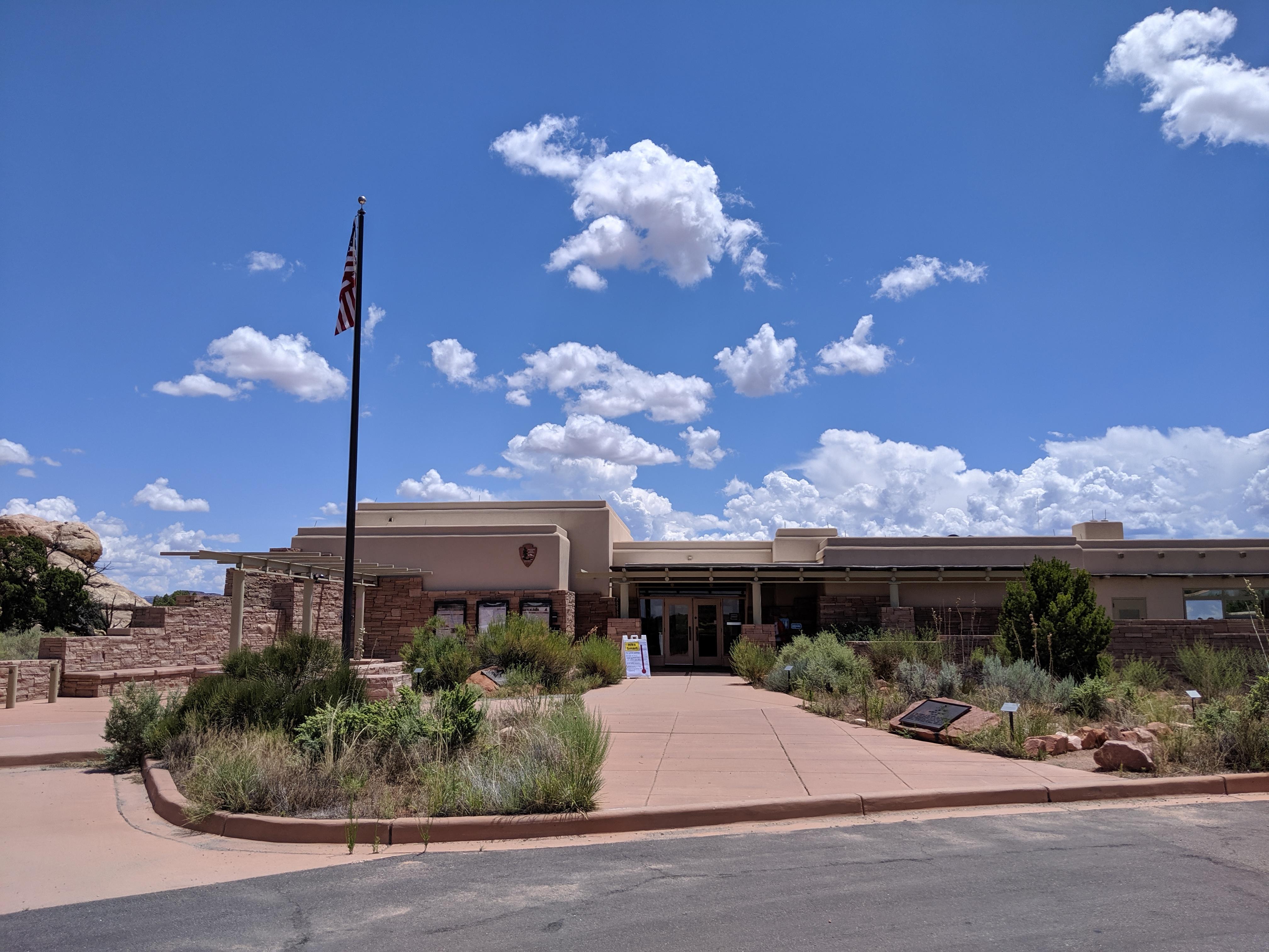
The Needles Visitor Center
The Needles Visitor Center normally offers exhibits, book & map sales, backcountry permits, information, picnic area, and park rangers on duty. The park orientation movie (15 minutes) is available on demand. Water is available year-round. When the visitor center is closed in winter, you must self-register for backcountry permits outside the visitor center entrance.
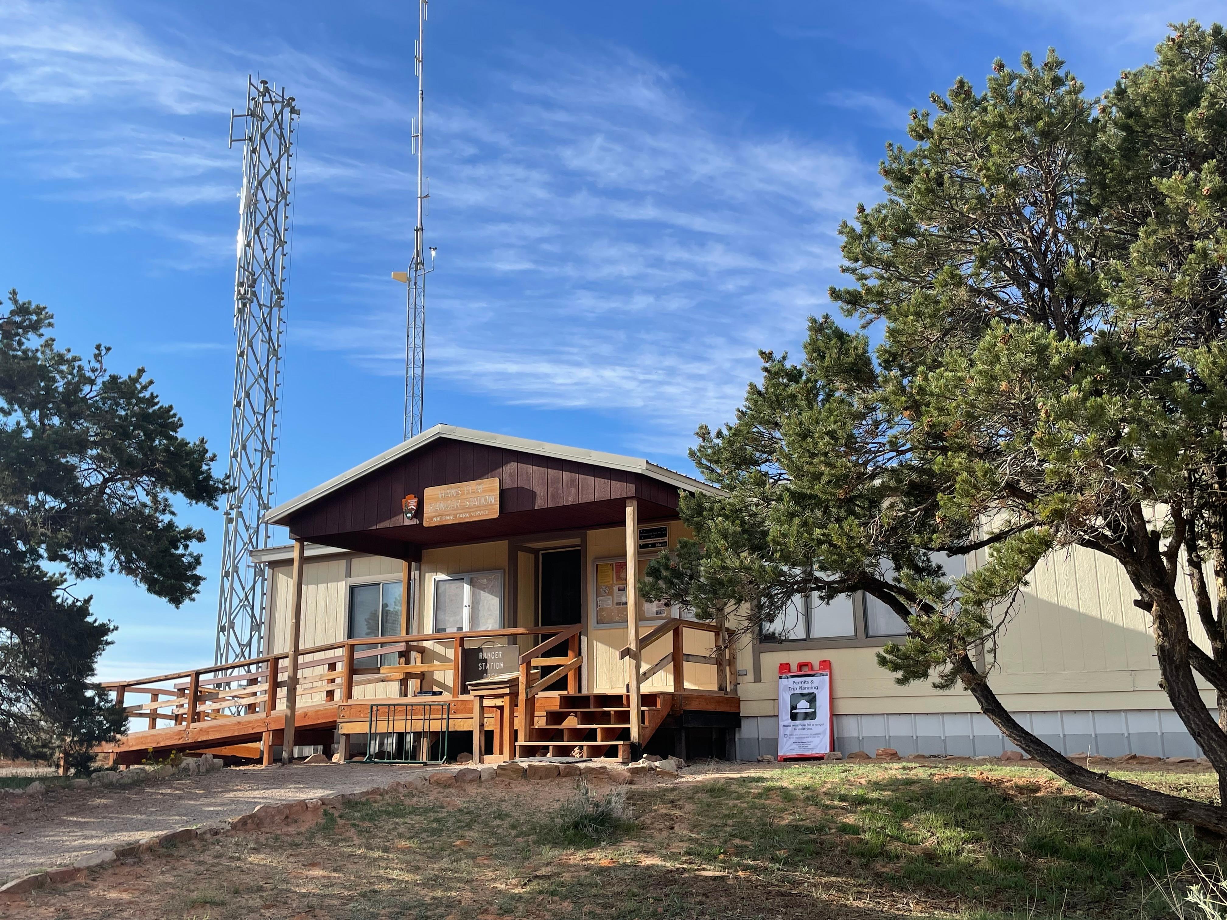
Hans Flat Ranger Station
The remote Hans Flat (Maze) Ranger Station is normally open daily year-round. This ranger contact station has a picnic table and vault toilet, and a small selection of books and maps for sale. There are no services, food, gas, trash collection, electricity for visitor use, nor potable water in The Maze. The nearest communities with amenities are Hanksville (68 miles) and Green River (86 miles).
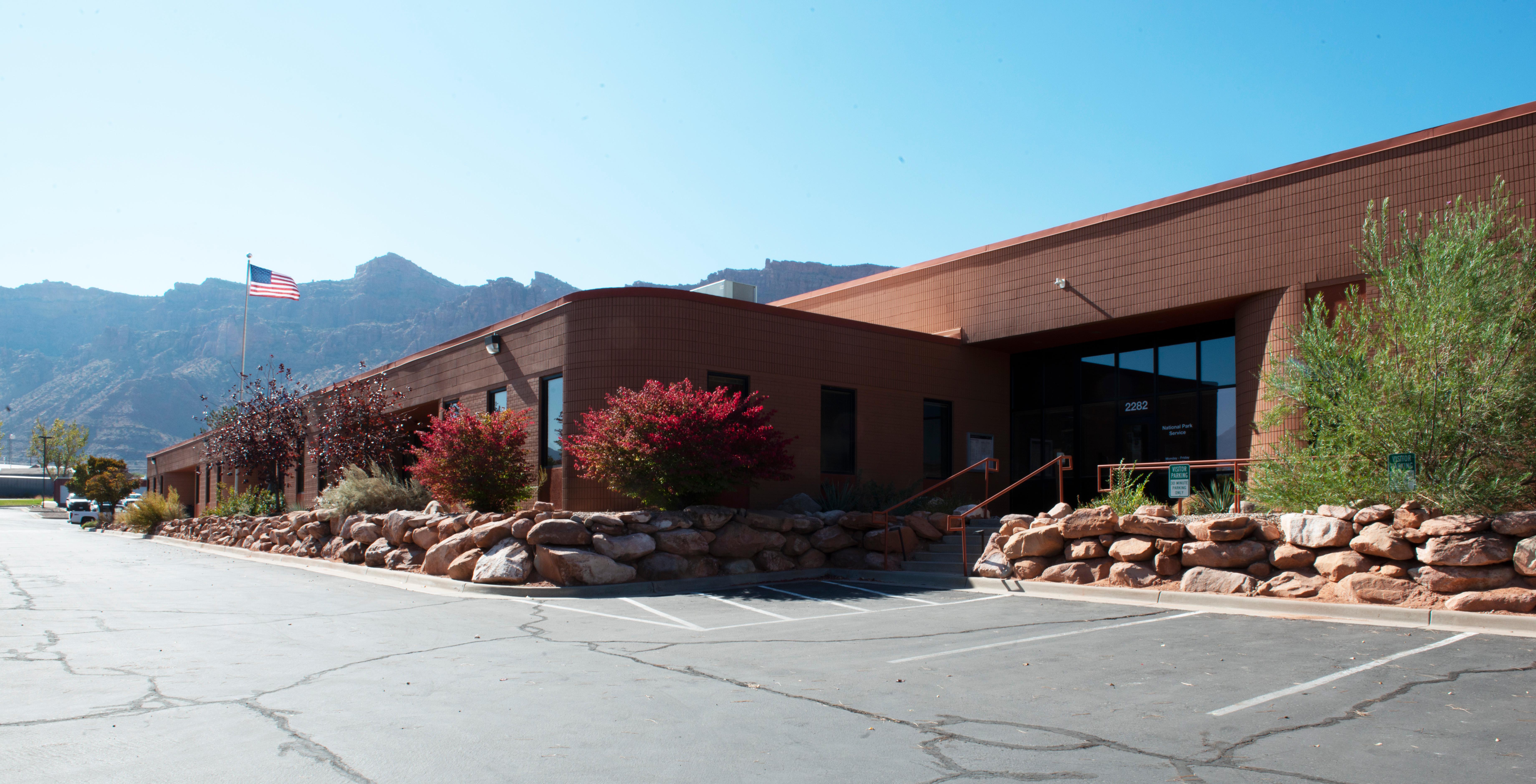
Canyonlands Backcountry Office
The central backcountry office is located at park administrative offices south of Moab. Rangers can answer questions about backcountry travel over phone or email and issue permits online.
Park stories
NPS Geodiversity Atlas—Canyonlands National Park, Utah
Project Profile: Orphaned Well Reclamation Work in Canyonlands National Park
Guide to the Harold P. Fabian Papers
Helping Managers Plan for Climate Change with Remote Sensing at Canyonlands National Park
Bighorn Sheep Reclaimed Abandoned Habitat during the Pandemic and Had Lots of Young. Now What?
An Infectious Strain of Pneumonia Threatens Capitol Reef's Prized Bighorn Herd
The Science of Conserving Native Fish: Mitigating Potential Effects of Flow Experiments along the Green River in Dinosaur National Monument
Who Lives in the Park?
The Names of Canyonlands Scavenger Hunt
Douglas Fir in the Desert - A Relict Population
On the Edge: A Visit to Tower Ruin
Park Air Profiles - Canyonlands National Park
Park information courtesy of the National Park Service Data API.